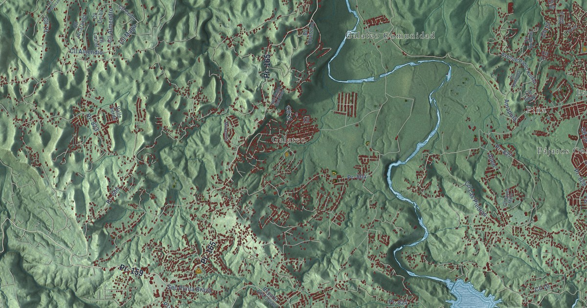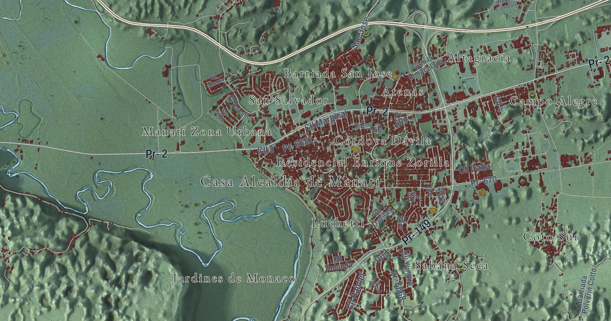
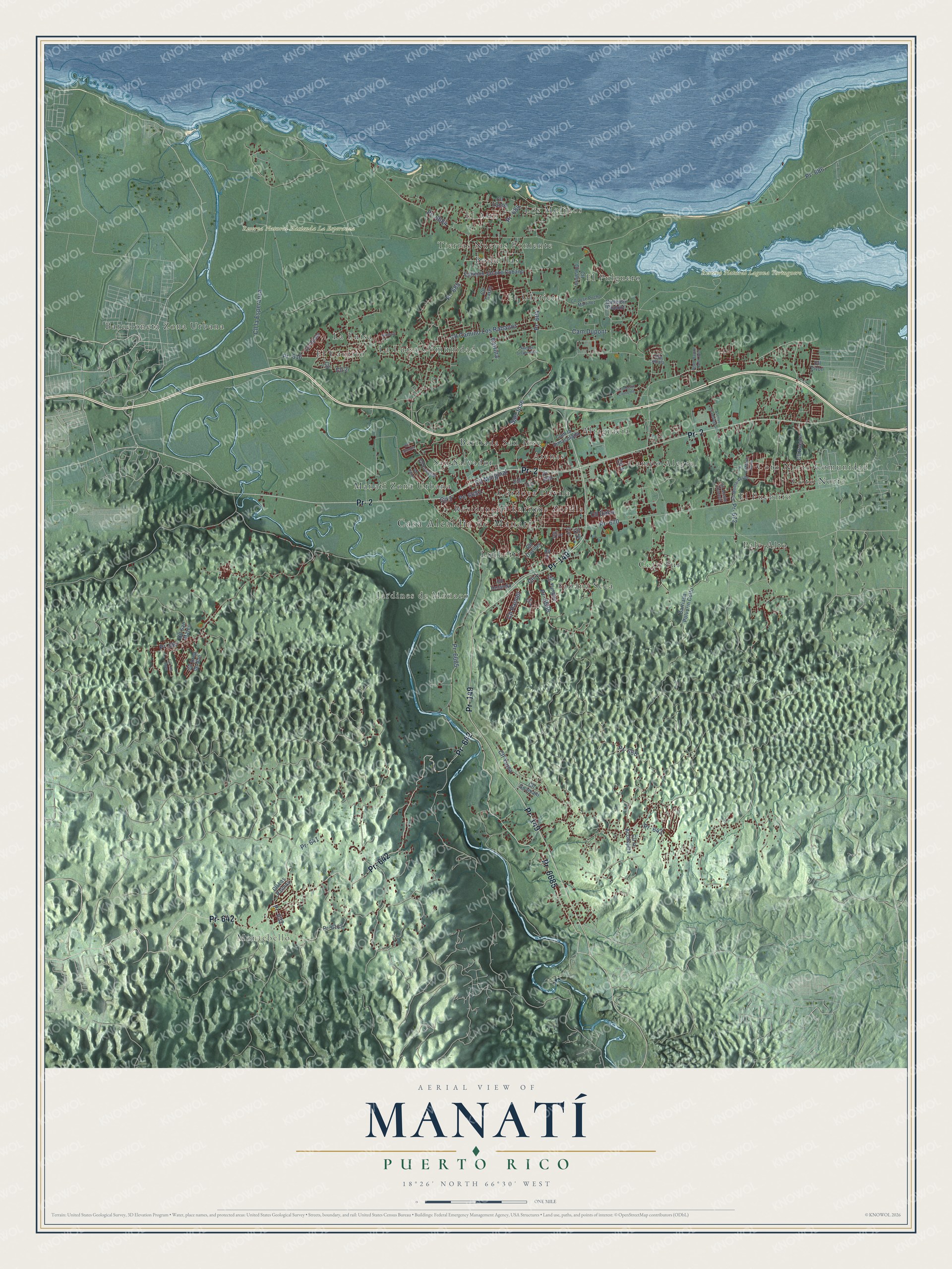
This beautifully detailed map of Manatí, Puerto Rico was created in 2026 using aerial imagery combined with modern topographical, census, street and landmark data. It's a modern aerial view of the municipio of Manatí, Puerto Rico, that combines modern data with a vintage aesthetic. The roads feature printed names, and if you look closely you can find your exact house accurately shown in its correct location.
Explore an aerial view of Manatí, Puerto Rico
On this map you'll find Casa Alcaldía de Manatí, Montebello, Reserva Natural Hacienda La Esperanza, Reserva Natural Laguna Tortuguero, Altagracia, Atenas, Barceloneta Zona Urbana, Barriada San Jose, Boquillas, Campo Alegre, Coto Norte, Coto Norte Comunidad, and more. Each red shape is a building, so zoom in on the preview and look for yours.
Manatí has a story worth telling. The 1940 WPA Guide to Puerto Rico puts it this way: "The large Central Monserrate, property of the Calaf family, is the source of livelihood for many residents of Manati."
Manatí is one of the 78 municipios of Puerto Rico. The Census Bureau counted 39,492 people here in 2020.
Take a closer look at the Manatí map
Names on this map
These names are printed on this map.
Places: Casa Alcaldía de Manatí, Montebello, Reserva Natural Hacienda La Esperanza, Reserva Natural Laguna Tortuguero, Altagracia, Atenas, Barceloneta Zona Urbana, Barriada San Jose, Boquillas, Campo Alegre, Coto Norte, Coto Norte Comunidad, Coto Sur, Córdova Dávila, El Alto, El Cantito, El Pueblito, El Pulguero, Jardines de Monaco, La Glorieta, La Luisa, La Luisa Comunidad, Los Molinos, Luchetti, Manatí Zona Urbana, Palo Alto, Residencial Enrique Zorilla, Sabana Seca, San Salvador and Tierras Nuevas Poniente.
Streets and roads: Pr- 642, Pr- 6685, Pr- 2, Pr- 149, Pr- 6682, Pr- 685, Pr- 668, Cll Marginal, Pr- 686, Cll 3, Pr- 667, Pr- 670.
More street names, A to Z
Avenue Champagnat, Avenue Serafin Diaz, Barriada Polvorin Cotto, Callejón Dupont, Callejón Jacobo Cubano, Cam Dupont, Cam la Inmaculada, Cll 1, Cll 2, Cll 4, Cll 5, Cll 6, Cll 7, Cll 9, Cll 14, Cll 15, Cll 16, Cll 19, Cll Arca de Noé, Cll Bucare, Cll Camino Los Rabanos, Cll Carey, Cll Coralina, Cll Dalia, Cll Davilas, Cll Guamani, Cll Holanda, Cll Jose Pocho Martinez, Cll la Aconejera, Cll la Esperanza, Cll Las Palmas, Cll Monte Everest, Cll Monte Santo, Cll Monte Verde, Cll Olimpia, Cll Opalo, Cll Pitirre, Cll Rainier, Cll Roberto Clemente, Cll Ruiseñor, Cll San Juan, Cll San Mateo, Cll Tivoli, Cll Yaboa, Cll Yuisa, Cll Yunque, Katrina, Pr- 604, Pr- 616, Pr- 632, Pr- 641, Pr- 643, Pr- 669, Pr- 672, Pr- 684, Pr- 6132, Pr- 6668, Pr- 6684, Pso Alcala, Repto Ramon North Soto, San Jose, Simbolo.
Created by KNOWOL in 2026. The buildings are small red shapes, the roads carry their printed names, and shaded relief shows the shape of the land. The title panel reads "AERIAL VIEW OF MANATÍ, PUERTO RICO" with 18°26' NORTH 66°30' WEST.
It looks right in a kitchen, an office or a den, and it's a gift for anyone who grew up in Manatí or moved away. Open the preview and find your street. See sizes and frames for the Manatí map.