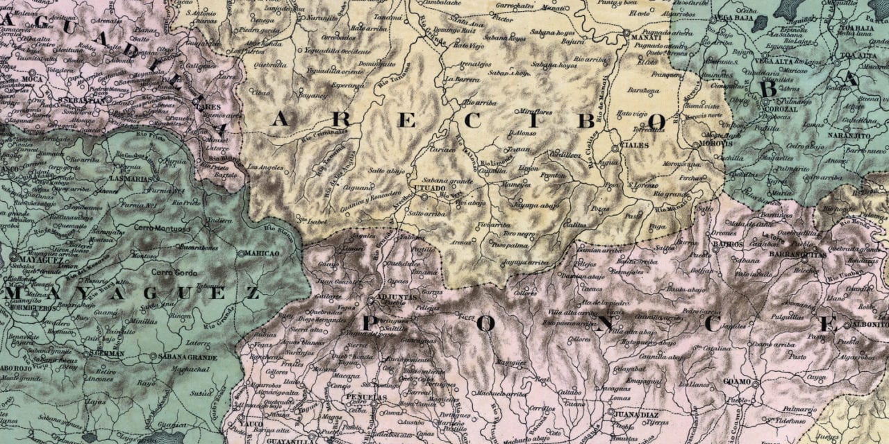
This historic map of Puerto Rico was created in 1886, and is titled “Mapa Topografico De La Isla De Puerto Rico”. The map shows a detailed view of Puerto Rico during Spanish provincial times.
The map shows Puerto Rico divided into seven counties: Aguadilla, Mayagüez, Arecibo, Ponce, Guayama, Humacao and Bayamón. Other landmarks on the map include Isla De Vieques and Puerto Rico’s islands, rivers, forests, roads, and more.
This historic map of Puerto Rico has been restored by KNOWOL. Reproductions of the restored map are available here.
Historic Old Map of Puerto Rico from 1886
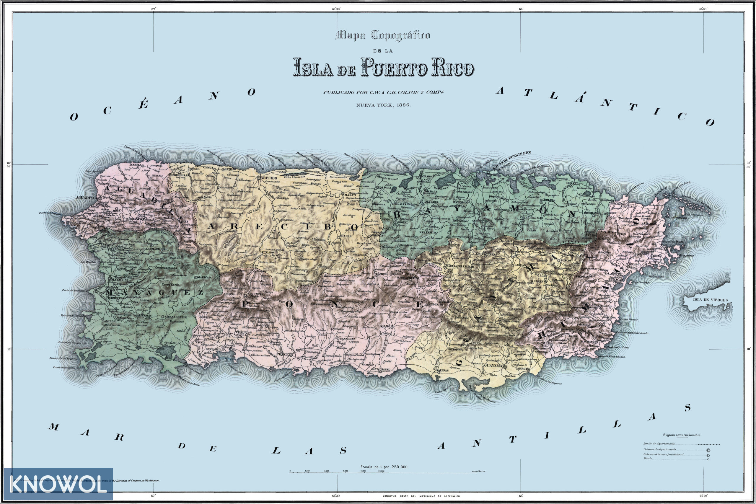
This vintage map of Puerto Rico makes an attractive addition to your office, library, or den, and can even be used to teach children the geography and history of the area. When you’re done exploring, click here to get your copy of the restored map.