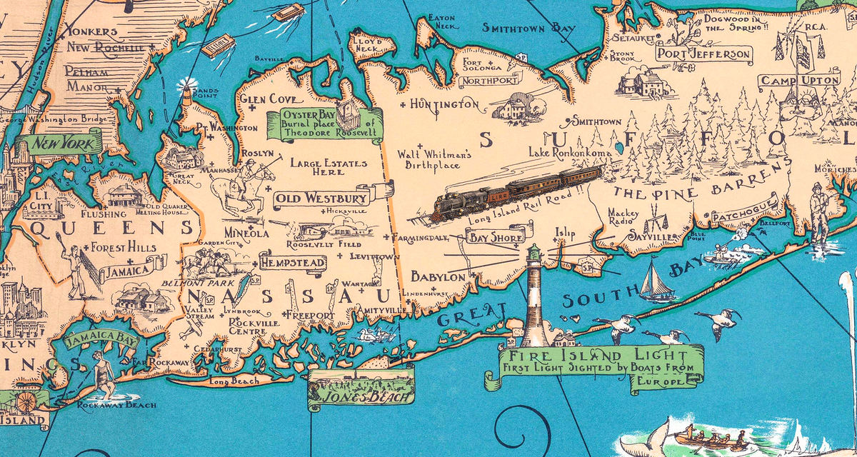
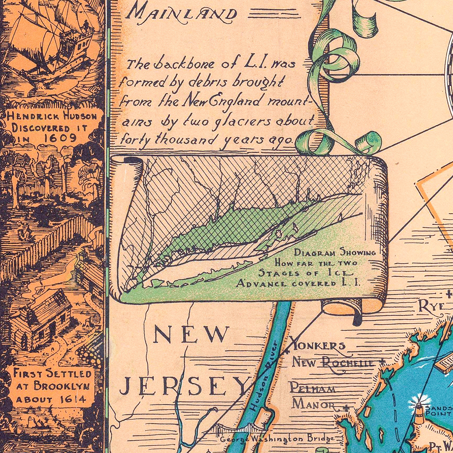
This vintage pictorial map of Long Island, New York was created by Courtland Smith, a prominent early 20th century illustrator and pictorial mapmaker, from data compiled by Richard Foster. The map shows a beautiful hand-drawn view of Long Island as it once was. Every village, harbor, and lighthouse from Coney Island to Montauk Point, with windmills spinning over the Hamptons, sailing ships heeled over in Long Island Sound, sea horses leaping out of the Atlantic, and a great schooner under full canvas off Montauk. Around the border, vignettes tell the story of the Island itself: “Home Sweet Home” in East Hampton, the Brooklyn Bridge, the Monitor sliding down the ways at the Brooklyn Navy Yard, Washington’s retreat from Brooklyn in 1776, deep-sea whalers, the first Long Island railroad in 1834, the famous Long Island ducks, and the potato fields of the East End. Reproductions of the restored map are available here.
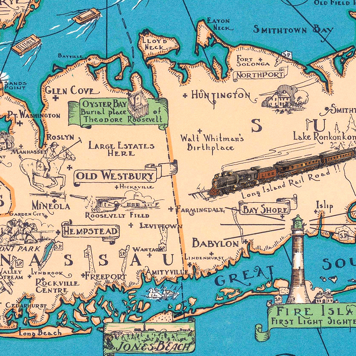
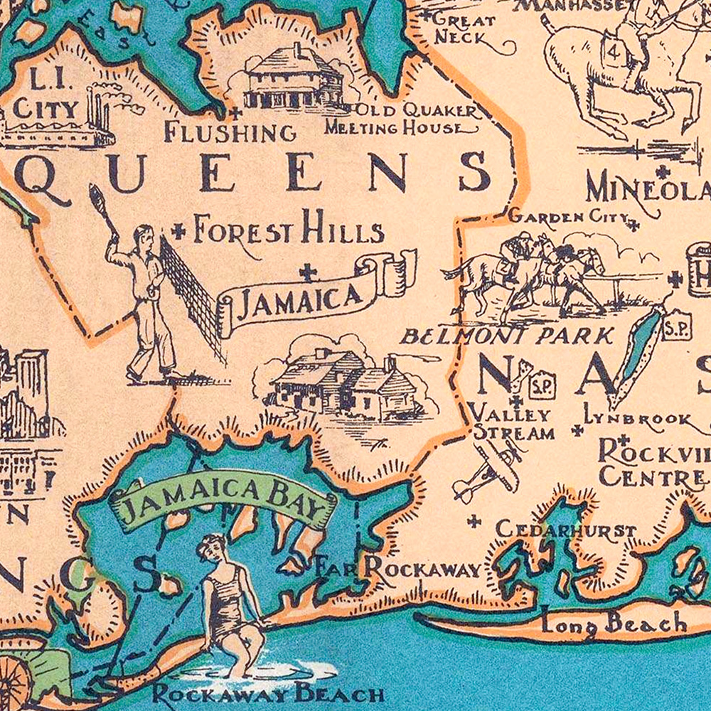
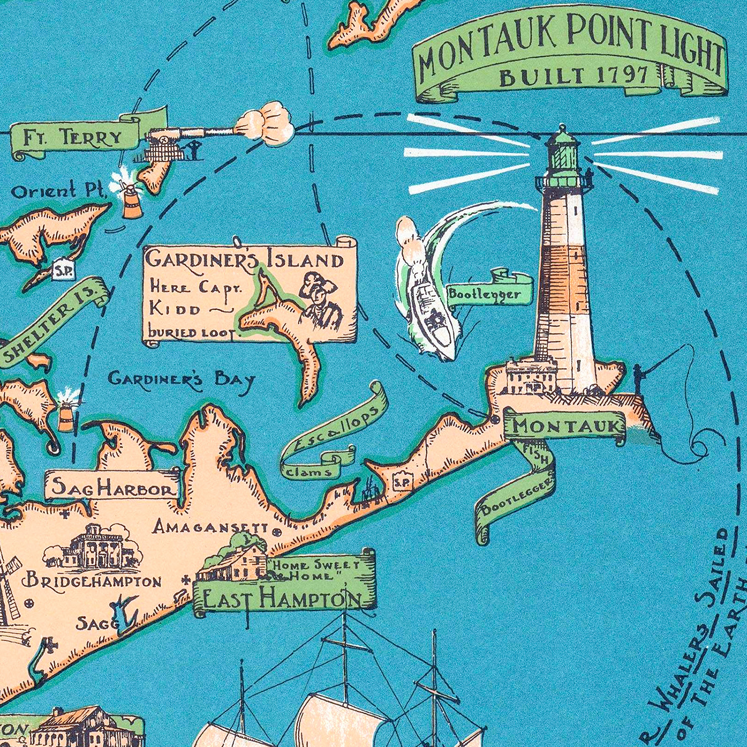
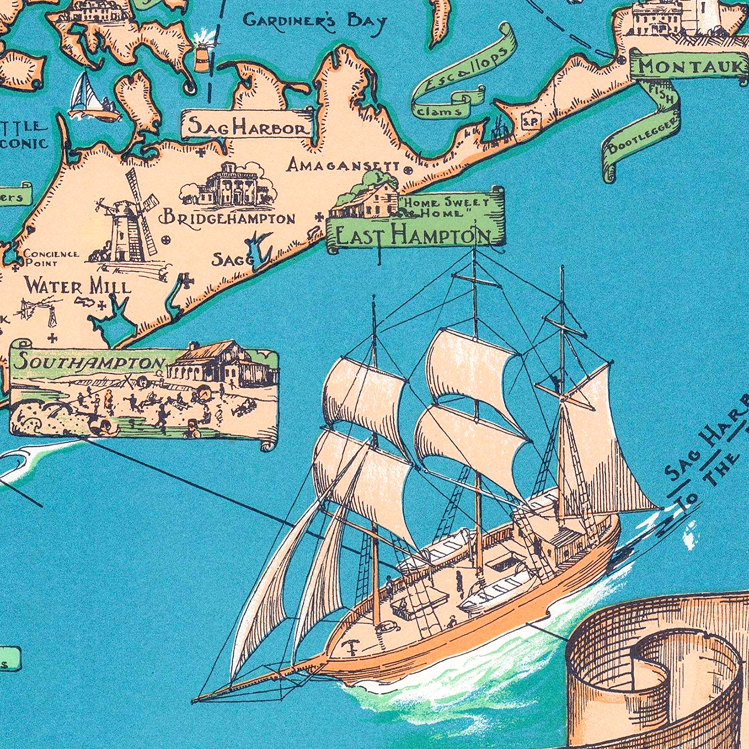
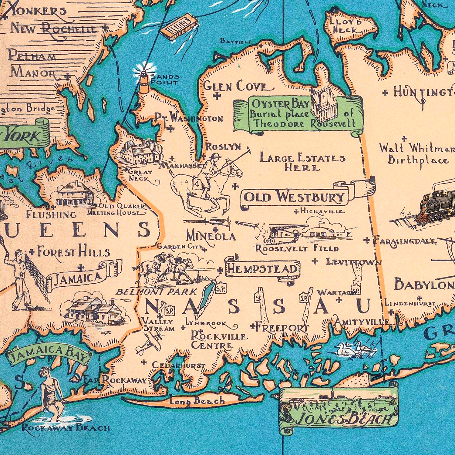
Historic Long Island landmarks on the map include Montauk Point Light (built in 1797 on the order of George Washington), Fire Island Light, Walt Whitman’s Birthplace, Gardiner’s Island (where Captain Kidd buried his treasure in 1699), Jones Beach, the Pine Barrens, the Brooklyn Navy Yard, Camp Upton, the Long Island Rail Road, the great estates of the Gold Coast, Coney Island, the Brooklyn Bridge, “Rum Row” off the South Shore where the bootleggers ran during Prohibition, and every beloved village from Brooklyn and Queens through Nassau and Suffolk — Flushing, Forest Hills, Hempstead, Old Westbury, Babylon, Islip, Port Jefferson, Riverhead, Greenport, Sag Harbor, Southampton, East Hampton, and Montauk.
This vintage map of Long Island has been lovingly restored by KNOWOL. Reproductions of the restored map are available here. You can click on the image below to zoom in and explore the details.
Vintage Pictorial Map of Long Island, New York
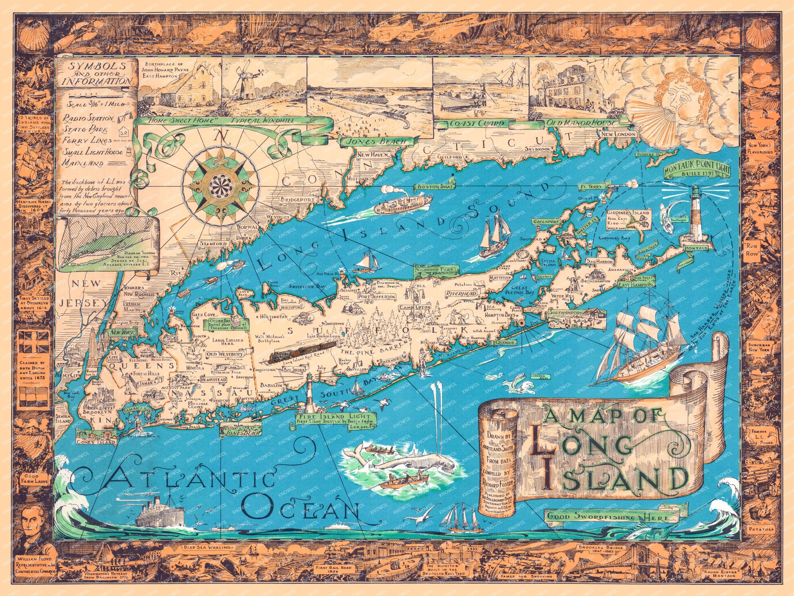
When this map was drawn, Long Island was a place of windmills and whalers, family farms and great estates, fishing villages and railroad towns. The Brooklyn Bridge was still a marvel. The trains ran out east to the potato fields. The lighthouses stood watch as they had for over a century. Long Islanders knew their neighbors, gathered at the same beaches their grandparents had, and lived the rhythm of a place shaped by the sea.
For anyone who grew up on Long Island, raised a family there, learned to swim at Jones Beach, took the LIRR into the city for their first job, sailed out of a North Shore harbor, summered in the Hamptons, or still calls the Island home no matter where life has taken them, this map is a one-page memory. The familiar coastline. The hand-lettered village names. The harbors and the lighthouses. The Island the way an artist once saw it, and the way you’ve always carried it with you.
This beautiful old map of Long Island makes an attractive addition to your office, library, den, or family room, and can even be used to teach children the geography and history of the Island. When you’re done exploring, click here to get your copy of the restored map.