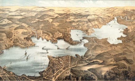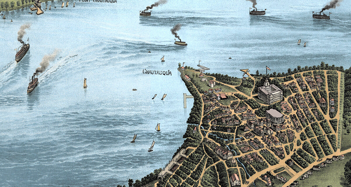
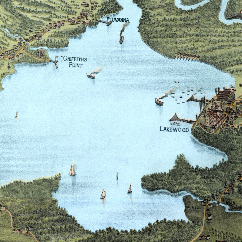
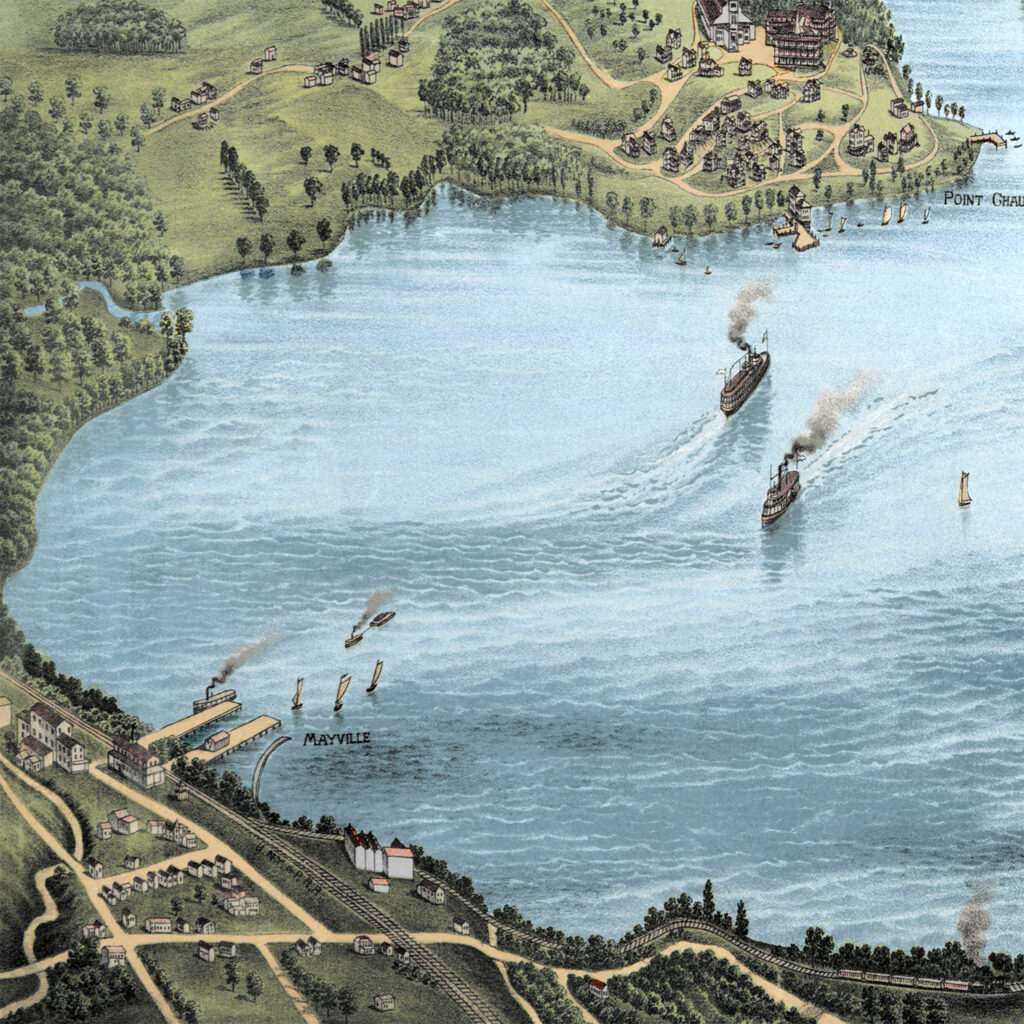
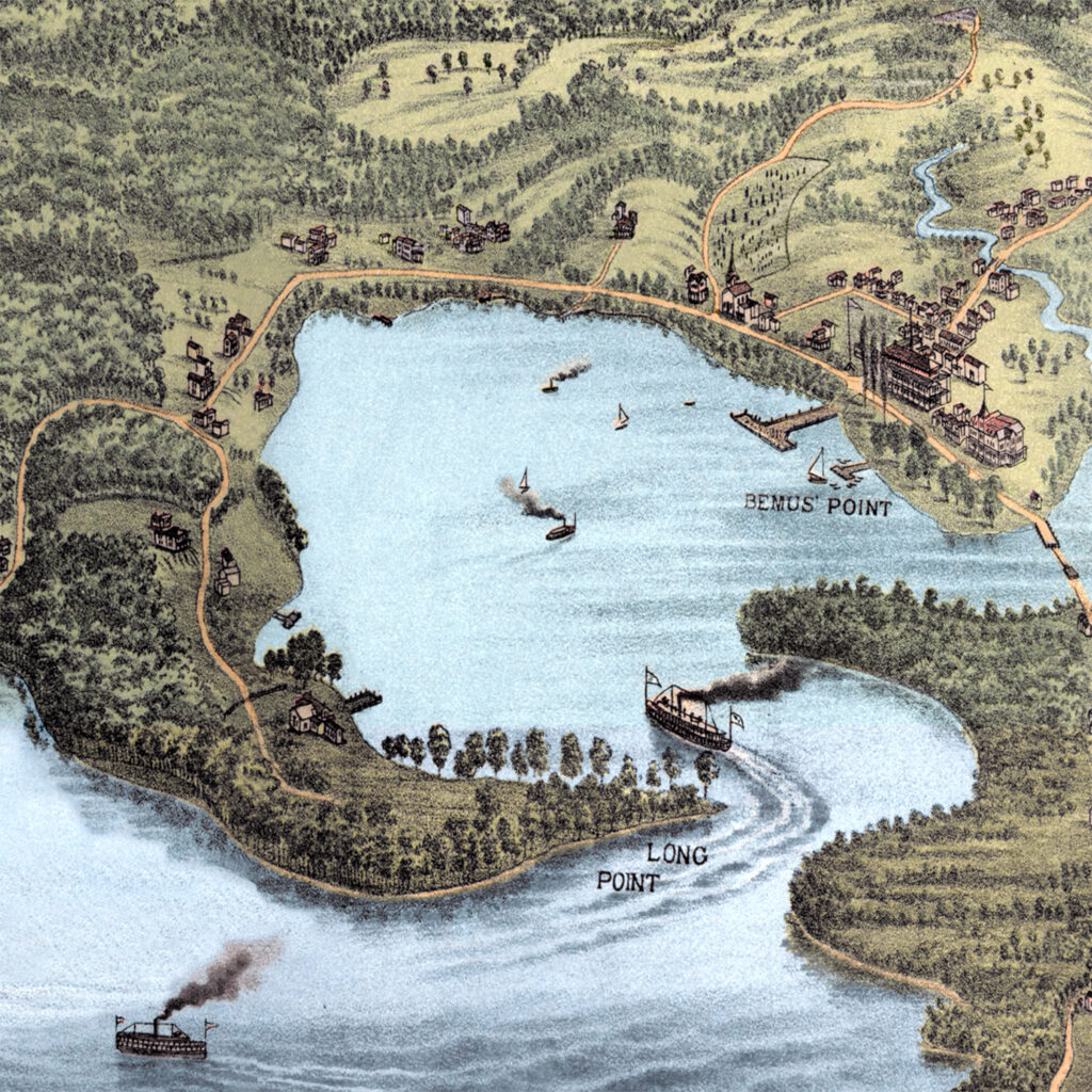
This vintage map of Lake Chautauqua, New York was created in 1885 by the Matthews-Northrup Company of Buffalo, New York. The map shows a beautiful bird’s-eye view of Chautauqua Lake as it once was, with steamboats crossing the water, small lakefront communities along the shore, winding country roads, railroads, wooded hills, open farmland, hotels, docks, and summer places that shaped life around the lake in the late 1800s. This restored and colorized edition brings the historic view back to life while preserving the original linework, labels, and details of the 1885 map.
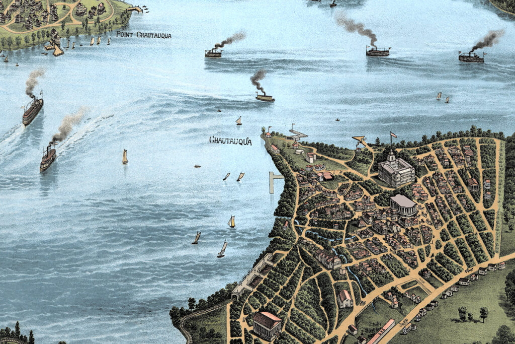
Historic Chautauqua Lake landmarks on the map include Point Chautauqua, Camp Collins, Dewittville, Mayville, Long Point, Lakewood, Griffiths Point, Fluvanna, Jamestown, Bemus Point, the Western New York & Pennsylvania Railroad, and many of the roads, shorelines, villages, wooded points, and lakefront places remembered by generations of families. Reproductions of the restored map are available here.
This vintage map of Lake Chautauqua has been restored and colorized by KNOWOL. Reproductions of the restored map are available here. You can click on the image below to zoom in and explore the details. No watermark appears on the printed version!
Vintage Map of Lake Chautauqua, New York 1885
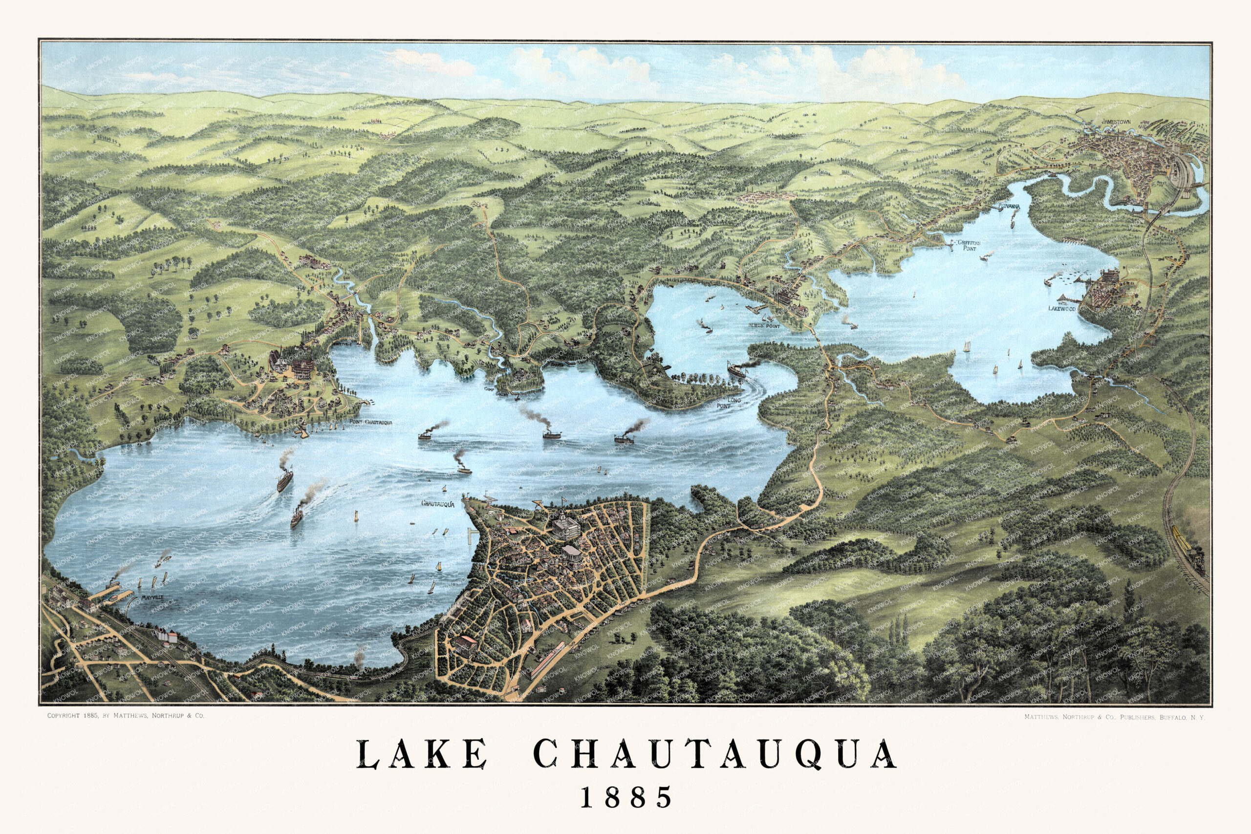
Restored and colorized 1885 bird’s-eye view map of Lake Chautauqua, New York, showing steamboats, sailboats, wooded hills, farms, roads, railroads, and historic lakefront communities including Mayville, Bemus Point, Long Point, Lakewood, Point Chautauqua, and Jamestown.
At the time this map was drawn, Chautauqua Lake was already one of western New York’s most beloved summer destinations. Families came to the lake for fresh air, boating, fishing, quiet mornings on the water, long afternoons along the shore, and summers spent between the villages, docks, cottages, hotels, and wooded points that made the area special. The steamboats shown on the map carried people from landing to landing, connecting Mayville, Bemus Point, Lakewood, Jamestown, Long Point, Point Chautauqua, and more.
For anyone who grew up visiting Chautauqua Lake, spent summers there, kept a boat on the water, stayed at a family cottage, or still thinks of the lake as home, this map is a one-page memory: the curve of the shoreline, the familiar names, the open water, the hills beyond the lake, and the feeling of looking out across Chautauqua on a clear summer day.
This beautiful old map of Lake Chautauqua makes an attractive addition to your office, library, lake house, cottage, den, or family room and can even be used to teach children the geography and history of the area. When you’re done exploring, click here to get your copy of the restored map.