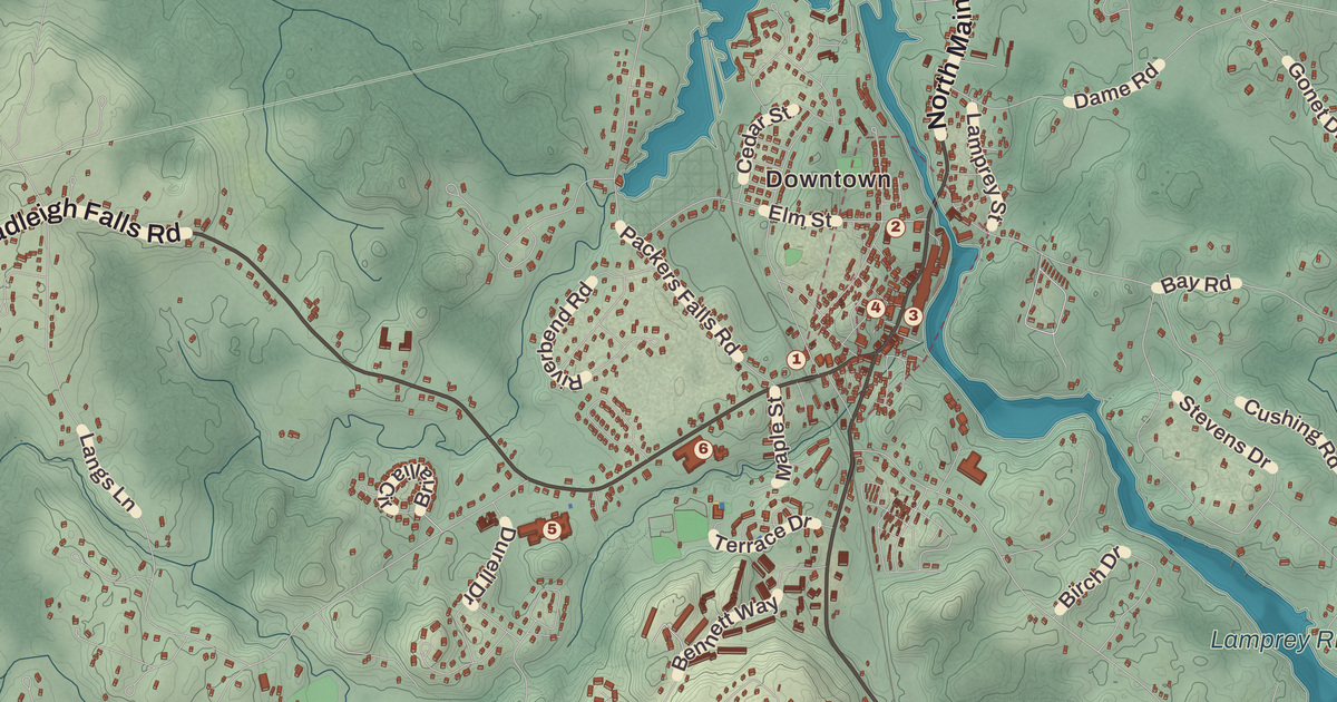
Newmarket’s stone mills line the Lamprey River at the falls, a short way above Great Bay. This map prints the Newmarket Mills there, the Newmarket Town Hall, the Stone School and the Newmarket Public Library, along with Bald Hill, Grapevine Hill, Four Corners and the Rockingham Country Club.
Newmarket is in Rockingham County, on Great Bay.
KNOWOL made this map in 2026 from public survey data and gave it the look of an old atlas. The shaded terrain around Bald Hill and Grapevine Hill comes from United States Geological Survey elevation data; Bald Hill, near the southwest corner, is the town’s highest point at 281 feet, and Great Hill rises to 228 feet just south of the center. The roads and the town line come from the Census Bureau, right down to smaller roads such as Hilton Drive. The Stone School and the Newmarket Industrial and Commercial Historic District are on the National Register of Historic Places, and we checked them against National Park Service records. Newmarket had 9,430 people at the 2020 census, 5,797 of them in the compact center around Routes 108 and 152.
See it on a wall
The Newmarket map as a framed print. Swipe for more.


Ships and trade
Newmarket was incorporated in 1727 as one of six towns Massachusetts granted in the last year of King George I’s reign. It began as a parish of Exeter, got full town privileges in 1737 and was probably named for Newmarket in Suffolk, England. The Lamprey River takes its name from John Lamprey, an early settler, not the fish, and for a while the town was even called Lampreyville. Newmarket traded with the West Indies, sending out timber, dried fish from the Squamscott and salted alewives from the Lamprey and bringing back whale oil, molasses and rum. It built ships too, many of them for the Royal Navy from local timber, and the town page cites a record of 21 ships built in a single year.
Wentworth Cheswill
Wentworth Cheswill was born in Newmarket in 1746, the grandson of Richard Cheswill, a formerly enslaved man of African ancestry who bought 20 acres from the Hilton grant in 1717 and is believed to be the first African American to own land in New Hampshire. Wentworth studied at Governor Dummer Academy in Massachusetts and came home to teach school. In 1768 he was elected town constable, and he was elected to some town office, selectman, auditor or assessor, every year but one until his death in 1817. His page says he’s believed to be the first African American elected to public office in the United States. During the Revolution he carried messages between Newmarket’s Committee of Safety and the Provincial Committee at Exeter, and in 1777 he marched to Saratoga with John Langdon’s company of light horse volunteers. He helped found the Newmarket Social Library in 1801, kept and copied the town’s records and studied its artifacts, and in 1805 he became a justice of the peace for Rockingham County. A state historical marker stands at his grave in Newmarket, and New Hampshire celebrated April 11, 2022, his 276th birthday, as Wentworth Cheswill Day.
The mill town
The Newmarket Manufacturing Company was incorporated in 1822 and built its first cotton mill in 1823 and 1824. With seven textile mills running on water power at the falls, it came to dominate the town’s waterfront and economy. It built housing for its workers and dams far up the watershed, creating Pawtuckaway Pond in Nottingham and Mendums Pond in Barrington, so it could release water into the Lamprey in a drought. The mills closed in the 1920s. The historic district’s page says what sets Newmarket apart is stone: where most mill towns in southern New England built in brick, Newmarket used stone for its mills and for houses, churches and schools too. The district runs along Main Street, Route 108, with the surviving mills along the river, shops across the street and homes on the side streets, and its town hall is a Greek Revival brick building of 1847. In the 1970s the mills were headquarters for the Timberland Company while it grew from a small work-boot maker into a fashion brand.
The Stone School stands on a steep hill above the commercial center at 1 Granite Street. William and Robert Channel, local farmers and stonemasons, began building it in 1841, of granite quarried at Durham Point, three stories on one side and two on the other, since it’s built into the hill. It was a school until 1966, when it went to the Newmarket Historical Society, which runs it as the Stone School Museum.
Henry Wajda, born in Newmarket in 1934, worked in a shoe factory in town before he became a jockey known as Hammerin’ Hank. He won more than 2,200 races, set a world record at Rockingham Park in 1958, and in 1960 at Suffolk Downs pulled a fellow jockey back into the saddle mid-race, a rescue that rider credited with saving his life. A state historical marker in Newmarket honors him as well.
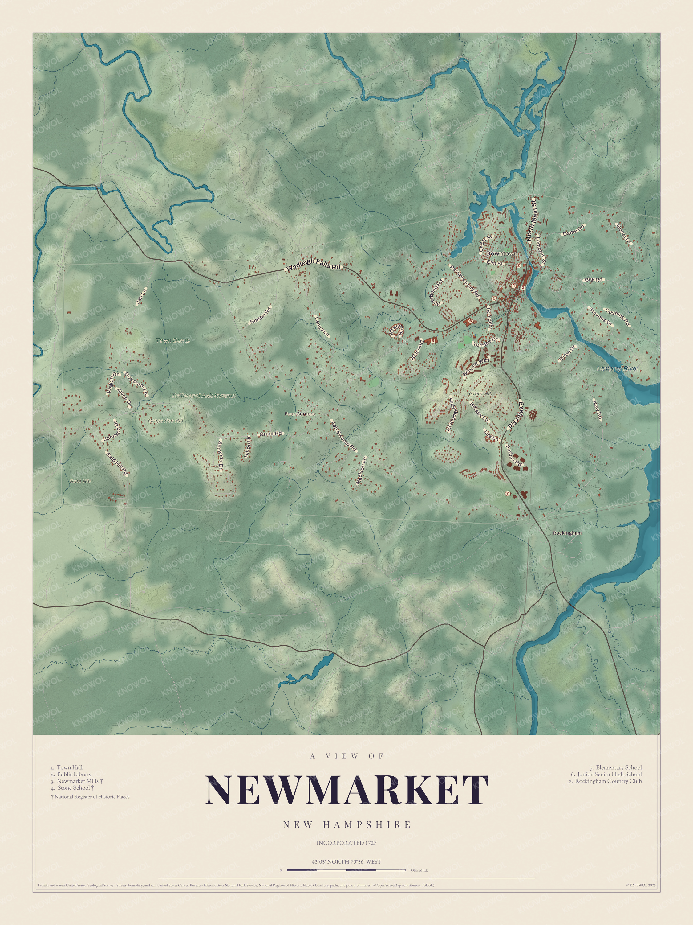
Click to explore a larger preview. The digital watermark does not appear on printed maps.
Names on this map
These names are printed on this map.
Places: Downtown, Rockingham, Four Corners, Bald Hill, Grapevine Hill, Great Hill, Lamprey River, Tuttle and Ash Swamp, Town Dump, Town Hall, Public Library, Newmarket Mills, Stone School, Elementary School, Junior-Senior High School and Rockingham Country Club.
Streets and roads: Wadleigh Falls Road, Exeter Road, North Main Street, Ash Swamp Road, Grant Road, New Road, Bay Road, Langs Lane, Hersey Lane, Ladyslipper Drive, Schanda Drive, Packers Falls Road.
More street names, A to Z
Alyce Drive, Bald Hill Road, Bennett Way, Birch Drive, Briallia Circle, Cedar Street, Cushing Road, Dame Road, Doe Farm Lane, Durell Drive, Elm Street, Forbes Road, Gonet Drive, Hilton Drive, Jan Lane, Johnson Drive, Lamprey Street, Lita Lane, Madison Lane, Maple Street, Norton Road, Riverbend Road, Stevens Drive, Terrace Drive, Wiggin Drive.
Along the Lamprey
The Lamprey River rises in Meadow Lake in Northwood and runs about 50 miles before it meets Great Bay at Newmarket. The Piscassic River joins it here, and the stretch from Epping down to that meeting is part of the National Wild and Scenic River System. Newmarket sits beside Great Bay in the southeast of the state, and Route 108 crosses the town, while Route 152 ends here. The Stone Church, a music venue, is on the town’s list of sites, as is the Stone School Museum. Bald Hill, Grapevine Hill, Rockingham and Four Corners are printed on the map, along with the Newmarket Elementary School and the Rockingham Country Club.
This map of Newmarket is a good addition to an office, library or den, and it can help teach children the geography and history of a stone mill town on Great Bay. It’s made for anyone who calls Newmarket home, from the falls of the Lamprey to Bald Hill, and KNOWOL created it in 2026 to show the town as it looks today. Zoom in on the preview above to explore the details, then click here to get your copy of the Newmarket map.

Sources