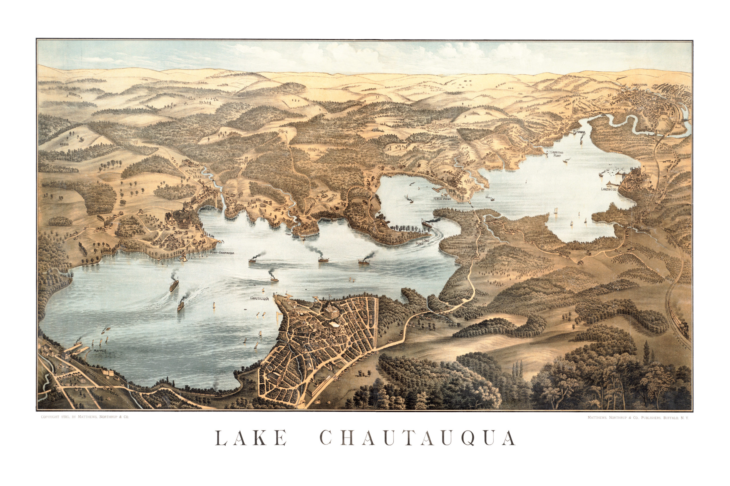
This historic old map of New York’s Chautauqua Lake was created in 1885 by the Matthews-Northrup Company of Buffalo. The map shows a detailed bird’s eye view of the area as it used to be, with vast fields of open space and steamboats traversing the lake.
Landmarks on the map include Point Chautauqua, Camp Collins, Dewitville, Mayville, Long Point, Lakewood, Griffiths Point, Fluvanna, Jamestown, Bemus Point, Western New York & Pennsylvania Railroad, and more.
This historic map of Chautauqua Lake has been restored by KNOWOL. Reproductions of the map are available here.
Bird’s Eye View of Lake Chautauqua in 1885.
This map of Chautauqua Lake will make an attractive addition to your office, library, or den and can even be used to teach children the geography and history of the area. When you’re done exploring, click here to get your copy.