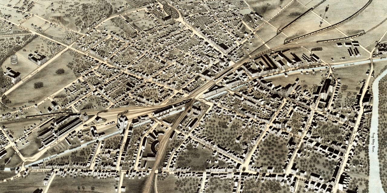
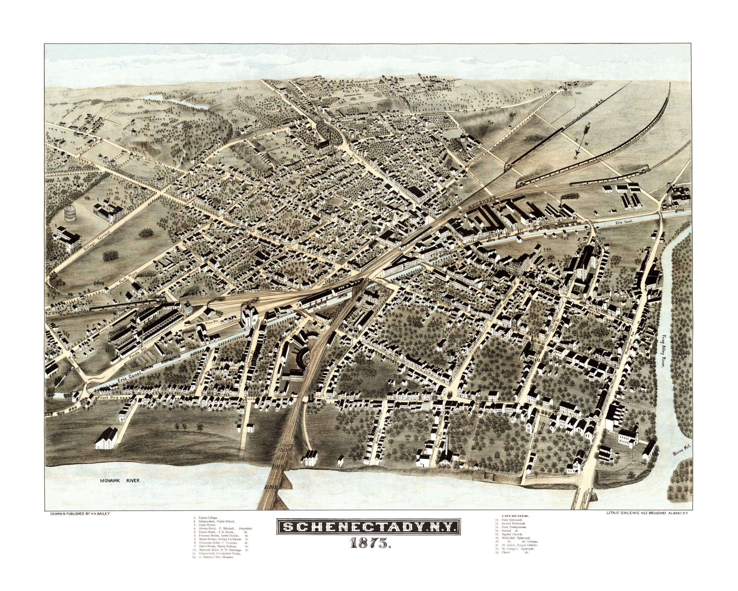
This map of Schenectady, New York was created in 1875 by H. H. Bailey, an artist and cartographer who spent his career traveling across America creating detailed bird’s eye view maps of small towns and their landmarks. Bailey visited Schenectady in 1875 and created this beautiful map.
The map guide highlights prominent residences and buildings in Schenectady at the time including Union College, Schenectady Union School, Givens Hotel, Burn’s Hotel, and Schenectady locomotive works.
This vintage map of Schenectady has been restored by the team at KNOWOL. Reproductions are available here.
Click here to see the full map.
This old map of Schenectady, NY will make an attractive addition to your office, library, or den, and can even be used to teach children the history of the town. When you’re done exploring, click here to get your copy.