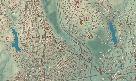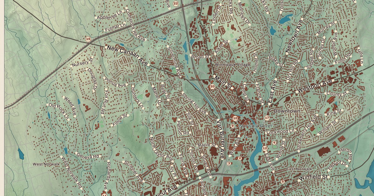
If you grew up in Norwalk, or you’ve ever walked Washington Street in SoNo on your way to the aquarium, you’ll find your city on this map just as it stands in 2026. Look for your road. Main Avenue, Westport Avenue, Connecticut Avenue, New Canaan Avenue, East Avenue, Riverside Avenue, Washington Street, Water Street, Winfield Street, Cranbury Road, Chestnut Hill Road and Kensett Avenue are all printed by name, along with many more.
Norwalk is in Fairfield County, on the northern shore of Long Island Sound.
KNOWOL made this map in 2026 from public survey data, and gave it the look of an old atlas. The shaded land, from the high ground at Silvermine, where the city tops out at 315 feet, down to Norwalk Harbor and East Norwalk Harbor, comes from United States Geological Survey elevation data. The streets and the city line come from the Census Bureau, right down to roads like Rowayton Avenue. South Norwalk, East Norwalk, West Norwalk, Rowayton, Silvermine, Winnipauk, Cranbury, Harborview and Shorehaven are printed by name. A guide of 34 numbered landmarks runs along the bottom, with the National Historic Landmark and the National Register sites marked, and we checked those against National Park Service records.
Founded in 1649
The land was bought from its Native owners in two deals, in 1640 and 1641. Roger Ludlow bought the land east of the Norwalk River from Chief Mahackemo, and Daniel Patrick the land to the west. The name may come from the Algonquin word noyank, meaning “point of land,” or more probably from the Native American name Naramauke. The first two settlers, Richard Olmsted and Nathaniel Ely, came from Hartford in 1649, and fourteen others followed. On September 11, 1651, the General Court of the Connecticut Colony decreed that “Norwaukee shall bee a townee.” The title panel prints Settled 1651, the year Norwalk became a town; the first homes went up two years before that, and a founders’ stone, now on East Avenue by East Norwalk station, reads “Norwalk founded A.D. 1649.”
The settlers grew corn and other grains and kept cows, and Calf Pasture Beach was used for pasturage as early as the 1650s. Later came flax and hemp, for linen and rope, and by the early 1700s flax was being shipped to the British Isles. Flax Hill Road, between South Norwalk and Rowayton, is a reminder of that crop. By 1880 oysters ruled the local economy, and ConnecticutHistory.org says Norwalk then had the largest fleet of steam-powered oyster boats in the world.
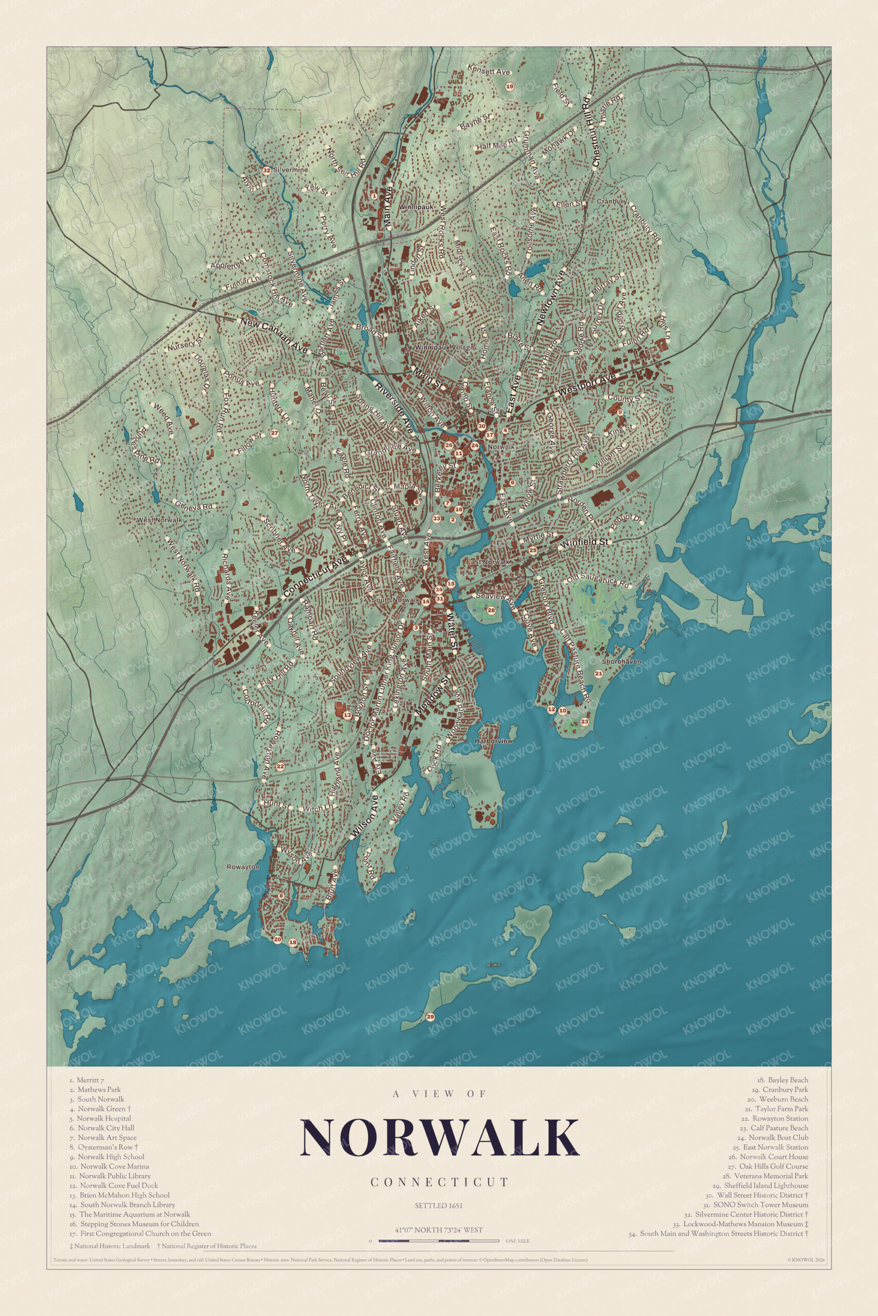
Click to explore a larger preview. The digital watermark does not appear on printed maps.
Names on this map
These names are printed on this map.
Places: Silvermine, East Norwalk, Rowayton, Calf Pasture Beach, Bayley Beach, Brien McMahon High School, Cranbury Park, First Congregational Church, Lockwood-Mathews Mansion, Maritime Aquarium, Mathews Park, Merritt 7, New Canaan, Norwalk Art Space, Norwalk Boat Club, Norwalk City Hall, Norwalk Court House, Norwalk Cove Fuel Dock, Norwalk Green, Norwalk High School, Norwalk Hospital, Norwalk Public Library, Sheffield Island Lighthouse Dock, South Norwalk Branch Library, Spring Hill, Taylor Farm Park, Veterans Memorial Park, Wall Street Historic District, Weeburn Beach and Winnipauk Village.
Streets and roads: Appletree Ln, Fulmar Ln, Ellen St, Murray St, Westport Ave, E Rocks Rd, Fox Run, Ferris Ave, W Norwalk Rd, Water St, Hunt St, Valley Rd.
More street names, A to Z
Wilson Ave.
The Green and Wall Street
The cluster of numbers in Central Norwalk centers on the Norwalk Green (4). It was a common until 1851 and is now a park owned by the city’s First Taxing District. The First Congregational Church on the Green (17) and St. Paul’s Episcopal Church both face it, and St. Paul’s parish goes back to 1737. The Norwalk Green Historic District was listed on the National Register in 1987, with 54 historic buildings, Mill Hill Historic Park and the World War I memorial on the green.
Just west is the Wall Street Historic District (30), the commercial and civic center of Central Norwalk, listed in 2009. Its 42 buildings sit mostly on the south side of Wall Street, among them a Gothic Revival church of 1860 at the corner of Wall and Mott Streets. The Norwalk Public Library (11) and the Norwalk Court House (26) are a short walk away. The guide also lists the Norwalk Boat Club (24).
Norwalk City Hall (6) is south of the green, at 125 East Avenue. Norwalk High School was founded in 1902 and first met in that building, now City Hall. The high school (9) has its own campus farther east now, and its crosstown rival is Brien McMahon High School (13), down near Rowayton. The two meet every Thanksgiving for a football game.
The Lockwood-Mathews Mansion and Mathews Park
South of the center, on West Avenue just west of the Norwalk River, is the Lockwood-Mathews Mansion Museum (33), a National Historic Landmark. LeGrand Lockwood, who made his fortune in banking and railroads, began building it in 1864 on his estate, then called Elm Park, and it was finished four years later. The architect was Detlef Lienau, and artists and artisans were brought from Europe, with the stonemasons and woodworkers coming from Italy. The house has 62 rooms, with colored marbles, inlaid floors and frescoed walls, and it has been described as “one of the earliest and finest surviving Second Empire style country houses ever built in the United States.”
Lockwood lost money in 1869 and died in 1872, and in 1876 Charles D. Mathews and his wife Rebecca bought the house. Their family lived there until 1938. In 1941 the city bought the estate as a public park, and in 1959 it planned to tear the mansion down for a new city hall. Local preservationists stepped in, and the Junior League of Stamford-Norwalk led a restoration in the late 1960s.
The mansion stands in Mathews Park (2). The Stepping Stones Museum for Children (16), a hands-on museum for children 10 and under, is in the park too. It opened in 2000, and in its lobby is the ColorCoaster, a kinetic sculpture spanning 27 feet, by the artist George Rhoads. The Norwalk Art Space (7) is beside it, and Norwalk Hospital (5) is a short way west.
SoNo and the Old Well
South Norwalk grew up around a well where sailing ships refilled their water casks. A deed of 1738 already calls Washington Street “the highway that leads to ye landing place called Ye Old Well,” and the village of Old Well was chartered as the city of South Norwalk on August 18, 1870. It had its own railroad station, trolleys, water company, electric company and schools. The cities of Norwalk and South Norwalk were joined early in the 1900s, and South Norwalk kept many of its own services as a taxing district. The guide marks South Norwalk (3) at South Norwalk station.
When the city planned to replace the old buildings on eastern Washington Street in the 1970s, residents got them listed on the National Register in 1977. That’s the South Main and Washington Streets Historic District (34), a close-packed block of late 1800s and early 1900s commercial buildings in Romanesque Revival, Second Empire and Italianate styles, with the 1895 railroad bridge at its center. The SONO Switch Tower Museum (31) is right by the tracks. The New York, New Haven and Hartford Railroad built the tower in 1896 to control the switches where the Danbury Branch leaves the main line, and it worked until 1986.
The Maritime Aquarium at Norwalk (15) opened as the Maritime Center on July 16, 1988, in an iron works factory from the 1860s, and visitors still walk on the factory’s original wood floors. It’s the only aquarium devoted to Long Island Sound, with harbor seals, sharks, sea turtles, otters and jellies, more than 2,700 animals in all. The South Norwalk Branch Library (14) is a few blocks west.
East Norwalk and Calf Pasture
Across the harbor is East Norwalk. Veterans Memorial Park (28) is there, and it’s where the Norwalk Oyster Festival is held every year. East Norwalk Station (25) is on the main line, about a mile north of Calf Pasture Beach.
Calf Pasture Beach (23) still carries the name of the colonists’ grazing land. The city was authorized to make a park here in 1917, and in 1922 the Betts, Marvin and Taylor families, who owned much of the land around it, gave their land to the city. The park opened in 1924. Today it has a large guarded beach and a fishing pier, and it’s where the city holds its Fourth of July fireworks. Taylor Farm Park (21), close by, has a tidal pool and room to walk the dog. The guide also lists the Norwalk Cove Marina (10) and the Norwalk Cove Fuel Dock (12).
Rowayton and the Islands
Rowayton, at the southwest end of the city, is a coastal neighborhood with its own taxing district, library and arts center. Rowayton Station (22) is on the main line here, and Oysterman’s Row (8) is farther south, toward the water. Early in the 1900s Bayley Beach, a coastal outpost of Wee Burn Country Club and the Roton Point Association were all part of the Roton Point Amusement Park, where steamboats brought day-trippers from New York. The guide marks Bayley Beach (18) and Weeburn Beach (20).
Offshore are the Norwalk Islands, a chain of more than 25 islands strung along six miles of the Sound, mostly about a mile out. They’re moraines left by the glaciers about 17,500 years ago, and on a clear day you can see Manhattan’s skyscrapers from them. At the southern end is the Sheffield Island Lighthouse (29). Captain Robert Sheffield bought the island in 1804, and in 1826 his son-in-law Gershom Smith sold 4 of its 53 acres to the federal government for a lighthouse. It was finished in 1828, with Smith as its first keeper. The present stone house, with its 44-foot light tower in the gable, was built in 1868, to the same design as the lights at Great Captain Island and Morgan Point. The light went dark in 1902. The Norwalk Seaport Association bought it in 1986, ferries have run out to it since 2002, and in 2011 it was lit again with solar power.
Silvermine, Cranbury and Merritt 7
In the north, Silvermine spreads along the Silvermine River into New Canaan and Wilton. It takes its name from old legends of a silver mine, though no silver has ever been found. In the 1700s the river fell steeply enough to power 12 or 13 mills, and in the early 1900s Silvermine grew into an art colony, whose artists founded the Silvermine Guild in 1922. The guide marks the Silvermine Center Historic District (32).
Cranbury Park (19) is the largest public park in Norwalk. It was the 227-acre country estate of Edward Beach Gallaher, an early figure in the automobile industry, and its Tudor Revival main house, built of Indiana limestone in 1929 to 1931, now sits among walking trails and a disc golf course. It was listed on the National Register in 2011. Merritt 7 (1) is the office park by the Merritt Parkway and Route 7. When Merritt 7 station opened there in 1985, it was the only privately built rail station in Connecticut. Oak Hills Golf Course (27), a public course, is in West Norwalk.
This map of Norwalk makes a handsome addition to a living room, office, library or den, and it can even help teach children the geography and history of the city. It’s a thoughtful gift for anyone who calls Norwalk home, grew up here, or moved away. Created by KNOWOL in 2026, it’s printed on museum quality archival paper in three sizes. Zoom in on the preview above to explore the details, then click here to get your copy of the Norwalk map.

Sources
- Norwalk, Connecticut, Wikipedia
- History of Norwalk, Connecticut, Wikipedia
- Norwalk, ConnecticutHistory.org
- Norwalk Green Historic District, Wikipedia
- Wall Street Historic District (Norwalk), Wikipedia
- Former Norwalk City Hall, Wikipedia
- Norwalk High School, Wikipedia
- Lockwood-Mathews Mansion, Wikipedia
- Lockwood-Mathews Mansion, National Register nomination, National Park Service
- Stepping Stones Museum for Children, Wikipedia
- South Norwalk, Connecticut, Wikipedia
- South Main and Washington Streets Historic District, Wikipedia
- SoNo Switch Tower, Wikipedia
- Maritime Aquarium at Norwalk, Wikipedia
- Calf Pasture Beach, Wikipedia
- Rowayton, Connecticut, Wikipedia
- Norwalk Islands, Wikipedia
- Sheffield Island Light, Wikipedia
- Silvermine, Connecticut, Wikipedia
- Cranbury Park (Norwalk), Wikipedia
- Merritt 7 station, Wikipedia