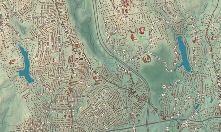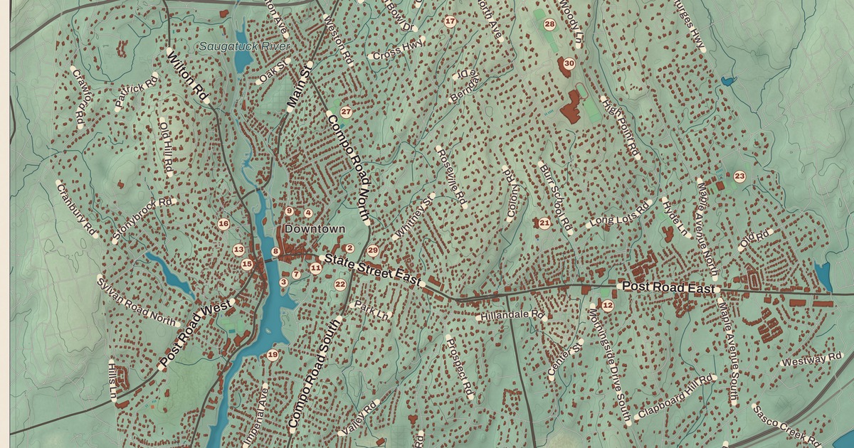
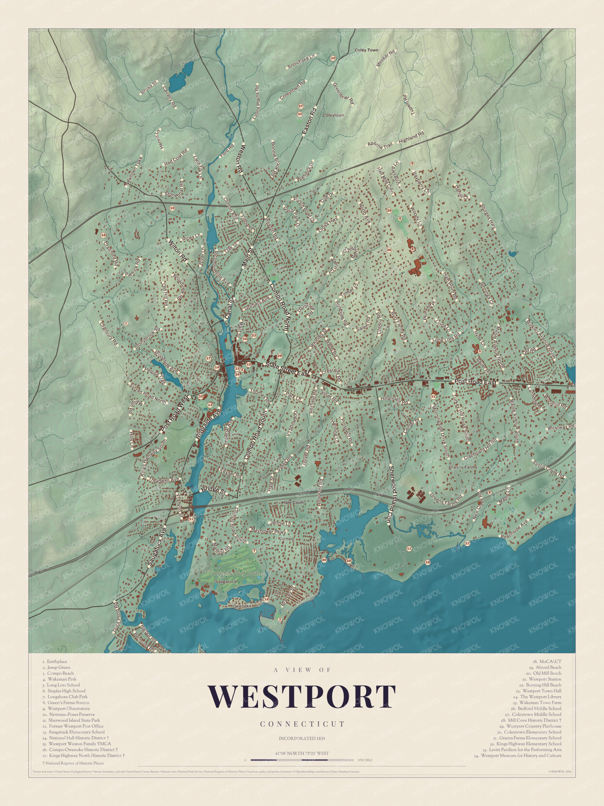
If you grew up in Westport, graduated from Staples, or spend summer evenings at Compo Beach, you’ll find your town on this map just as it stands in 2026. Look for your road. Post Road East, Post Road West, Main Street, State Street East, Compo Road South, Greens Farms Road, Saugatuck Avenue, Bridge Street, Kings Highway North, Long Lots Road, Coleytown Road, Weston Road and Easton Road are all printed by name, along with many more.
Westport is in Fairfield County, on Long Island Sound at the mouth of the Saugatuck River.
KNOWOL made this map in 2026 from public survey data, as a modern aerial view laid out like a page from a vintage atlas. The land is shaded from United States Geological Survey elevation data, and 9,618 buildings are drawn in their places. The streets and the town line come from the Census Bureau. Saugatuck, Compo, Owenoke, Greens Farms and Coleytown are printed by name. A guide of 34 numbered landmarks runs along the bottom, with the National Register sites marked, and we checked those against National Park Service records. From across the room it’s the whole town from Coleytown to the Sound. Up close, you can find your own street.
From Machamux to Westport
People lived here at least 7,500 years ago, and the first English settlers found the Pequot calling the area Machamux, which the colonists took to mean “beautiful land”. The first farms belonged to the five Bankside Farmers from Fairfield, and the community they built was officially named Green’s Farm in 1732, for one of them, John Green. On May 28, 1835, it was incorporated as the Town of Westport, with land from Fairfield, Weston and Norwalk. That’s the year on the title panel: Incorporated 1835.
For decades after that Westport was a farm town, and it became the leading onion-growing center in the United States and a shipping center, in part to carry its onions to market. From about 1910 artists, musicians and writers, F. Scott Fitzgerald among them, moved here, and the town became known as a “creative heaven”. Then in the later 1900s it became a suburb of New York City.
Post Road East, Compo Road South and Greens Farms
The numbers below match the guide printed on the map. Start at Jesup Green (2), in the middle of the sheet, with The Westport Library (24) and the Levitt Pavilion for the Performing Arts (33) close by. Post Road East runs through downtown past the Former Westport Post Office (12). Head the other way on Post Road West and you’ll reach the National Hall Historic District (14), where Wilton Road comes in. Turn south on Compo Road South and follow it past Longshore Club Park (7) down to Compo Beach (3), with the Compo-Owenoke Historic District (16) and Old Mill Beach (20) nearby.
Greens Farms Road heads east from there toward Green’s Farms Station (8), Burying Hill Beach (22) and Sherwood Island State Park (11). Back up north, North Avenue passes Bedford Middle School (26) and Coleytown Middle School (27), and Cross Highway runs northeast toward Wakeman Town Farm (25). Many of the roads are named, and each small block is a building, so zoom in on the preview and look for yours.
Names on this map
These names are printed on this map.
Places: Greens Farms, Compo Beach, Alvord Beach, Bedford Middle School, Burying Hill Beach, Coleytown Elementary School, Coleytown Middle School, Compo--Owenoke Historic District, Hale Court, Jesup Green, King's Highway Elementary School, Kings Highway North Historic District, Long Lots School, Longshore Golf Course, Mill Cove Historic District, National Hall Historic District, Newman-Poses Preserve, Old Mill Beach, Saugatuck Elementary School, Sherwood Island State Park, South Wilton, Staples High School, The Levitt Pavilion for the Performing Arts, The Westport Library, Wakeman Park and Westport Town Hall.
Streets and roads: Ford Rd, Coleytown Rd, Plains Rd, Tupelo Rd, Warnock Dr, Rayfield Rd, Imperial Ave, Post Rd, Westway Rd, Jennie Ln, Farms Rd and Beachside Ave.
Downtown and the Saugatuck River
Downtown, the old Westport Village, sits around the Post Road and Main Street by the Saugatuck River. On the west bank is the National Hall Historic District, listed on the National Register in 1984, whose centerpiece is National Hall itself, a three-story Italianate building of 1873. Up the hill west of downtown is the Kings Highway North Historic District (17), 58 acres along a road first laid out in 1672 between New York and Boston, with old cemeteries, a small militia training ground and houses from colonial days to the artists’ homes of the early 1900s. Westport Town Hall (23) and the Westport Museum for History and Culture (34) are near downtown, and Kings Highway Elementary School (32) and Saugatuck Elementary School (13) are close by. Nearby is the Westport Country Playhouse (29). The New York producer Lawrence Langner turned an 1835 tannery into a theater with a Broadway-quality stage, and the curtain first went up there on June 29, 1931. Down the river is Saugatuck, a name that means “mouth of the tidal river”, with Westport Station (21) near the southwest corner of town.
The Minute Man at Compo Beach
On April 25, 1777, the British invaded Connecticut at Compo Beach, and two days of fighting followed at Danbury and Ridgefield. Westport’s Minute Man statue honors the civilians who took up arms on a minute’s notice. It stands in the middle of the intersection of Compo Road South and Compo Beach Road, said to be the exact spot of the fiercest fighting between the British and the local militia.
The sculptor, H. Daniel Webster, was 29 when he got the job in 1909. He’d moved to Westport three years earlier to join its young artist community, and he had the statue cast by Tiffany & Co. at Roman Bronze Works. More than a thousand people came for the unveiling on June 17, 1910. On May 6, 1957, the statue made its national television debut on I Love Lucy, with Lucille Ball as the Minute Man.
Connecticut Humanities has the full story of the statue. On the map, follow Compo Road South toward Compo Beach (3) and you’ll come to the spot.
Compo, Greens Farms and the Shore
Compo takes its name from the Paugussett word Compaug, the bear’s fishing ground. The Compo-Owenoke Historic District, 154 acres listed in 1991, is the summer colony that grew up south of Compo Road South between 1910 and 1940, with Colonial Revival, Tudor Revival and bungalow cottages. Part of Owenoke Point was an island until it was joined to the mainland in the 1930s. Nearby, the Mill Cove Historic District (28) is a row of small cottages built between 1908 and 1940 on a barrier beach, reachable only on foot.
East of Compo is Greens Farms, Westport’s oldest neighborhood, with its own train station and Greens Farms Elementary School (31) in a Gothic-style building. At its western edge is Sherwood Island State Park, 238 acres of beach, wetland and woods. Daniel Sherwood settled on what was then Fox Island in 1787, and the park is numbered as Connecticut’s first state park because the state began buying land here in 1914. Alvord Beach (19) is in the guide too.
North Westport
Staples High School (6), up North Avenue, was founded in 1884 by Horace Staples, a businessman in shipping, hardware and banking, and it has been on its 70 North Avenue campus since 1958. Long Lots School (5) is to the east, and Wakeman Park (4) is up near Wakeman Town Farm. In the northwest, Earthplace (1) keeps a 62-acre sanctuary, the largest open space in Westport, along with rescued hawks, owls and other wild animals that can’t go back to the wild. The Westport Weston Family YMCA (15) and MoCA|CT (18) are up that way too. Coleytown, at the north edge of town near Weston, is named for a farmer named Coley, and Coleytown Elementary School (30) sits there beside the middle school. The Westport Observatory (9) and the Newman-Poses Preserve (10) are in the far north.
A gift for anyone who grew up between Coleytown and Compo
Created by KNOWOL in 2026, this map of Westport belongs in an office, library or den, or a beach house hallway, and it makes a handsome addition to a living room. It can even help teach children the geography and history of the town. The title panel reads “Westport, Connecticut,” with “Incorporated 1835” and the coordinates 41°08′ North, 73°21′ West.
It’s a thoughtful gift for a Staples graduate, a family that just moved to town, anyone who calls Westport home, or anyone who’s watched the sun go down at Compo. Open the preview, zoom in and find your street. It’s printed on museum quality archival paper in three sizes. See sizes and frames for the Westport map.

Maps of towns near Westport
- Map of Norwalk, Connecticut
- Map of Fairfield, Connecticut
- Map of Weston, Connecticut
- Map of Wilton, Connecticut
- Map of Darien, Connecticut
- Map of New Canaan, Connecticut
Sources
- Westport, ConnecticutHistory.org
- Westport, Connecticut, Wikipedia
- National Hall Historic District, Wikipedia
- Kings Highway North Historic District, Wikipedia
- Westport Country Playhouse, Wikipedia
- The Minute Man, Westport, ConnecticutHistory.org
- Compo-Owenoke Historic District, Wikipedia
- Mill Cove Historic District, Wikipedia
- Greens Farms, Connecticut, Wikipedia
- Sherwood Island State Park, Wikipedia
- Staples High School, Wikipedia
- Earthplace, Wikipedia