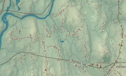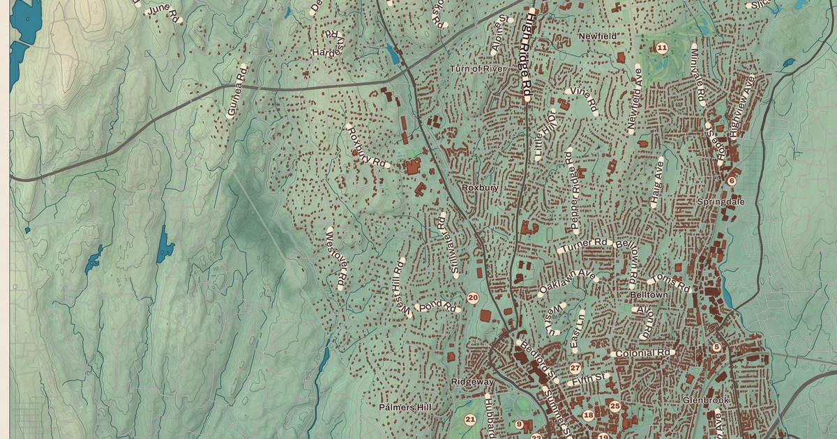
If you grew up in Stamford, or you’ve ever caught a train at Stamford Station, you’ll find your city on this map just as it stands in 2026. Look for your road. Washington Boulevard, Tresser Boulevard, East Main Street, West Main Street, High Ridge Road, Long Ridge Road, Newfield Avenue, Courtland Avenue, Cove Road, Westover Road and Northfield Street are all printed by name, along with many more.
Stamford is in Fairfield County, on Long Island Sound near the southwestern tip of Connecticut.
KNOWOL made this map in 2026 from public survey data, and gave it the look of an old atlas. The shaded land, from the hills of North Stamford down to Stamford Harbor and Westcott Cove on the Sound, comes from United States Geological Survey elevation data. The streets and the city line come from the Census Bureau, right down to roads like Newfield Avenue. North Stamford, Long Ridge, Hunting Ridge, Roxbury, Springdale, Glenbrook, the South End, Shippan Point and Dolphin Cove are printed by name. A guide of 34 numbered landmarks runs along the bottom, with the National Register sites marked, and we checked those against National Park Service records.
From Rippowam to Stamford
The Siwanoy people called this place Rippowam, and the first English settlers used the name too. On July 1, 1640, Nathaniel Turner of the New Haven Colony signed an agreement with the Siwanoy sagamores Wascussee and Ponus for the land. In May 1641 the Reverend Richard Denton came from Wethersfield, and that spring 29 Puritan families from Wethersfield followed him. That’s the year on the title panel: Founded 1641. On April 6, 1642, the settlement was renamed Stamford, after the town in Lincolnshire, England.
In the 1700s Stamford did well shipping goods by water to New York and the West Indies. New Canaan split off as its own town in 1801 and Darien in 1820. Stamford became a borough in 1830 and a city in 1893, and by then New Yorkers were building summer homes on the shore and starting to commute by train. In 1868 Linus Yale Jr. and Henry Robinson Towne founded the Yale Lock Manufacturing Company in the South End, and its locks gave Stamford an early nickname, the Lock City. Later Colonel Jacob Schick built electric dry shavers on Atlantic Street, and Stamford is called the birthplace of that industry. In the 1960s and 1970s corporations moved here from New York City, and downtown grew tall. Today Stamford is the state’s largest city by area and, at the 2020 census, its second most populous, with 135,470 people.
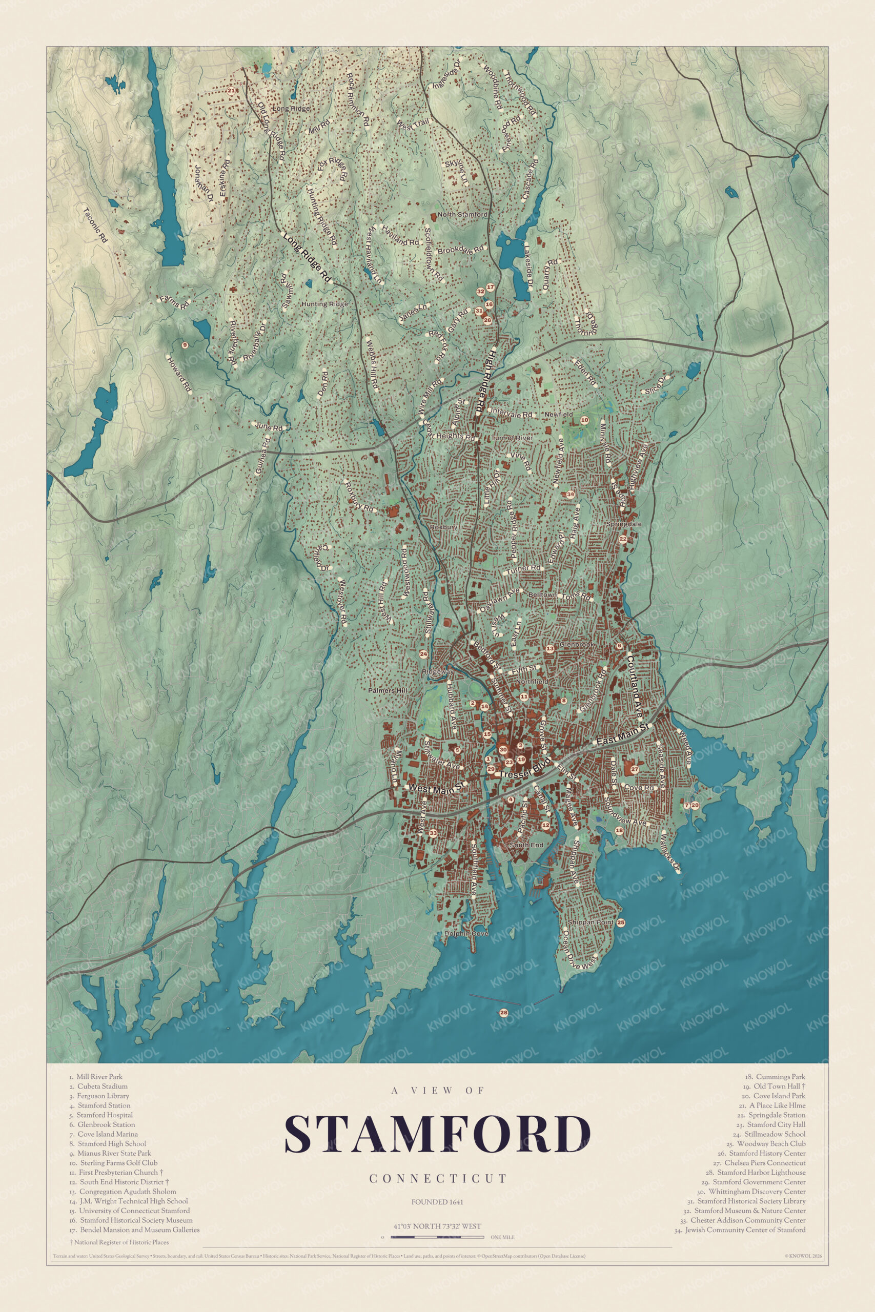
Click to explore a larger preview. The digital watermark does not appear on printed maps.
Names on this map
These names are printed on this map.
Places: North Stamford, Long Ridge, Glenbrook, Springdale, Turn of River, A Place Like Hlme, Chelsea Piers, Congregation Agudath Sholom, Cove Island Marina, Cove Island Park, Cubeta Stadium, Cummings Park, Dolphin Cove, Ferguson Library, First Presbyterian Church, Hunting Ridge, J. M. Wright Technical High School, Mianus River State Park, Mill River Park South, Old Town Hall, Palmers Hill, South End Historic District, Stamford City Hall, Stamford Harbor Lighthouse, Stamford High School, Stamford Historical Society Library, Stamford Historical Society Museum, Stamford Hospital, Sterling Farms Golf Club, Stillmeadow School, University of Connecticut Stamford Campus and Woodway Beach Club.
Streets and roads: Hunting Rdg, Riverbank Rd, Webbs Hill Rd, Brookdale Rd, Heights Rd, Pepper Ridge Rd, Hubbard Ave, W Main St, Pacific St, Wallacks Dr and Still Meadow.
Downtown
The tight cluster of numbers just north of the harbor and the South End is downtown, the heart of Stamford since colonial times. The Downtown Stamford Historic District, listed on the National Register in 1983 and enlarged in 1985 and 2002, takes in the older commercial streets around Atlantic, Main, Bank and Bedford Streets, including the Avon Theatre of 1939. At Main and Atlantic Streets is the Old Town Hall (19), a Beaux-Arts building with a limestone front and a clock tower. It was designed in 1905 by Edgar Josselyn and Nathan Mellen to replace a town hall lost to fire, and it opened in 1906, when the city had about 19,000 people. It stopped being the seat of government in 1963 and stood empty for years, but it was listed on the National Register in 1972, restored by 2010, and it’s in use again today. Stamford City Hall (23) and the Stamford Government Center (29) are listed together a short walk away.
The Ferguson Library (3) and the University of Connecticut Stamford (15) are both downtown. Mill River Park (1) runs along the Mill River between downtown and the West Side. After the old Mill River dam came out and the river was restored, the park opened in May 2013 with what’s called the largest cherry tree grove in New England. A carousel came in 2017, an ice rink and fountain in 2018, and in 2022 the Whittingham Discovery Center (30), a nature education building.
Stamford Station (4) is just south of downtown. Its official name honors the politician Stewart B. McKinney, and in 2018 it was the second busiest station on the Metro-North network, after Grand Central Terminal. Stamford Hospital (5), the city’s only hospital, is west of downtown. To the northwest, J.M. Wright Technical High School (14), which first opened in 1919, reopened in 2014 after a big renovation, with Cubeta Stadium (2) close by. The Chester Addison Community Center (33) is to the southwest.
The Fish Church and Strawberry Hill
North of downtown, at 1101 Bedford Street, is the First Presbyterian Church (11), better known as the Fish Church. The architect Wallace K. Harrison designed it, and it was dedicated in March 1958. Seen from the side or in plan, it’s shaped like a fish, an early Christian symbol, and its sanctuary glows with stained glass made of more than 20,000 pieces of faceted glass. Its Maguire Memorial Tower, 260 feet tall, holds a carillon of 56 bells, and in 2021 the church was named a National Historic Landmark.
Stamford High School (8) is a short way east, on Strawberry Hill Avenue, in a building finished in 1928. Farther up Strawberry Hill Avenue is Congregation Agudath Sholom (13), a Modern Orthodox congregation founded in 1889 by twenty-two members, which built its present synagogue in 1965. Stillmeadow School (24) is to the northwest.
The South End and the Shore
Below downtown, past the railroad and Interstate 95, is the South End, a peninsula between the Stamford Canal and the Rippowam River. It was one of the first parts of Stamford cleared by the settlers, held in common from 1641 to 1665, and from the 1800s until the middle 1900s it was the city’s manufacturing heart, home to Yale and Towne. The guide marks it as the South End Historic District (12), 177 acres with 449 buildings, most from the 1870s to the 1930s, and the Pulaski Street Bridge, an iron truss over the Rippowam. Since 2008 the Harbor Point project has turned old industrial land into apartments, offices and shops.
East of downtown is Chelsea Piers Connecticut (27), the first branch of New York’s Chelsea Piers, which opened in July 2012. Out in the harbor, on Chatham Rock about 3,600 feet from shore, is the Stamford Harbor Lighthouse (28), a cast iron tower of 1882 made in Boston. It was sold to a private owner in 1955 and listed on the National Register in 1991. East of the harbor is Shippan Point, the city’s southernmost neighborhood, with its big houses looking out over the water.
Cummings Park (18), 79 acres on the Sound, is named for Homer Stille Cummings, a Stamford mayor who became Franklin Roosevelt’s Attorney General and liked to walk this shore. Cummings Beach once had a colony of harbor seals, and a white marble seal statue remembers them. The Woodway Beach Club (25) is near Westcott Cove. Farther east is Cove Island Park (20), 83 acres of beaches, trails, salt marsh and woods, and the home of SoundWaters, an environmental education group with an 80-foot schooner. The Audubon Society counts it among the state’s Important Bird Areas, with 287 kinds of birds seen here, and it protects Stamford’s last undeveloped sand dune. Residents buy their beach passes at the Government Center. The guide also lists the Cove Island Marina (7).
Glenbrook, Springdale and North Stamford
East of downtown, the New Canaan branch of the railroad runs up through Glenbrook and Springdale, and each has its stop on the guide: Glenbrook Station (6) and Springdale Station (22). In 1856 Charles Henry Phillips, the pharmacist who invented milk of magnesia, built a wax and camphor factory in what’s now Glenbrook, along the Noroton River. Springdale has had its name since 1868, the year the first train ran to New Canaan on the Fourth of July, and its station opened that year. Hope Street is its main street. Farther north are the Jewish Community Center of Stamford (34) and the Sterling Farms Golf Club (10).
North of the Merritt Parkway is North Stamford, the largest part of the city and the least crowded. Here, on 118 acres, is the Stamford Museum & Nature Center (32), with a working farm, trails, a planetarium and an observatory. Its centerpiece is the Bendel Mansion and Museum Galleries (17), the Tudor-style summer house that the department store founder Henri Bendel built in the late 1920s on a hill above Laurel Lake. The museum moved here in 1955, and the mansion is a gallery today. Close by is the Stamford Historical Society’s campus, which the guide numbers three times: the Stamford Historical Society Museum (16), the Stamford History Center (26) and the Stamford Historical Society Library (31).
Up in the northwest corner is Mianus River State Park (9), 527 acres shared with Greenwich, which takes in the city-owned Mianus River Park and Treetops, the old estate of the singer and actress Libby Holman. The guide also prints A Place Like Hlme (21) in the far north.
This map of Stamford makes a handsome addition to a living room, office, library or den, and it can even help teach children the geography and history of the city. It’s a thoughtful gift for anyone who calls Stamford home, grew up here, or moved away. Created by KNOWOL in 2026, it’s printed on museum quality archival paper in three sizes. Zoom in on the preview above to explore the details, then click here to get your copy of the Stamford map.

Sources
- Stamford, Connecticut, Wikipedia
- History of Stamford, Connecticut, Wikipedia
- Stamford, ConnecticutHistory.org
- Downtown Stamford, Wikipedia
- Old Town Hall (Stamford), Wikipedia
- Old Town Hall, National Register nomination, National Park Service
- Mill River Park, Wikipedia
- Stamford Transportation Center, Wikipedia
- Stamford Hospital, Wikipedia
- J. M. Wright Technical High School, Wikipedia
- Fish Church (First Presbyterian Church of Stamford), Wikipedia
- Congregation Agudath Sholom, Wikipedia
- South End Historic District (Stamford), Wikipedia
- Chelsea Piers, Wikipedia
- Stamford Harbor Ledge Light, Wikipedia
- Shippan Point, Wikipedia
- Cummings Park, Wikipedia
- Cove Island Park, Wikipedia
- Glenbrook (Stamford), Wikipedia
- Springdale (Stamford), Wikipedia
- Springdale station, Wikipedia
- Stamford Museum & Nature Center, Wikipedia
- Henri Willis Bendel, Wikipedia
- Treetops (Mianus River State Park), Wikipedia