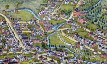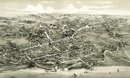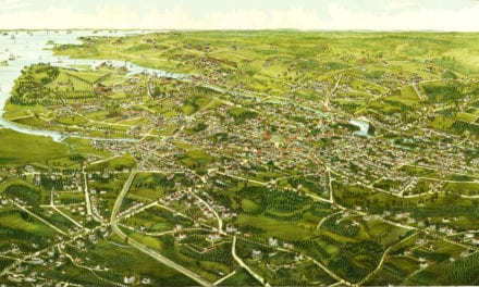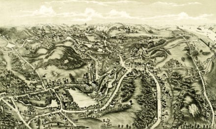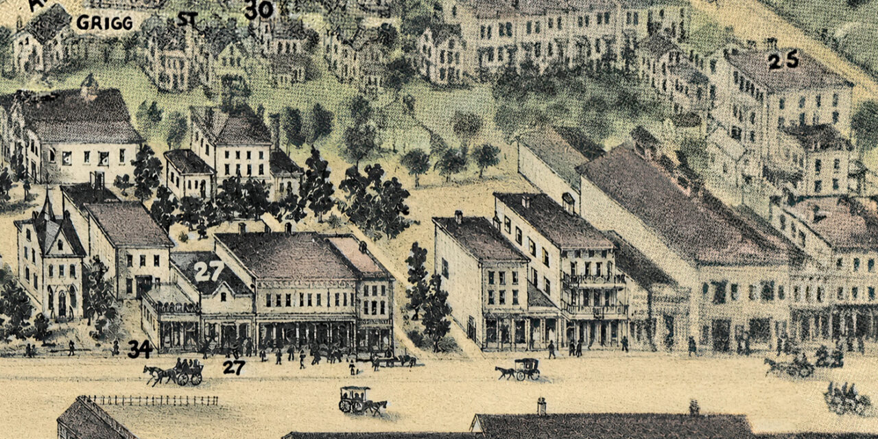
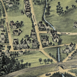
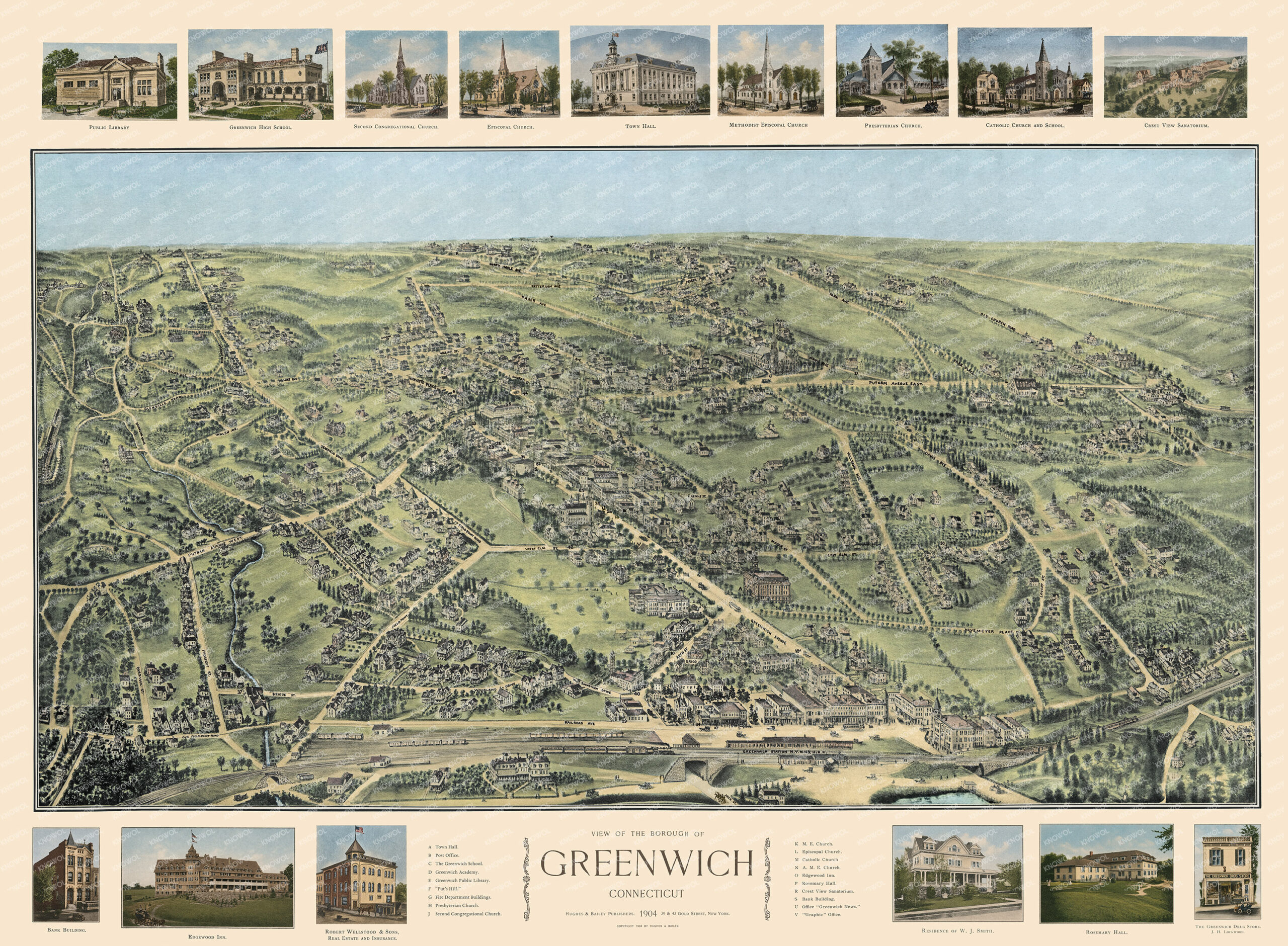
This vintage map of Greenwich, Connecticut was created in 1904 by O.H. Bailey, a prominent 19th century map maker. The map shows a bird’s eye view of Greenwich as it once was, including street names and old landmarks. This is the only known colorized version of the map to exist.
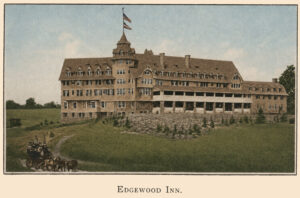
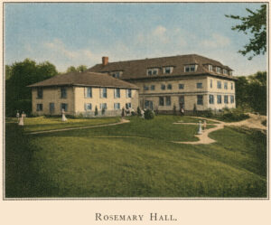
Historic Greenwich landmarks on the map include Greenwich Academy, The Greenwich School, Put’s Hill, Edgewood Inn, Rosemary Hall, Crest View Sanatorium, Office of “Greenwich News”, the Greenwich Station of the New York and New Haven Railroad, Public Library, Town Hall, Greenwich High School and many of the churches that still stand today.
This vintage map of Greenwich has been lovingly restored and colorized by KNOWOL. Reproductions of the restored map are available here. You can click on the image below to view a large version.
Vintage Map of Greenwich, Connecticut 1904
Explore a restored 1904 bird’s-eye view map of Greenwich, Connecticut by O.H. Bailey, featuring historic streets, churches, schools, estates, railroads, and landmarks.
At the time this map was drawn, Greenwich was in a period of rapid transformation. The New York and New Haven Railroad had connected the town to the city, drawing wealthy New York families out to build the grand estates that would define the area for decades, and the quiet farming and shoreline community of the 1800s was quickly becoming one of the most fashionable suburbs in the Northeast. Greenwich Avenue was already equipped with sidewalks, street lighting, and water lines, but was being paved and would soon carry a streetcar line. The schools, churches, and landmarks shown on this map capture a town rapidly growing into the Greenwich you know today.
This beautiful old map of Greenwich makes an attractive addition to your office, library, or den and can even be used to teach children the geography and history of the area. When you’re done exploring, click here to get your copy of the restored map.