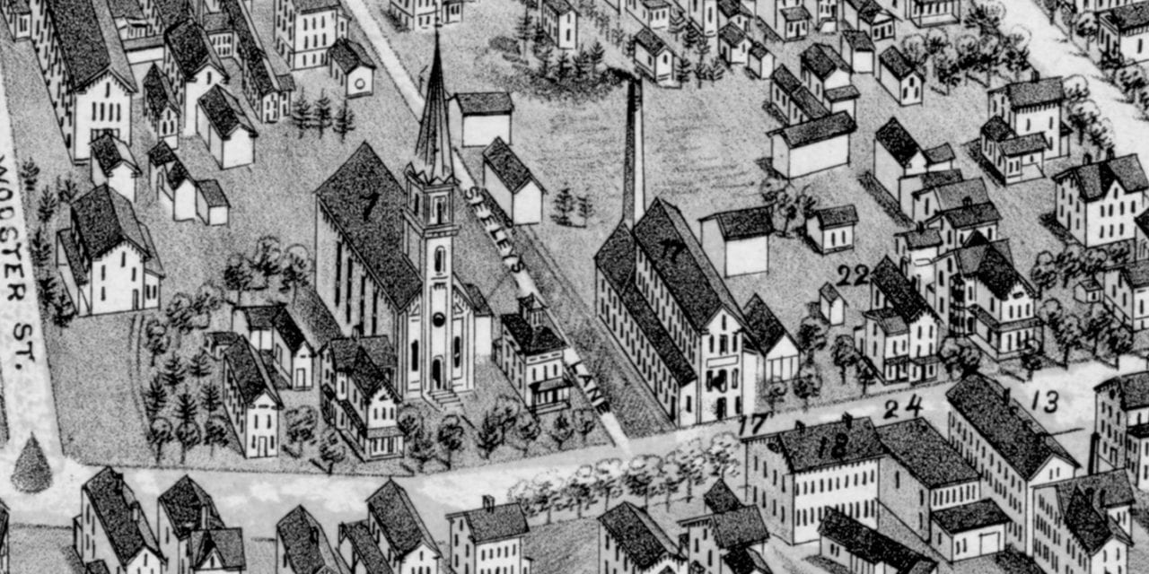
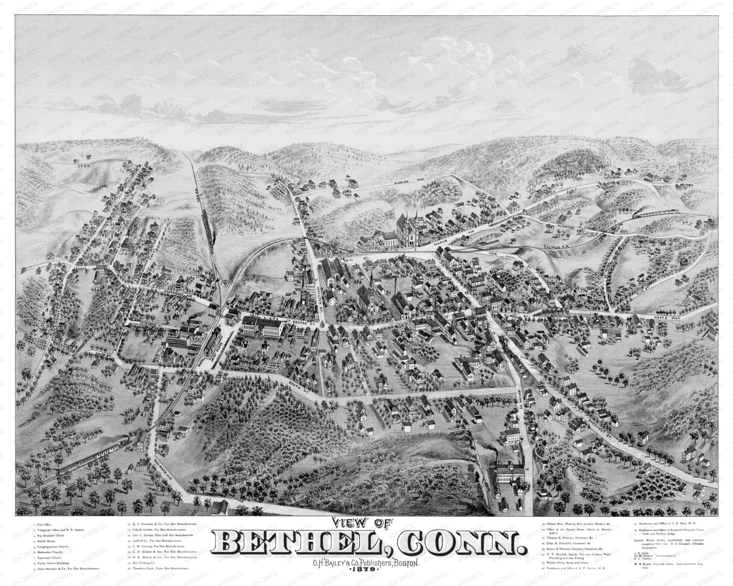
This old map of Bethel, Connecticut was created in 1879 by O.H. Bailey, a prominent 19th century map maker. The map shows a bird’s eye view of Bethel as it once was, including street names and old landmarks. Approximately 3,000 people lived in town at the time.
Landmarks on the map include Bethel House, Fox Brothers’ Hotel, Telegraph Office & Railroad Station, Danbury & Norwalk Railroad, Farnham’s Fur Hat Manufacturers, Public School Buildings, Clark Paper Box Manufacturing, Gilbert Brothers Planing Mill, Eureka Water Works, and more.
This historic map of Bethel was restored by KNOWOL. Reproductions of the restored map are available here.
Bird’s Eye View of Bethel, Connecticut in 1879
This restored map of Bethel will make an attractive addition to your office, library, or den and can even be used to teach children the geography and history of the area. When you’re done exploring, click here to get your copy of the restored map.