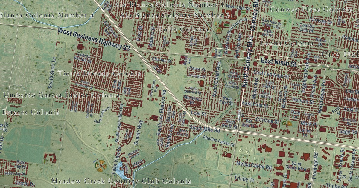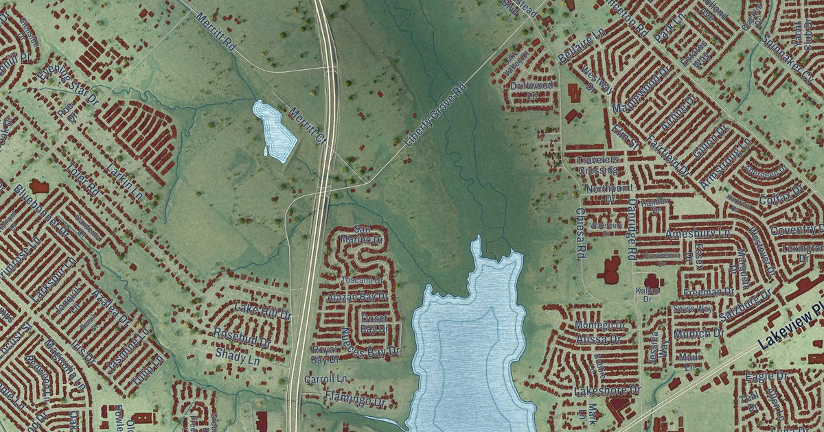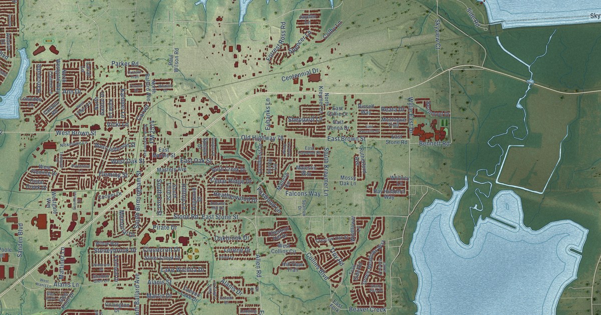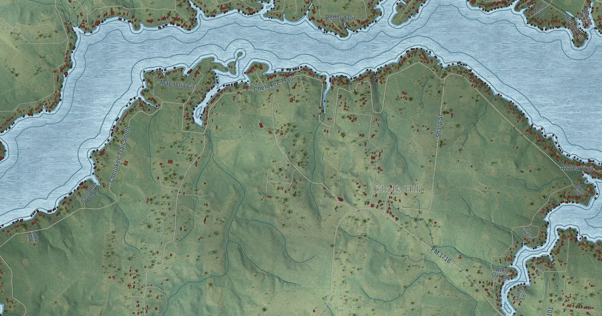
This beautifully detailed map of Lake Cherokee, Texas was created in 2026 using aerial imagery combined with modern topographical, census, street and landmark data. It's a modern aerial view of Lake Cherokee in Rusk County, Texas, that combines modern data with a vintage aesthetic. The roads feature printed names, and if you look closely you can find your exact house accurately shown in its correct location.
Explore an aerial view of Lake Cherokee, Texas
On this map you'll find Chalk Hill, Mayflower, Estes Parkway, Miller Street, Cherokee Trail, FM 1716, Cherokee Trail South, Lake Cherokee, Quail Run, Jay Drive, FM 2011, FM 782 North, and more. Each red shape is a building, so zoom in on the preview and look for yours.
Lake Cherokee is a community in Rusk County. The Census Bureau counted 2,980 people here in 2020. The map prints the town name in its title panel, with the coordinates below it.
Take a closer look at the Lake Cherokee map
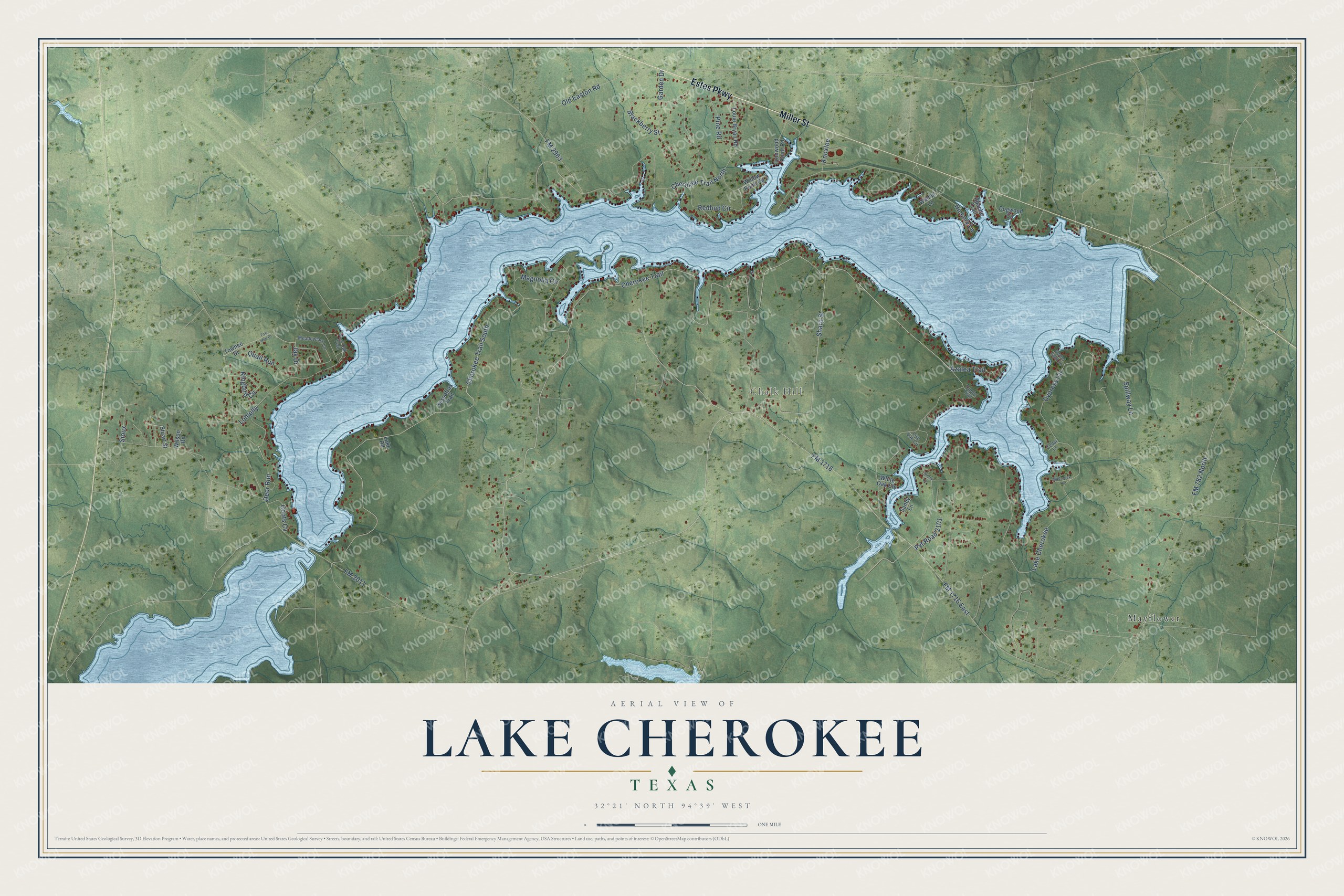
Names on this map
These names are printed on this map.
Places: Chalk Hill and Mayflower.
Streets and roads: Estes Parkway, Miller Street, Cherokee Trail, FM 1716, Cherokee Trail South, Lake Cherokee, Quail Run, Jay Drive, FM 2011, FM 782 North, Cherokee Trail North, Sharp Street.
More street names, A to Z
Apache Trail, Azalea Trail, Blackberry Street, Cedar Lane, Cherry Lane, Coots Cv, Cypress Circle, Deer Run, Dogwood Circle, FM 1716 East, FM 2963, Garden Drive, Hickory Lane, Ironwood Point Road, Kingbird Circle, Knoxlee, Lake Road, Live Oak Circle, Loblolly, Louie Bryan Road, Magnolia Circle, Meadowlark Lane, Mudcreek Lane, Old Easton Road, Pine Road, Post Oak Trail, Pvt Road 2101, Redbud Circle, Sandy Lane, Sassafras Trail, Sioux, Spillway Lane, Stuart Street, Sweet Gum Lane, Towhee Drive, Tow Hee Drive, Tupelo Trail, Walnut Lane, White Oak Circle, Willow Point Road, Wilson Road.
See it on a wall
The Lake Cherokee map as a framed print. Swipe for more.


Created by KNOWOL in 2026. The buildings are small red shapes, the roads carry their printed names, and shaded relief shows the shape of the land. The title panel reads "AERIAL VIEW OF LAKE CHEROKEE, TEXAS" with 32°21' NORTH 94°39' WEST.
It suits a den, a classroom or a front hall, and it makes a gift for anyone with Lake Cherokee roots. Open the preview and find the block you know. See sizes and frames for the Lake Cherokee map.