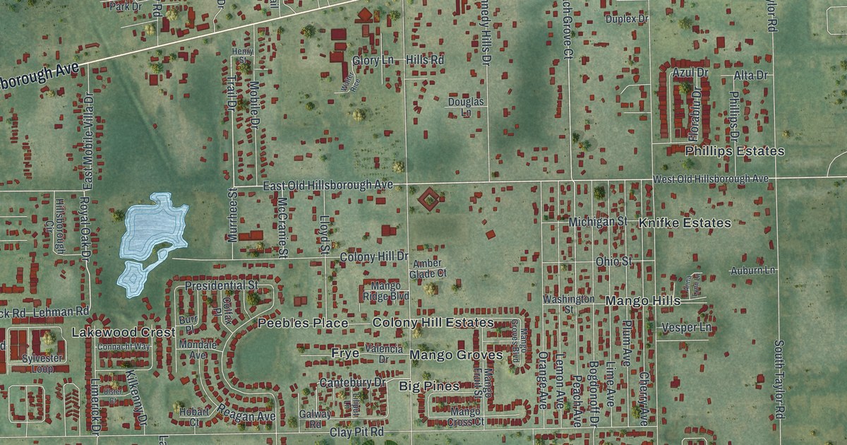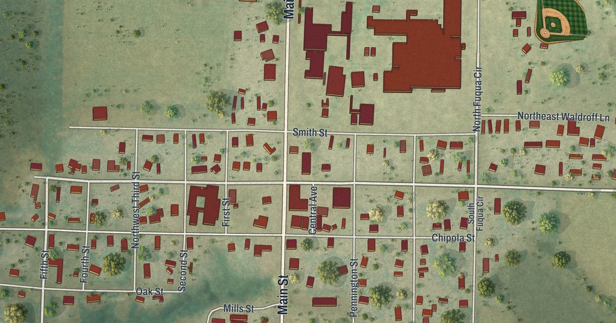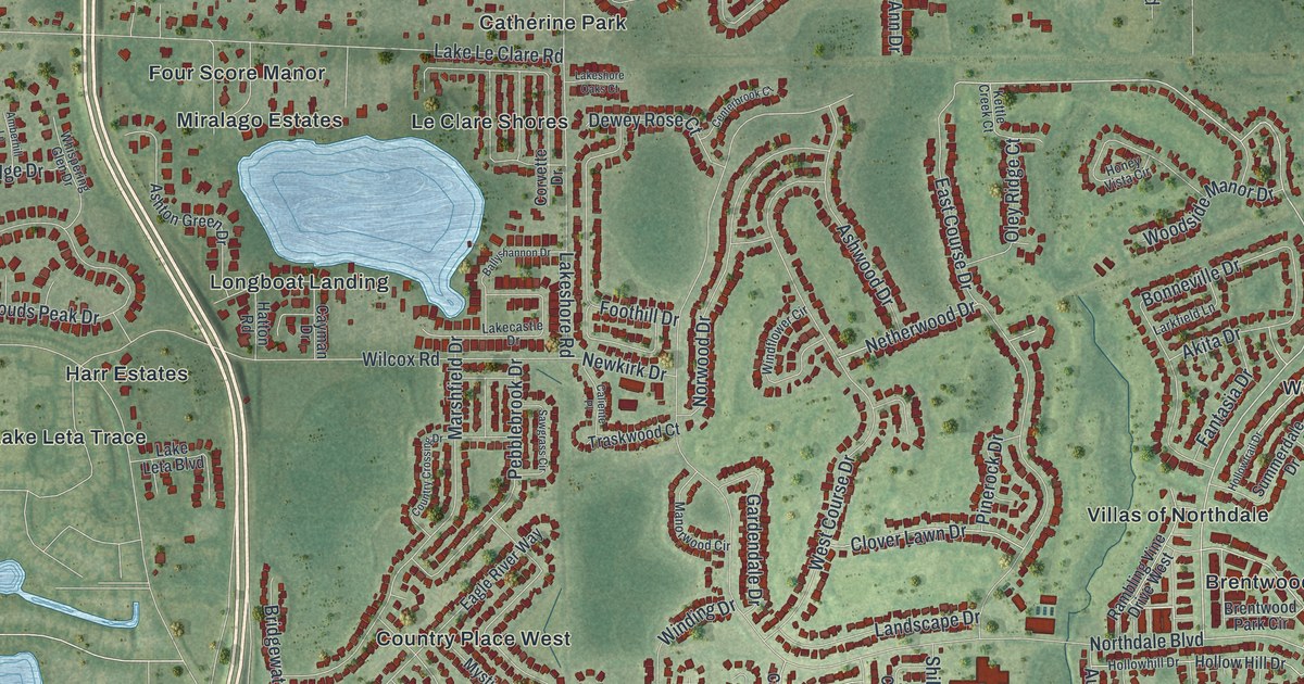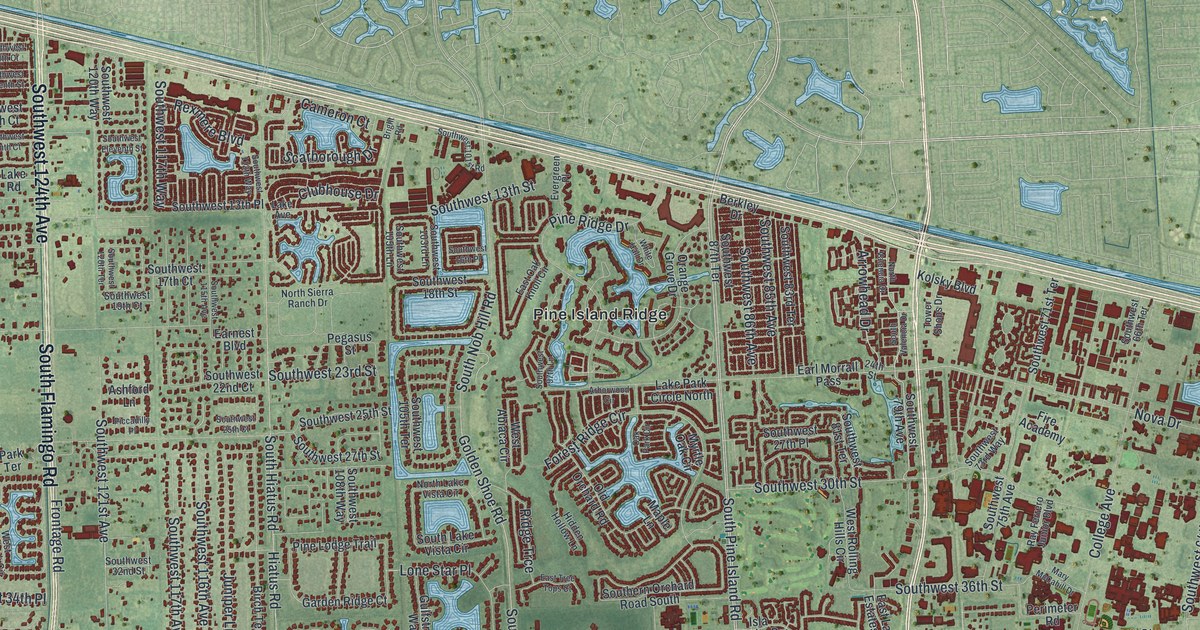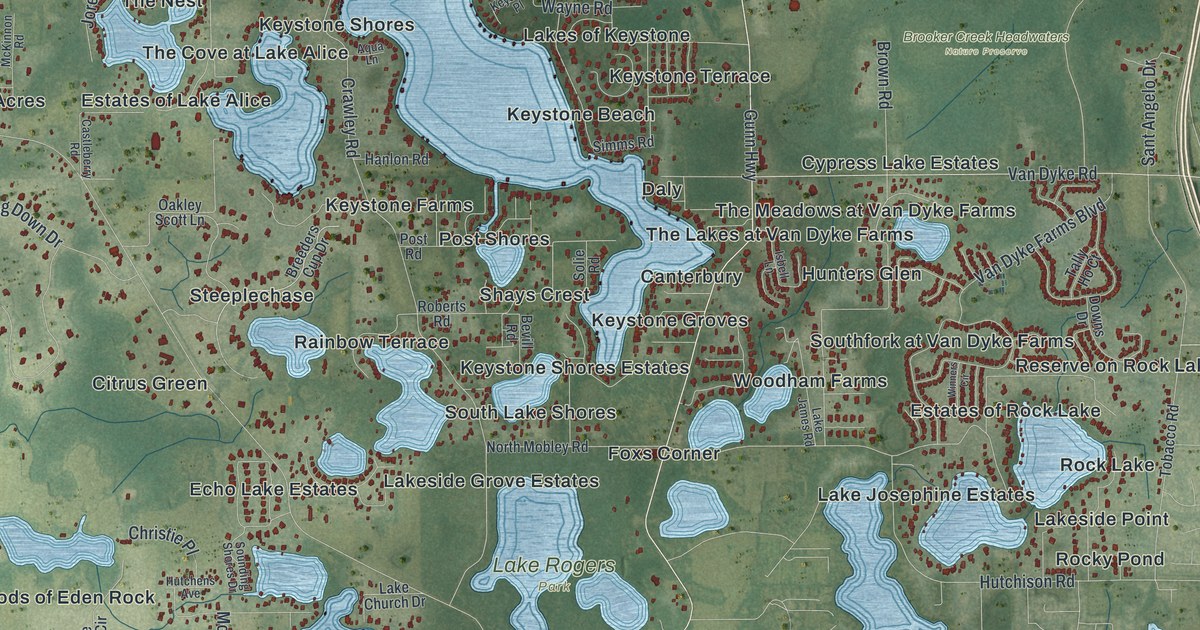
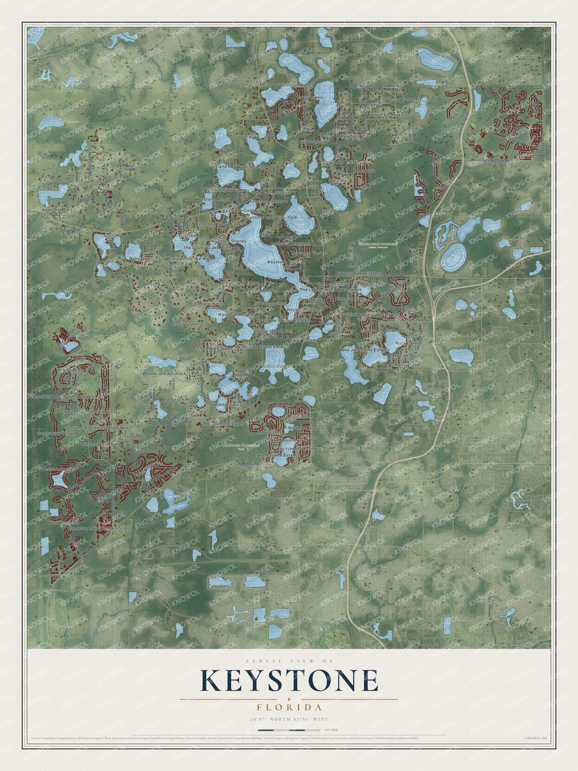
This beautifully detailed map of Keystone, Florida was created in 2026 using aerial imagery combined with modern topographical, census, street and landmark data. It's a modern aerial view of Keystone in Hillsborough County, Florida, that combines modern data with a vintage aesthetic. The roads feature printed names, and if you look closely you can find your exact house accurately shown in its correct location.
Explore an aerial view of Keystone, Florida
On this map you'll find Brooker Creek Headwaters Nature Preserve, Lake Dan Nature Preserve, Lake Rogers Park, Northwest Equestrian Park, West Hampton, Fern Glen, Gulf Pine, Canterbury North at the Eagles, Keystone Grove Lakes, Rocky Pond, Angel Farms Estates, Keystone Groves, and more. Each red shape is a building, so zoom in on the preview and look for yours.
Here is a piece of Keystone history. In the 1880s, when many Florida towns kept a shotgun quarantine against yellow fever, Keystone was where mail was left for summer campers on the Gulf coast near Clearwater. The postman rode over and picked out his own mail, stained with disinfectant to guard against the fever. That's from the Florida Place Names.
Keystone is a community in Hillsborough County. The Census Bureau counted 25,211 people here in 2020.
Take a closer look at the Keystone map
Names on this map
These names are printed on this map.
Places: Brooker Creek Headwaters Nature Preserve, Lake Dan Nature Preserve, Lake Rogers Park, Northwest Equestrian Park, West Hampton, Fern Glen, Gulf Pine, Canterbury North at the Eagles, Keystone Grove Lakes, Rocky Pond, Angel Farms Estates, Keystone Groves, Montreux, Island Ford Lake Beach, Durango, Woods of Eden Rock, Keystone Terrace, Steeplechase, Westwood Lakes, Northton Groves, Southfork at Van Dyke Farms, Keystone Park, Lake Fern, Waterchase, Keystone Farms, Hunters Glen, Echo Lake Estates, Crippenwood, Canterbury Village, South Lake Shores, Estates of Lake Alice, Lake Julia, Great Lakes, Nine Eagles, Keystone Park Colony, Saint Andrews at the Eagles, Belmack Acres, Daly, Keystone Reserve, Lake Josephine Estates, Stillwater, Alldredge, Northlake Village, Estates of Rock Lake, Lake Maurine, Hampton Lakes at Main Street, The Meadows at Van Dyke Farms, Keystone Lake View Park, Citrus Green, The Nest, Woodham Farms, Foxs Corner, Cypress Lake Estates, Turnberry at the Eagles, Odessa Woods, Horseshoe Estates, Rainbow Terrace, Lake Maurine Estates, Keystone Cove, Shays Crest, Lakes of Keystone, Rock Lake, Lady Lake Estates, Lakeside Point, Lakeside Grove Estates, Post Shores, The Cove at Lake Alice, Keystone Shores, Windsor Park at the Eagles, Reserve on Rock Lake, The Lakes at Van Dyke Farms, Keystone Beach, Innfields, Patterson Road, Keystone Manor, Keystone Crossings, Arbor Lakes, Lake Calm Estates, Canterbury, Keystone Shores Estates, Farmington and Wyndham Lakes.
Streets and roads: Angel Lane, Nine Eagles Drive, West County Line Road, Gunn Highway, Race Track Road, Tarpon Springs Road, Boy Scout Road, Crawley Road, West Lutz Lake Fern Road, South Mobley Road, Trotting Down Drive, Crescent Road.
More street names, A to Z
Aqua Lane, Barrie Acres Trail, Berea Drive, Bevill Road, Blake Road, Blazing Star Drive, Blue Tick Road, Blue Whetstone, Bonnie Cove Lane, Breeders Cup Drive, Brooker Creek Drive, Brown Road, Burrell Road, Bys Run, Carlson Circle, Castleberry Road, Castlemaine Drive, Chaville Road, Chemille Drive, Christie Place, Clay Bird Drive, Colley Road, Colwood Drive, Council Crest Drive, County Line Road, Crescent Drive, Cypress Bridge Drive, Downs Drive, Dupont Circle, Eagle Oak Drive, Eagles Entry Drive, Forrest Drive, Foxtrot Road, Furlong Circle, Garden Arbor Drive, Garden Lake Circle, Gator Hole Road, Gibson Lane, Glass Lake Drive, Hanlon Road, Hiawatha Road, Huckavalle Road, Hunting Hawk Trail, Hutchens Avenue, Hutchison Road, Indian Queen Drive, Innfields Drive, Isbell Lane, Jana Drive, Jiretz Road, Jones Road, Jorene Road, Keystone Place, Kodi Lane, Lady Rose Court, Lake Church Drive, Lake James Road, Lake Julia Circle, Lake Osceola Lane, Leatherleaf Drive, Lightsey Road, Loch Drive, Lutz Lake Fern Road, Lydia, Marsh Trail Drive, Mc Cormick Drive, McGlamery Road, McKinnon Road, Meridian Point Drive, Michigan Avenue, Milam Drive, Mirabella Place, Mirabelle Vista Court, Miracle Lane, Morden Blush Drive, Muirfield Drive, Netscher Road, North Mobley Road, Oakdale Road, Oakley Scott Lane, Oak Street, Old Country Road, Pine Tree Road, Pine Valley Drive, Pony Express Way, Portmarnock Drive, Post Road, Ramblewood Road, Reflections Boulevard, Reptron Boulevard, Roberts Road, Rogers Road, Royal Dublin Avenue, Royal George Avenue, Royce Waterford Circle, Rustic Woods Trail, Saint Laurent Drive, Sant Angelo Drive, Savoy Circle, Sierra Pines Boulevard, Silver Dollar Lane, Silver Shores Lane, Simms Road, Solie Road, Sounding Shores Drive, Starling Drive, Still Lakes Drive, Tally Ho Court, Tar Flower Drive, Tobacco Road, Trumpeter Court, Tudor Chase Drive, Turnbury Oak Drive, Tyler Road, Tyler Run Avenue, Van Dyke Farms Boulevard, Van Dyke Road, Waterchase Boulevard, Waterville Circle, Wayne Road, Westwood Lakes Boulevard, Wind Dancer Street, Winners Circle, Woodstock Drive, Woodstock Road, Wyndham Lakes Drive.
See it on a wall
The Keystone map as a framed print. Swipe for more.


Created by KNOWOL in 2026. The buildings are small red shapes, the roads carry their printed names, and shaded relief shows the shape of the land. The title panel reads "AERIAL VIEW OF KEYSTONE, FLORIDA" with 28°07' NORTH 82°36' WEST.
It suits a den, a classroom or a front hall, and it makes a gift for anyone with Keystone roots. Open the preview and find the block you know. See sizes and frames for the Keystone map.