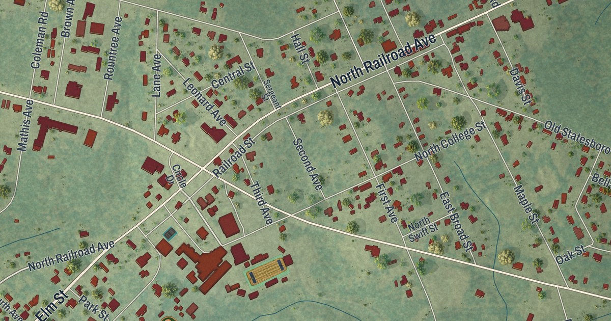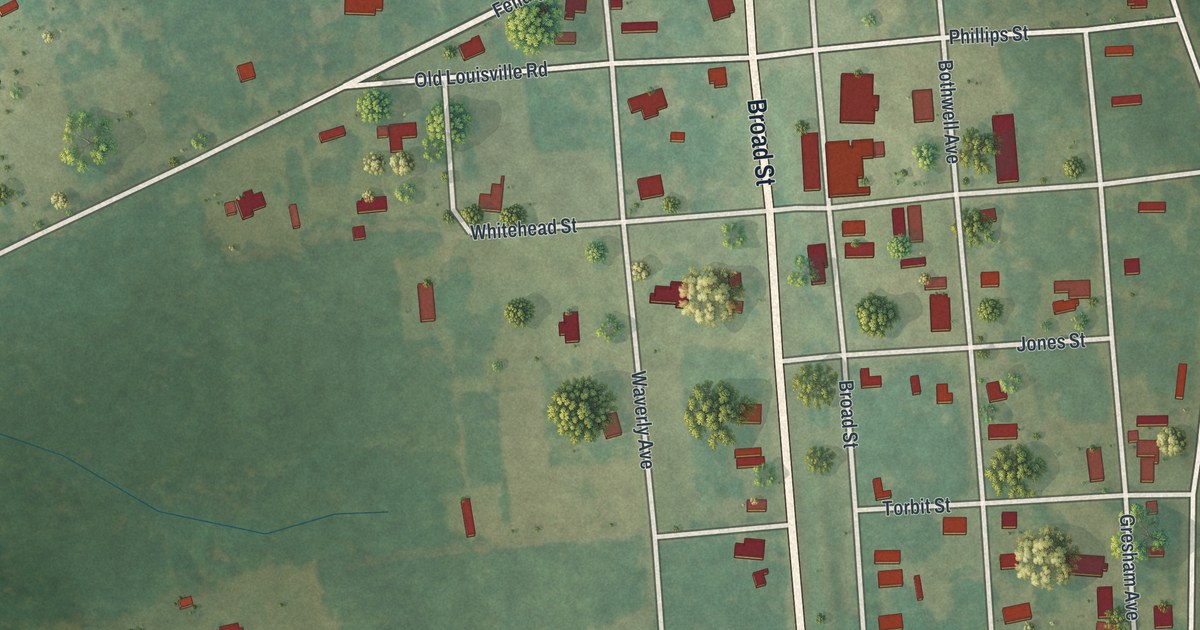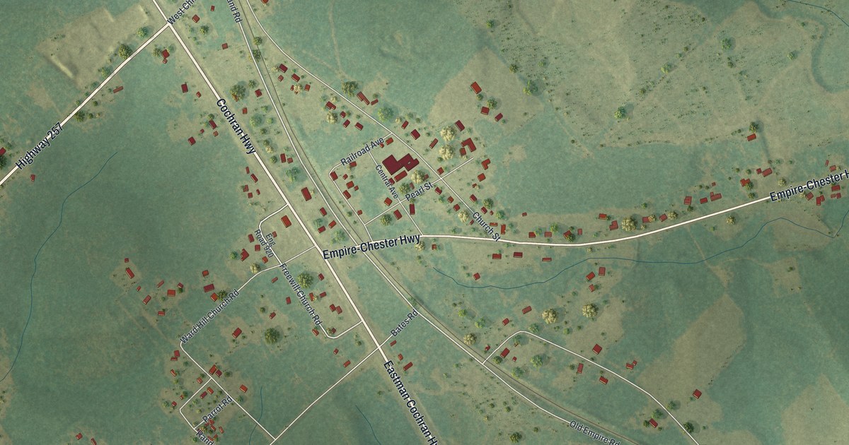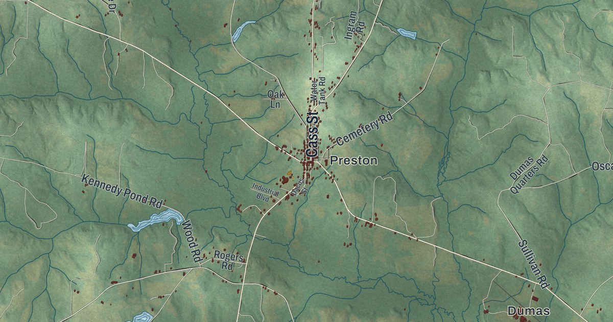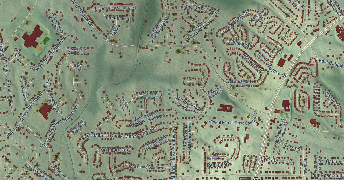
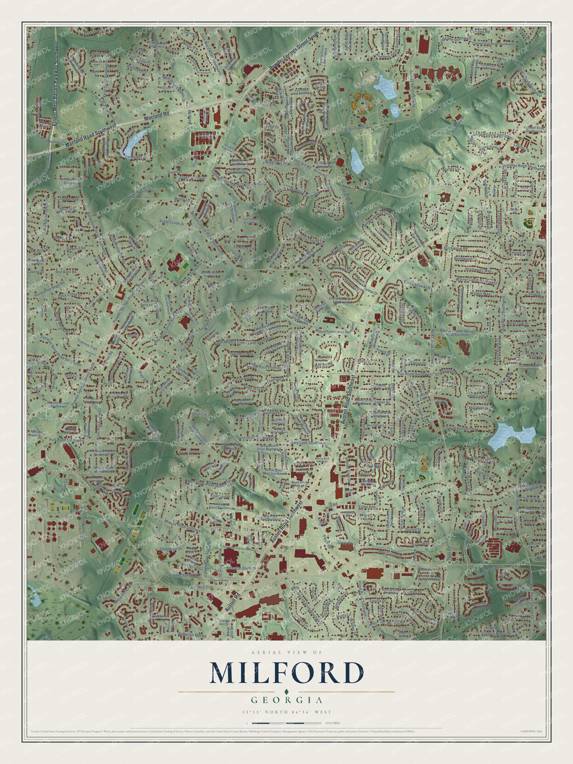
This beautifully detailed map of Milford, Georgia was created in 2026 using aerial imagery combined with modern topographical, census, street and landmark data. It’s a one-of-a-kind view of Milford that combines accurate data with a vintage aesthetic. The map shows every building in its true location, many of the roads carry their names, and the shaded topographic relief shows the shape of the land.
Explore an aerial view of Milford, Georgia
On the map you’ll find Sherwood Estates, Quails Nest, Blue Ridge Manor, Hurt Road Park, Tramore Park, and Dogwood Golf Club, along with Cherokee Trail, Powder Springs Street South, Austell Road Southwest, Austell Road Southeast, Macland Road, Ernest West Barrett Parkway Southwest, and more. If you look closely you can even find your house accurately drawn in its correct location. Zoom in on the preview to look for yours.
Did You Know?
From Internet Archive: "In 1866 he moved to Albany, Dougherty Co., Ga., where he kept a hotel until 1869, when he moved to Baker county, and settled on a plantation near Milford."
Milford is a community in Cobb County.
Take a closer look at the Milford map
Names on this map
These names are printed on this map.
Places: Sherwood Estates, Quails Nest, Cherokee Trail, Blue Ridge Manor, Hurt Road Park, Tramore Park and Dogwood Golf Club.
Streets and roads: Powder Springs Street South, Austell Road Southwest, Austell Road Southeast, Macland Road, Ernest West Barrett Parkway Southwest, Austell Road, Macland Road Southwest, Windy Hill Road, Caneridge Drive, South Hurt Road Southwest, Milford Church Road Southwest, Winston Road.
More street names, A to Z
Academy Drive, Agnes Street Southwest, Alaina Circle, Al Bishop Drive, Albury Lane, Alsace Lane, Amber Place, Amelia Drive, Amy Lane Southwest, Anderson Mill Road, Anderson Ridge Drive, Angus Trail Southwest, Arbor Mill Drive, Arbor Trail, Arden Drive, Arkose Drive, Ashley Circle, Ashley Station Drive, Asquith Avenue Southwest, Auldyn Drive, Azure Grove Court, Bankstone Drive Southwest, Barnes Meadow Road, Barwick Court, Battle Trail, Bay Berry Court, Bay Berry Drive Southwest, Bayford Court, Benningfield Drive Southwest, Bergerac Court, Beverly Lane, Birchwood Lane, Birchwood Road, Birchwood Way, Blue Ridge Drive Southwest, Bond Road, Brackett Drive, Brackett Road, Brackett Street, Bradley Drive, Brandon Lee Drive Southwest, Brandon Lee Way, Branson Place, Brantley Drive, Brantley Drive Southwest, Bridgehampton Road, Brookwood Drive Southwest, Bryan Way Southwest, Burfordi Drive Southwest, Byers Drive, Byron Court, Cades Cove Court, Callaway Road Southwest, Caller Court, Caneridge Pointe, Carithers Drive, Carolina Road, Chamberlain Circle Southwest, Chamirey Drive Southwest, Champion Drive, Chapel Hill Court, Chauncey Lane, Chauncey Lane Southwest, Cheatham Hill Road, Cheatham Woods Drive Southwest, Chelwick Drive, Cherrywood Lane, Chisholm Trail, Chisolm Trail Southwest, Church Road Southwest, Citizen Circle, Clare Cottage Trce Southwest, Clare Court Southwest, Clarion Circle, Clarion Lane, Clay Drive Southwest, Clayhill Pointe Southwest, Clintwood Drive, Cold Springs Trail Southwest, Colleen Circle, Connecticut Road Southwest, Corbin Place Southwest, County Services Parkway, Covered Bridge Place, Covey Flush Court, Creekview Drive Southwest, Cumberland Club Road Southwest, Cumberland Creek Place, Cumberland Creek Terrace, Cunningham Road Southwest, Dalby Way, Darlington Way Southwest, Daytona Way Southwest, Deerfield Circle, Denson Lane, Derbyshire Drive Southwest, Devore Drive Southwest, Donald Road, Donna Drive, Dorothy Drive Southwest, Doyle Lane, Doyle Lane Southwest, Durrell Street, Dyer Park Lane, East-West Con, East Callaway Road, Elaine Drive, Elkhart Circle Southwest, Ellen Drive, Elsdon Drive, Ernest West Barrett Parkway, Esten Drive, Everwood Drive Southwest, Fairridge Circle Southwest, Farmington Drive Southwest, Favor Pines Court, Favor Road Southwest, Favorwood Drive, Faye Court, Felton Hill Road, Fern Valley Drive Southwest, Finglas Drive Southwest, Fisher Drive, Flintlock Lane, Floyd Oaks Drive, Floyd Road, Floyd Road Southwest, Forelock Place, Foxfire Drive Southwest, Foxglove Drive, Fran Lane, Fred Walker Drive, Frontier Trail, Glynn Oaks Drive Southwest, Green Drive, Greenridge Drive Southwest, Greenway Drive Southwest, Greer Drive, Gregory Manor Circle, Gregory Manor Drive, Grindstone Drive, Grindstone Place, Grove Field Lane, Grove Valley Way, Hammondton Road, Hammond Woods Circle Southwest, Hampshire Road, Hampton Estates Drive, Harris Court, Harris Road, Hartridge Drive, Hasty Lane, Havel Drive Southwest, Heatherwood Lane Southwest, Hencley Circle Southwest, Heritage Green Drive, Heritage Ridge Lane, Herren Drive, Hetz Court, Heyford Vw, Hicksmil Drive, Hicks Road, Hicks Road Southwest, Hidden Valley Drive Southwest, Hillboro Circle Southwest, Hillhouse Road Southwest, Holbrook Drive, Horseshoe Bend Road, Horseshoe Bend Road Southwest, Hospital North Drive Southwest, Hospital South Drive, Hospital West Drive, Hurt Road, Hurt Road Southwest, Ilex Court, Indian Springs Drive Southwest, Jack Creek Road, Janna Lane Southwest, Jerry Lane, Jessie Court, John Ward Road Southwest, John Wesley Court, Josh Court, June Springs Drive Southwest, Justin Drive, Kalb Court, Keith Drive, Keith Drive Southwest, Kelsey Chase Court, Kensington Court, Killarney Drive Southwest, Kimberly Drive Southwest, King Arthur Drive Southwest, Kolb Farm Circle Southwest, Kolb Manor Circle, Kolb Ridge Court Southwest, Kolb Ridge Drive Southwest, Kurt Drive Southwest, Lakeside Place, Lanier Drive, Lanier Drive Southwest, Laurie Jo Drive, Lawton Bridge Road, Leatherleaf Drive Southwest, Lee Ann Drive, Linworth Boulevard, Lipson Drive Southwest, Litchfield Way, Lorene Drive, Lorne Court, Lost Bridge Road, Luther Terrace, Lyle Lane, Macland Crossing, Macland Square Drive, Main Station Drive Southwest, Majestic Drive, Majestic Lane, Marathon Circle, Martin Road Southwest, McEachern Manor Drive, Medical Park Drive, Mellor Lane, Merry Oak Road Southwest, Merryweather Trail, Mesa Valley Road, Michael Drive Southwest, Milford Chase Southwest, Milford Creek Cts Southwest, Milford Creek Lane Southwest, Milford Creek Overlook Southwest, Milford Cts Southwest, Milford Farms Lane Southwest, Milford Forest Drive Southwest, Milford Place Southwest, Milford Trail Southwest, Milford Vw Southwest, Mill Creek Court Southwest, Mill Creek Lane, Mill Stream Lane, Millwood Drive Southwest, Mimosa Drive Southwest, Moccasin Way, Montclair Drive, Mountview Drive Southwest, Mulkey Road Southwest, Neal Court, Neese Drive, Neva Drive, North Creek Drive, North Milford Creek Lane Southwest, Oak Leaf Court, Oakton Drive, Oakton Way Southwest, Old Tennessee Road Southwest, Ollie Crk, Olson Drive, Orange Hill Drive, Oregon Trail, Owens Drive, Pacific Drive, Pair Road Southwest, Palmetto Moon Road, Pamela Circle Southwest, Park Trail Circle, Park Trail Circle Southwest, Pastel Drive, Pat Mell Road Southwest, Patriot Square, Pawnee Trail, Peel Castle Lane, Perch Drive Southwest, Perch Lane Southwest, Perch Overlook Southwest, Peteywood Drive, Phillips Drive Southwest, Pilgrim Place, Pine Branch Drive, Pine Needle Drive Southwest, Plantation Road Southwest, Platt Street, Plummers Place, Portsmouth Court, Powder Horn Trail Southwest, Powder Springs, Powder Springs Road Southwest, Powder Way, Pullman Court, Pullman Lane, Quail Run Southwest, Quiet Creek Court, Red Barn Road, Red Berry Lane, Red Hill Road, Reed Drive Southwest, Regal Ridge Road, Rhinehart Drive, Rhinehart Road, Rifle Ridge Southwest, Rifle Way, River Bend Circle, Rock Creek Drive, Rockingway Drive Southwest, Roxboro Drive Southwest, Russell Drive, Russell Street, Rustic Drive Southwest, Sandell Trail Southwest, Sandlake Drive Southwest, Santa Fe Trail, Sasanqua Lane Southwest, Sawmill Road, Schaffer Road Southwest, Scott Lane Southwest, Sebring Court, Seminole Circle, Settlers Walk Court, Settlers Walk Way, Shadowridge Drive Southwest, Shady Lane, Shadyside Road Southwest, Shay Drive, Sherrod Drive, Sherrod Drive Southwest, Sherwood Place Southwest, Shiloh Drive, Shoal Mill Road, Silverchase Drive, Silver Leaf Court Southwest, Silver Leaf Drive, Sir Galahad Drive Southwest, Sir Lancelot Place Southwest, Skyline Place Southwest, Smith Avenue Southwest, Smyrna Powder Springs Road Southeast, Snowapple Road, South Champion Drive, South Creek Drive, South Hospital Way, South Hurt Road, Sparrow Wood Lane, Squire Drive Southwest, Station Club Drive, Sterling Trail Southwest, Stone Harbor Parkway, Story Drive Southwest, Sugar Creek Drive, Tenneyson Lane, Terrace Drive, Thrasher Drive Southwest, Tiffany Drive Southwest, Trail To Olley Southwest, Tramore Pointe Parkway, Tranquil Drive, Travis Street, Trestle Drive, Trestle Drive Southwest, Tumnus Trail, Turner Road Northwest, Twilley Ridge Road, Twin Courts Lane Southwest, Tyrell Drive, Tyrell Drive Southwest, Valley Brook Drive Southwest, Velvet Creek Drive Southwest, Vermillion Lane, Village Lane Drive, Wagon Trail, Walnut Circle Southwest, Walnut Way, Wanda Circle, Waymar Court, Waymar Drive, Wayne Street, Wellborn Way, Westbury Court, Westport Circle, Whipporwill Drive Southwest, Whistle Drive, Whistle Drsw, White Haven Drive, White Oak Drive, White Oak Lane, White Way Drive, Wildwood Drive, Willa Way, William Paul Drive, Wilshire Drive, Wilshire Drive Southwest, Windage Court, Windage Drive, Windcrest Circle, Windcrest Drive, Windy Hill, Winesap Drive, Winfield Court, Winston Road Southwest, Woodleigh Road Southwest, Wood Meadows Drive, Woodmore Drive Southwest, Woods Lane, Wynbrook Road Southwest, Yates Avenue, Yates Avenue Southwest, York Road, York Road Southwest.
See it on a wall
The Milford map as a framed print. Swipe for more.


This beautifully detailed map of Milford makes an attractive addition to your office, library, or den, and it can even be used to teach children the geography and history of the area. It also makes a great gift for anyone with Milford roots. When you’re done exploring, click here to get your copy of the Milford map.