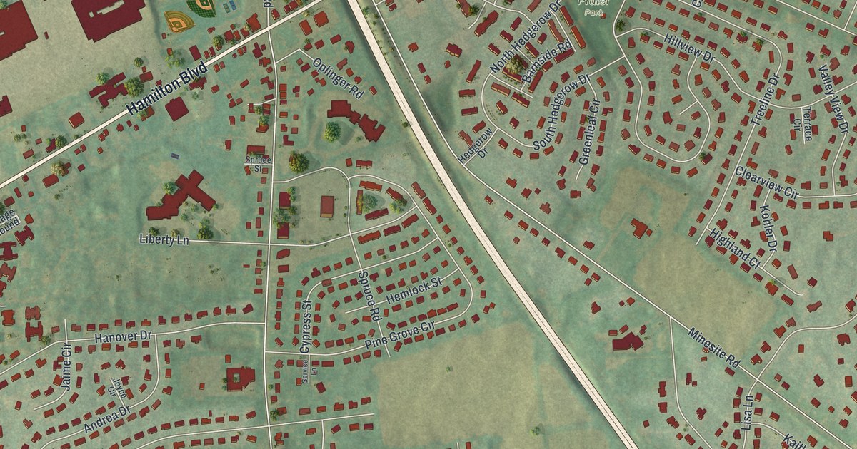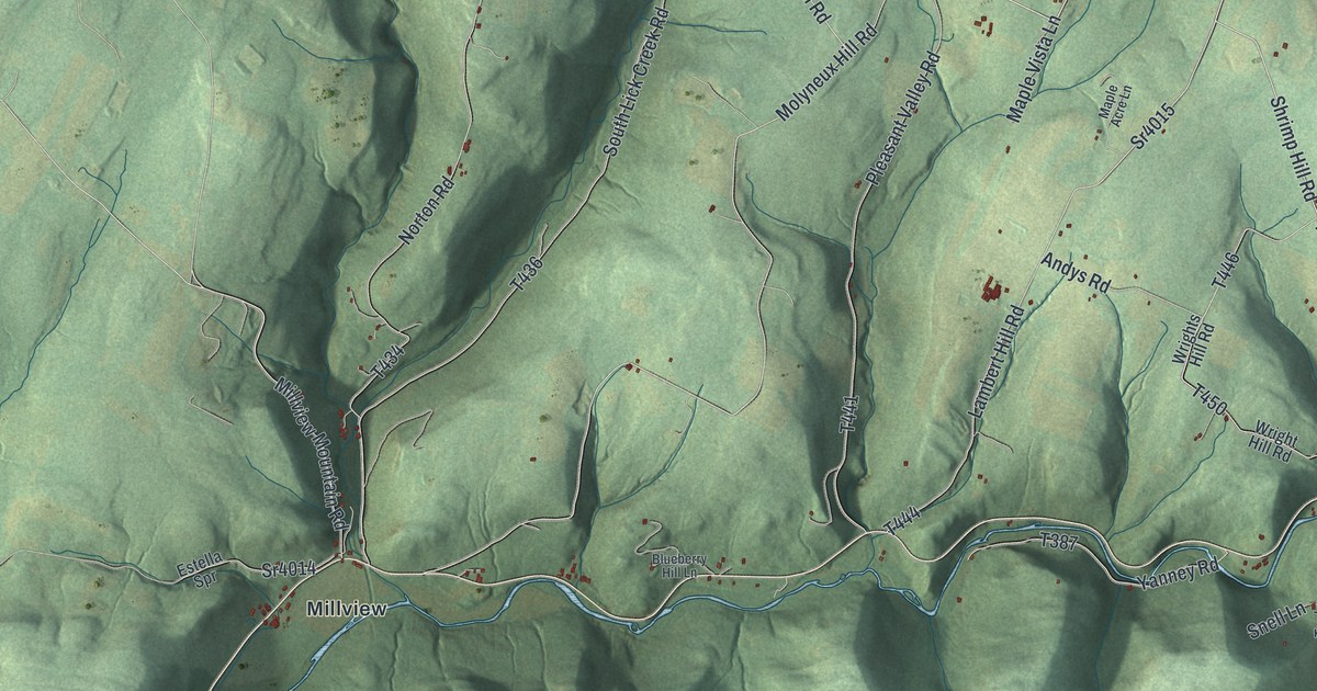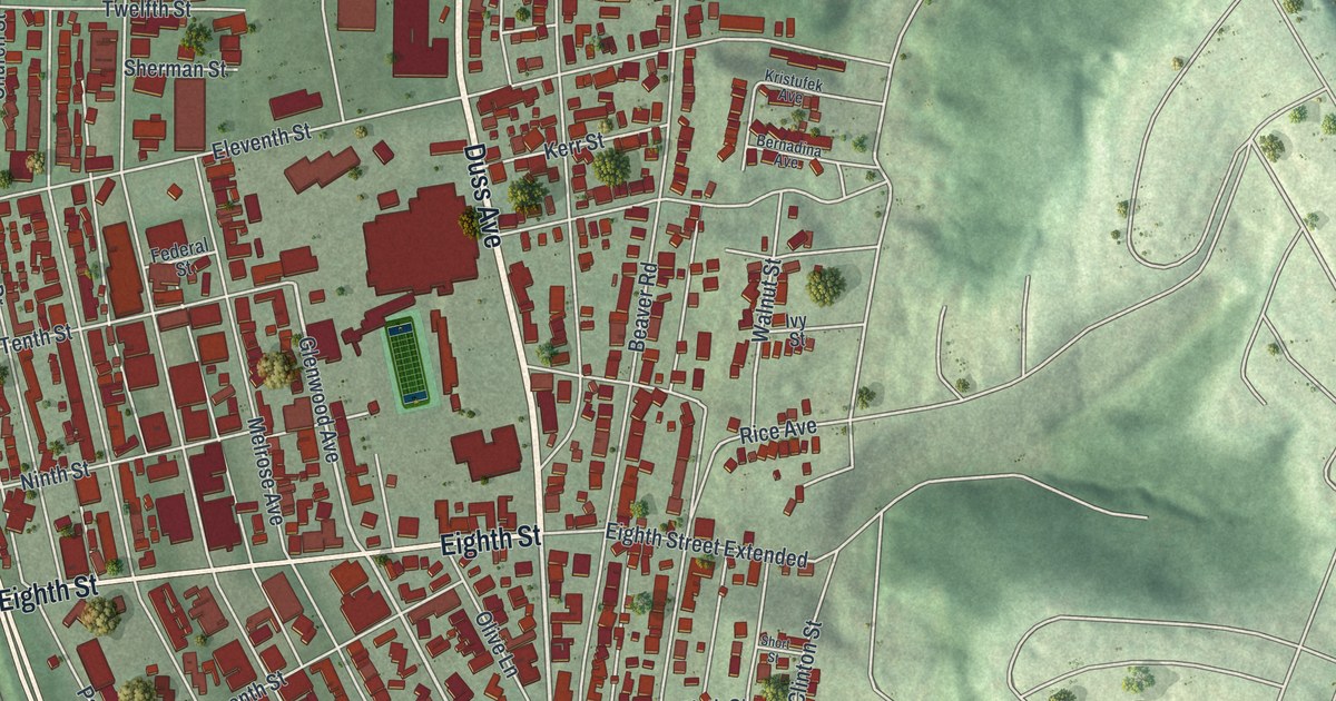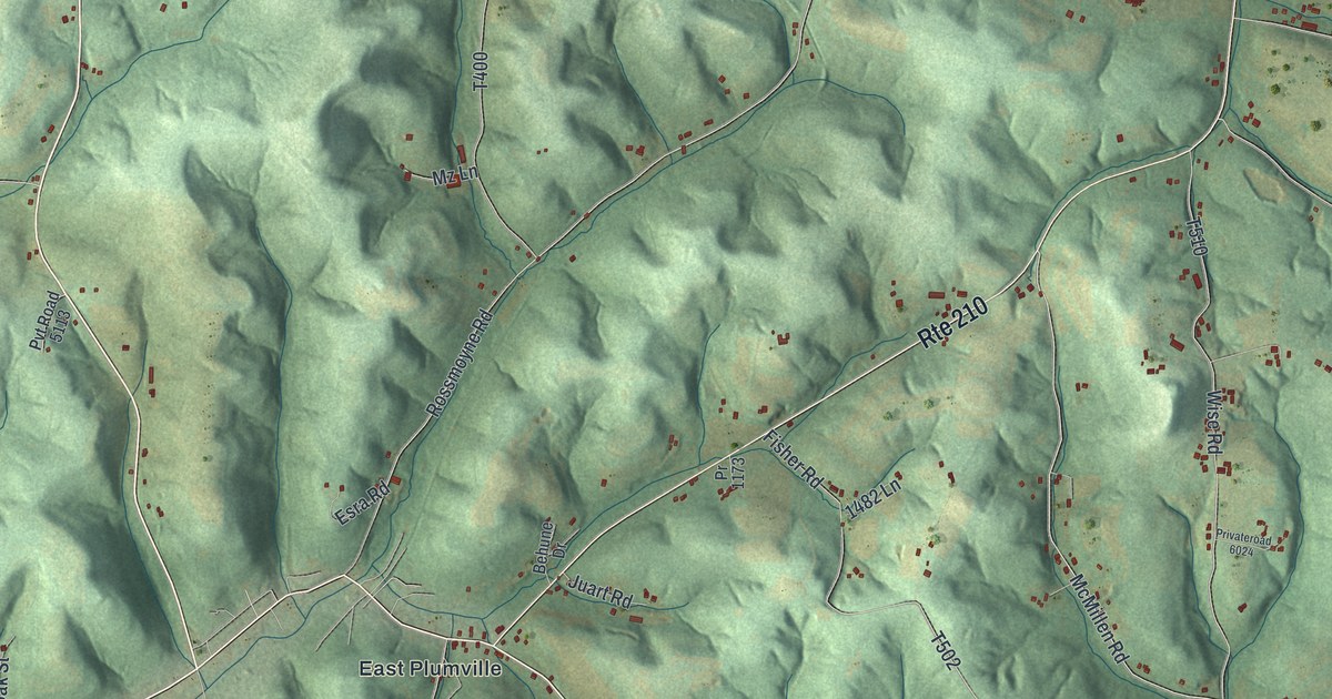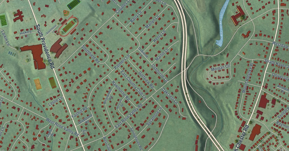
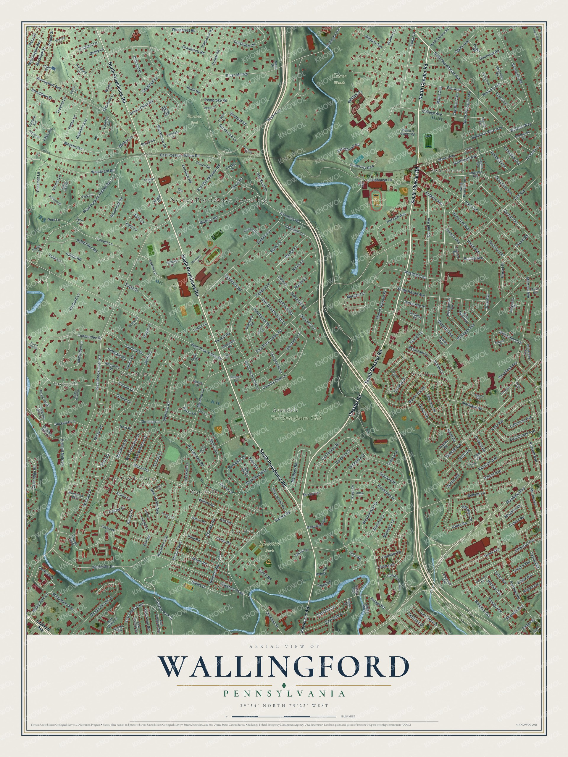
This beautifully detailed map of Wallingford, Pennsylvania was created in 2026 using aerial imagery combined with modern topographical, census, street and landmark data. It’s a one-of-a-kind view of Wallingford that combines accurate data with a vintage aesthetic. The map shows every building in its true location, many of the roads carry their names, and the shaded topographic relief shows the shape of the land.
Explore an aerial view of Wallingford, Pennsylvania
On the map you’ll find Nether Providence Township, Crum Woods, Furness Park, Houston Park, Clothier Fields, Avendale, Sackville, Woodlyn, Crum Creek Manor, Providence, Swarthmore, Waterville, and more. If you look closely you can even find your house accurately drawn in its correct location. Zoom in on the preview to look for yours.
Did You Know?
From Internet Archive: "William Johnson came from England about 1660, settled at New Haven, Connecticut, and ten years later became one of the proprietors of Wallingford, and one of the signers of the Compact."
Wallingford is a community in Delaware County.
Take a closer look at the Wallingford map
Names on this map
These names are printed on this map.
Places: Nether Providence Township, Crum Woods, Furness Park, Houston Park, Clothier Fields, Avendale, Sackville, Woodlyn, Crum Creek Manor, Providence, Swarthmore, Waterville, Lapidea and The Springhaven Club.
Streets and roads: South Providence Road, South Chester Road, Chester Road, North Chester Road, North Providence Road, North Swarthmore Avenue, Cedar Lane, Macdade Boulevard, Irvings Road, Bullens Lane, Fieldhouse Lane, Rutgers Avenue.
More street names, A to Z
Academy Place, Albany Court, Amherst Avenue, Applebough Lane, Ardsley Road, Arthur Court, Ash Road, Atlanta Court, Austin Court, Avonbrook Lane, Avonbrook Road, Avondale Road, Balignac Avenue, Barley Mill Road, Barry Lane, Beaumont Drive, Beech Road, Benjamin West Avenue, Berkshire Drive, Bickmore Drive, Blackrock Road, Blackthorn Road, Blakeley Road, Blue Hill Road, Bodine Avenue, Bowers Lane, Brent Drive, Briarcrest Drive, Briarwood Road, Brighton Avenue, Brookside Avenue, Brookside Road, Bryn Mawr Avenue, Burden Road, Burning Tree Drive, Byre Lane, Callender Lane, Cambridge Road, Cameron Drive, Canterbury Drive, Carleton Road, Catherine Avenue, Cedar Hollow Drive, Cedar Road, Chatham Place, Chester Park Drive, Chestnut Avenue, Chestnut Lane, Chestnut Parkway, Chestnut Street, Christian Lane, Church Road, College Avenue, Colonial Drive, Colson Road, Columbia Avenue, Columbus Court, Colwell Road, Constitution Avenue, Conway Drive, Cooper Drive, Copples Lane, Cornell Avenue, Cottonwood Avenue, Country Club Lane, Creekside Drive, Creekside Lane, Creghan Avenue, Cresson Lane, Crestview Circle, Cricket Lane, Crum Creek Drive, Crum Ledge Lane, Dale Lane, Dartmouth Avenue, Dartmouth Circle, Denis Lane, Denver Court, Derwood Drive, Devon Lane, Dewey Lane, Dickinson Avenue, Dogwood Lane, Donna Avenue, Dougherty Drive, Dover Court, Drew Avenue, Drexel Place, Drexel Road, Duryea Drive, East 24th Street, East 25th Street, East Avon Road, East Brookhaven Road, East Chelton Road, East Country Club Lane, East Parkway Avenue, East Possum Hollow Road, East Roland Road, East Rose Valley Road, East Wiltshire Drive, Edgmont Avenue, Eisenhower Avenue, Elm Avenue, Elm Road, Elmwood Avenue, Emerald Lane, Emlen Street, Engle Drive, Essex Avenue, Fairfield Drive, Fairhill Road, Fairview Court, Fairview Road, Fern Lane, Fifth Avenue, Fildes Lane, Forest Lane, Forest View Road, Fox Lane, Fraternity Row, Freedom Road, Furness Lane, Garnet Lane, Garrett Avenue, Geary Lane, Georgetown Road, Gladstone Road, Glendale Road, Glen Road, Glenwood Lane, Golfview Road, Governors Drive, Grace Road, Grandview Road, Grant Avenue, Green Valley Road, Greenway Road, Guernsey Road, Harper Avenue, Harvard Avenue, Harvey Road, Hastings Avenue, Haverford Avenue, Haverford Place, Hawthorne Road, Hempstead Lane, Henry Lane, Hickory Lane, Highland Avenue, Hillborn Avenue, Hillcrest Road, Hillsboro Mills Lane, Hilltop Road, Hood Road, Hoyt Place, Hunter Lane, Irving Lane, Irving Road, Jefferson Avenue, Juniata Avenue, Karen Lane, Kelly Avenue, Kelly Lane, Kendall Road, Kent Road, Kenyon Avenue, Kershaw Road, Kincaid Mills Lane, Knoll Road, Kossuth Avenue, Lafayette Avenue, Lake Avenue, Larkin Lane, Laurel Lane, Laurie Lane, Leiper Street, Leslie Lane, Liberty Road, Lincoln Avenue, Linden Lane, Locust Lane, Lombardy Drive, Lukens Avenue, Mallard Mill Run, Maple Avenue, Maple Road, Marie Drive, Marietta Avenue, Markham Street, Marlyn Lane, Martin Lane, Martroy Road, Meadowbrook Lane, Meadow Lane, Meadow Road, Medbury Road, Media Parkway, Michaels Lane, Michigan Avenue, Mildred Avenue, Milmont Avenue, Moore Road, Moreland Road, Morgan Circle, Morgan Lane, Morris Avenue, Morris Lane, Mount Holyoke Place, Moylan Avenue, Myers Avenue, New Jersey Avenue, North Princeton Avenue, Oakcrest Lane, Oak Knoll Drive, Oberlin Avenue, Ogden Avenue, Orchard Avenue, Orchard Lane, Osborne Lane, Osbourne Lane, Palmers Lane, Park Avenue, Parklane Road, Park Valley Lane, Parrish Hall Road, Pembroke Road, Penn Avenue, Penn Street, Pennsylvania Avenue, Pine Road, Pleasant Hill Road, Plush Mill Road, Pool Lane, Porter Lane, Prichard Lane, Pritchard Lane, Providence Avenue, Purdy Lane, Putnam Boulevard, Putters Lane, Rabbit Run Road, Radio Park Lane, Randall Avenue, Raymond Circle, Ridgewood Road, Ridley Avenue, Ridley Drive, Ridley Mill Lane, Ridley Street, Riverview Road, Rogers Lane, Ronaldson Street, Rosewood Lane, Ryanard Road, Sackville Lane, Sackville Mills Lane, Saybrook Lane, Scenic Drive, Schiavello Drive, School Lane, Schoolside Lane, Scott Circle, Scott Lane, Seventh Avenue, Sharlow Lane, Sheffield Road, Shepherds Lane, Sherman Avenue, Single Lane, Sixth Avenue, Smithfield Road, Somerset Place, South Princeton Avenue, Springhaven Road, Sproul Lane, Stackhouse Lane, Stanford Drive, Stratford Road, Strath Haven Avenue, Sycamore Lane, Sykes Road, Tara Place, Taylor Avenue, Taylor Drive, Thayer Road, Todmorden Drive, Todmorden Lane, Treetop Lane, Tulip Lane, Turner Road, Union Avenue, University Place, Valley Road, Valley View Road, Vassar Avenue, Vauclain Avenue, Vernon Lane, Vernon Street, Village Greens Lane, Visitor's Center Road, Walker Lane, Wallingford Avenue, Wallingford Road, Walnut Lane, Walnut Road, Walter Street, Washington Avenue, Waterford Way, Waterville Road, Wellesley Road, Wellesly Avenue, West Brookhaven Road, Westbury Road, West Country Club Lane, Westdale Avenue, Westminster Avenue, Westminster Drive, West Possum Hollow Road, West Rose Valley Road, West Wiltshire Drive, Whittier Place, Widener Way, Wilder Road, Williamson Avenue, Willow Bend Drive, Willow Lane, Willow Road, Windsor Place, Winterlock Way, Woodbrook Lane, Woodcrest Road, Woodland Avenue, Woodlyn Circle, Woodward Road, Yale Avenue, Yates Avenue, Youngs Avenue.
See it on a wall
The Wallingford map as a framed print. Swipe for more.


This beautifully detailed map of Wallingford makes an attractive addition to your office, library, or den, and it can even be used to teach children the geography and history of the area. It also makes a great gift for anyone with Wallingford roots. When you’re done exploring, click here to get your copy of the Wallingford map.