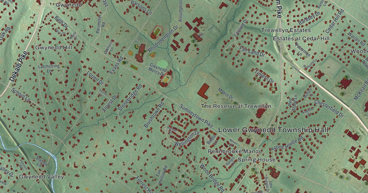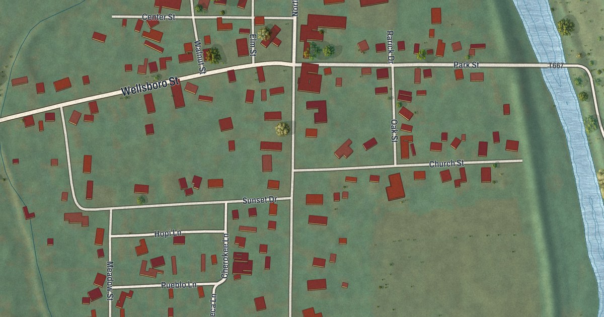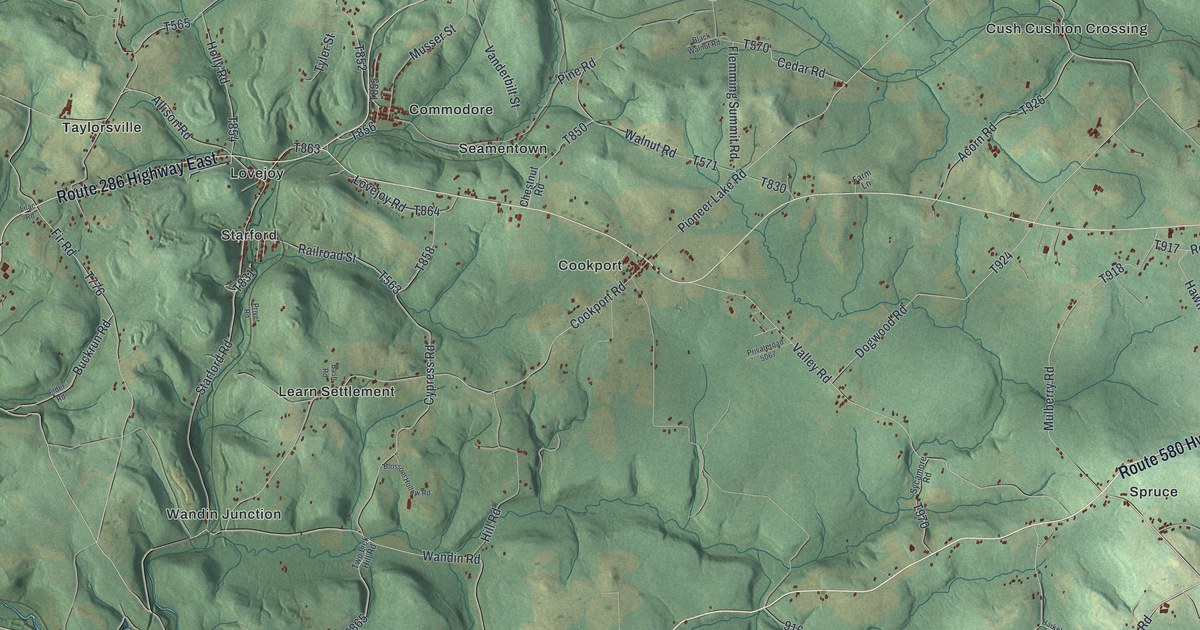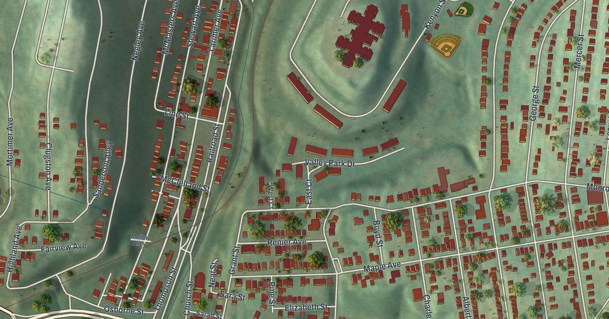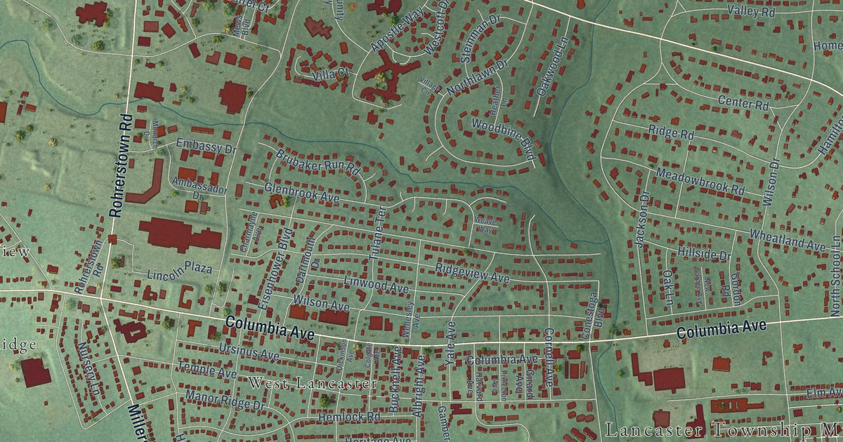
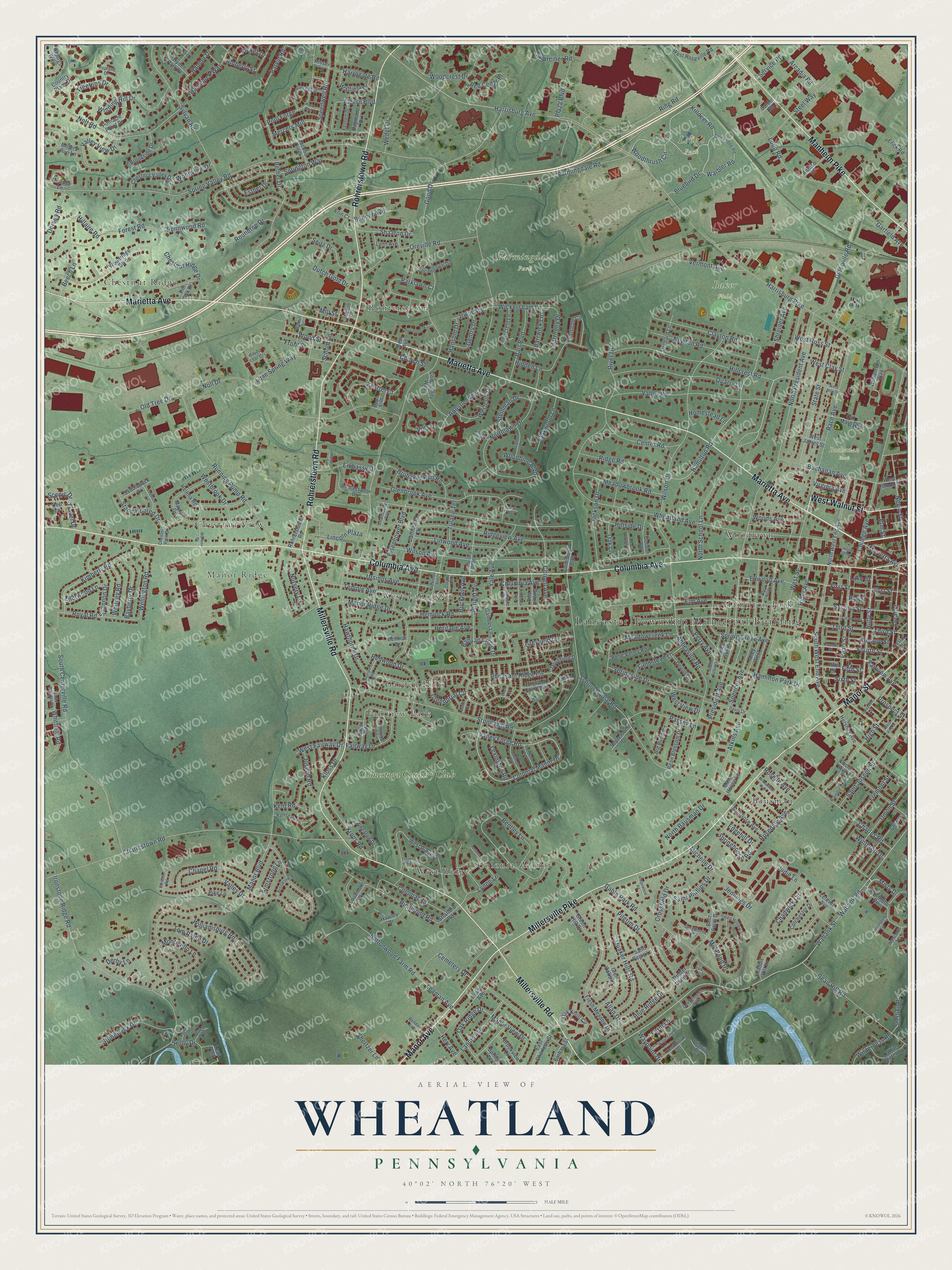
This beautifully detailed map of Wheatland, Pennsylvania was created in 2026 using aerial imagery combined with modern topographical, census, street and landmark data. It’s a one-of-a-kind view of Wheatland that combines accurate data with a vintage aesthetic. The map shows every building in its true location, many of the roads carry their names, and the shaded topographic relief shows the shape of the land.
Explore an aerial view of Wheatland, Pennsylvania
On the map you’ll find Lancaster Township Municipal Building, Baker Field, Buchanan Park, Farmingdale Park, Long’s Park, Fairview Park, Chestnut Ridge, Bausman, West Lancaster, West Ridge, Woodlawn, Chestnut View, and more. If you look closely you can even find your house accurately drawn in its correct location. Zoom in on the preview to look for yours.
Did You Know?
From Internet Archive: "Ephraim Skiles, shortly after his marriage, settled on a farm near Black Lick Furnace, in East Wheatland township, where he lived and raised a large family of children."
Wheatland is a community in Lancaster County.
Take a closer look at the Wheatland map
Names on this map
These names are printed on this map.
Places: Lancaster Township Municipal Building, Baker Field, Buchanan Park, Farmingdale Park, Long's Park, Fairview Park, Chestnut Ridge, Bausman, West Lancaster, West Ridge, Woodlawn, Chestnut View, Rohrerstown, Colonial Manor, Garden Hills, Hamilton Park, Manor Ridge, Conestoga Country Club and Leaf Park.
Streets and roads: Marietta Avenue, Columbia Avenue, Millersville Road, Rohrerstown Road, Millersville Pike, Manheim Pike, Manor Avenue, West Walnut Street, Manor Street, North School Lane, Colonial Manor Drive, Judie Lane.
More street names, A to Z
Abbeyville Road, Abraso Street, Albern Boulevard, Albright Avenue, Allan Drive, Alley North, Alley South, Alley West, Ambassador Drive, Amberly Street, Apostle Way, Arcadia Road, Armstrong Lane, Aspen Court, Atkins Avenue, Banner Drive, Banyan Circle Drive, Barbara Street, Barr Boulevard, Barrcrest Lane, Barrholly Drive, Barrwick Lane, Bayberry Drive, Bay Street, Bean Blossom Drive, Bean Hill Road, Bear Avenue, Beech Lane, Belle Valley Road, Bender Avenue, Benmar Drive, Bennet Avenue, Bentley Lane, Bermuda Road, Bethel Drive, Betz Farm Drive, Big Bend Road, Birch Court, Bluebird Drive, Blue Ridge Drive, Brendle Avenue, Brookline Road, Brookside Drive, Brookview Drive, Brubaker Run Road, Bryan Drive, Buchanan Avenue, Buchers Mill, Bucknell Avenue, Buttonwood Farm Road, Calder Road, Calvert Lane, Capri Road, Catherine Street, Cemetery Drive, Center Road, Chadwick Circle, Chapel Road, Charles Road, Charlestown Road, Charmayne Avenue, Chestnut Ridge Drive, Chestnut Valley Drive, Chestnut View Drive, Chickadee Road, Church Street, Clayton Road, Clover Hill Road, Colchester Drive, Colgate Avenue, College Avenue, Colonial Road, Community Way, Conestoga Boulevard, Coral Street, Cornell Avenue, Country Place Drive, Crossfield Drive, Crystal Street, Dartmouth Drive, Davis Drive, Deep Hollow Lane, Dell Lane, Derby Lane, Devon Drive, Dickinson Avenue, Dillerville Road, Dorsea Road, Dovefield Drive, Dutch Gold Drive, East Charlotte Street, Edgehill Drive, Eisenhower Boulevard, Elder Court, Ellwood Avenue, Elm Avenue, Elm Street, Embassy Drive, Erick Road, Erin Court, Esther Drive, Euclid Avenue, Fairview Avenue, Fairway Drive, Farmingdale Road, Farm Lane, Fieldstead Lane, Fifth Street, Finch Court, First Street, Forest Road, Fourth Street, Fremont Street, Fresh Meadow Drive, Front Street, Gable Park Road, Gamber Lane, Garfield Avenue, Gentlemen's Way, Gentry Drive, George Street, Girard Avenue, Glenbrook Avenue, Glen Oaks Drive, Good Drive, Gordon Road, Grandview Avenue, Greenbriar Circle, Green Hill Drive, Greyfield Drive, Greythorne Road, Hager Alley, Hamilton Park Drive, Hamilton Road, Hammock Way, Hansom Drive, Harrisburg Avenue, Harrisburg Pike, Harrogate Road, Harvard Avenue, Hawley Drive, Hawthorne Drive, Heasy Avenue, Heather Lane, Helena Road, Hemlock Road, Heritage Avenue, Herr Avenue, Hershey Avenue, Hidden Lane, High Street, Hillaire Road, Hillcrest Road, Hillside Drive, Holly Drive, Homestead Lane, Hudson Street, Hyde Park Drive, Ironstone Ridge Road, Irwin Avenue, Jackson Drive, Jacobs Creek, Jennings Drive, Joseph Road, Kenneth Drive, Kensington Road, Kensington Terrace, Kent Road, Kestrel Court, Killdeer Road, Kimberly Road, Kloss Drive, Kreps Road, Kurtz Mill, Lafayette Street, Lake Street, Landis Avenue, Leaman Avenue, Lefever Avenue, Lexington Road, Lime Spring Way, Lincoln Plaza, Linwood Avenue, Longwood Court West, Loop Road, Louxmont Drive, Lynn Avenue, Lynne Lane, Malibou Drive, Manor Boulevard, Manor House Lane, Manor Ridge Drive, Manor View Drive, Mayfair Drive, Meadowbrook Road, Meadowcreek Lane, Mercers Mill, Mews Boulevard, Michelle Drive, Millers Run Lane, Mill Pond Drive, Mill Street, Mimosa Lane, Misty Drive, Monarch Drive, Monticello Lane, Montrose Avenue, Nevin Street, New Garden Avenue, Newton Road, Noll Drive, Nolt Road, North Bausman Drive, Northlawn Drive, North President Avenue, North West End Avenue, Nursery Lane, Oak Knoll Circle, Oak Lane, Oak Ridge Drive, Oakwood Lane, Ocean Avenue, Old Main Drive, Old Tree Drive, Orchard Lane, Oreville Road, Oriole Court, Paddock Lane, Park Lane, Parklawn Court, Parvin Road, Passey Lane, Pearl Street, Pennwood Road, Perry Avenue, Pheasant Ridge Circle, Picket Drive, Pike Lane, Pilgriim Drive, Pilgrim Drive, Pinnacle Point Drive, Pin Oak Drive, Plaza Boulevard, Plymouth Road, Pool Forge, President Avenue, Princeton Avenue, Prospect Street, Quaker Hills Road, Quarry Lane, Rabbit Hill Lane, Race Avenue, Ramsgate Lane, Raymond Drive, Red Cedar Place, Redwood Drive, Richmond Road, Rider Avenue, Ridge Road, Ridgeview Avenue, Ridgewood Road, Ridings Way, Ring Road, Risser Lane, River Drive, Rosedale Avenue, Roselle Avenue, Roundtop Drive, Royal Road, Ruby Street, Running Pump Road, Saddleback Drive, Saint Joseph Street, Saint Phillips Drive, Saint Regis Lane, Saratoga Road, Scarsdale Circle, Scenic Drive, School House Road, School Lane, Second Street, Seitz Drive, September Drive, Service Road, Shaaron Drive, Shannon Drive, Shertzer Lane, Sherwood Lane, Shreiner Avenue, Shreiner Road, Silver Leaf Court, Sixth Street, Southbrook Drive, South Centerville Road, South School Lane, South West End Avenue, Speedwell Road, Spencer Avenue, Springbrook Court, Spring Drive, Spring Grove Avenue, Springhouse Road, Springlawn Drive, Springside Drive, Springton Way, Spring Valley Road, Standardbred Drive, State Street, Steel Way, Steinman Drive, Sterling Place, Stone Mill Road, Stonewyck Drive, Stratford Road, Sylvan Road, Temple Avenue, Terrace Drive, Third Street, Timber Point Lane, Tom Paine Drive, Topland Drive, Travel Drive, Treetops Drive, Tulane Terrace, Union Street, Ursinus Avenue, Valley Drive, Valley Forge Road, Valley Road, Valley View Drive, Vermont Avenue, Villa Court, Village Circle, Virginia Avenue, Wabank Road, Wabank Street, Walfield Drive, Walnut Street, Warbler Road, Water Leaf Road, Waypoint Drive, Weaver Way, Wedel Drive, Wellesley Avenue, Wellington Road, Westbrook Drive, West Clay Street, Westcott Drive, West Fairway Drive, West James Street, West Lemon Street, West New Street, Weston Road, West Ridge Drive, West Roseville Road, West Ross Street, West Street, West View Drive, West Vine Street, Wheatland Avenue, Wheaton Drive, White Chapel Road, White Water Road, Whitfield Road, Whitney Road, Wickersham Lane, Wilderness Road, Williamsburg Road, Williamson Way, Wilson Avenue, Wilson Drive, Winding Hill Drive, Winthrop Drive, Woodbine Boulevard, Woodcrest Drive, Woodridge Boulevard, Woods Avenue, Wood Street, Woodthrush Circle, Woodview Drive, Wyncroft Terrace, Yale Avenue, Yorktown Road.
See it on a wall
The Wheatland map as a framed print. Swipe for more.


This beautifully detailed map of Wheatland makes an attractive addition to your office, library, or den, and it can even be used to teach children the geography and history of the area. It also makes a great gift for anyone with Wheatland roots. When you’re done exploring, click here to get your copy of the Wheatland map.