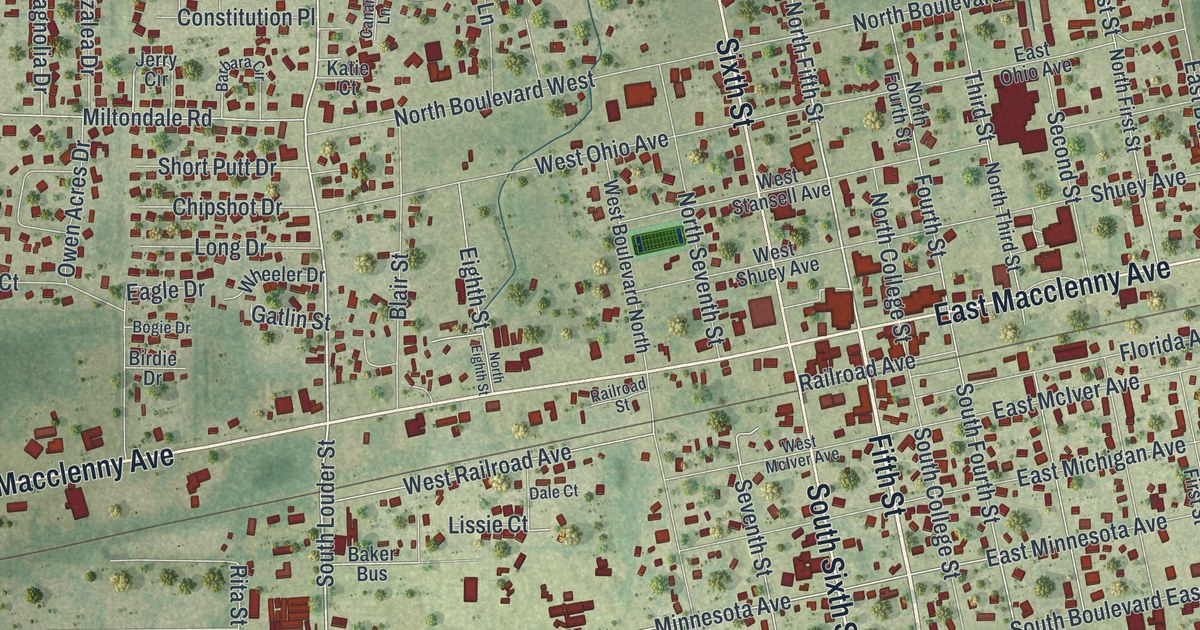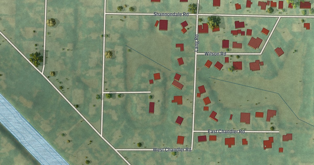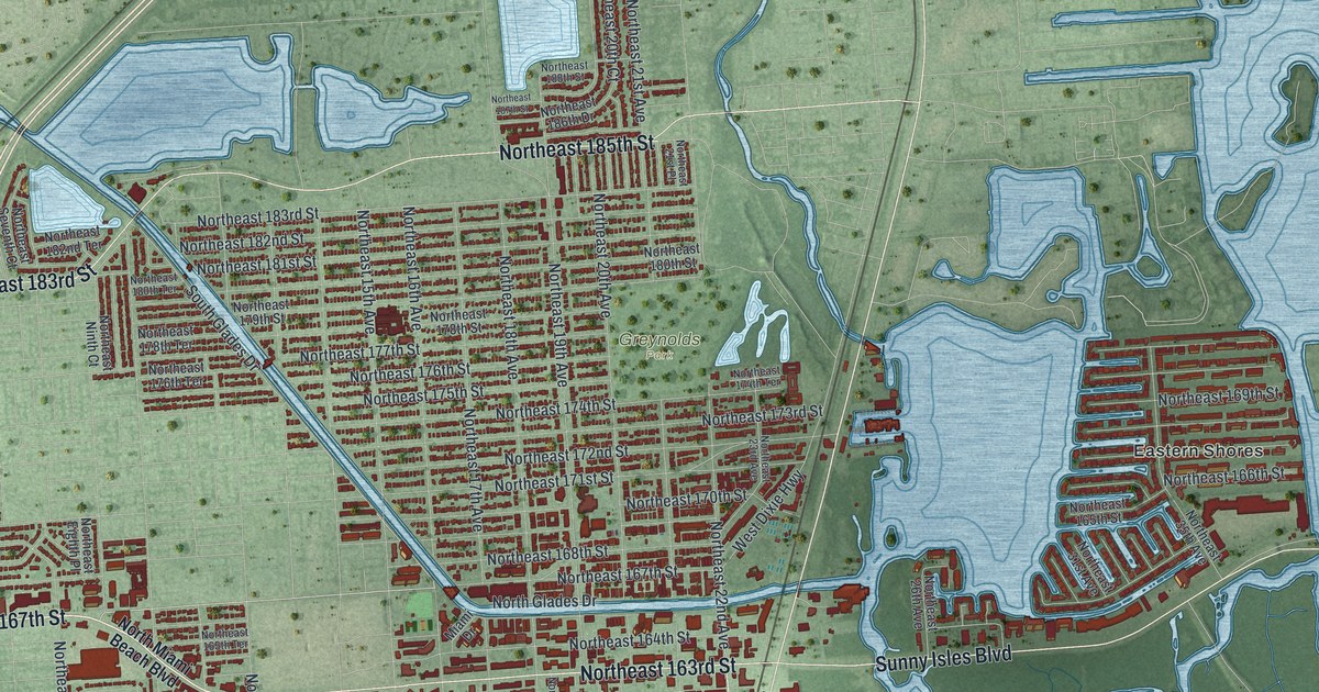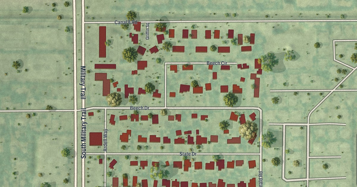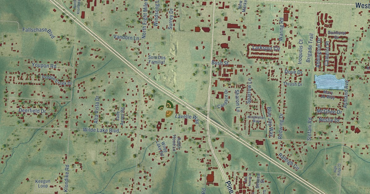
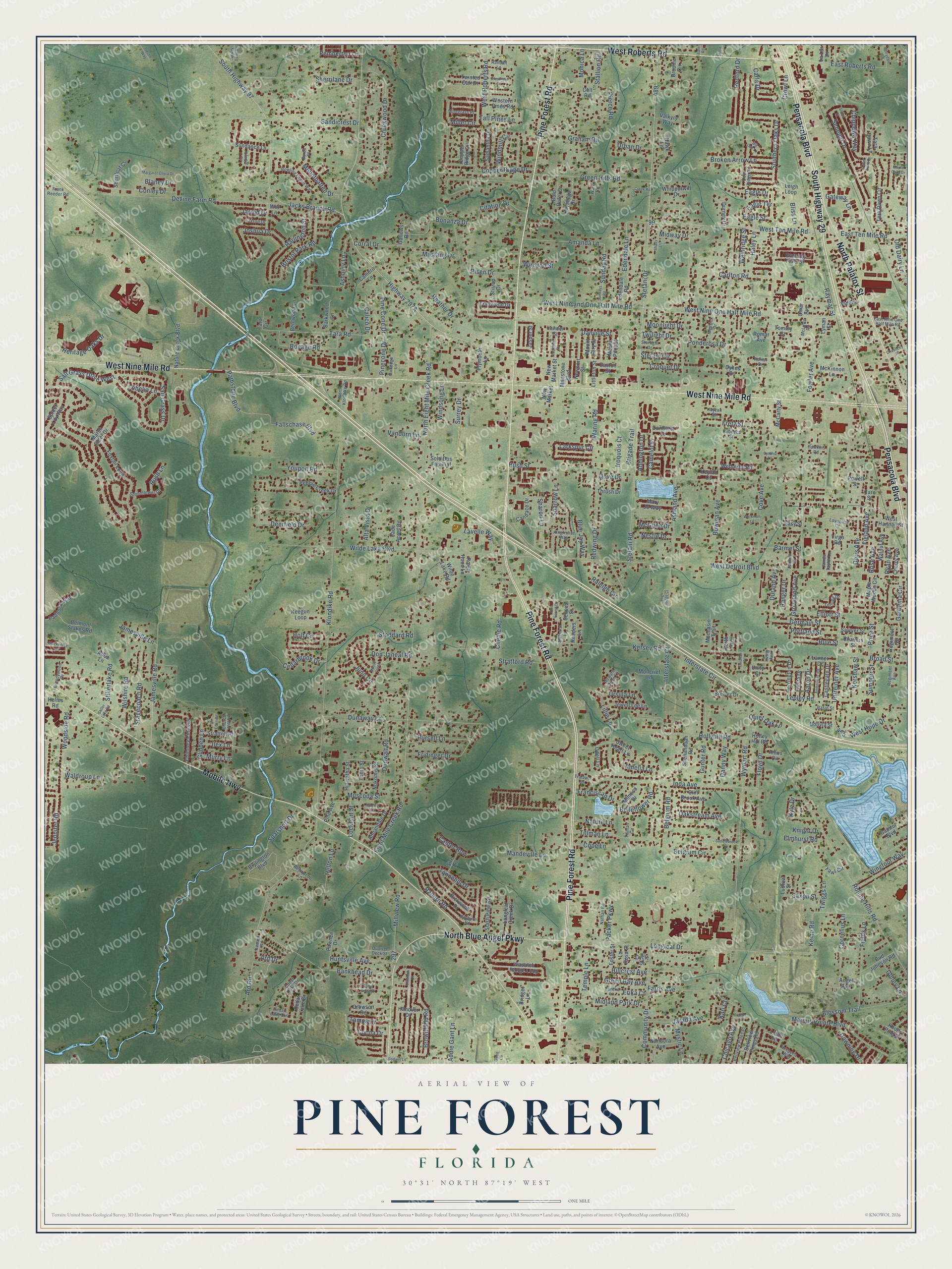
This beautifully detailed map of Pine Forest, Florida was created in 2026 using aerial imagery combined with modern topographical, census, street and landmark data. It’s a one-of-a-kind view of Pine Forest that combines accurate data with a vintage aesthetic. The map shows every building in its true location, many of the roads carry their names, and the shaded topographic relief shows the shape of the land.
Explore an aerial view of Pine Forest, Florida
On the map you’ll find Pine Forest Road, West Roberts Road, West Nine Mile Road, Pensacola Boulevard, Mobile Highway, South Highway 29, North Palafox Street, North Blue Angel Parkway, Jacks Branch Road, West Hope Drive, Stillerlake Road, Salt Grass Drive, and more. If you look closely you can even find your house accurately drawn in its correct location. Zoom in on the preview to look for yours.
Take a closer look at the Pine Forest map
Names on this map
These names are printed on this map.
Streets and roads: Pine Forest Road, West Roberts Road, West Nine Mile Road, Pensacola Boulevard, Mobile Highway, South Highway 29, North Palafox Street, North Blue Angel Parkway, Jacks Branch Road, West Hope Drive, Stillerlake Road, Salt Grass Drive.
More street names, A to Z
Aaron Drive, Abba Lane, Abbington Drive, Addie Gant Lane, Alta Vista Drive, Alysheba Drive, Amanda Lane, Amberidge Road, Amelia Lane, Amos Circle, Angel Avenue, Annandale Drive, Ard Drive, Ard Road, Ashbury Lane, Ashland Avenue, Bankhead Drive, Barkwood Lane, Barmel Street, Basin Street, Belgium Circle, Belgium Road, Belleflower Road, Bellview Pines Place, Bellview Pines Road, Belmont Stakes Road, Bentwood Lane, Berrydale Road, Big Oak Lane, Blackhorse Circle, Blaney Drive, Bliss Lane, Blossom Trail, Blue Jay Way, Bocage Road, Bold Ruler Drive, Bolivia Street, Bonanza Drive, Bowling Green Way, Bowman Avenue, Brandywood Drive, Brewer Drive, Bridget Lane, Brigade Trail, Bristol Park Road, Broad Street, Broken Arrow Lane, Broome Circle, Brownfield Road, Brylington Boulevard, Bud Johnson Road, Bush Street, Byron Place, Calahan Place, Calico Drive, Camelot Place, Camero Lane, Candace Drive, Canter Row, Capitol Boulevard, Carla Drive, Carlton Road, Caro Street, Castlegate Drive, Cdear Lake Drive, Cedarbrook Drive, Cedar Lake Circle, Cedar Lake Drive, Cedar Ridge Drive, Chauncey Street, Chavers Street, Chellie Road, Cherry Avenue, Chicago Avenue, Chimney Pines Drive, Chippewa Way, Church Hill Place, Citation Drive, Cliff Brook Avenue, Cocoa Drive, Colt Road, Community Drive, Conley Drive, Cool Creek Road, Cope Lane, Copper Ridge Circle, Copper Ridge Drive, Cornelius Lane, Corral Drive, Cove Avenue, Creekwood Drive, Crestfield Circle, Croquet Drive, Crowl Lane, Crowson Road, Cycle Drive, Cynthia Lane, Danny Way, Danville Street, Deerfield Drive, Deer Ridge Road, Devine Farm Road, Don Janeal Road, Doris Avenue, Dove Drive, Downing Drive, Dunaway Lane, Dunhurst Drive, Dunwalt Road, Durand Avenue, Durney Drive, Dykes Road, Eagle Drive, Eagle Street, Eagle Terrace, East Nine One Half Mile Road, Easton Street, East Roberts Road, East Ten Mile Road, Easy Street, Edendale Lane, Edendale Road, Eight Mile Creek Road, Elliott Street, Elmhurst, Elmhurst Road, Erika Court, Eureka Lane, Evening Falls Drive, Fallschase Boulevard, Farris Avenue, Fields Lane, Fiesta Drive, Figland Avenue, Flintlock Drive, Floyd Drive, Foster Street, Fowler Avenue, Foxtail Loop, Franciscan Drive, Frank Reeder Road, Franks Court, Fretz Street, Fridinger Drive, Gallows Road, Gardenia Circle, Gateway Lane, Germain Street, Glidden Lane, Godwin Lane, Graham Road, Green Bay Avenue, Green Hills Road, Groveland Avenue, Gulledge Lane, Gulley Lane, Gunter Road, Gwen Circle, Haley Lane, Hanover Drive, Harding Drive, Harlington Street, Hawkins Road, Hawk Lane, Heather Drive, Helms Road, Helton Lane, Heritage Oaks Drive, Herrington Drive, Hesperia Way, Hiawatha Street, High Ridge Court, Hillcrest Avenue, Holley Hill Road, Hollyhill Road, Holt Circle, Howard Dean Lane, Huntsville Avenue, Ilex Lane, Inda Avenue, Interstate Circle, Interstate Court, Iroquois Court, Irving Avenue, Jade Acres Road, James Taylor Lane, Jamesville Lane, Jamesville Road, Jarada Avenue, Jarmen Lane, Jarrod Drive, Jason Drive, Jasper Street, Jennifer Road, Jewell Lee Lane, Joshua Drive, Juno Circle, Kanard Road, Kari Court, Kayzan Street, Keegun Loop, Kemp Road, Kersey Road, Kershaw Street, Keylan Cv, Kingfisher Way, Klondike Road, Knight Drive, Knotty Pine Drive, Kyle Drive, La Lar Lane, Lancer Drive, Lander Street, Larkspur Circle, La Rosa Street, Lavelle Way, Leigh Loop, Lepley Road, Liana Lane, Lillie Lane, Littleton Street, Lobelia Lane, Lockhart Street, Longleaf Creek Drive, Longleaf Drive, Lovebird Court, Ludlow Street, Lyman Street, Mandeville Lane, Maple Oaks Drive, Maple Woods Circle, Marcus Pointe Boulevard, Margaret Olivia Drive, Marsh Elder Drive, Mary Jo Way, McCarty Street, McGhee Drive, McKinnon Lane, McLuvin Road, Messick Drive, Midland Park Drive, Midway Drive, Milestone Boulevard, Millet Circle, Millview Road, Mimosa Drive, Moccasin Trail, Moncrief Lane, Monica Lane, Moonlight Drive, Mossy Creek, Mount Airy Street, Mountbatten Drive, Mount Pilot Street, Murry Lane, Muscoda Street, Mustang Drive, Mystic Lane, Nandora Avenue, Nathan Road, Nature Creek Boulevard, Nature Lane, Nestle Drive, New Market, New Market Street, Newport Street, Nokomis Street, North Eight Mile Creek Road, North Klondike Road, Nowak Dairy Road, Oakstream Avenue, Odell Lane, Old Dairy Lane, Omar Avenue, Packer Parkway, Paddock Way, Pathstone Boulevard, Pawnee Drive, Pebble Creek Drive, Pemberton Lane, Perth Avenue, Pierce Road, Pine Avenue, Pinecone Drive, Pine Cone Drive, Pine Forest Drive, Plymouth Lane, Ponderosa Drive, Portland Street, Powell Street, Price Street, Pursell Lane, Quarter Deck Street, Quiet Oak Lane, Raburn Road, Raleigh Circle, Randall Lane, Ranger Drive, Rayburn Road, Raymar Street, Rebecca Street, Redford Drive, Redwing Drive, Reeders Lane, Regiment Avenue, Regiment Drive, Resmondo Lane, Rickwood Drive, Risen Drive, River Birch Drive, Robin Hood Lane, Rockland Street, Rolling Hills Road, Romar Avenue, Romar Drive, Rose Avenue, Rule Street, Rush Lane, Ryan Avenue, Saddlebrook Drive, Salt Grass Drive West, Samantha Drive, Sandicrest Drive, Sawyer Street, Saxon Street, Seneca Street, Senegal Drive, Shady Lane, Sharon Lane, Shear Street, Shenandoah Road, Sherrilane Drive, Shortleaf Court, Sir Eden Road, Sire Lane, Slash Pine Road, Solo Dos Familiaf, Southern Oaks Drive, South Highway 97, Sparrow Lane, Sparshott Drive, Spider Lily Way, Spoonflower Drive, Stagecoach Road, Stallion Road, Stallworth Lane, Starlight Drive, Stefani Circle, Stefani Drive, Stefani Road, Stiller Lake Road, Stirrup Drive, Stoddard Road, Stratford Road, Stratton Place, Sumpter Street, Sundance Lane, Sunday Road, Sundays Road, Sundial Circle, Surrey Drive, Sweet Heart Lane, Tall Pines Lane, Tampa Drive, Tannehill Drive, Tara Circle, Tara Dawn Circle, Tara Dawn Lane, Tara Road, Tate Road, Temple Lane, Thrush Drive, Tillman Circle, Tillman Lane, Tommy Street, Tonto Street, Tortuga Drive, Trailwood Drive, Tralawn Drive, Trestle Way, Tuttle Lane, Twiggs Lane, Twilight Drive, Twisted Oak Drive, Unity Court, Untreiner Avenue, Urban Drive, Ursula Lane, Valkyry Way, Vandorn Lane, Videlia, Virgo Road, Walbridge Street, Waldroup Lane, Walnut Avenue, Ware Road, Waring Road, Wasatch Range Loop, West Detroit Boulevard, Western Pines Road, West Hannah Street, West Nine and One Half Mile Road, West Nine One Half Mile Road, West Ten Mile Road, Wetherby Road, Whipporwill Drive, Wilde Lake Boulevard, Wilde Lake Road, Wilshire Road, Windmill Circle, Windsong Lane, Wingfoot Way, Winston Street, Wiregrass Place, Witt Lane, Woodside Road, Workman Lane, Wymart Road, Yawl Circle, Youpon Road.
See it on a wall
The Pine Forest map as a framed print. Swipe for more.


This beautifully detailed map of Pine Forest makes an attractive addition to your office, library, or den, and it can even be used to teach children the geography and history of the area. It also makes a great gift for someone who left Pine Forest and still calls it home. When you’re done exploring, click here to get your copy of the Pine Forest map.