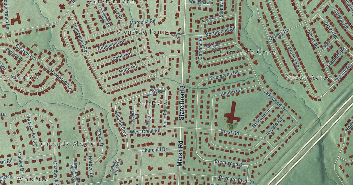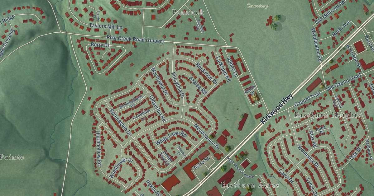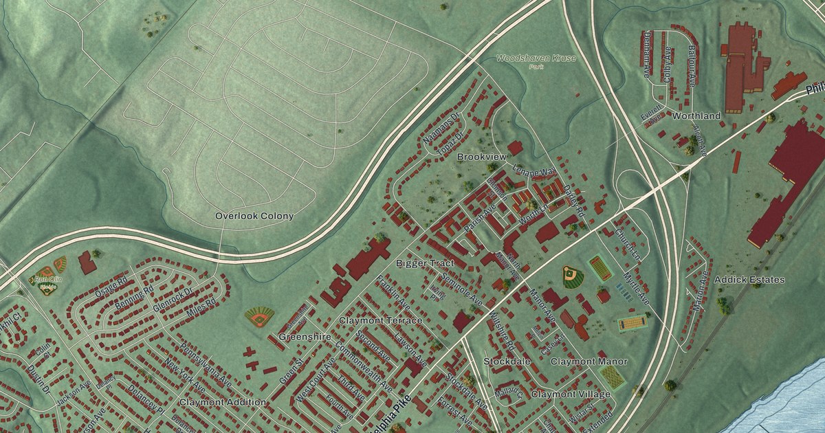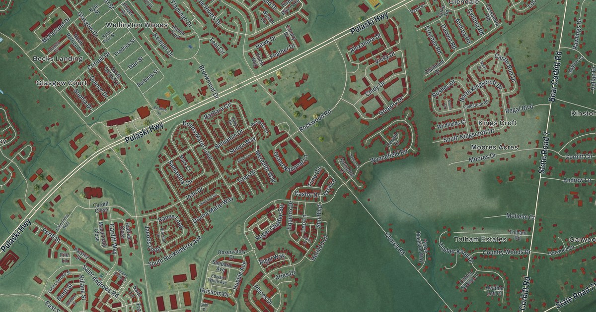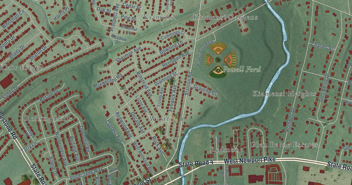
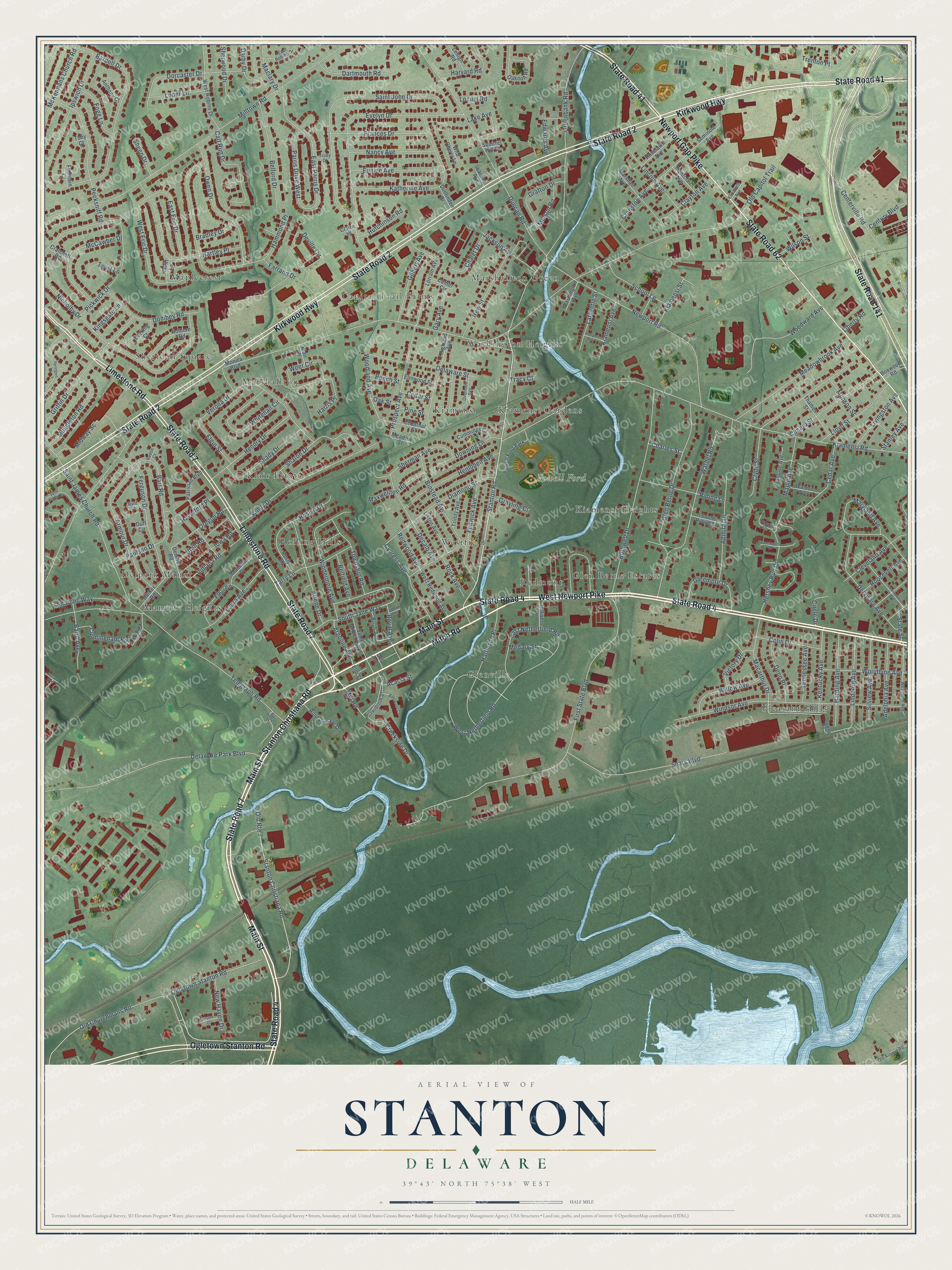
This beautifully detailed map of Stanton, Delaware was created in 2026 using aerial imagery combined with modern topographical, census, street and landmark data. It’s a one-of-a-kind view of Stanton that combines accurate data with a vintage aesthetic. The map shows every building in its true location, many of the roads carry their names, and the shaded topographic relief shows the shape of the land.
Explore an aerial view of Stanton, Delaware
On the map you’ll find Powell Ford, Manette Heights, Sheridan Square, Glenville, Marshallton Green, Pleasant Hills, Westfield, Klair Estate, Capital Trail Farms, Maplecrest, Glen Berne Estates, Washington Heights, and more. If you look closely you can even find your house accurately drawn in its correct location. Zoom in on the preview to look for yours.
Did You Know?
Stanton was named for Stephen Stanton, a local property owner. In 1777 George Washington camped here with his army from August 28 to September 8. He expected General Howe to march this way to Philadelphia. The British turned west through Newark instead, and Washington moved his men toward Brandywine Springs. That’s from the 1938 WPA guide to Delaware.
Stanton is a community in New Castle County.
Take a closer look at the Stanton map
Names on this map
These names are printed on this map.
Places: Powell Ford, Manette Heights, Sheridan Square, Glenville, Marshallton Green, Pleasant Hills, Westfield, Klair Estate, Capital Trail Farms, Maplecrest, Glen Berne Estates, Washington Heights, Kiamensi Gardens, Rolling Hills, Kiamensi, Redmont, Kiamensi Heights, Delpark Manor, Marshallton and Powell Ford Park.
Streets and roads: State Road 4, State Road 7, Limestone Road, West Newport Pike, Mitch Road, State Road 41, Stanton Christiana Road, Main Street, State Road 2, Kirkwood Highway, State Road 141, Newport Gap Pike.
More street names, A to Z
Acacia Street, Adelphia Avenue, Admiral Drive, Advent Court, Anthony Court, Argonne Avenue, Arlene Drive, Armour Drive, Baird Avenue, Bardell Drive, Barker Road, Barr Road, Beech Street, Belfield Avenue, Belford Drive, Bentwood Court, Binstead Avenue, Birch Avenue, Bond Street, Boxwood Road, Bradley Drive, Byrd Court, Calf Run Drive, Cedar Avenue, Cedar Street, Center Circle, Centerville Road, Century Boulevard, Chalet Drive, Charles Street, Chestnut Street, Circle Drive, Claire Place, Clayton Avenue, Cleveland Avenue, Clyde Street, Colefax Court, Colin Drive, Cranston Avenue, Cratchett Road, Creekside Drive, Crowell Road, Cummings Court, Cunard Street, Cunningham Road, Cypress Avenue, Darby Drive, Dartmouth Road, Dawnbrook Drive, Decalb Avenue, Del Avenue, Delaware Avenue, Delaware Park Boulevard, Delaware Street, Dennis Road, Denn Place, Deville Circle, Diamond Street, Dombey Road, Dorcaster Drive, Dorking Court, Downing Lane, Duff Circle, Duncan Road, Dunlinden Drive, East Eric Drive, East Netherfield Road, East Parris Drive, East Robino Drive, Edwards Avenue, Elgin Street, Elizabeth Avenue, Elm Street, Elmwood Street, Ethel Circle, Eunice Avenue, Evelyn Drive, Farrand Drive, Fenpor Avenue, Fenwick Avenue, Ferguson Drive, First State Boulevard, Fleetwood Court, Fogg Lane, Fountain Court, Frances Drive, Gary Avenue, Gilbert Avenue, Glen Berne Drive, Glenmore Drive, Grafton Drive, Grayling Court, Greenbank Road, Griffin Drive, Hammond Place, Harbeson Place, Harding Avenue, Harris Place, Hartley Place, Harvard Road, Haverford Place, Hendry Drive, Henlopen Avenue, Hershey Run Drive, Highland Avenue, Holborn Road, Honeysuckle Drive, Hutchinson Road, Indiana Road, Iowa Road, Ipswich Drive, Jackson Avenue, Katherine Avenue, Kelbark Lane, Kentucky Avenue, Kiamensi Avenue, Kiamensi Road, Kiamensi Street, Kingsgate Lane, Klair Place, Lafayette Street, Lake Avenue, Larson Avenue, Laura Avenue, Lehigh Road, Liberty Road, Lincoln Avenue, Lindberg Avenue, Liston Avenue, Livingston Avenue, Lloyd Street, Locust Road, Loper Lane, Lorrain Avenue, Macarthur Drive, Maclary Drive, Manette Drive, Manlove Avenue, Maple Avenue, Marshall Avenue, Maryland Avenue, Maxwellton Road, McCawber Drive, McKennans Church Road, Meadowbrook Avenue, Meadow Street, Medary Street, Melson Road, Midway Sc, Mill Road, Milltown Road, Monica Boulevard, Montclair Avenue, Muggleton Road, Munson Street, Nancy Avenue, New Haven Drive, Newport Road, New Street, Nicholby Drive, Oaknoll Road, Oak Street, Ogletown Stanton Road, Old Airport Road, Old Capitol Trail, Old Churchmans Road, Old Route 7, Oregon Road, Overlook Avenue, Owen Drive, Parris Drive West, Patrician Boulevard, Paulson Drive, Pecksniff Road, Pennsylvania Avenue, Petro Drive, Pickwick Drive, Pine Street, Prospect Avenue, Redwood Avenue, Reese Court, Riding Lane, Rock Avenue, Roosevelt Avenue, Roselawn Avenue, Roslyn Drive, Roslyn Road, Rothwell Drive, Royal Avenue, Saint James Church Road, Saint James Drive, Saint John Drive, Saint Mihiel Avenue, Sandy Drive, School Lane, Sears Boulevard, Second Avenue, Seminole Avenue, Shady Drive, Sharon Drive, Sharons Way, Sheen Drive, Sherman Avenue, Sherwood Drive, Silview Avenue, South Jane Way, South Riding Lane, Springers Lane, Squirrel Hill Court, Stanley Avenue, Stanton Road, State Road 62, State Street, Tarry Lane, Telegraph Road, Tennessee Avenue, Thames Street, Toby Court, Tolliver Drive, Township Road, Tracy Court, Trenton Place, Trinity Avenue, Trudy Drive, Truitt Lane, Twist Lane, Utah Road, Verona Drive, Victory Drive, Walnut Avenue, Wardel Road, Washington Avenue, Weer Circle, West Eric Drive, Westmont Avenue, West Netherfield Road, West Redwood Avenue, West Robino Drive, Whitehall Circle, Wild Cherry Lane, Willow Avenue, Wilson Street, Windermere Avenue, Windsor Avenue, Woodbine Avenue, Woodland Avenue, Woodward Avenue.
See it on a wall
The Stanton map as a framed print. Swipe for more.


This beautifully detailed map of Stanton makes an attractive addition to your office, library, or den, and it can even be used to teach children the geography and history of the area. It also makes a great gift for anyone with Stanton roots. When you’re done exploring, click here to get your copy of the Stanton map.