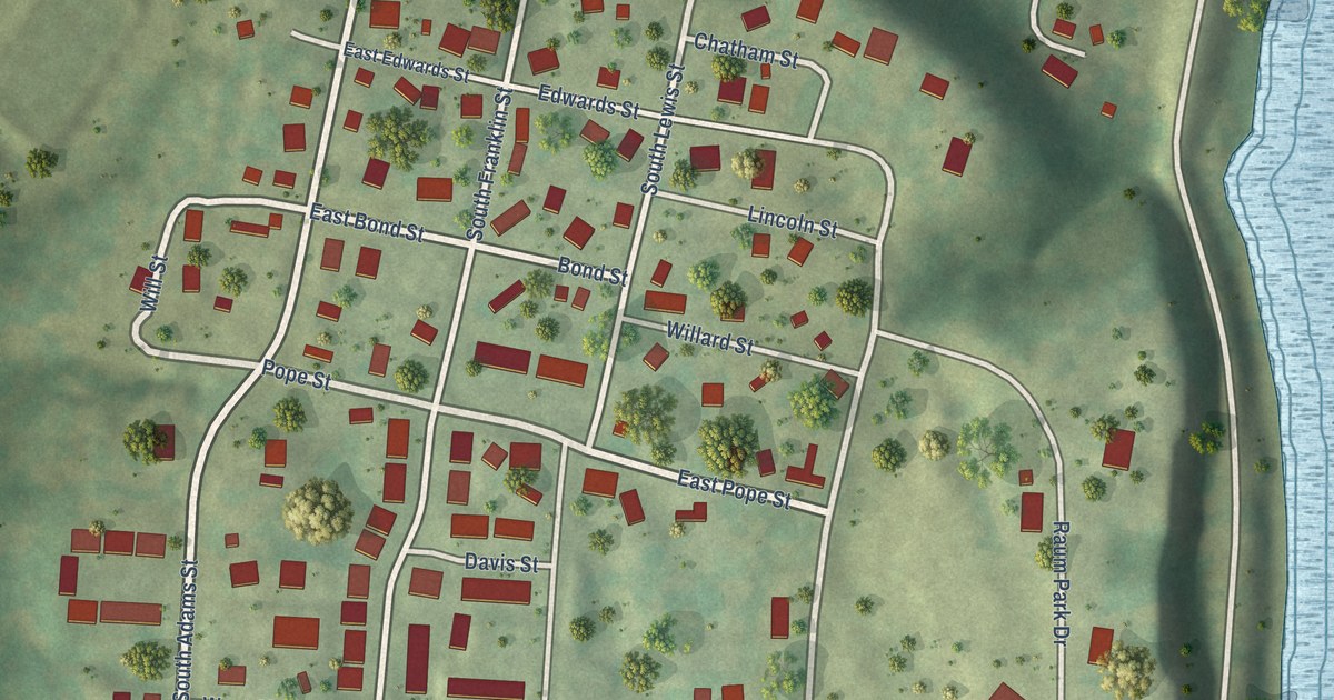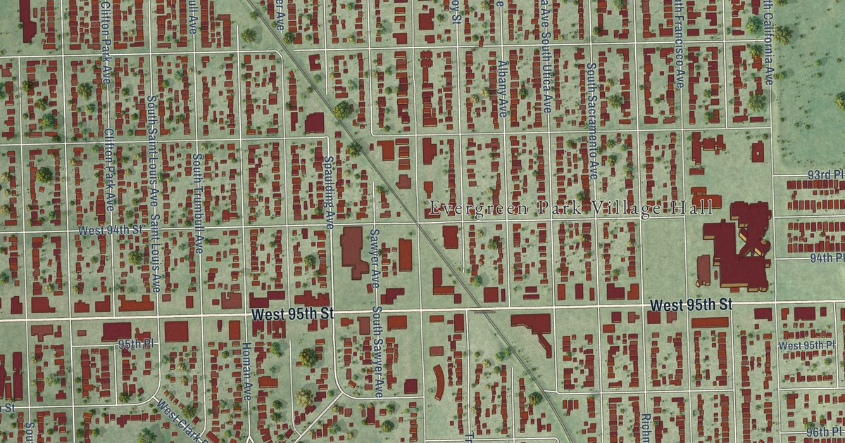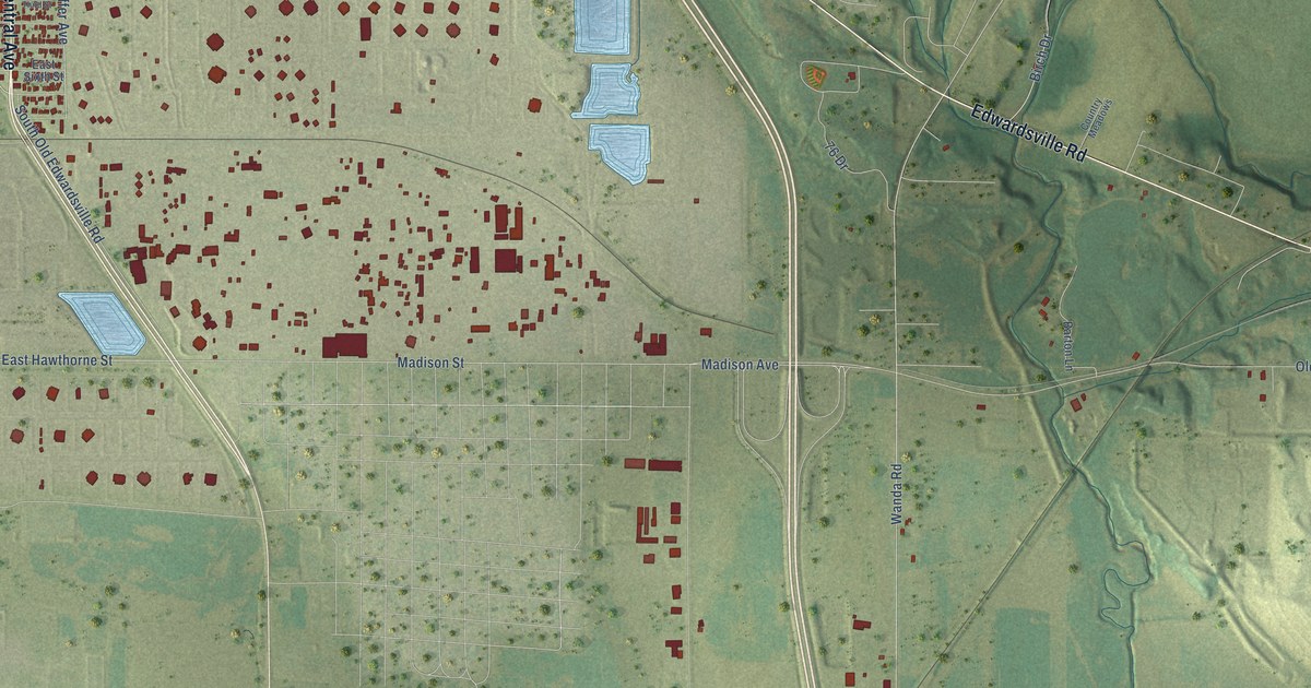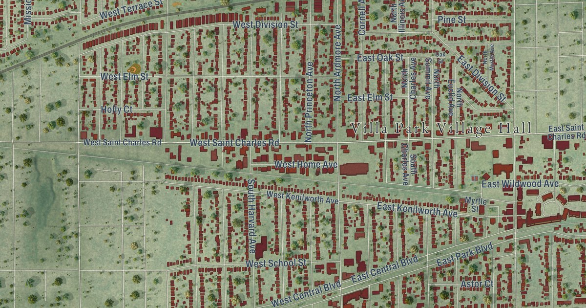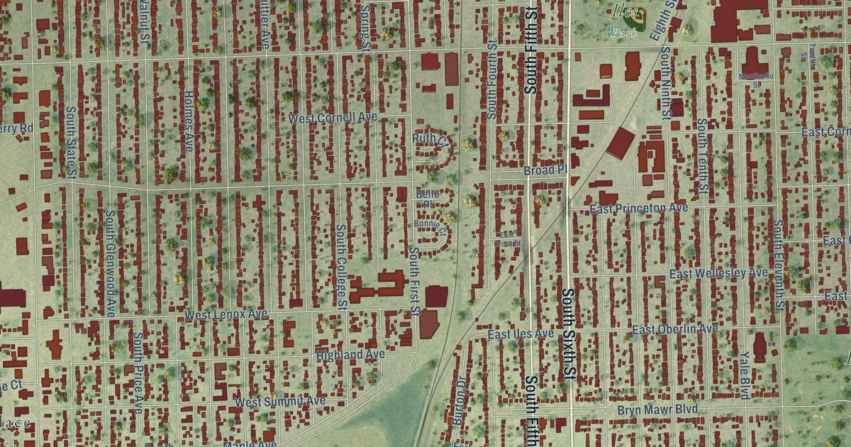
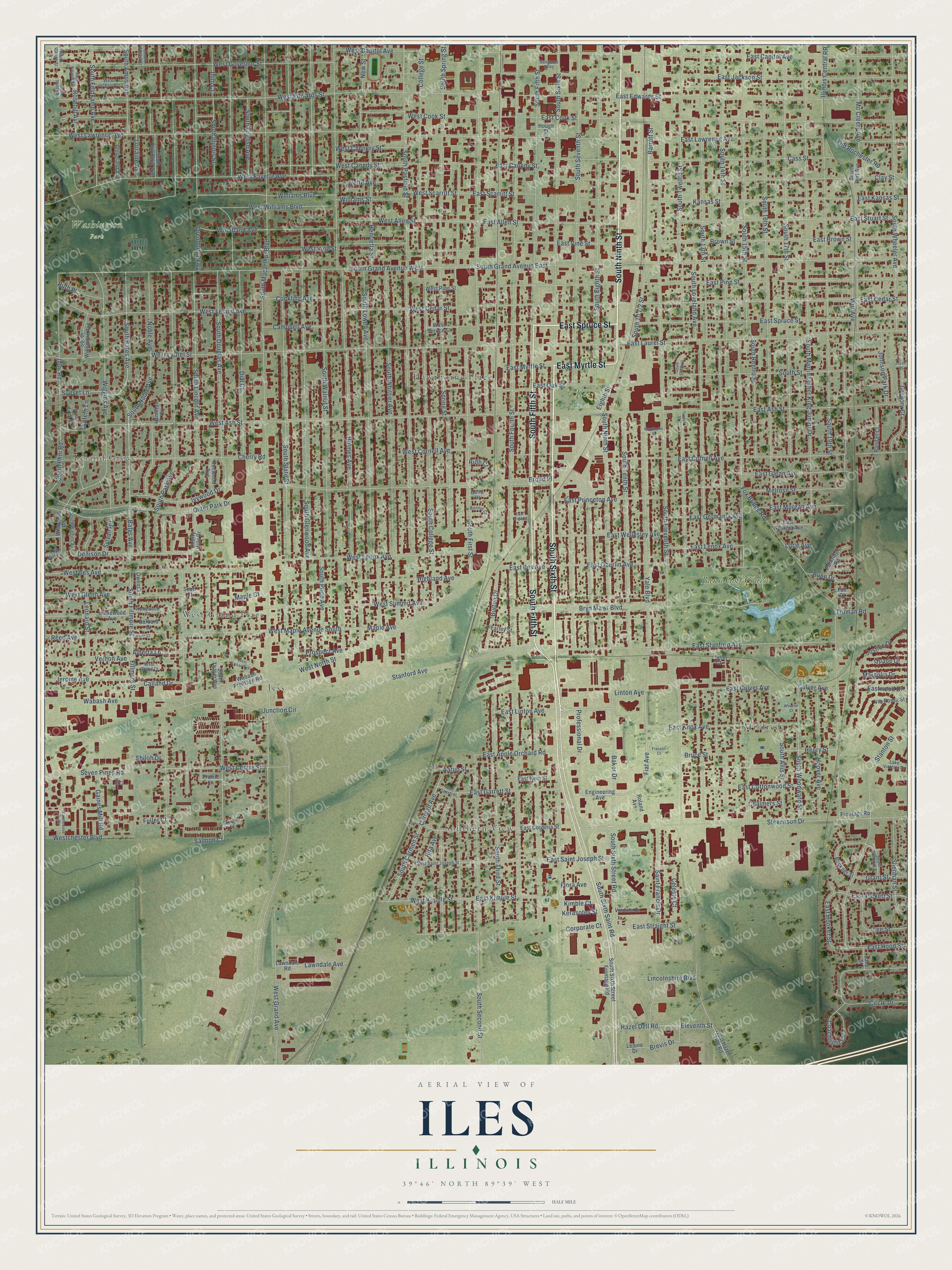
This beautifully detailed map of Iles, Illinois was created in 2026 using aerial imagery combined with modern topographical, census, street and landmark data. It’s a one-of-a-kind view of Iles that combines accurate data with a vintage aesthetic. The map shows every building in its true location, many of the roads carry their names, and the shaded topographic relief shows the shape of the land.
Explore an aerial view of Iles, Illinois
On the map you’ll find Hobbs Park, Washington Park, Iles Park, Southern View, Leland Grove, West Grand Place, Mildred, Hawthorne Place, Jess, and Bunn Golf Course, along with South Sixth Street, South Ninth Street, and more. If you look closely you can even find your house accurately drawn in its correct location. Zoom in on the preview to look for yours.
Did You Know?
From the 1927 History of Illinois and Her People: "The Iles people settled at Springfield, and owned much of the land in the vicinity of the state capital."
Iles is a community in Sangamon County.
Take a closer look at the Iles map
Names on this map
These names are printed on this map.
Places: Hobbs Park, Washington Park, Iles Park, Southern View, Leland Grove, West Grand Place, Mildred, Hawthorne Place, Jess and Bunn Golf Course.
Streets and roads: South Sixth Street, South Ninth Street, East Spruce Street, East Myrtle Street, South Fifth Street, East Linton Avenue, Linton Avenue, Fiat Avenue, Stevenson Drive, South Macarthur Boulevard, South First Street, West Centre Street.
More street names, A to Z
Aarup Street, Alberta Lane, Baker Drive, Barbara Court, Barrett Street, Bates Avenue, Belle Place, Bonnie Court, Brevis Drive, Broad Place, Brown Street, Bruce Street, Bryn Mawr Boulevard, Buckner Street, Bunn Drive, Burton Drive, Calland Drive, Campbell Avenue, Candlewood Drive, Carman Avenue, Cass Street, Celeste Court, Chalmers Street, Cherry Hills Drive, Cherry Road, Circle Drive, Clay Street, Cleveland Avenue, Coachlight Court, College Street, Conkling Avenue, Corporate Court, Culver Avenue, Denison Drive, Dial Court, East Allen Street, East Apple Orchard Road, East Ash Street, East Brown Street, East Canedy Street, East Capitol Avenue, East Cedar Street, East Cook Street, East Cordelia Street, East Cornell Avenue, East Cottonwood Street, East Cross Street, East Culver Avenue, East Edwards Street, East Garrett Street, East Georgia Avenue, East Germania Avenue, East Glenn Avenue, East Hood Street, East Hooker Street, East Iles Avenue, East Jackson Street, East Kansas Street, East Kern Street, East Kimble Street, East Knox Avenue, East Laurel Street, East Lawrence Avenue, East Lenox Avenue, East Morgan Avenue, East Oak Street, East Oberlin Avenue, East Pickett Street, East Pine Street, East Princeton Avenue, East Saint Joseph Street, East Scarritt Street, East Stanford Avenue, East Straight Street, East Stuart Street, East Vine Street, East Wellesley Avenue, Eastwood Drive, Eighth Street, Eleventh Street, Engineering Avenue, Farley Street, Fayette Avenue, Fillmore Street, Flora Avenue, Fox Bridge Road, Fox Court, Fresson Court, Frontage Road, Fuller Court, Gaines Mill Road, Goodwin Court, Grant Street, Gregory Court, Hamilton Court, Hazel Dell Road, Henrietta Street, Henry Street, Highland Avenue, Holmes Avenue, Homewood Avenue, Homewood Court, Hoover Avenue, Hough Street, Illini Court, Illini Road, Illinois Central RR, Ivywood Drive, Jerome Avenue, Johnson Park Drive, Joyce Lane, Junction Circle, Justice Drive, Kansas Street, Kenwood Avenue, Kerasotes Street, Kimble Court, Lake Victoria Drive, Lane Street, Lantern Lane, Lawndale Avenue, Lawndale Road, Lee Street, Lejune Drive, Leonard Street, Lincolnshire Boulevard, Little Avenue, Lorraine Avenue, Luka Court, Maple Avenue, Maple Court, Margolia Drive, Mc Creery Avenue, Melrose Street, Monticello Street, New Street, Noble Avenue, Old Rochester Road, Orendorff Parkway, Outer Park Drive, Owens Lane, Parkridge Road, Pine Tree Drive, Prairie Lane, Professional Drive, Prospect Avenue, Quade Drive, Randall Court, Reed Avenue, Reed Court, Rita Avenue, Roland Avenue, Rosehill Avenue, Ruth Court, Ruth Place, Saint Francis Drive, Salmon Court, Sangamo Alley, Scott Court, Seven Pines Road, Sherman Street, Shiloh Drive, South 13th Street, South 14th Street, South 15th Street, South 16th Street, South 17th Street, South 19th Street, South Adelia Street, South Allis Street, South Amos Avenue, South Bates Avenue, South Carmen Street, South College Street, South Columbia Avenue, South Douglas Avenue, South Eighth Street, South Eleventh Street, South English Avenue, South Feldkamp Avenue, South Fillmore Street, South Fourth Street, South Fremont Street, South Glenwood Avenue, South Grand Avenue East, South Grand Avenue West, South Illini Road, South Illinois Street, South Lincoln Avenue, South Loveland Avenue, South Lowell Avenue, South Martin Luther King Junior Drive, South Noble Avenue, South Park Avenue, South Pasfield Street, South Price Avenue, South Renfro Street, South Rosehill Avenue, South Second Street, South Seventh Street, South Sixth Saint Road, South Sixth Street Frontage Road, South Sixth Street Road, South Spring Street, South Stange Avenue, South Stange Street, South State Street, South Street, South Street Court, South Tenth Street, South Thayer Avenue, South Third Street, South Twelfth Street, South Walnut Street, South Wheeler Avenue, South Whittier Avenue, South Wiggins Avenue, South Willemore Avenue, South Wirt Avenue, South Woodward Street, Spring Street, Stanford Avenue, Stanton Street, Sunset Lane, Sylvan Road, Top Hill Lane, Trailer Court, Truman Road, Twelfth Street, Vernon Avenue, Via Rossa Street, Vindale Drive, Wabash Avenue, Wabash Frontage Road, West Allen Street, West Ash Street, West Canedy Street, West Capitol Avenue, West Cedar Street, West Chenery Street, Westchester Boulevard, West Cook Street, West Cornell Avenue, West Edwards Street, West Fayette Avenue, West Garrett Street, West Glenn Avenue, West Governor Street, West Grand Avenue, West Grand Court, West Hazel Dell Road, West Iles Avenue, West Jackson Street, West Kimble Street, West Laurel Street, West Lawrence Avenue, West Leland Avenue, West Lenox Avenue, West Maple Avenue South, West North Street, West Pine Street, West Saint Joseph Street, West Scarritt Street, West Spruce Street, West Summit Avenue, West Urban Avenue, West Vine Street, West Williams Boulevard, Wheeler Court, Wiggins Avenue, Wildwood Road, Williams Boulevard, Williams Street, Wirt Avenue, Woodland Avenue, Yale Boulevard.
See it on a wall
The Iles map as a framed print. Swipe for more.


This beautifully detailed map of Iles makes an attractive addition to your office, library, or den, and it can even be used to teach children the geography and history of the area. It also makes a great gift for anyone with Iles roots. When you’re done exploring, click here to get your copy of the Iles map.