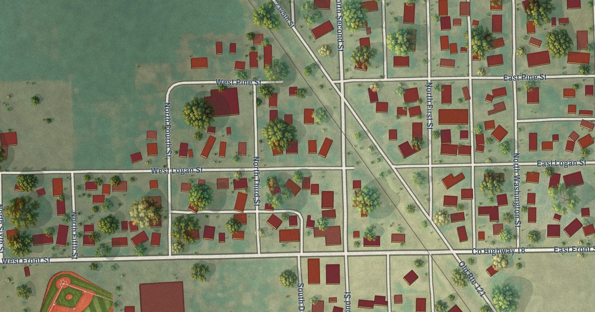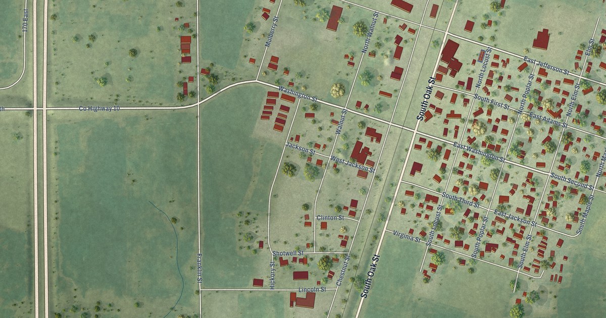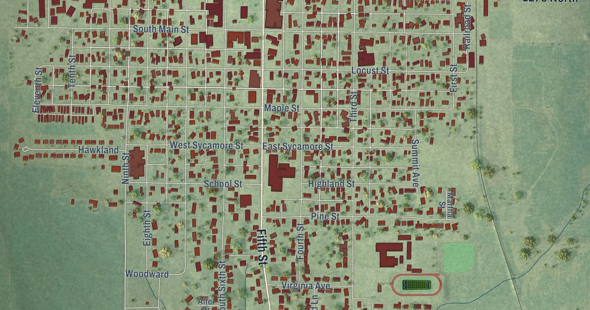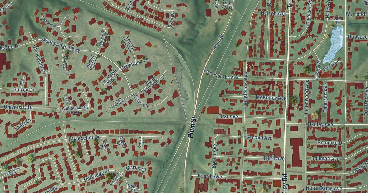
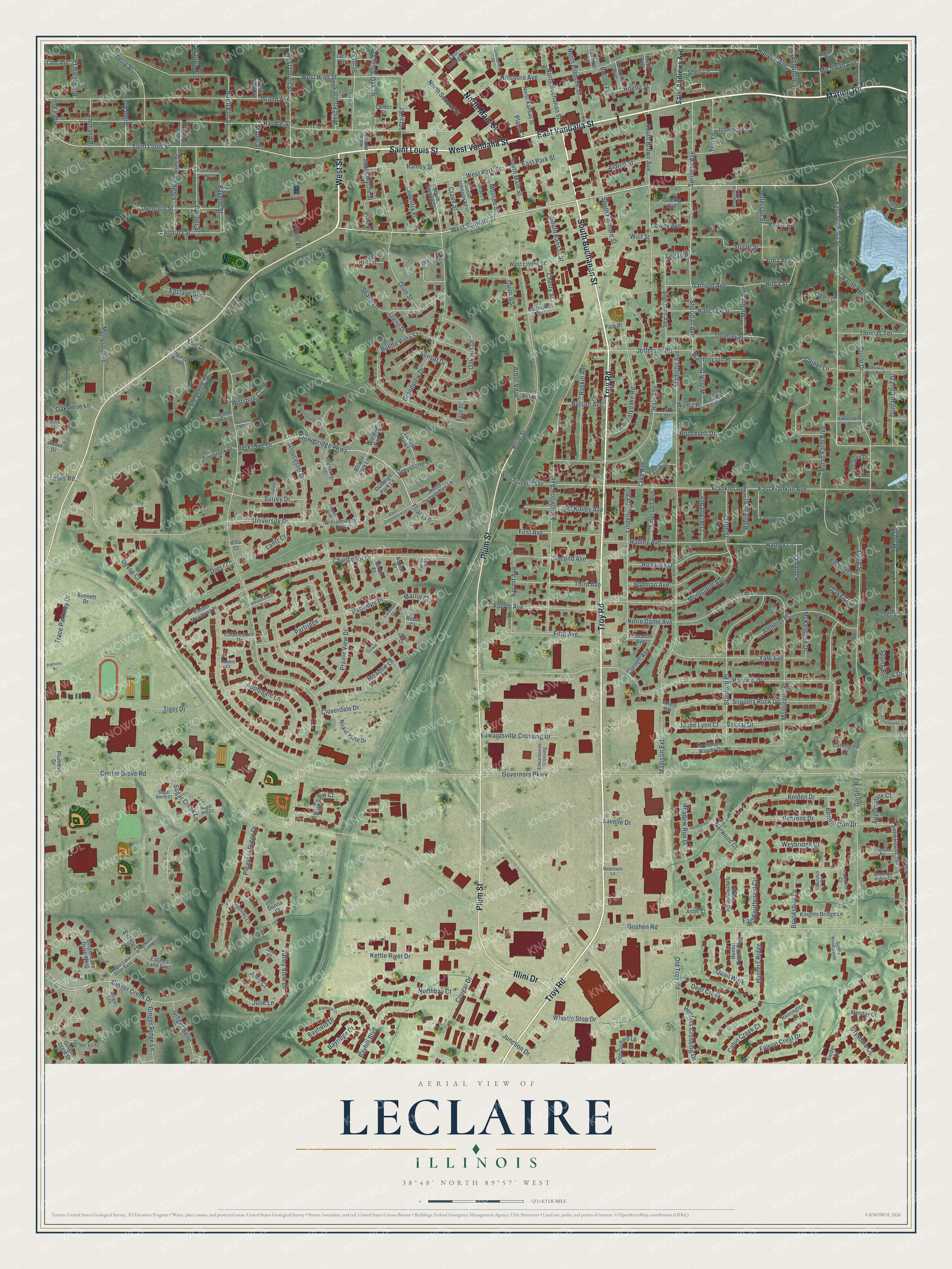
This beautifully detailed map of Leclaire, Illinois was created in 2026 using aerial imagery combined with modern topographical, census, street and landmark data. It’s a one-of-a-kind view of Leclaire that combines accurate data with a vintage aesthetic. The map shows every building in its true location, many of the roads carry their names, and the shaded topographic relief shows the shape of the land.
Explore an aerial view of Leclaire, Illinois
On the map you’ll find Township Park and Lusk Park, along with North Main Street, Saint Louis Street, West Street, West Vandalia Street, Marine Road, Troy Road, South Buchanan Street, East Vandalia Street, Plum Street, Illini Drive, and more. If you look closely you can even find your house accurately drawn in its correct location. Zoom in on the preview to look for yours.
Did You Know?
Factory owner N. O. Nelson founded Leclaire between 1890 and 1895 as a planned community for his workers. He shared company profits with them. That idea came from the Maison LeClaire in Paris, which gave the town its name. Edwardsville annexed Leclaire in 1933.
Leclaire is a community in Madison County.
Take a closer look at the Leclaire map
Names on this map
These names are printed on this map.
Places: Township Park and Lusk Park.
Streets and roads: North Main Street, Saint Louis Street, West Street, West Vandalia Street, Marine Road, Troy Road, South Buchanan Street, East Vandalia Street, Plum Street, Illini Drive, East Schwarz Street, West Schwarz Street.
More street names, A to Z
Aldrup Street, Allen Avenue, Amherst Place, Ammann Place, Applegate Lane, Appomattox Court, Arbor Vitae, Aspen Court, Aster Court, Autumn Forest, Banner Street, Barnett Drive, Bayfield Drive, Bayhill Boulevard, Bayridge Court, Baywood Court, Behrens Drive, Belden Drive, Bennett Drive, Bennington Drive, Berkshire Drive, Birch Court, Biscayne Drive, Bollman Avenue, Bramble Lane, Bristol Park Lane, Broadview Drive, Brookshire Lane, Brookside Court, Bryant Avenue, Buena Vista Street, Bunn Avenue, Burns Farm Boulevard, Burton Place, Cabin Creek Court, Cardinal Court, Carrington Court, Carters Grove, Castle Court, Center Grove Road, Center Street, Chaderic Court, Chancellor Drive, Cherry Street, Churchill Court, Circle Drive, Clay Street, Cloverdale Drive, Cobblestone Drive, Columbia Avenue, Commercial Street, Cornell Avenue, Cougar Drive, Coventry Place, Crane Street, Creek Street, Cypress Court, Deer Creek, Devon Court, Dewey Avenue, Donna Court, Dorset Court, Drake Court, Drysdale Court, Dude Place, Duke Street, Dunlap Cove Drive, Dunleigh Park Lane, Durham Court, East Avenue, East College Street, East Franklin Avenue, East Park Street, East Southcrest Circle, Edwardsville Crossing, Edwardsville Crossing Drive, Emerson Avenue, Enclave Boulevard, Esic Drive, Estate Lane, Estates Lane East, Falcon Crest Drive, Fayette Street, Fifth Avenue, First Avenue, Florida Street, Fourth Avenue, Franklin Avenue, Friars Lane, Garfield Avenue, Georgia Street, Gerber Road, Ginger Bend, Ginger Creek Drive, Ginger Crest Drive, Ginger Forest Court, Ginger Lake Drive East, Ginger Lake Drive West, Ginger Lea, Ginger Ridge Lane, Gloucester Drive, Goldenrod Lane, Goshen Road, Goshen Woods Estate, Governors Parkway, Grand Avenue, Grandview Drive, Grant Drive, Greenway Drive North, Greystone Lane, Gueltig Avenue, Hadley Avenue, Hadley Court, Hadley Lane, Hale Avenue, Halleck Avenue, Hancock Street, Harrison Street, Harvard Drive, Herbert Place, Hilda Street, Hill Lane, Hillsboro Avenue, Hoehn Street, Holyoake Road, Hunter Pointe Boulevard, Hunters Crossing Drive, Hunters Ridge, Irma Avenue, Isherwood Avenue, Jaime Lynn Court, Jason Court, Jefferson Road, Jefferson Street, Jennifer Lane, Julie Court, Julie Lane, Junction Drive, Kettle River Drive, Kiowa Street, Knights Bridge Lane, Kristy Lane, Ladd Avenue, Lake Avenue, Lake Drive, Lancashire Drive, Lane Street, Lantz Court, Lautner Lane, Lavelle Drive, Legion Drive, Leverett Lane, Lewis Road, Lindenwood Avenue, Little Round Top Drive, Logan Place, London Park Lane, Longfellow Avenue, Madison Avenue, Madison Extension, Magnolia Street, Maple Street, Martin Court, Mary Drive, McKendree Drive, McKinley Avenue, Meade Avenue, Meadow Lane, Meadow Rue Drive, Mengstrasse, Michigan Avenue, Minnesota Street, Mission Road, Monday Court, Monroe Street, Montclaire Avenue, Montclaire Woods Drive, Monticello Place, Morton Avenue, Nelson Avenue, Nickel Plate Drive, Northbay Court, Northbridge Circle, North Buchanan Street, North Charles Street, North Elm Street, North Estates Lane, North Fillmore Street, North Kansas Street, North Myrtle Street, North Oak Street, North Oxfordshire Lane, North Second Street, North Shore Drive, Norwood Court, Notre Dame Avenue, Oak Hill Drive, Oakland Avenue, Oak Lane, Oakstone Lane, Old Orchard Lane, Old Troy Road, Olive Street, Orchid Court, Oriole Court, Park Place, Parkview Court, Partners Drive, Partridge, Partridge Place, Pebble Court, Pinebrook Drive, Pineridge Court, Pine Street, Plaza Court, Pleasant Ridge Drive, Plummer Drive, Prairie View Drive, Princeton Avenue, Quail Walk, Quartz Knoll, Quince Street, Ramey Street, Randle Street, Remington Court, Richetta Drive, Roanoke Drive, Robin Court, Robinson Lane, Roosevelt Drive, Rose Avenue, Ruskin Avenue, Sage Drive, Saint Andrews Avenue, Schwarz Street Plaza, Scott Street, Second Avenue, Seminary Ridge Court, Seminole Street, Shady Lane, Shell Lane, Sheridan Avenue, Sherman Avenue, Slippery Rock Drive, Snider Drive, South Benton Street, Southbridge Lane, South Brown Avenue, South Charles Street, South Fillmore Street, South Johnson Street, South Kansas Street, South Main Street, South Myrtle Street, South Oxfordshire Lane, South Street, Spring Brook Drive, Springer Avenue, Spring Street, Stanford Place, Stolze Street, Stonebridge Parkway, Stonebrooke Drive, Sugar Bend Court, Sugar Creek Lane, Sugar Hill Court, Sunset Drive, Surrey Court, Surrey Drive, Terra Verde, Terry Street, Third Avenue, Thomas Street, Thomas Terrace, Tiger Drive, Timber Lane, Timber Meadows Place, Trace Parkway Drive, Trio Lane, University Drive, Vadalabene Drive, Valley View Drive, Vassar Drive, Villa Court, Warren Street, Warwick Park Lane, Washington Place, Weber Drive, Wellesly Court, West Fourth Street, West Franklin Avenue, West High Street, West Linden Street, West Park Street, West Southcrest Circle, West Union Street, Weybridge Court, Whippoorwill Way, Whistle Stop Drive, Williamsburg Boulevard, Wilson Drive, Wiltshire Court, Wolf Street, Wyma Place, Yale Avenue, Yorkshire Court.
See it on a wall
The Leclaire map as a framed print. Swipe for more.


This beautifully detailed map of Leclaire makes an attractive addition to your office, library, or den, and it can even be used to teach children the geography and history of the area. It also makes a great gift for anyone who grew up in Leclaire or moved away. When you’re done exploring, click here to get your copy of the Leclaire map.