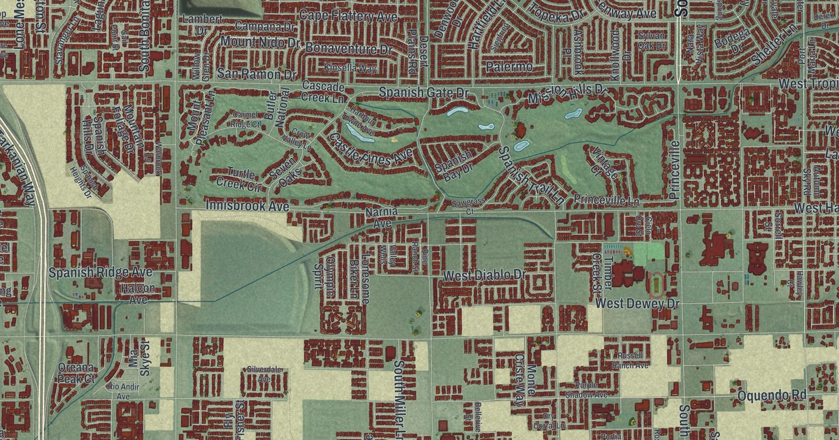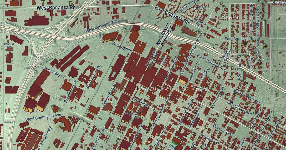
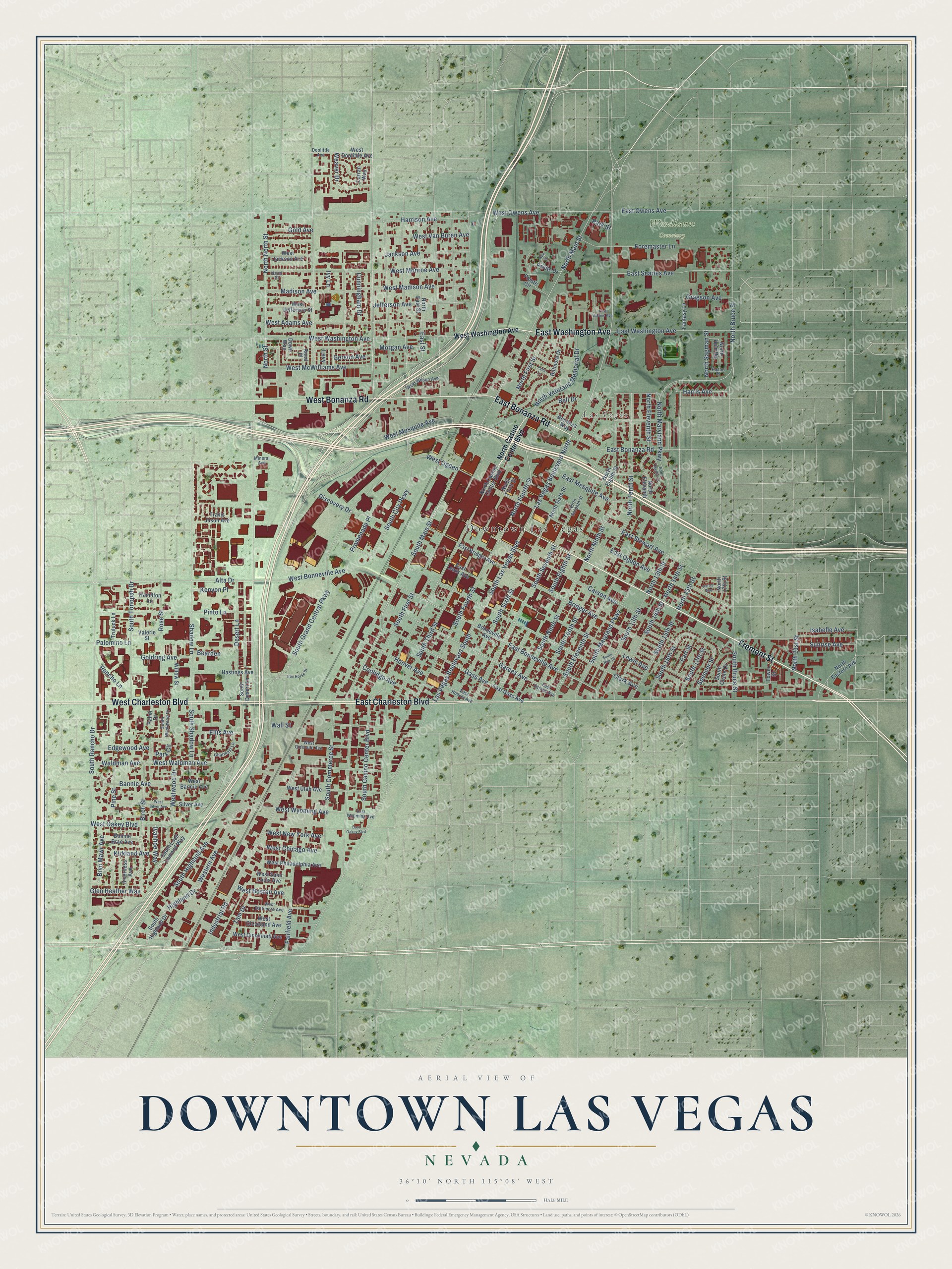
This beautifully detailed map of Downtown Las Vegas, Nevada was created in 2026 using aerial imagery combined with modern topographical, census, street and landmark data. It’s a one-of-a-kind view of Downtown Las Vegas that combines accurate data with a vintage aesthetic. The map shows every building in its true location, many of the roads carry their names, and the shaded topographic relief shows the shape of the land.
Explore an aerial view of Downtown Las Vegas, Nevada
On the map you’ll find Las Vegas and Woodlawn Cemetery, along with Fremont Street, West Bonanza Road, East Bonanza Road, East Charleston Boulevard, East Washington Avenue, West Charleston Boulevard, South Main Street, North Fourth Street, Las Vegas Boulevard North, and more. If you look closely you can even find your house accurately drawn in its correct location. Zoom in on the preview to look for yours.
Did You Know?
Las Vegas began in 1905 with an auction of 110 acres beside the Union Pacific Railroad tracks. That land became downtown. The Hotel Nevada opened there in 1906 as the first hotel in the area. It still welcomes guests today as the Golden Gate Hotel and Casino.
Take a closer look at the Downtown Las Vegas map
Names on this map
These names are printed on this map.
Places: Downtown Las Vegas, Las Vegas and Woodlawn Cemetery.
Streets and roads: Fremont Street, West Bonanza Road, East Bonanza Road, East Charleston Boulevard, East Washington Avenue, West Charleston Boulevard, South Main Street, North Fourth Street, Las Vegas Boulevard North, Birch Street, North Main Street, Ivanhoe Way.
More street names, A to Z
Alta Drive, Bannie Avenue, Bearden, Bell Drive, Biltmore Drive, Bonanza Way, Bonneville Avenue, Bonnie Brae Avenue, Bridger Avenue, Bryn Mawr Avenue, Carson Avenue, Charmast Lane, Clark Avenue, Coolidge Avenue, Cunningham Drive, Curran Way, Desert Lane, Discovery Drive, Doolittle Avenue, Down Way, Earl Street, East Adams Avenue, East Bonneville Avenue, East Bridger Avenue, East Garces Avenue, East Gass Avenue, East Hoover Avenue, East Lewis Avenue, East Mesquite Avenue, East Oakey Boulevard, East Ogden Avenue, East Owens Avenue, East Searles Avenue, East Stewart Avenue, East Street, East Wyoming Avenue, Edgewood Avenue, Ellis Avenue, Fairfield Avenue, Fantasy Lane, Foremaster Lane, Garces Avenue, Gass Avenue, Gerson Avenue, Glen Heather Way, Gold Avenue, Goldring Avenue, Gragson Avenue, Hamilton Lane, Hand Place, Harley Way, Harris Avenue, Harrison Avenue, Hastings Avenue, Highland Drive, Hoover Avenue, Industrial Road, Inverness Avenue, Iron Horse Drive, Isabelle Avenue, Ivy Lane, Jackson Avenue, Jefferson Avenue, Ken Street, Kenyon Place, Kirkland Avenue, Las Vegas Boulevard South, Levy, Lewis Avenue, Madison Avenue, Mineral Avenue, Morgan Avenue, North 13th Street, North 14th Street, North 15th Street, North 17th Street, North 21st Street, North Bruce Street, North Casino Center Boulevard, North Eastern Avenue, North East Street, North Eighth Street, North Eleventh, North Eleventh Street, North First Street, North Held Road, North Maryland Parkway, North Ninth Street, North North Street, North Sagman Street, North Seventh Street, North Sixth Street, North Street, North Tenth Street, North Third Street, North Twelfth Street, North Veterans Memorial Drive, Pahor Drive, Paiute Circle, Paiute Drive, Palm Lane, Palomino Lane, Park Circle, Park Street, Pastel Place, Pine Street, Pinto Lane, Promenade Place, Rancho Lane, Reed Place, Rose Street, Shadow Lane, Silver Avenue, South 13th Street, South 14th Street, South 15th Street, South 16th Street, South 17th Street, South Bruce Street, South Casino Center Boulevard, South Circle Drive, South City Parkway, South Commerce Street, South Desert Lane, South Eighth Street, South Eleventh Street, South First Street, South Fourth Street, South Grand Central Parkway, South Highland Avenue, South Highland Drive, South Las Vegas Boulevard, South Loch Lomond Way, South Maryland Parkway, South Ninth Street, South Rancho Drive, South Rue 13, South Seventh Street, South Shadow Lane, South Sixth Street, South Tenth Street, South Third Street, South Tonopah Drive, South Westwood Drive, Spencer Street, Sunrise Avenue, Tam Drive, Tower Street, Travis Jason Avenue, Truluck Lane, Valerie Street, Waldman Avenue, Wall Street, Weaver Drive, West Adams Avenue, West Baltimore Avenue, West Bannie Avenue, West Bonneville Avenue, West Boston Avenue, West Chicago Avenue, West Cincinnati Avenue, West Cleveland Avenue, West Colorado Avenue, West Doolittle Avenue, Western Avenue, West Jackson Avenue, West Jefferson Street, West Madison Avenue, West McWilliams Avenue, West Mesquite Avenue, West Monroe Avenue, West New York Avenue, West Oakey Boulevard, West Ogden, West Owens Avenue, West Philadelphia Avenue, West Saint Louis Avenue, West Silver Avenue, West Utah Avenue, West Van Buren Avenue, West Waldman Avenue, West Washington Avenue, West Wilson Avenue, Westwood Drive, West Wyoming Avenue, Willow Street.
See it on a wall
The Downtown Las Vegas map as a framed print. Swipe for more.


This beautifully detailed map of Downtown Las Vegas makes an attractive addition to your office, library, or den, and it can even be used to teach children the geography and history of the area. It also makes a great gift for anyone who grew up in Downtown Las Vegas or moved away. When you’re done exploring, click here to get your copy of the Downtown Las Vegas map.