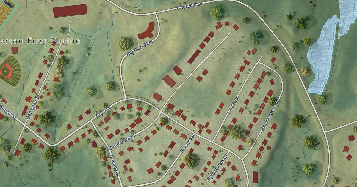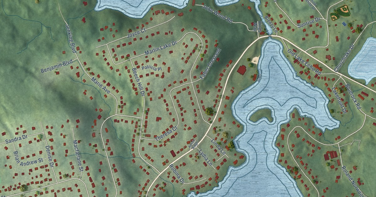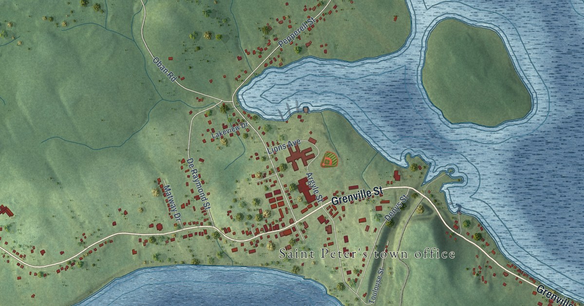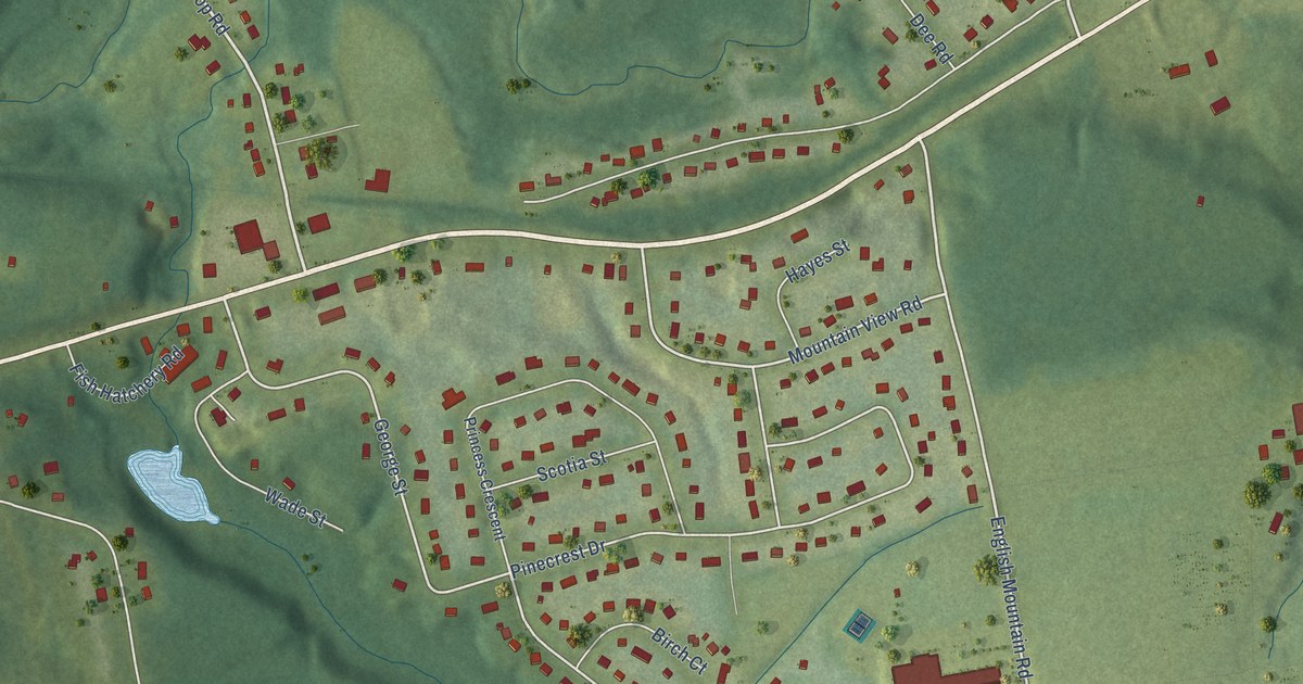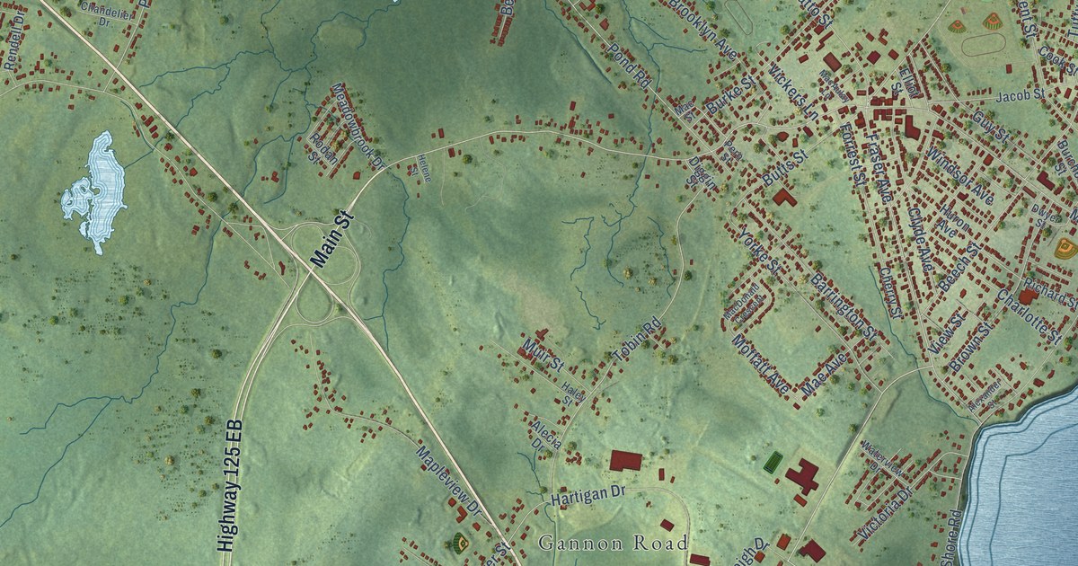
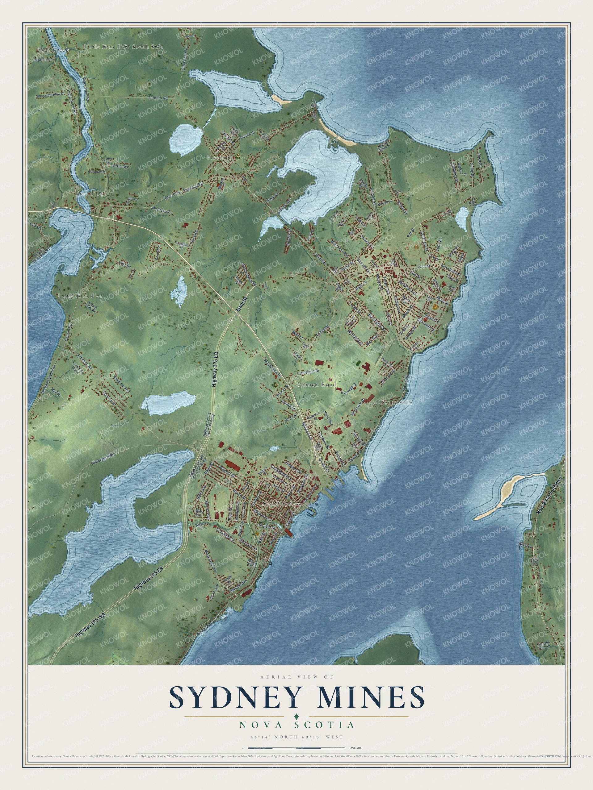
This beautifully detailed map of Sydney Mines, Nova Scotia was created in 2026 using aerial imagery combined with modern topographical, census, street and landmark data. It’s a one-of-a-kind view of Sydney Mines that combines accurate data with a vintage aesthetic. The map shows every building in its true location, many of the roads carry their names, and the shaded topographic relief shows the shape of the land.
Explore an aerial view of Sydney Mines, Nova Scotia
On the map you’ll find Mill Creek, Little Bras d’Or South Side, Bras d’Or, North Sydney, Little Bras d’or, Florence, and Centreville, along with Gannon Road, Main Street, Highway 125 EB, Highway 125 WB, New Waterford Highway, and more. If you look closely you can even find your house accurately drawn in its correct location. Zoom in on the preview to look for yours.
Take a closer look at the Sydney Mines map
Names on this map
These names are printed on this map.
Places: Mill Creek, Little Bras d'Or South Side, Bras d'Or, North Sydney, Gannon Road, Little Bras d'or, Florence and Centreville.
Streets and roads: Main Street, Highway 125 EB, Highway 125 WB, New Waterford Highway, Memorial Drive, Fraser Avenue, Pleasant Street, Blowers Street, Pierce Street, LeGatto Street, Archibald Avenue, Pond Road.
More street names, A to Z
Alder Point Road, Alecia Drive, Alexander Street, Allans Lane, Allen Lane, Amber Drive, Archie Street, Atlantic Street, Baird Street, Barrington Street, Beach Street, Beech Street, Bendix Street, Black Point Street, Bonnar Lane, Bras D'Or - Florence Road, Brooklyn Avenue, Brook Street, Brown Street, Burchell Street, Burke Street, Butts Street, Cable Street, Caledonia Street, Campbell Street, Centre Street, Chandelier Drive, Charlotte Street, Cherry Street, Church Road, Church Street, Clifford Street, Clyde Avenue, Colonel Street, Colonial Drive, Commercial Street, Convent Street, Cook Street, Cottage Street, Cox Lane, Crescent Street, Diggin Street, Dinaut Drive, Dipersio Street, Dwyer Street, East Street, Egan Street, Elliot Street, Eveleigh Drive, Fairholme Close, Felixs Lane, Fifth Avenue, Forrest Street, Four Wheel Drive, Georges River Road, Gisborne Street, Golden Drive, Guy Street, Haley Street, Hankin Street, Hare Avenue, Harpers Lane, Hartigan Drive, Helene Street, High Street, Highway 125 EB Exit 2 Off Ramp, Highway 125 WB Exit 2 Off Ramp, Hillier Avenue, Hillside Boularderie Road, Hill Top Drive, Holic Avenue, Howatson Boulevard, Howell Street, Howley Road, Hull Drive, Huron Avenue, Jacob Street, James Street, Jardine Street, Jessome Street, Johnson Road, King Street, Laffin Lane, Lamonds Street, Leblanc Road, Liscomb Point Drive, Little Pond Road, Lorne Street, MacAulay Lane, MacDonald Crescent, MacDonald Lane, Mackay Street, MacLean Street, Mac Street, Mae Avenue, Manning Street, Mapleview Drive, Margaret Street, Marshs Lane, May Street, McGean Street, Meadowbrook Drive, Meech Avenue, Miles Avenue, Moffatt Avenue, Moulton Avenue, Muir Street, Musgraves Lane, Napoleon Street, Nicholas Street, Notre Dame Street, Ocean Street, Old Branch Road, Oram Drive, Oram Street, Orrin Avenue, Park Road, Park Street, Parnell Street, Peck Street, Peppett Street, Pero Street, Pitt Street, Point Aconi Road, Power Street, Purves Street, Queen Street, Rankin Street, Rateau Street, Regent Street, Rendell Drive, Richard Street, Riggs Avenue, Rodan Street, School Street, Seaview Drive, Shore Road, Spring Grove Road, Spruce Meadow Drive, Stacey Avenue, Station Street, Sunrise Drive, Third Avenue, Thistle Drive, Tobin Avenue, Tobin Road, Toronto Road, Tutty Street, Vale Street, Vickers Lane, Victoria Drive, View Street, Villa Drive, Waterview Drive, Webster Street, West Street, Wilkie Drive, Windsor Avenue, Yorke Street, Young Avenue, Young Street.
See it on a wall
The Sydney Mines map as an 18 x 24 inch print in a black frame.

This beautifully detailed map of Sydney Mines makes an attractive addition to your office, library, or den, and it can even be used to teach children the geography and history of the area. It also makes a great gift for anyone who grew up in Sydney Mines or moved away. When you’re done exploring, click here to get your copy of the Sydney Mines map.