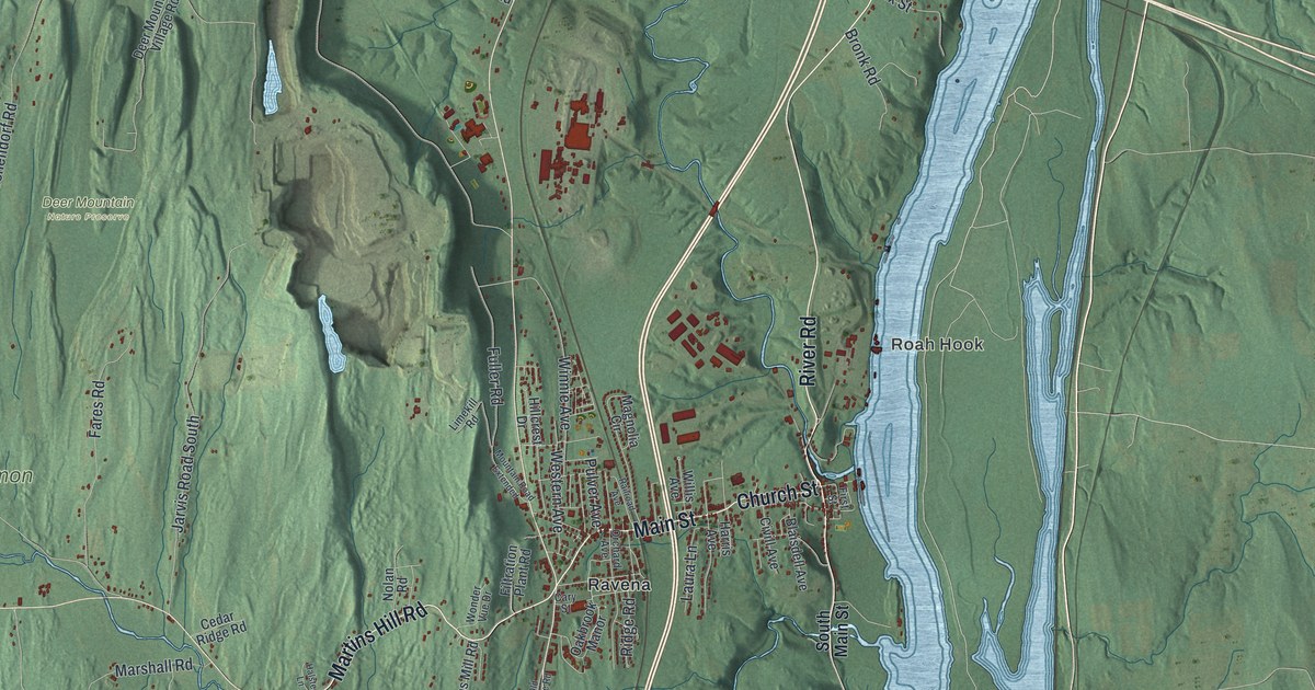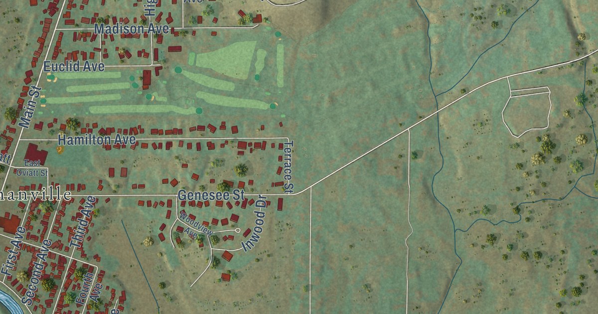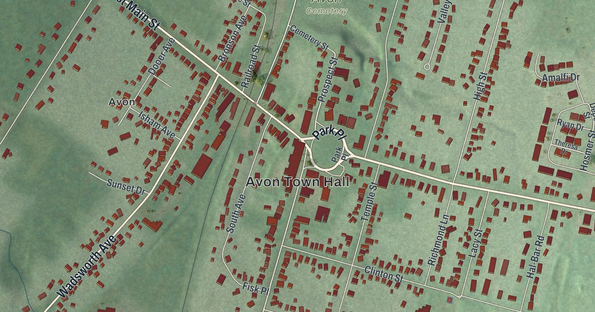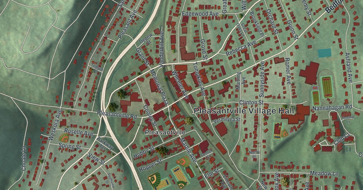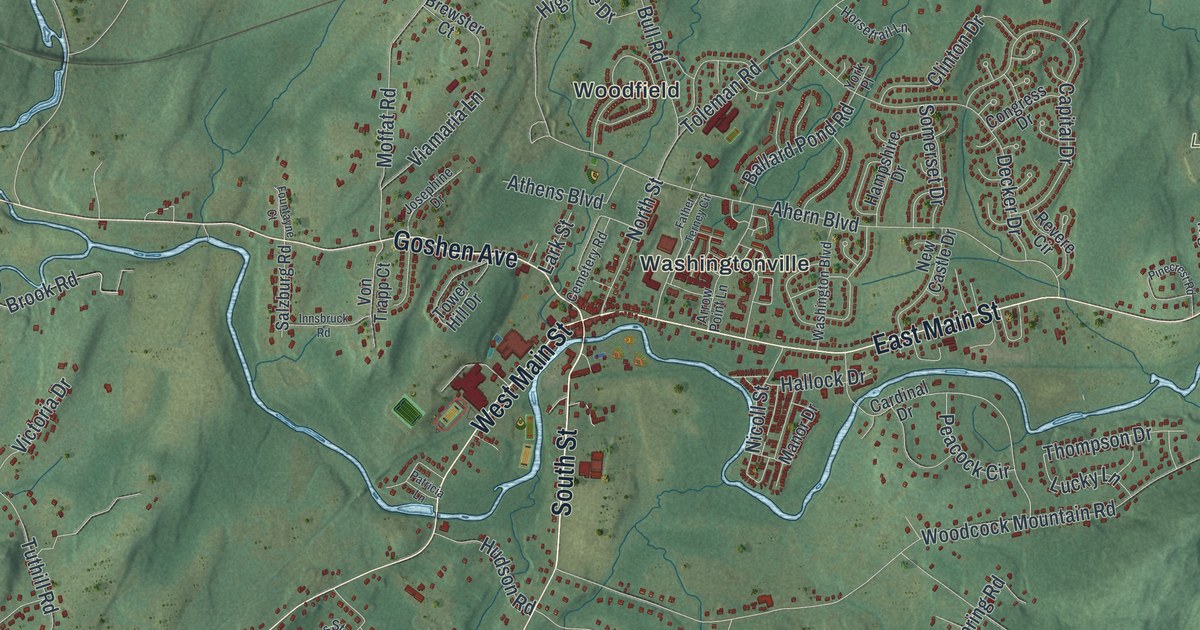
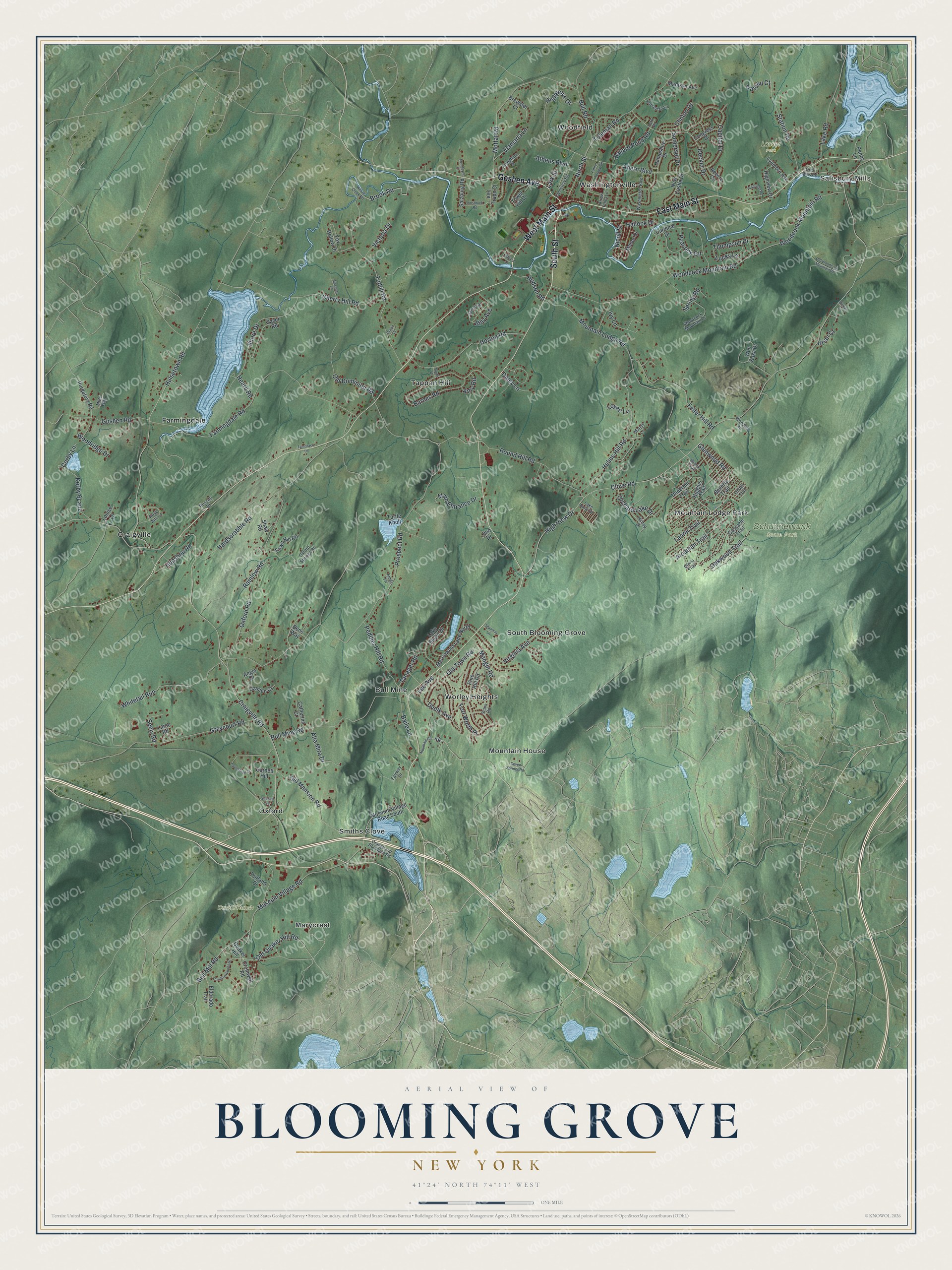
This beautifully detailed map of Blooming Grove, New York was created in 2026 using aerial imagery combined with modern topographical, census, street and landmark data. It’s a one-of-a-kind view of Blooming Grove that combines accurate data with a vintage aesthetic. The map shows every building in its true location, many of the roads carry their names, and the shaded topographic relief shows the shape of the land.
Explore an aerial view of Blooming Grove, New York
On the map you’ll find Salisbury Mills, Bull Mine, Craigville, Farmingdale, Marycrest, Lasser Park, and Schunnemunk State Park, along with South Street, Main Street, Goshen Avenue, Old Quaker Hill Road, Clove Road, and more. If you look closely you can even find your house accurately drawn in its correct location. Zoom in on the preview to look for yours.
Did You Know?
Blooming Grove was formed from part of Cornwall in 1799. It later gave up land to create Hamptonburgh in 1830 and Chester in 1845. The Brotherhood Winery in Washingtonville opened in 1839. It is the oldest winery in the United States still running without a break.
Take a closer look at the Blooming Grove map
Names on this map
These names are printed on this map.
Places: Salisbury Mills, Duck L'Ranch, Lasser Park, Schunnemunk State Park, Bull Mine, Craigville, Farmingdale, Marycrest, Mountain House, Mountain Lodge Park, Oxford, Smiths Clove, South Blooming Grove, Tappan Hill, Washingtonville, Woodfield and Worley Heights.
Streets and roads: South Street, East Main Street, West Main Street, Goshen Avenue, Old Quaker Hill Road, Clove Road, Craigville Road, Mountain Lodge Road, Prospect Road, Hulsetown Road, Oxford Road, Farmingdale Road.
More street names, A to Z
Ahern Boulevard, Alta Mira Drive, Amy Road, Angle Drive, Arcadian Trail, Arrow Point Lane, Athens Boulevard, Baile Lane, Ballard Pond Road, Barnes Road, Bens Way, Beverly Trail, Billy Avenue, Blossom Court, Brewster Court, Brian Court, Brook Road, Brook Trail, Bull Mill Road, Bull Mine Road, Bull Road, Capital Drive, Cardinal Drive, Cascade Trail, Catherine Court, Cemetery Road, Cherry Hill Road, Clinton Drive, Congress Drive, Corby Lane, Country Woods Drive, Cromwell Road, Daley Lane, Damien Court, Decker Drive, Dristin Drive, Duelk Avenue, Durland Drive, Eldorado Trail, Emily Lane, Equestrian Drive, Fairway Drive, Father Terney Circle, Fawn Hill Road, Felter Hill Road, Fort Worth Place, Fountayne Court, Fox Hollow Drive, Garnett Hill, Glenwood Road, Gloria Trail, Goshen Road, Greycourt Road, Hallock Drive, Hampshire Drive, Hardscrabble Road, Heard Road, Helms Hill Road, Higgins Trail, Highgrove Drive, High View Drive, Highview Drive, Hilltop Drive, Hilmar Lane, Horsetrail Lane, Horton Road, Hubshop Road, Hudson Road, Innsbruck Road, Ivy Lane, James Street, Jmd Drive, Josephine Drive, Lake Anne Drive, Lake Road, Lake Shore Drive, Lark Street, Laroc Road, Laurel Trail, Lee Avenue, Linden Trail, Louise Lane, Loyee Lane, Lucky Lane, Lynmore Avenue, Madisyn Avenue, Main Entrance Drive, Mandy Lane, Mangin Road, Manor Drive, Merriewold Lane North, Mitts Way, Moffat Road, Mountain Road, Museum Village Road, Museum Village Road South, Natchu Court, New Castle Drive, Nicoll Street, North Drive, North Street, Oakwood Trail, Old Dominion Road, Old Mansion Road, Old Town Road, Old Woodcock Mountain Road, Orange and Rockland Road, Orchard Lake Drive, Orrs Mills Road, Oxford Springs Road, Patricia Lane, Peacock Circle, Peddler Hill Road, Penny Lane, Pinecrest Road, Pine Hill Road, Purgatory Road, Quaker Hill, Ramlow Road, Revere Circle, Rose Ann Lane, Round Hill Road, Ruscitti Drive, Sackett Square, Salzburg Road, Sayer Road, Sears Road, Seely Road, Seven Springs Road, Shannon Lane, Shaw Road, Shore Drive, Somerset Drive, Spring Road, Station Road, Tamarack Lane, Tanager Road, Thompson Drive, Toleman Road, Tower Hill Drive, Turtle Knoll, Tuthill Road, Underhill Trail, Viamaria Lane, Victoria Drive, Virginia Avenue, Von Trapp Court, Washington Boulevard, Whitetail Run, Willow Creek Road, Won Kasa Drive, Woodard Road, Woodcock Mountain Drive, Woodcock Mountain Road, Woodridge Drive, York Place.
See it on a wall
The Blooming Grove map as a framed print. Swipe for more.


This beautifully detailed map of Blooming Grove makes an attractive addition to your office, library, or den, and it can even be used to teach children the geography and history of the area. It also makes a great gift for someone who left Blooming Grove and still calls it home. When you’re done exploring, click here to get your copy of the Blooming Grove map.