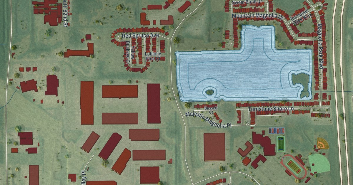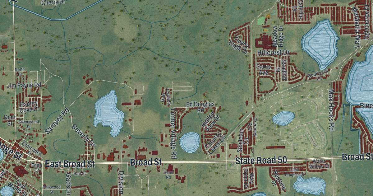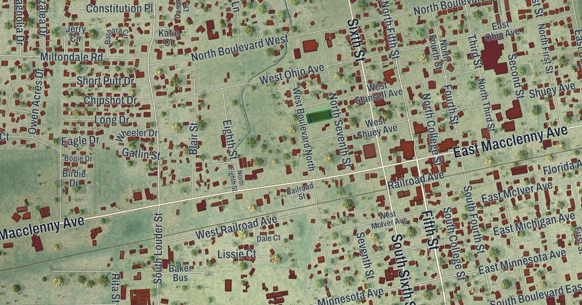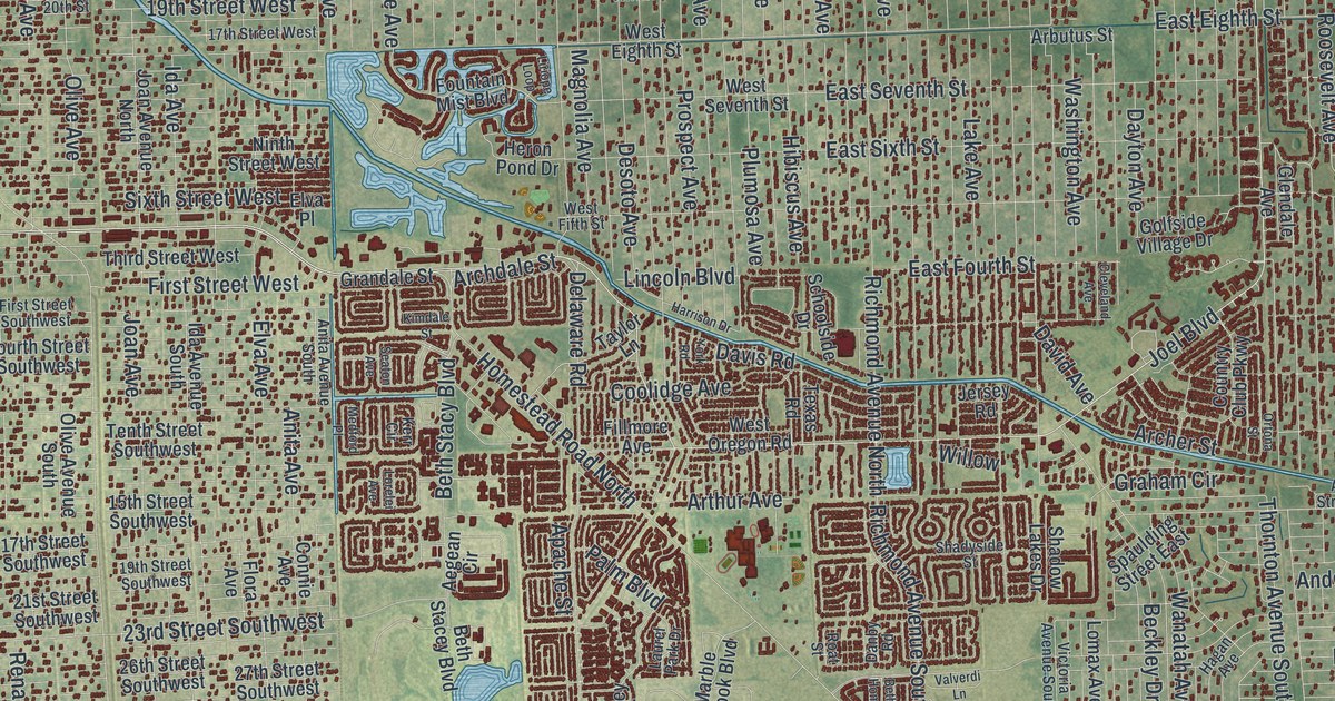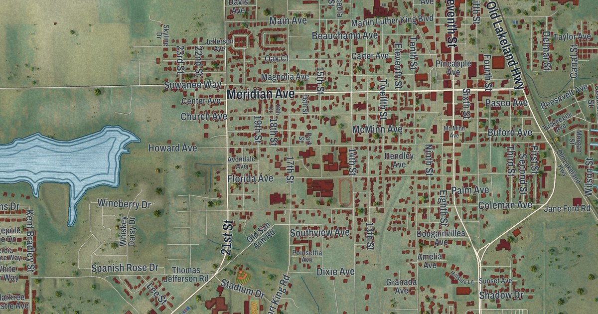
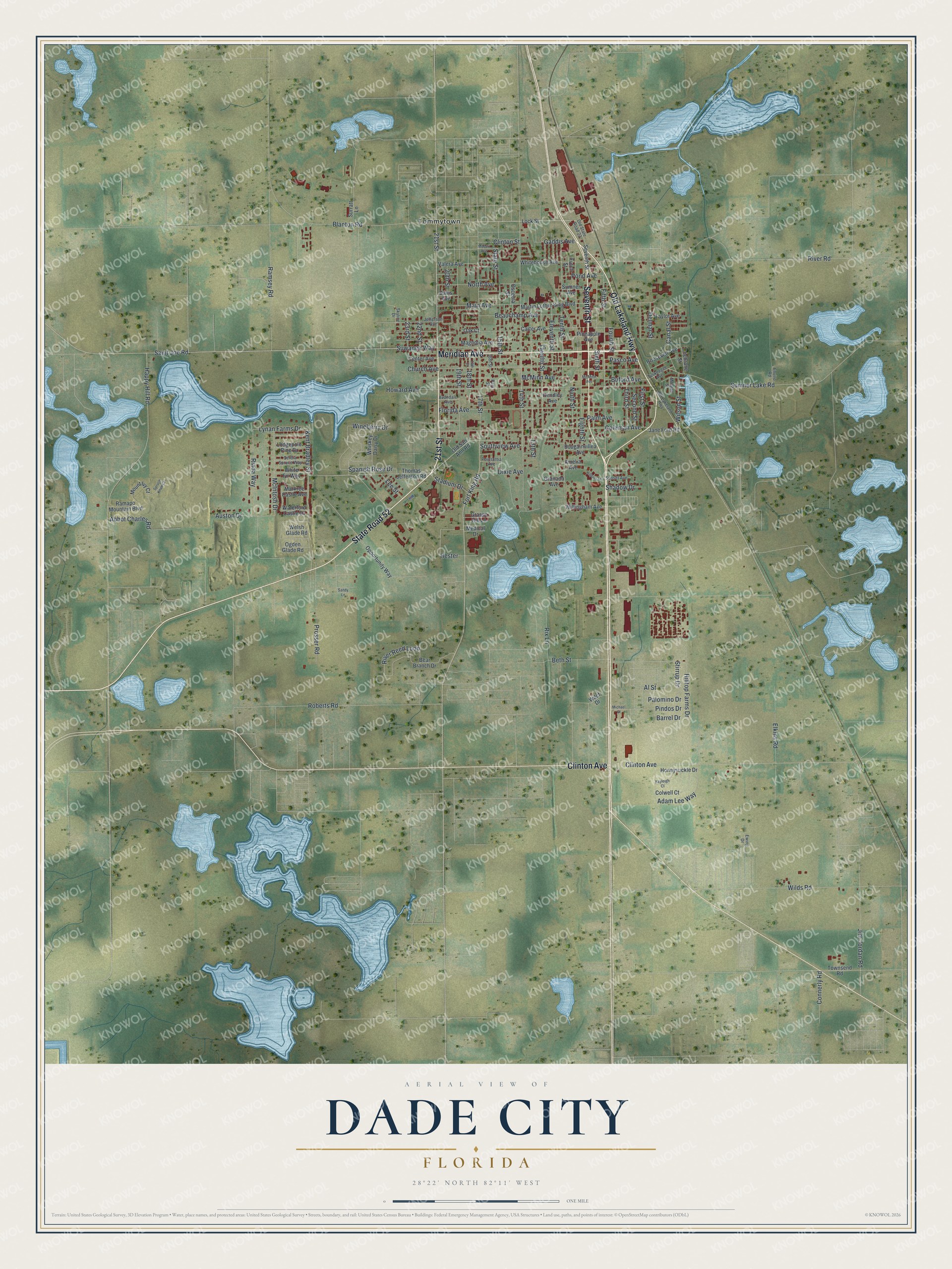
This beautifully detailed map of Dade City, Florida was created in 2026 using aerial imagery combined with modern topographical, census, street and landmark data. It’s a one-of-a-kind view of Dade City that combines accurate data with a vintage aesthetic. The map shows every building in its true location, many of the roads carry their names, and the shaded topographic relief shows the shape of the land.
Explore an aerial view of Dade City, Florida
On the map you’ll find Tommytown, along with Meridian Avenue, 21st Street, State Road 52, Old Lakeland Highway, Clinton Avenue, Seventh Street, Fort King Road, Suwanee Way, 14th Street, Howard Avenue, Tenth Street, and more. If you look closely you can even find your house accurately drawn in its correct location. Zoom in on the preview to look for yours.
Did You Know?
Dade City honors U.S. Army Major Francis L. Dade. He and most of his men were killed in the Dade Battle, which sparked the Second Seminole War. A settlement called Fort Dade stood nearby in the 1870s. When the railroad came, merchants moved closer to it, and the new town became Dade City in 1884.
Take a closer look at the Dade City map
Names on this map
These names are printed on this map.
Places: Tommytown.
Streets and roads: Meridian Avenue, 21st Street, State Road 52, Old Lakeland Highway, Clinton Avenue, Seventh Street, Fort King Road, Suwanee Way, 14th Street, Howard Avenue, Tenth Street, Church Avenue.
More street names, A to Z
13th Street, 15th Street, 16th Street, 17th Street, 18th Court, 18th Street, 19th Street, 20th Street, 22nd Street, 23rd Street, Abbot Charles Road, Adam Lee Way, Al Street, Amelia Avenue, Auston Drive, Avondale Avenue, Barrel Drive, Bear Branch Drive, Beauchamp Avenue, Beth Street, Blanton Road, Bougainvillea Avenue, Buford Avenue, Canal Street, Carter Avenue, Center Avenue, Clinton Street, Cochrane Street, Coleman Avenue, Colwell Court, Connerly Road, Davis Avenue, Delmar Street, Dixie Avenue, Eighth Street, Eleventh Street, Elkins Road, Enviro Road, Ewing Drive, Fifth Street, First Street, Florida Avenue, Fourth Street, Futch Street, Gaddis Avenue, Granada Avenue, Grassy Hill Lane, Happy Hill Road, Hendley Avenue, Hester, Hillside Lane, Hilltop Farms Drive, Honeysuckle Drive, Jane Ford Road, Jefferson Avenue, Jim Jordan Road, Kayleigh Court, Kent Bradley Street, Lee Street, Lock Street, Lodgepole Pine Drive, Lynan Farms Drive, Magnolia Avenue, Main Avenue, Markree Castle Avenue, Martin Luther King Boulevard, McIntosh Drive, McMinn Avenue, Mc Minn Avenue, Medical Drive, Michael Street, Moceri Avenue, Morgan Street, Mount Ivy Court, Ninth Street, North Avenue, Oak Court, Ogden Glade Road, Old San Ann Road, Old State Road 23, Opportunity Way, Osceola Street, Palm Avenue, Palomino Drive, Park Street, Pasco Avenue, Pindos Drive, Pineapple Avenue, Poinsettia Avenue, Pond Avenue, Prosser Road, Ramapo Mountain Boulevard, Ramsey Road, Riada Way, River Reed Loop, River Road, Rix Lane, Roberts Road, Roosevelt Avenue, Saint Joe Road, Sandy Lane, Second Street, Serbia Spruce Way, Shadow Drive, Sixth Street, Skyline Drive, Southview Avenue, Spanish Rose Drive, Spruce Knob Court, Stadium Drive, State Street, Stirrup Drive, Sumner Avenue, Sumner Lake Road, Sunset Avenue, Surratt Lane, Taylor Avenue, Third Street, Thomas Jefferson Road, Townsend Road, Tuskeegee Avenue, Twelfth Street, Valera Avenue, Waterford Castle Drive, Wdcf Drive, Welsh Glade Road, Whiskey Daisy Drive, White Fir Way, Whitehouse Avenue, Wilds Road, Willingham Avenue, Wilson Street, Wineberry Drive.
See it on a wall
The Dade City map as a framed print. Swipe for more.


This beautifully detailed map of Dade City makes an attractive addition to your office, library, or den, and it can even be used to teach children the geography and history of the area. It also makes a great gift for anyone with Dade City roots. When you’re done exploring, click here to get your copy of the Dade City map.