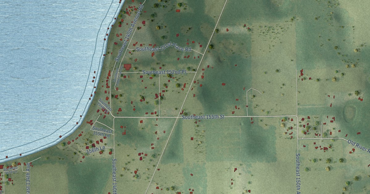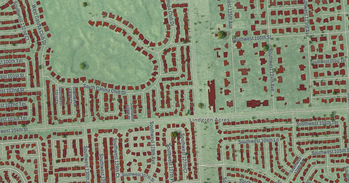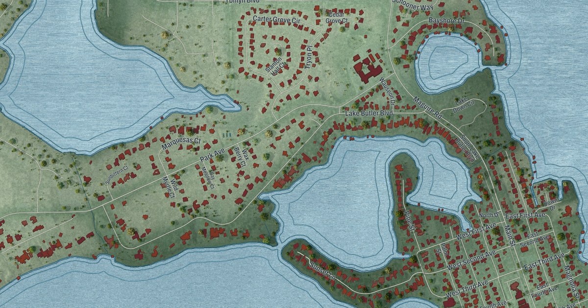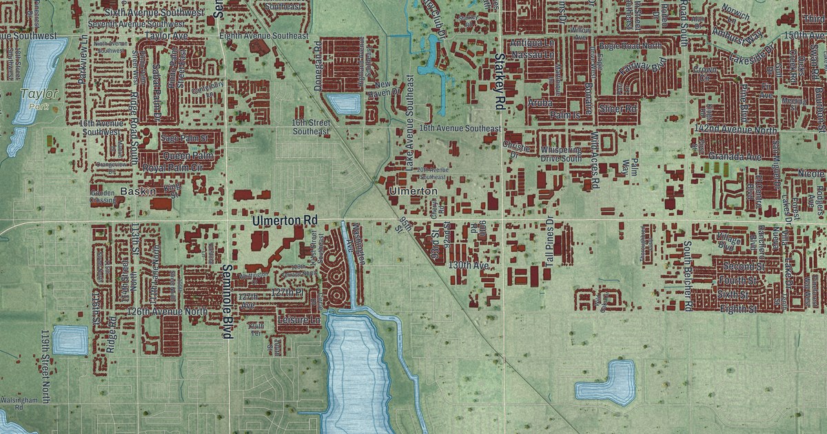
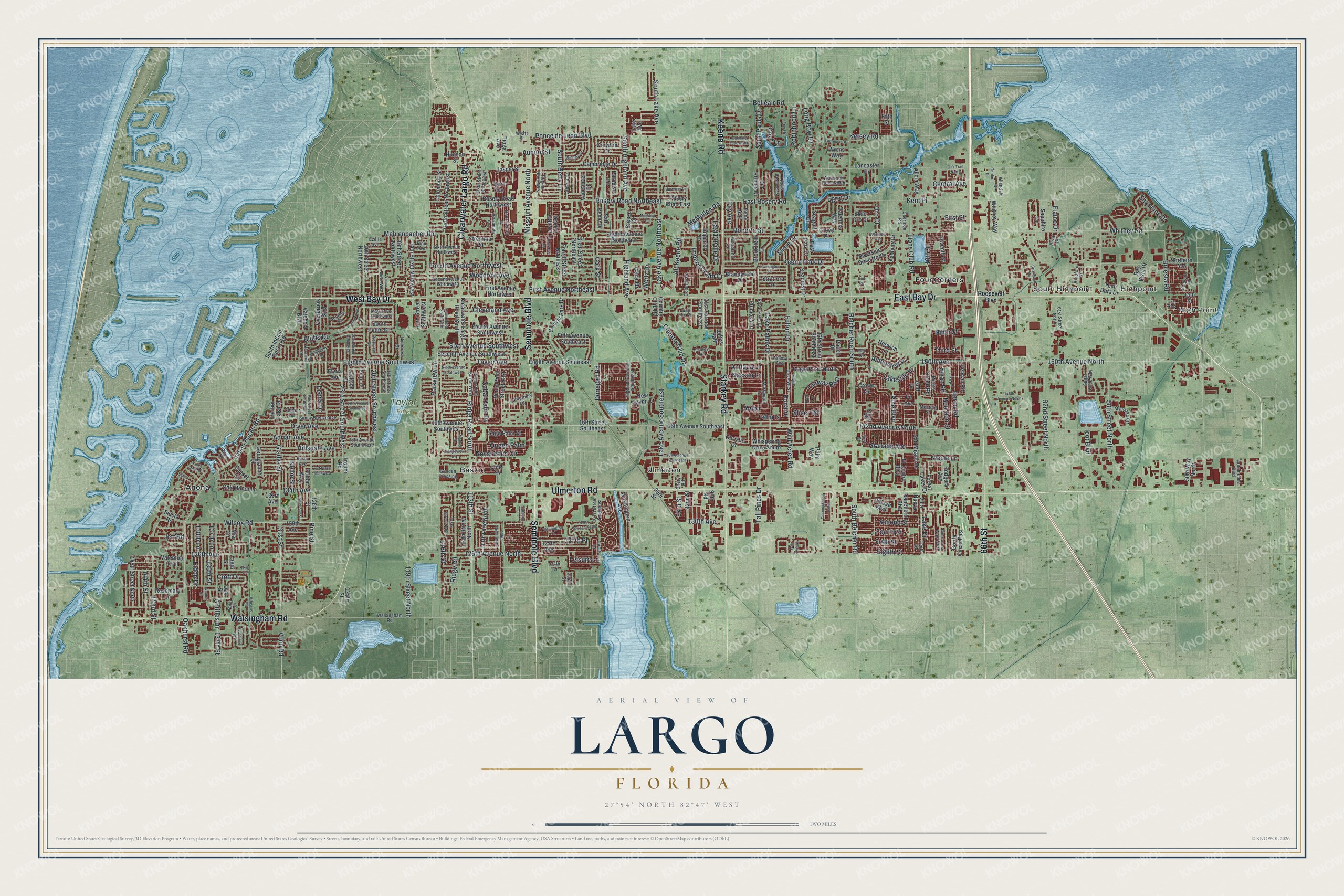
This beautifully detailed map of Largo, Florida was created in 2026 using aerial imagery combined with modern topographical, census, street and landmark data. It’s a one-of-a-kind view of Largo that combines accurate data with a vintage aesthetic. The map shows every building in its true location, many of the roads carry their names, and the shaded topographic relief shows the shape of the land.
Explore an aerial view of Largo, Florida
On the map you’ll find High Point, South Highpoint, Taylor Park, Anona, Baskin, Four Corners, and Ulmerton, along with Ulmerton Road, East Bay Drive, Seminole Boulevard, Starkey Road, and more. If you look closely you can even find your house accurately drawn in its correct location. Zoom in on the preview to look for yours.
Did You Know?
Largo took its name from a lake. A surveyor in 1845 recorded Lake Tolulu. By 1888 it had been renamed Lake Largo. People living west of the lake adopted the name for their community. The town incorporated in 1905, and the lake was drained in 1916 so the town could grow.
Take a closer look at the Largo map
Names on this map
These names are printed on this map.
Places: High Point, Highpoint, South Highpoint, Taylor Park, Anona, Baskin, Four Corners and Ulmerton.
Streets and roads: Ulmerton Road, East Bay Drive, Seminole Boulevard, Starkey Road, Walsingham Road, West Bay Drive, Keene Road, Clearwater Largo Road, 66th Street, Second Street, 150th Avenue North, 126th Avenue North.
More street names, A to Z
13th Street Southwest, 14th Avenue Southwest, 14th Street, 14th Street Northwest, 16th Avenue Southeast, 16th Avenue Southwest, 16th Street, 16th Street Northwest, 16th Street Southeast, 18th Avenue Southwest, 18th Street Southwest, 20th Avenue Southeast, 20th Street Northwest, 20th Street Southwest, 21st Place Southwest, 21st Terrace Southeast, 22nd Street Southwest, 23rd Street Southwest, 27th Street, 36th Street Southeast, 50th Way North, 58th Street North, 61st Street North, 62nd Street North, 90th Road, 92nd Street, 93rd Street, 95th Street, 101st Street Southeast, 104th Street, 109th Street North, 111th Lane North, 113th Street, 114th Street North, 115th Street North, 116th Street, 119th Street North, 124th Terrace, 125th Street, 126th Avenue, 127th Avenue, 127th Place, 128th Street, 129th Avenue, 129th Terrace North, 130th Avenue, 131st Street, 133rd Avenue, 134th Avenue, 136th Street, 137th Lane, 137th Street, 138th Lane, 138th Street, 142nd Avenue North, 143rd Street, 144th Street, 145th Street North, 146th Avenue North, 150th Avenue, Adrian Avenue, Alan Drive, Alberta Drive, Alicia Way, Allendale Drive, Alt Keene Road, Amhurst Way, Antilles Drive, Antiqua Lane, Arbor Court, Arrandale Avenue, Aruba, Arvis Circle East, Ashbury Drive, Auburn Street, Aurora Court, Automobile Boulevard, Bamboo Lane, Bay Vista Drive, Beechwood Lane, Belcher Road South, Belleair Road, Bluffs Drive, Bogie Road North, Bolesta Road, Bonaire, Bourbon Street, Bradford Street, Brandywine Drive, Breeze Drive, Briarwood Drive, Britton Street, Brookfield Drive, Caerleon Road, Cambridge Drive, Canterbury Lane, Cara Drive, Cardinal Drive, Cardinal Lane, Central Avenue, Central Park Drive, Cheryl Road, Christie Drive, Circle Drive, Clearwater Largo Road South, Cleveland Avenue, Clifton Terrace, Coit Road, Colonial Drive, Columbus Street, Cork Street, Country Club Drive, Country Club Road, Cove Drive, Cove Lane, Crescent Drive, Croft Drive, Crown Circle, Croydon Drive, Del Robles Drive, Dicks Creek Road, Donegan Road, Dryer Avenue, Eagle Drive West, East Deville Drive, East Park Drive, East Rosery Road, Egret Drive, Eighth Avenue Northeast, Eighth Avenue Southeast, Eighth Avenue Southwest, Eighth Street, Elaine Drive, El Centro Boulevard, El de Oro Drive, Eldon Drive, Elyria Avenue, Ezelle Avenue, Fairway Boulevard, Fay Avenue, Fifth Avenue Southeast, Fifth Street, Fir Avenue, First Avenue Northeast, First Avenue Northwest, First Street, Forest Lakes Drive, Fourth Avenue Northwest, Fourth Avenue Southwest, Fourth Street, Fourth Street Northeast, Fox Road, Fulton Drive, Fulton Way, Gatewood Drive, Georgianna Drive, Gladys Street, Golden Gate Drive, Gooden Crossing, Gorda Circle East, Granada Avenue, Grove Place, Gulf Drive, Harbor Lake Drive, Harmony Drive, Heron Road, Hibiscus Road, Highland Avenue, Highland Avenue Southeast, Hillsdale Avenue, Hudson Street, Huntington Drive, Icot Boulevard, Imperial Drive, Imperial Palm Court, Indian Rocks Road, Irene Avenue, Jackson Street, Jakes Path, Jasper Street, Jeff Road, Judy Lee Drive, Karen Avenue, Kay Drive Southwest, Keating Drive, Keene Park Drive, Kent Place, Kersey Road, Kings Point Drive, Kings Road, King Street, Lake Avenue, Lake Avenue Northeast, Lake Avenue Southeast, Lake Drive, Lake Palms Drive, Lake Road, Lakeside Drive, Lancaster Drive, Laurence Drive, Leisure Lane, Leona Drive, Lions Club Road, Long Bow Lane, Madrid Drive, Markley Drive, Martinique Lane, Mary Sue Street, McCrillus Road, McMullen Road, Meeting Street, Mehlenbacher Road, Mia Circle, Missouri Avenue North, Myerlake Circle, Nassau Lane, Nellie Street, New Haven Drive, Nicole Lane, Ninth Avenue Southwest, Ninth Street, Northern Avenue, Norwich Lane, Oakdale Lane North, Oakhurst Road, Oak Manor Lane, Oak Street, Oak Trail North, Orangeview Drive, Oro Court, Oval Drive West, Overbrook Boulevard, Palm Drive, Palm Is, Palm Way, Paradise Lane, Parakeet Lane, Parkview Lane, Parr Lane, Pelican Road, Pindo Palm Street East, Pindo Palm Street West, Pine Avenue, Pine Boulevard, Pinecrest Drive, Pineforest Way West, Pine Street, Pine Street Southwest, Plumosa Drive, Ponce de Leon Boulevard, Queen Palm, Ranchero Boulevard, Regina Drive West, Ridge Road, Ridge Road South, Riverside Drive North, Roberta Street, Robinhood Lane, Rodeo Drive, Rodgers Avenue, Roosevelt Boulevard, Rosemary Lane, Rosery Road East, Rosery Road Northeast, Rosery Road Northwest, Royal Palm Circle, Royal Palm Drive, Sabal Palm Drive, Sago Palm Street, Saint Pauls Drive, San Miguel Drive, San Remo Drive, Sapphire Lane, Seacrest Drive, Seagull Drive, Second Avenue Northwest, Seton Lane, Seventh Avenue Southwest, Seventh Street, Shore Drive, Shoreline Drive, Siesta Road, Sixth Avenue Northwest, Sixth Avenue Southwest, Sixth Street, Sixth Street Northeast, Sixth Street Northwest, Slicer Road, South Belcher Road, South Betty Lane, South Highland Avenue, South Indian Rocks Road, South Lake Avenue, South Patlin Circle, Stratford Drive, Stremma Road, Sugar Cane Way, Sunny Breeze Avenue, Sunset Circle, Swan Road, Tall Pines Drive, Taylor Avenue, Tech Data Drive, Tenth Street, Tenth Street Northwest, Tenth Street Southwest, Third Avenue, Third Street, Thoroughbred Loop, Tioga Avenue, Trotter Road, Twig Terrace, Valencia Boulevard, Valencia Way, Valentine Trail, Vancouver Drive, Velma Drive West, Village Boulevard, Villa Nueva, Vonn Road, Washington Avenue, Wateroak Drive North, Wertz Drive, Westbury Avenue, Westview Road, Whispering Drive South, Whitney Road, Whitney Way, Whittington Court, Wilcox Road, Wild Acres Road, Wild Oaks Circle, Willow Avenue, Windsor Drive, Woodland Drive, Woodrow Avenue, Wrens Way, Wyatt Street.
See it on a wall
The Largo map as a framed print. Swipe for more.


This beautifully detailed map of Largo makes an attractive addition to your office, library, or den, and it can even be used to teach children the geography and history of the area. It also makes a great gift for someone who left Largo and still calls it home. When you’re done exploring, click here to get your copy of the Largo map.