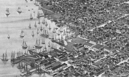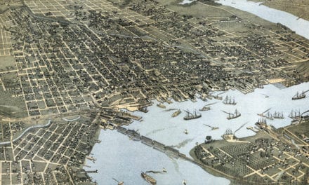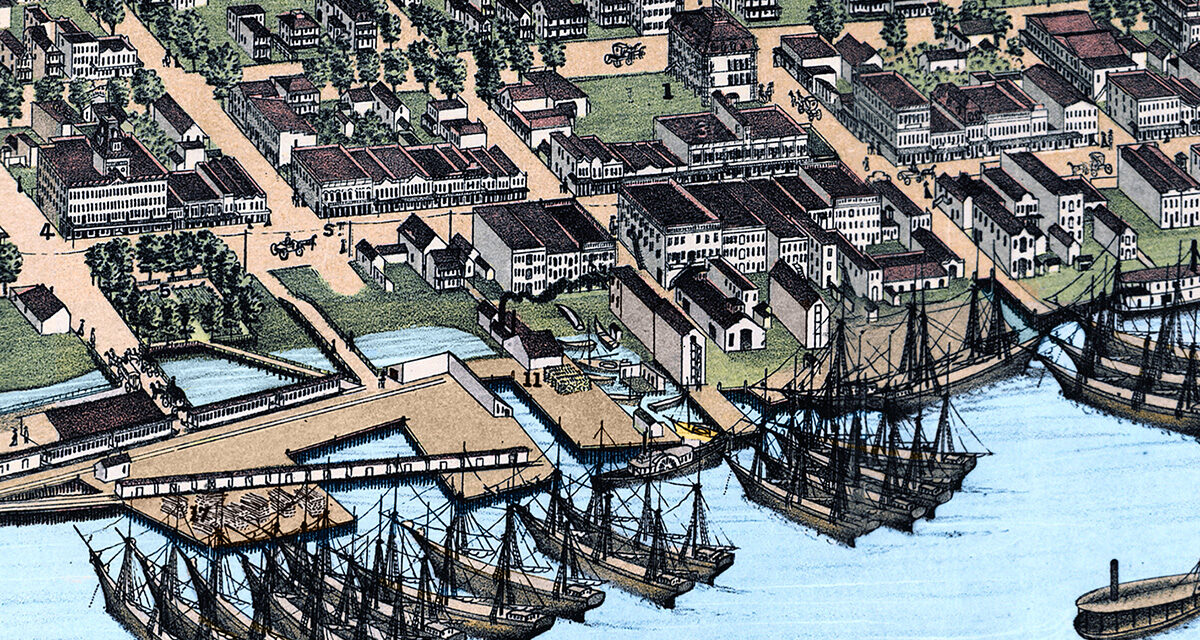
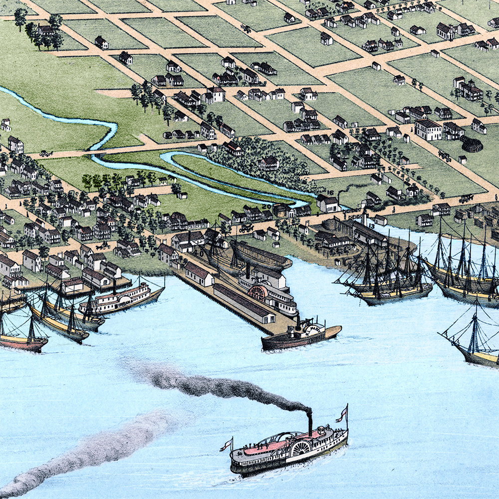
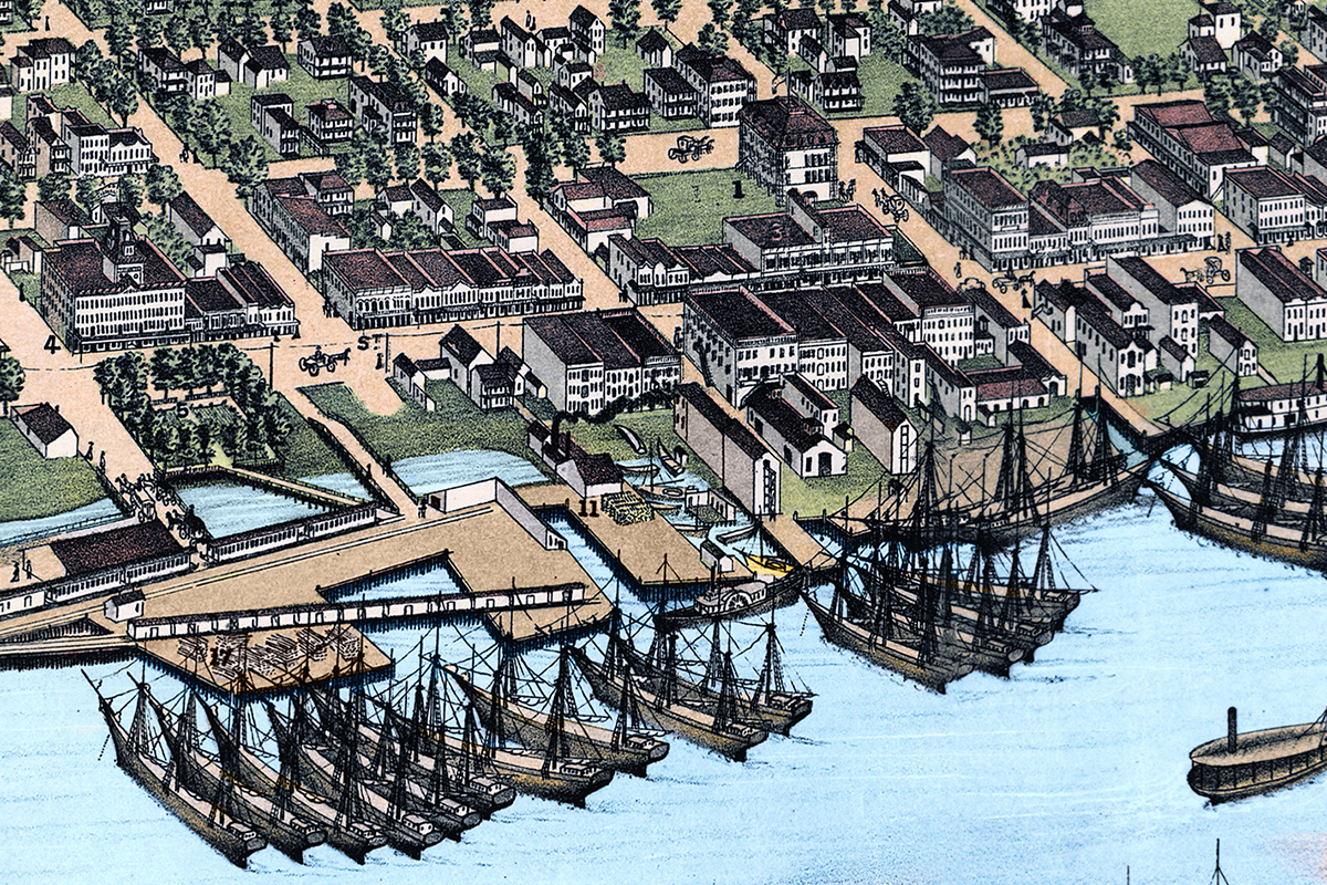
This historic map of Jacksonville, Florida was created in 1876 by Augustus Koch, a prominent 19th century map maker. The map shows a bird’s eye view of Jacksonville as it once was, including street names and old landmarks. Zoom in below to view the street grid, waterfront, public buildings, hotels, churches, factories, and ships along the St. Johns River. Reproductions of the restored map are available here.
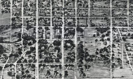
Bird’s-eye maps were popular in the late 1800s before aerial photography was common. Artists like Koch traveled from town to town creating detailed panoramic views that captured America at a certain point in time. They literally walked the streets and drew houses and buildings exactly as they looked. They were often so accurate you can count the windows on historic buildings and notice they are the same today.
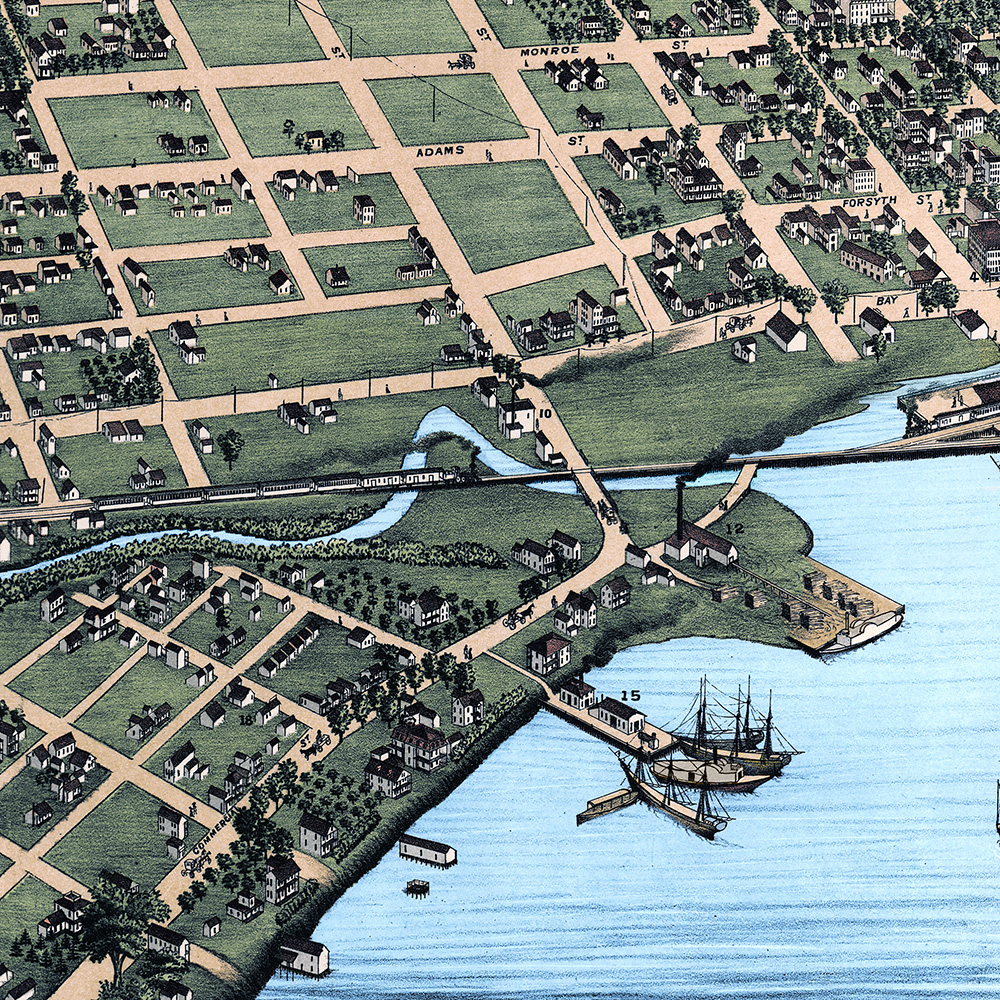
In 1876 Jacksonville was a young city rebuilding and expanding after the Civil War. Florida was in the final years of Reconstruction, and Jacksonville was emerging as one of the most important urban centers in the state. Its location on the St. Johns River made it a natural place for trade, travel, shipping, and tourism.
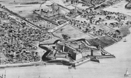
Landmarks on the map include Duval High School, Cookman Institute, the City Jail & Engine House, Hook and Ladder Company House, Magnolia Market, Jacksonville Ship Yard, National Hall, Industrial Machine Works, Grand National Hotel, St. James Hotel, Buesing’s Soap Factory, and many others.
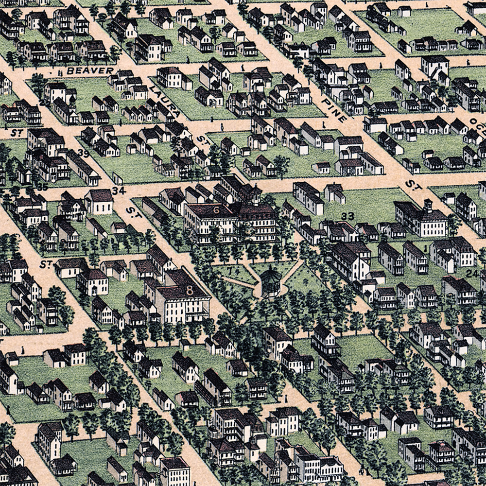
This map lets us study the city before the enormous changes of the late 19th and early 20th centuries. Many buildings shown here would later disappear through redevelopment, fire, growth, and changing patterns of transportation. The map preserves a version of Jacksonville that can no longer be walked in quite the same way, but can still be explored in remarkable detail.
This historic map of Jacksonville has been restored by KNOWOL from the original 1876 view. The restoration brings new clarity to the linework, streets, buildings, and waterfront details while preserving the historic character of the original map. Reproductions of the restored map are available here.
Historic View of Jacksonville, Florida in 1876
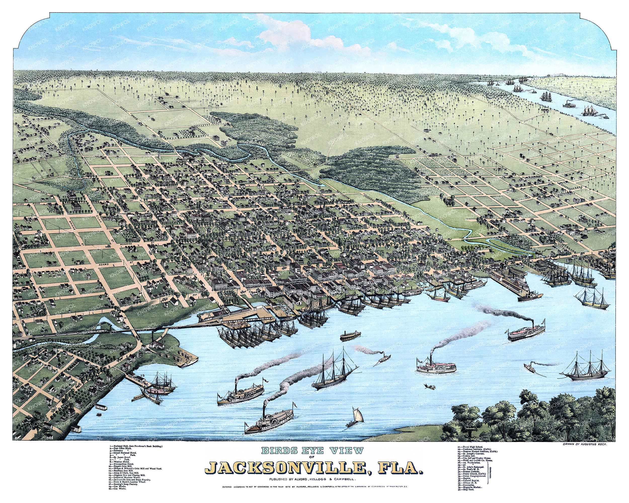
This vintage view of Jacksonville makes an attractive addition to an office, library, study, classroom, or den. It is also a wonderful way to teach children and adults about local geography, historic landmarks, and the way Jacksonville grew along the St. Johns River. The longer you look, the more details begin to appear: old street names, river traffic, public buildings, hotels, factories, schools, churches, and pieces of a city that was still taking shape.
Whether you have family roots in Jacksonville, collect Florida history, or simply enjoy studying old maps, this 1876 bird’s-eye view offers a rare look at the city during one of its most important periods of growth. When you’re done exploring, click here to get your copy of the restored map.