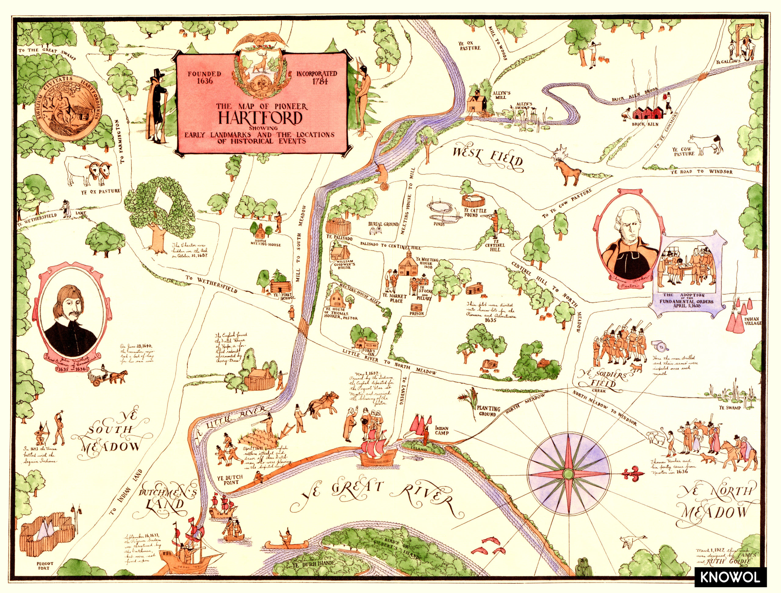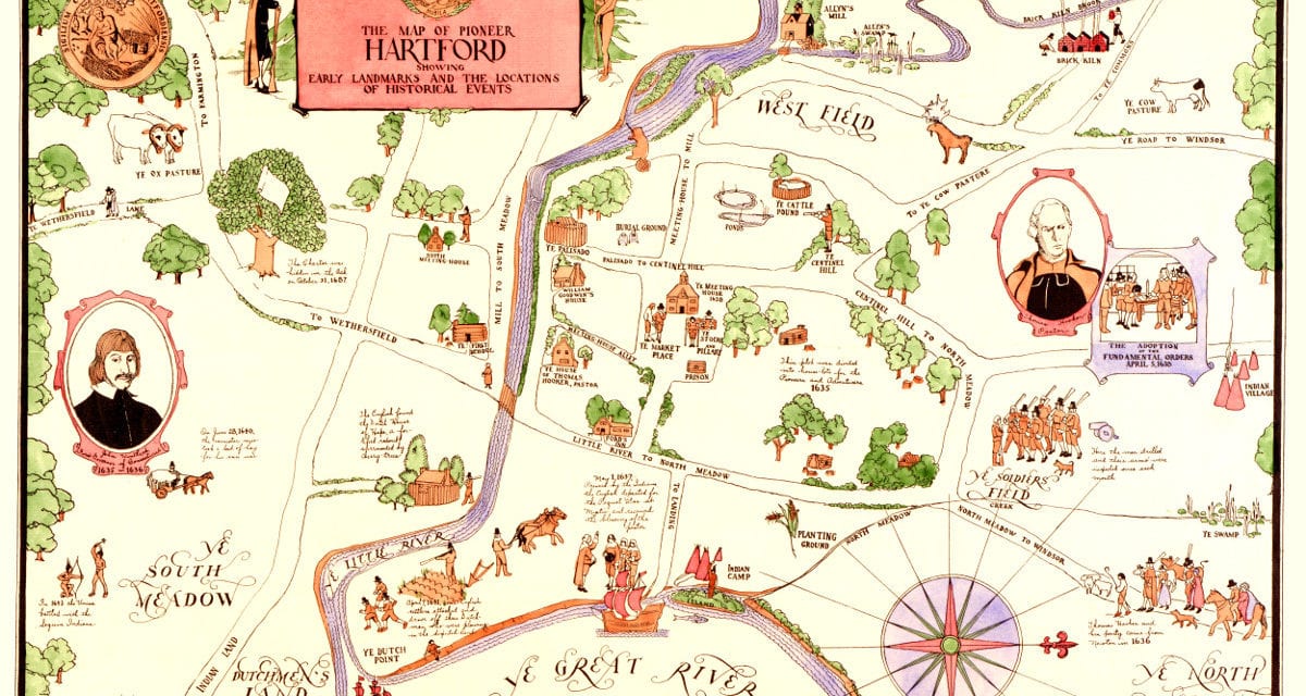
This vintage map of Hartford, CT was created in 1927 and shows Hartford as it looked in the 1600’s. The map was created by James and Ruth Goldie, and has been restored to its original condition by the team at KNOWOL.
The map is titled “The Map of Pioneer Hartford, showing early landmarks and the locations of historical events” and shows the location of interesting events and anecdotes from Hartford’s history, including:
September 16, 1633: The pilgrim traders were threatened by the Dutchmen, but were not fired upon.
May 1, 1637: Pressed by the Indians, the English departed for the Pequot War at Mystic and received the blessing of the pastor.
April 7, 1641: Some English settlers attacked and drove off the Dutch men who were plowing in the disputed land.
October 31, 1687: The charter was hidden in the oak.
You can explore a copy of the map below, or click here to get a high resolution print of the map to display in your home.
Click here to see a larger version of the map.