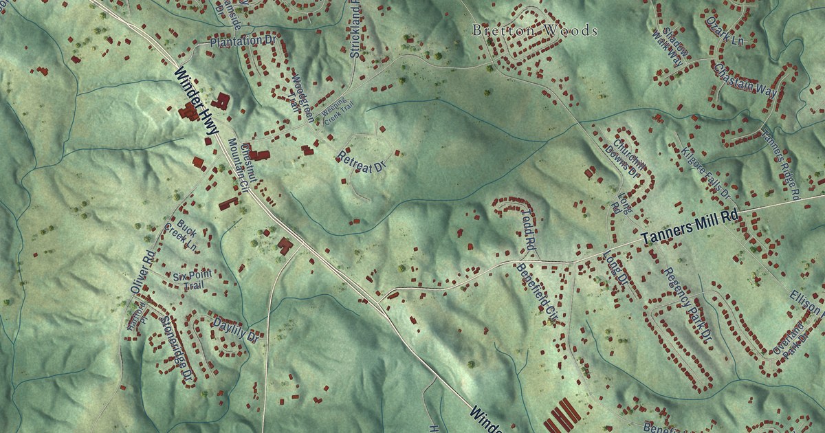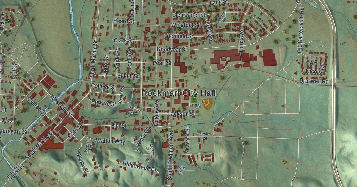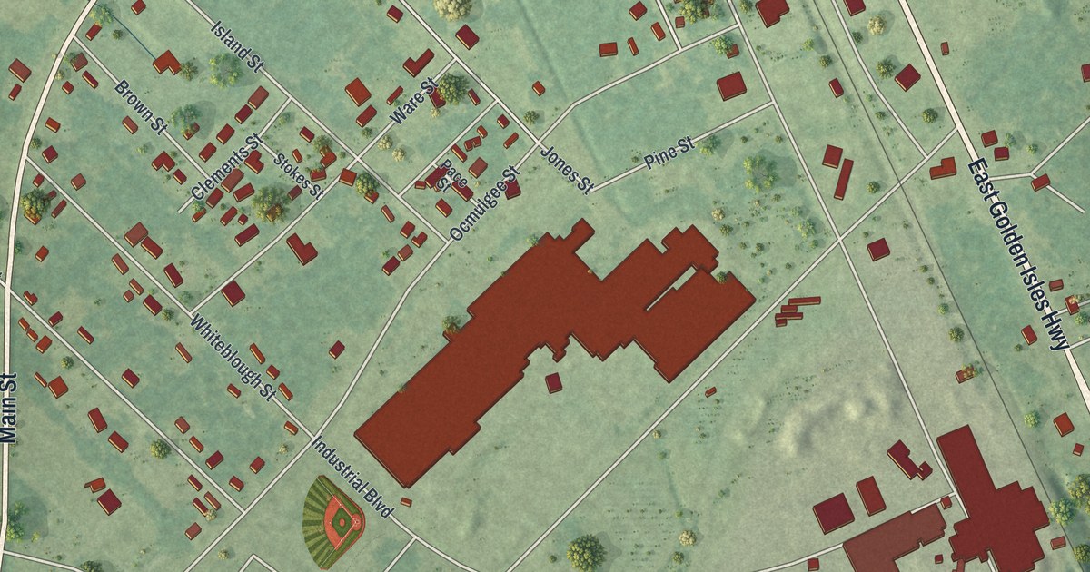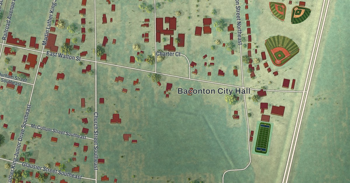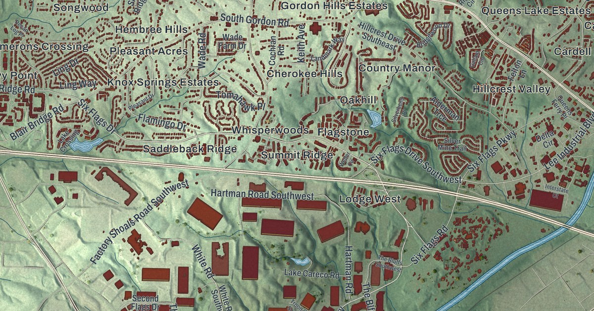
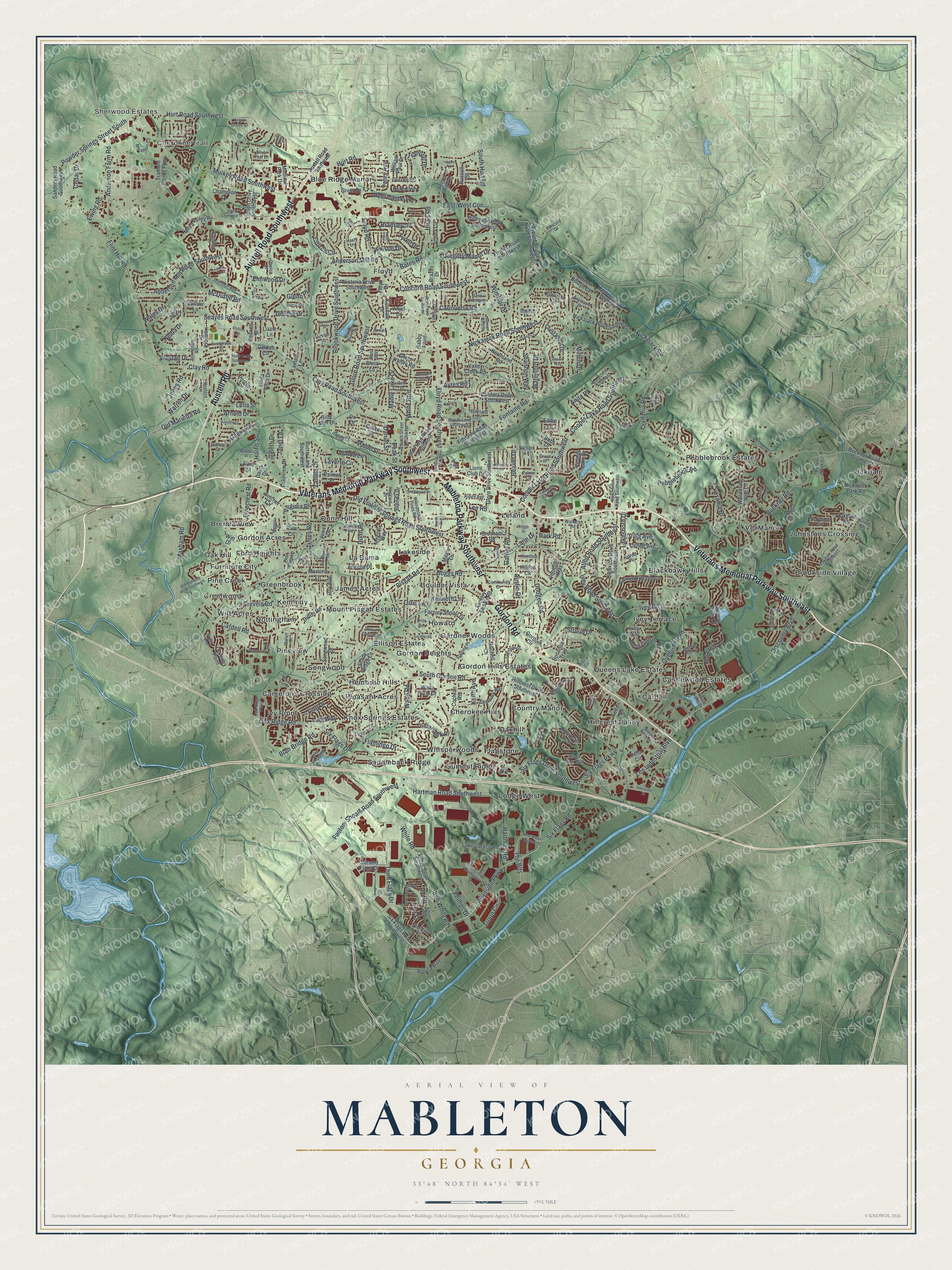
This beautifully detailed map of Mableton, Georgia was created in 2026 using aerial imagery combined with modern topographical, census, street and landmark data. It’s a one-of-a-kind view of Mableton that combines accurate data with a vintage aesthetic. The map shows every building in its true location, many of the roads carry their names, and the shaded topographic relief shows the shape of the land.
Explore an aerial view of Mableton, Georgia
On the map you’ll find Blackhawk Hills, Boulder Vista, Brenda View, and Brookside Village, along with Veterans Memorial Parkway, Mableton Parkway, Austell Road, Gordon Road, Six Flags Drive, Cherokee Trail, and more. If you look closely you can even find your house accurately drawn in its correct location. Zoom in on the preview to look for yours.
Did You Know?
Scottish immigrant Robert Mable bought 300 acres in southern Cobb County in 1843. When the Georgia Pacific Railway opened a station here in December 1881, its chief engineer put up a sign reading Mableton to honor him. The first train from Atlanta arrived just before Christmas.
Take a closer look at the Mableton map
Names on this map
These names are printed on this map.
Places: Sherwood Estates, Cherokee Trail, Blackhawk Hills, Blue Ridge Manor, Boulder Vista, Brenda View, Brookside Village, Camerons Crossing, Cardell, Castlewood Estates, Cherokee Hills, Country Manor, Creelwood, Dunn Hill, Ellison Estates, Flagstone, Floyd, Ford Heights, Furniture City, Gardner Woods, Gordon Acres, Gordon Heights, Gordon Hills Estates, Greenbrook, Hembree Hills, Hillcrest Valley, Howard, Ivey Terrace, Ivy Point, James Acres, Johnstons Crossing, Kennedy, Knox Springs Estates, La Bama, Lakeside, Leland, Lodge West, Mount Pisgah Estates, Nottingham, Oak Hill, Oakdale, Oakhill, Pebblebrook Estates, Pine Creek, Pineview, Pleasant Acres, Queens Lake Estates, Saddleback Ridge, Songwood, Summit Ridge, Vel Manor, Whisperwoods and Witt Acres.
Streets and roads: Veterans Memorial Parkway Southwest, Mableton Parkway Southwest, Austell Road Southwest, Veterans Memorial Parkway Southeast, Gordon Road, Austell Road, Six Flags Drive, Riverside Parkway, Six Flags Road, Oak Ridge Road, Six Flags Drive Southwest, Lee Industrial Boulevard.
More street names, A to Z
Alaina Circle, Alderman Trce, Aldred Place, Allen Road Southeast, Anastasia Drive, Anderson Farm Road, Anderson Mill Road, Anderson Mill Road Southwest, Angelia Drive, Anita Place, Anjul Drive, Anna Way, Anne Boleyn Court, Annette Lane, Annie Lane, Aquila Way, Arnold Drive, Austell Road Southeast, Austin Drive, Ayres Road, Azure Grove Court, Barbara Lane, Barnes Drive, Bates Road, Beaver Drive, Belcher Circle, Bennett Street, Benson Hurst Drive, Beth Drive, Billy Max Drive, Bishop Run Lane, Blair Bridge Road, Bobs Drive, Bob White Road, Boggs Road, Bonanza Trail, Brandemere Drive, Brantley Drive, Brazos Drive, Brenda Drive, Brentwood Drive, Bridgewood Drive, Britt Road, Brookwood Drive Southwest, Buckner Road, Buckner Road Southeast, Burris Lane Southwest, Cardell Road, Carlouetta Road, Carriage Drive, Castlebar Court Southeast, Castle Lake Drive, Cedar Drive, Century Park Place, Champion Drive, Chelou Drive, Chris Lane, Church Street Southwest, Citizen Circle, Civitania Road, Clay Road, Clay Road Southwest, Cochran Road, Collett Avenue, Community Drive, Concord Drive, Concord Road Southwest, Cooper Lake Road Southeast, Cooper Lake Road Southwest, Coopers Glen Drive, Corley Drive, Coventry Point, Covered Bridge Road Southwest, Crest Knoll Drive, Creveis Road, Dalby Way, Dale Drive, Daniel Street, Davis Drive, Debbie Drive, Delta Circle, Dillon Road, Discovery Boulevard, Discovery Place, Dodgen Road, Donna Street, Drake Manor, Drennon Avenue, Dublin Court, Dunn Parkway, Dunn Road, Duron Place, Durrell Street, Eason Way, East-West Con, Eddie Lane, Elm Street, Elmwood Drive, Evergreen Drive, Ewing Road, Factory Shoals Drive, Factory Shoals Road, Factory Shoals Road Southwest, Fairview Circle, Fawn Trail, Faye Court, Felton Hill Road, Felton Lane, First Street, Fisher Drive, Flamingo Drive, Flint Hill Road, Floyd Drive, Floyd Road, Floyd Road Southwest, Fontaine Road, Fontaine Road Southwest, Fowler Road Southwest, Fox Road, Gabby Point, Gallant Circle, Gann Crossing, Gardner Street, Garner Road, Gherry Drive, Glandor Drive, Glenn Place, Glore Drive Southwest, Glore Road Southwest, Golden Circle, Gordon Circle, Gordon Road Extended, Grace Street, Graywood Circle, Green Valley Road, Greer Drive, Gregory Manor Drive, Gresham Road, Haggard Drive, Harris Street, Hartman Road, Hartman Road Southwest, Hasty Lane, Hemlock Drive, Hendrix Lane, Heritage Mist Trail, Hicks Road, Hicks Road Southwest, Highview Drive Southeast, Hillcrest Drive Southeast, Hillhouse Road Southwest, Hilltop Circle, Hurt Road, Hurt Road Southwest, Interstate Court, Ivey Road, Ivey Road Southeast, Ivey Way, James Road, Janet Lane, Jewell Drive, Jones Road, Joseph Club Drive, Keith Avenue, Kemolay Road, Kenneth Lane, Kinsdale Drive, Kinvarra Circle, Knoll Street, Lake Careco Road, Lake Crossing, Lakeshore Drive, Lakeview Drive, Lamont Drive, Landers Drive Southwest, Landmark Way, Lane Drive, Lantern Lane, Laurie Jo Drive, Laverte Circle, Ledford Drive, Lee Road, Leland Drive, Lelia Street, Lenoa Lane, Linda Vista Drive, Ling Drive, Ling Way, Lions Club Drive, Lipson Drive Southwest, Lizzie Lane, Mable Lake Drive, Mable Street, Magnolia Drive, Malvin Drive, Maran Lane Southwest, Marathon Circle, Marlene Lane, Maxham Road, McDuffie Road, Medford Lane, Medical Park Drive, Megcole Way, Mesa Valley Road, Milam Drive, Millen Drive, Mitchell Lane, Mobley Street, Moss Drive, Mount Gerizim Road, Mulkey Road Southwest, Nelda Drive, Nickajack Park Road, Nickajack Road, Nickajack Road Southeast, Nickajack Road Southwest, North Allen Road Southwest, North Avenue, Northland Road, North Valentine Drive, Oakdale Road, Oakdale Road Southeast, Oak Ridge Parkway, Old Alabama Road Southwest, Old Floyd Road Southwest, Old Marietta Road, Old Powder Springs Road Southwest, Orris Lane, Ox Drive, Palmer Place, Palms Lane, Park Road, Peak Street, Pebble Brook Circle, Pebblebrook Road, Pecan Log Place, Peel Castle Lane, Phillips Drive, Pine Circle, Pine Cone Lane, Pinecrest Road, Pineland Circle, Pisgah Road, Pleasant Drive, Posten Lane, Powder Springs Street South, Powell Drive, Queen Mill Road, Queens Ferry Place, Queens River Drive, Regal Hills Lane, Rhinehart Drive, Ridge Avenue, Rioca Circle, Rose Circle, Roy Avenue, Russell Street, Sanders Road Southwest, Seayes Road Southwest, Second Flags Drive, Shady Lane, Shady Ridge Lane, Shannon Way, Shire Court, Silverbend Place, Silver Leaf Drive, Silver Mine Trail, Six Flags Parkway, Six Flags Road Southwest, Songwood Drive, South Champion Drive, South Cobb School Road, South Gordon Road, South Hurt Road, Springdale Road, Stallion Road, Starling Place, Stella Circle, Stoneywood Circle, Stroud Drive, Sylvania Drive, The Blfs, The Bluffs Southwest, Third Flags Drive, Thunderwood Road, Tomahawk Place, Tramore Pointe Parkway, Tranquil Drive, Trestle Drive, Trigger Drive, Troon Circle, Troon Circle Southwest, Tyrell Drive, Valentine Drive, Valley Creek Road, Venetian Way, Vernon Drive, Villa Avenue, Vinings Lake Drive, Vinings Place Trail, Vinings Vintage Circle, Virginia Place, Vonda Lane, Wade Farm Drive, Wade Road, Wales Drive, Wallace Road, Wana Circle Southeast, Wandering Vine Lane, Warren Drive, Waterford Drive, Weber Circle, Weslan Drive, Whispering Pines Road, Whistle Drive, White Boulevard, White Road, White Road Southwest, William Paul Drive, Willow Crest Way, Willow Lane, Windsor Drive, Wisteria Drive Southwest, Witt Drive, Woodland Lane, Yates Avenue, Zanola Drive.
See it on a wall
The Mableton map as a framed print. Swipe for more.


This beautifully detailed map of Mableton makes an attractive addition to your office, library, or den, and it can even be used to teach children the geography and history of the area. It also makes a great gift for anyone with Mableton roots. When you’re done exploring, click here to get your copy of the Mableton map.