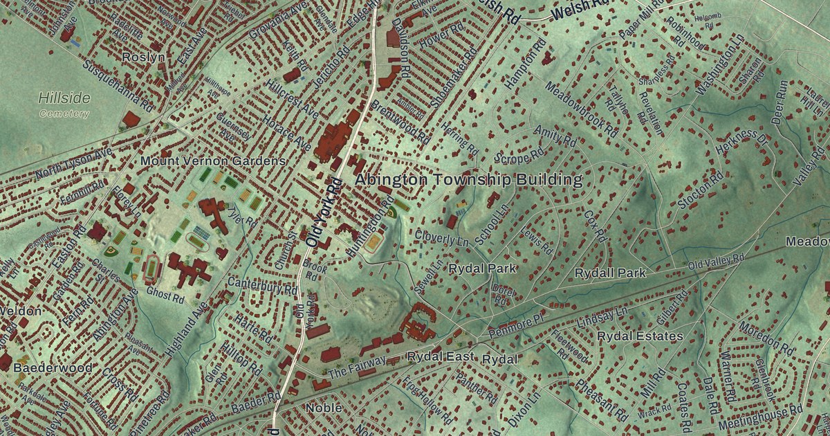
If you grew up in Abington, or have family in Glenside, Roslyn or Rydal, this map has a lot for you to find. It's a modern aerial view of Abington Township in Montgomery County, Pennsylvania, made from modern data and given a vintage look. The township fills the middle of the sheet, packed with small red buildings. Soft green hills are shaded all around it. Old York Road runs right down the center, past the Abington Township Building. Explore the print options for Abington.
From Old York Road to Meetinghouse Road
Start at the Abington Township Building, printed near the middle of the map on Old York Road. Follow Old York Road north. You'll cross Edge Hill Road and reach Rubicam and Welsh Road near the top. Now turn around and head south. Susquehanna Road, Rydal Road and Washington Lane all cross Old York Road below the Township Building. Keep going, and Meetinghouse Road branches off to the east. It runs past Rydal Green toward Huntingdon Pike. Huntingdon Pike runs down the right side past Bethayres, Meadowbrook and Hollywood. Lorimer Park and Fox Chase Farm are printed just east of it. Over on the west side, Glenside, Ardsley and Roslyn sit near Hillside Cemetery. Many of the roads are labeled, and each red shape is a building, so zoom in on the preview and look for yours.
Meetinghouse Road is where Abington Friends Meeting stands, and a state historical marker there tells the story of Benjamin Lay. He lived from 1682 to 1759. Lay was a Quaker, and he was an early voice for ending slavery right away. He wrote a sharp attack on Quakers who owned slaves, and they threw him out. He put on bold public protests. He also refused to use anything made by enslaved people. He lived in a cave nearby.
The marker says his protests helped lead Quakers to become the first religious group to end slavery among their own members, in 1776. The Pennsylvania Historical and Museum Commission put up the marker in 2018. That same year, his grave was marked at the Quaker burial ground nearby. The meeting and the burial ground aren't labeled on this map. But Meetinghouse Road is, so follow it east from Old York Road and you're close to where he's buried.
A gift for anyone from Glenside to Bethayres
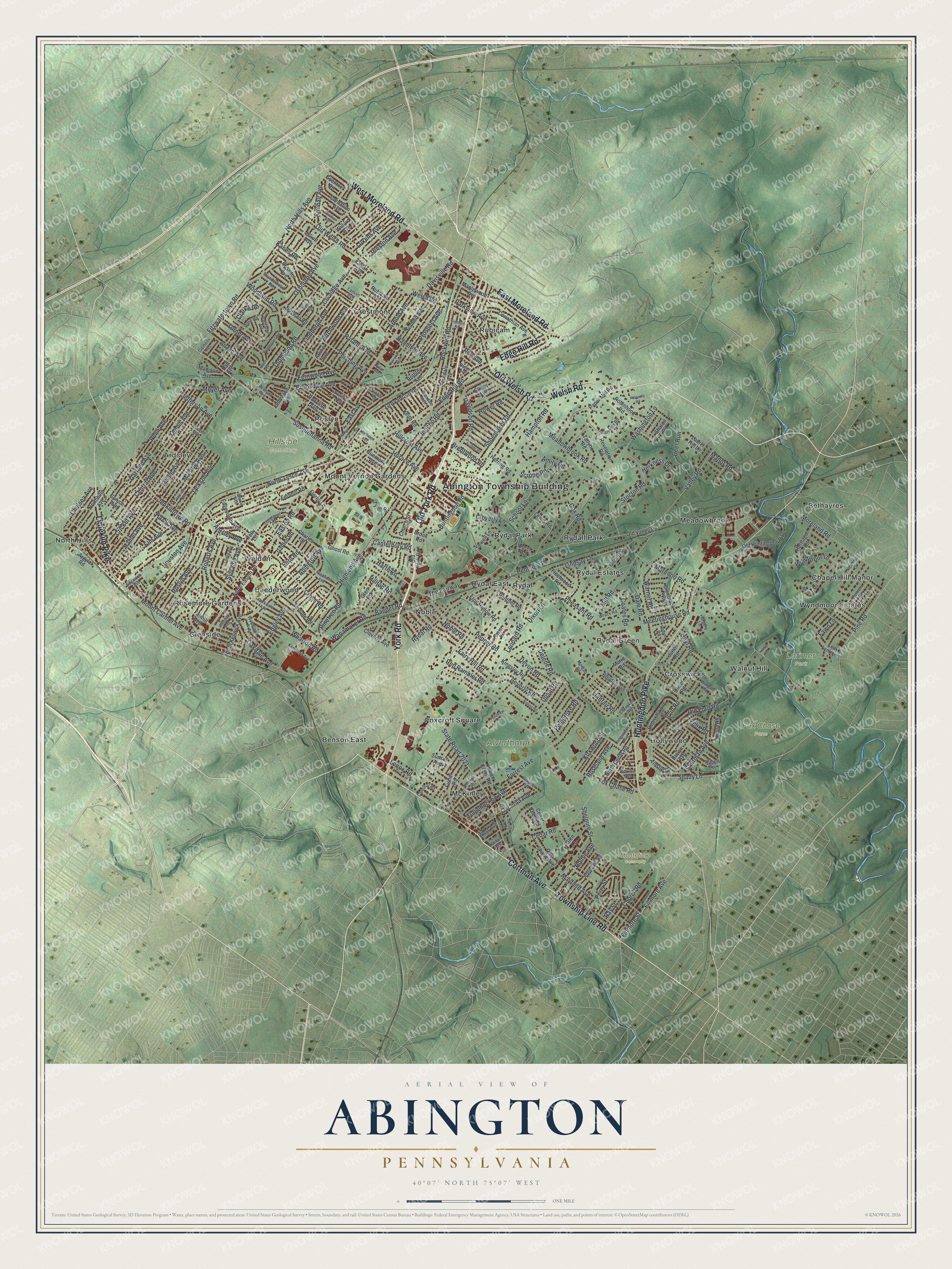
Created by KNOWOL in 2026, this Abington map shows the township's streets and buildings in deep red on shaded green hills. The hill shading comes from USGS elevation data. The title panel reads "Aerial View of Abington, Pennsylvania," with the coordinates 40°07' North, 75°07' West and a one-mile scale bar.
It fits an office, a den or a family room. It's a thoughtful gift for someone who grew up in Abington and moved away, or for a family with roots in Rydal, Roslyn or Crestmont. Open the preview, find Old York Road and follow it to a street you know. Shop the Abington, Pennsylvania map.