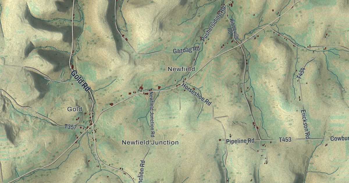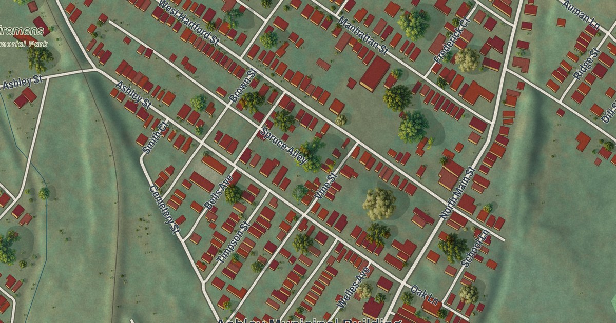
If you grew up in Ashley, have family on Manhattan Street or still know the way to the municipal building, this map shows your town block by block. It's a modern aerial view of Ashley, a borough in Luzerne County, Pennsylvania, made from modern data and given a vintage look. About 2,000 buildings are marked in red on soft green hills. The streets spread out from the Ashley Municipal Building in the middle of the sheet, with Franklin Junction at the top and Preston down at the lower left. Explore the print options for Ashley.
From the Ashley Municipal Building to Preston
Start at the Ashley Municipal Building, near the middle of the map. Just above it, Ashley Street and Cemetery Street run side by side toward the top of the sheet, with short streets linking them. Ashley Street also passes Firemens Memorial Park, which is labeled. Brown Street crosses both of them and keeps going north to Manhattan Street. Follow Manhattan Street east past Franklin Junction. Now go back to the municipal building. Hazleton Street heads east from there to Wilkes Barre Township Boulevard. Nearby, Andrew Drive and Janet Drive curve through their own small neighborhood. For the last leg, take Planes Avenue south to Rodgers Avenue. That brings you into Preston, where Cook Street, Fall Street and High Street cross the lower part of the map. Many streets are labeled and each red shape is a building, so zoom in on the preview and look for yours.
Ashley went by a lot of names before it got this one. They're listed in an 1893 history of Luzerne County. Long ago, the place was called Skunktown. Then came Peestone, Hightown, Newton, Hendricksburg, Scrabbletown, Coalville, Nanticoke Junction and Alberts. A tavern run by Samuel Pees gave it one more, Peesville. The first settler was Abner Wade, but the book notes that the town was never called Wadetown. When a coal mine was sunk in 1851, people agreed to drop Scrabbletown for Coalville. Coalville Street is printed on the map today, down at the lower left where it meets Rose Street.
The name Ashley came with the railroad. The New Jersey Central built its shops here, and the post office name changed from Hendricksburg to Ashley. By 1892, the book says, 700 men worked in those shops. The borough's charter is dated December 5, 1870. Ashley was also the foot of the "planes." Coal trains leaving town had to climb Big Mountain, a rise of 1,000 feet, on three long, steep stretches of track. Wire ropes pulled the cars up, and an engine at the top of each plane turned a big drum to wind the rope. The writer asked why they didn't just dig a tunnel. His answer was that it would have run fifteen miles to White Haven, deep under the mountain. Find Planes Avenue in the middle of the map and follow it south toward Rodgers Avenue.
A state historical marker on South Main Street, which is printed on the map, tells a later chapter. The Glen Alden Coal Company built the Huber Coal Breaker there in 1939. It could handle 7,000 tons of coal a day. The coal was sprayed with a shiny chemical to make Glen Alden's "Blue Coal." The breaker shut down in 1976 and was torn down in 2014. Another marker, in Wilkes-Barre, honors William G. McGowan, who started MCI Communications. It says he was a native of Ashley.
For someone who grew up between Franklin Junction and Preston
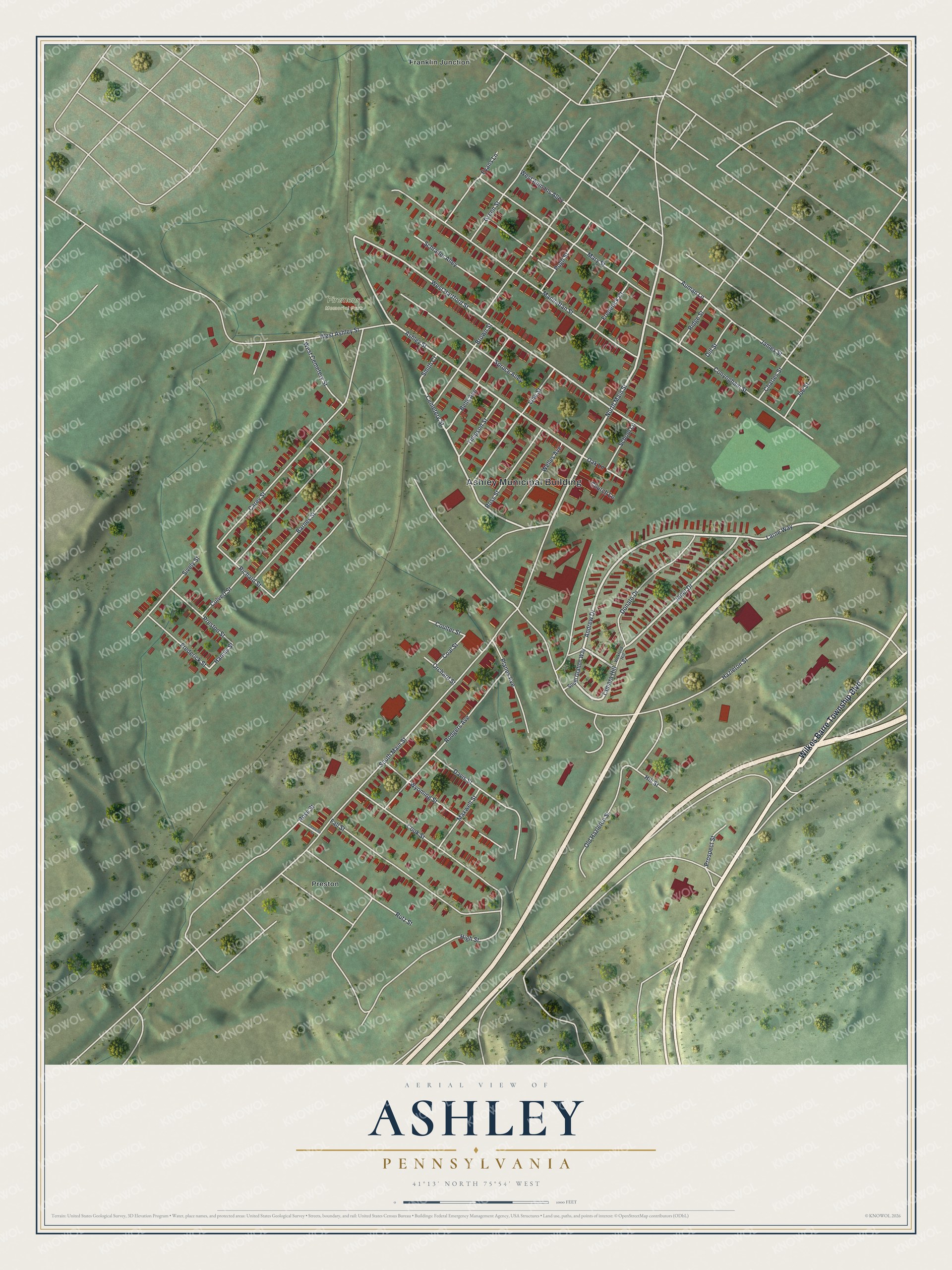
Created by KNOWOL in 2026, this map of Ashley fits a living room, a den or a kitchen wall. The street lines come from Census Bureau records, and the hills are shaded from USGS elevation data. The title panel reads "Aerial View of Ashley, Pennsylvania," with the coordinates 41°13' North, 75°54' West.
It's a good gift for someone who grew up in Ashley and moved away, or who still has family on Manhattan Street, Cook Street or Ashley Street. Open the preview, zoom in and find the street you know. Shop the Ashley, Pennsylvania map.