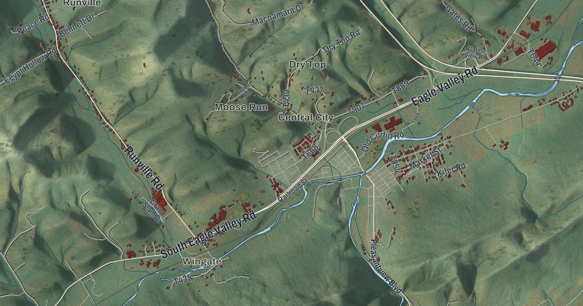
If you grew up in Wingate, Runville or Central City, or you drive North Eagle Valley Road past Curtin, this map covers the hollows and ridges around home. It's a modern aerial view of Boggs Township in Centre County, Pennsylvania, made from modern data and given a soft, vintage look. Green ridges fill the top half of the sheet, with Sproul State Forest printed up top. The villages sit lower down, along Runville Road and the Eagle Valley roads, and each building is marked in red. Explore the print options for Boggs, Centre County.
Runville Road, Central City and Curtin
Start at Wingate, near the bottom of the map on South Eagle Valley Road. Runville Road heads north from there, up a long hollow. It reaches Runville, where Peace Road and Lucas Road branch off. Keep going north past Thomas Hill Road and Chestnut Grove Road. Runville Road ends at Snow Shoe Mountain Road near Gum Stump. Snow Shoe Mountain Road climbs on to Rhoads, and Hall Road runs up toward the top left corner. Now go back down to Central City, just northeast of Wingate. Moose Run sits just west of it and Dry Top just north, both along Dry Top Road. Follow Eagle Valley Road northeast from Central City. Farther on it's printed as North Eagle Valley Road, and it runs up to Curtin, beside a lake that isn't labeled. Holters Crossing is just east of Curtin, and State Game Lands Number 92 is printed on the hills above. Many roads are labeled, and each red shape is a building, so zoom in on the preview and look for yours.
Boggs Township was formed from Spring Township in 1814. The 1883 History of Centre and Clinton Counties says much of the land was rough and mountain country. A lot of it had never been plowed. The woods were cut for charcoal, which fed the iron works at Milesburg and Curtin. Central City and Curtin were both stops on the Bald Eagle Valley Railroad.
The same book tells a story from the early days. One evening an animal carried off a pig from Andrew Boggs's pen. The next night a worker just over from Ireland stood guard. When the pigs squealed, he chased the animal and fought it with clubs and stones. It sprang at him, and he hit it on the head. When Boggs came up, he found a large panther lying dead. The worker still had the pig. Once he learned what he'd fought, he went straight to the house. After that, he never went out after dark alone.
Curtin's story starts with Philip Antes. He bought land there in 1787 and began building a mill that same year. His daughter Polly was four weeks old when the family moved in. The book says the first Methodist group in the Bald Eagle area met at his house, and preachers held services in the mill. Later the Curtins ran the Eagle Works there. A state historical marker on North Eagle Valley Road says Roland Curtin began making iron at Curtin about 1810. It also says the last old-style furnace in the United States was in blast here. It shut down in 1922. The map doesn't mark the furnace. You can find the marker's spot just past Curtin Road, where Curtin sits on the map.
For anyone from Curtin, Runville or Central City
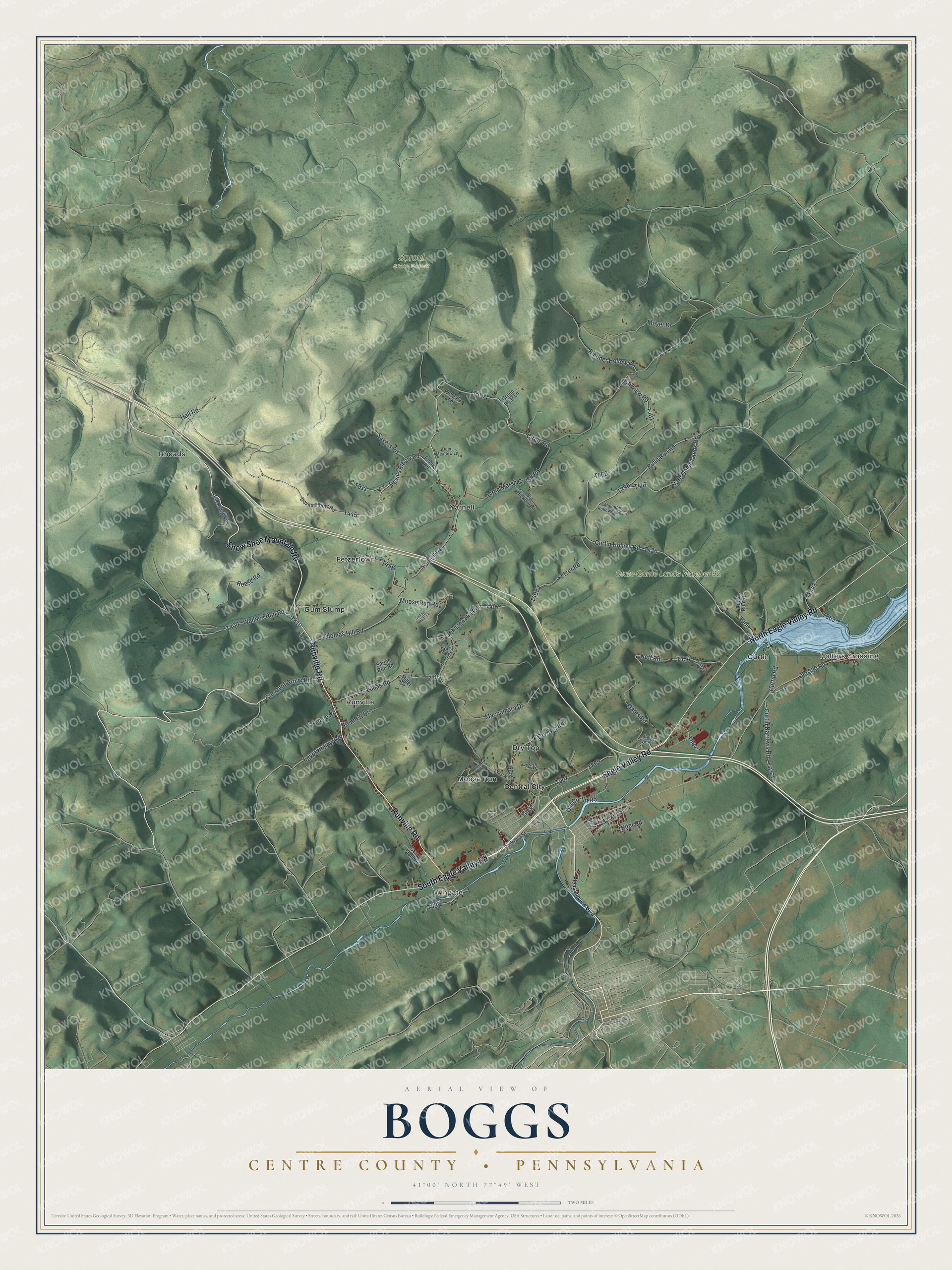
Created by KNOWOL in 2026, this Boggs map shows the ridges in shaded green, from Sproul State Forest down to the valley roads, with red buildings along Runville Road and Eagle Valley Road. The shaded ridges come from USGS elevation data. The title panel reads "Aerial View of Boggs, Centre County, Pennsylvania," with 41°00' North 77°49' West and a two-mile scale bar.
It suits a den, a hunting camp or a kitchen wall. It's a good gift for someone who grew up along Runville Road or near Curtin and moved away. Open the preview, start at Wingate, and trace the road you'd take home. Shop the Boggs, Centre County, Pennsylvania map.