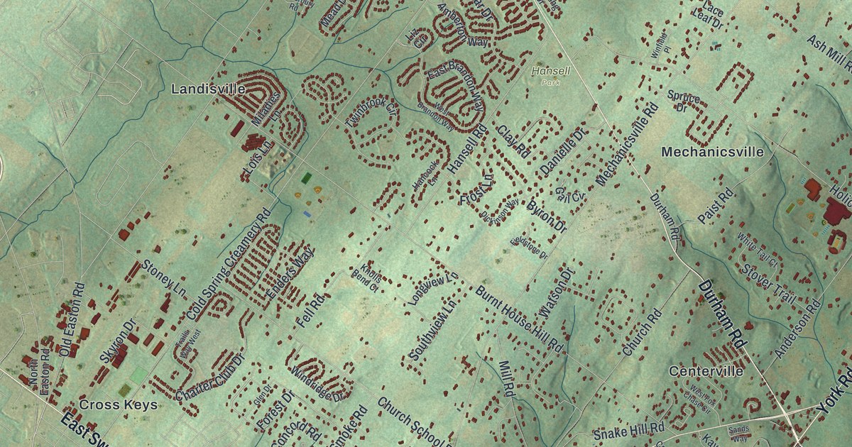
If you grew up in Buckingham Township, or you still drive Durham Road and York Road most days, this map gives you a lot to find. It's a modern aerial view of Buckingham in Bucks County, Pennsylvania, made from modern data and given a vintage artistic feel. Soft green hills fill the sheet, and the township's buildings are marked in deep red. Villages like Lahaska, Holicong, Furlong, Wycombe and Pineville are labeled across the township. Explore the print options for Buckingham, Bucks County.
Centerville, where Durham Road and York Road cross
Start at Centerville near the middle of the map, where Durham Road and York Road cross. Follow York Road northeast past Holicong. Up near the top, Lahaska sits on Street Road. Now go back to Centerville and take Durham Road the other way. It heads south past Buckingham Valley, then turns east to Pineville near the right edge. Back at the crossroads, follow York Road southwest. It crosses Swamp Road at Furlong and runs down to Bridge Valley. Near Furlong, Forest Grove Road branches off and heads east past Forest Grove to Wycombe. In the top left, the thickest cluster of red sits around Landisville and Cross Keys. Many roads are labeled, and each red shape is a building, so zoom in on the preview and look for yours.
That crossing is old. The 1876 county history called Buckingham the largest township in Bucks County. It said the Durham and York roads were two of the main highways in the county. They ran the whole length and width of Buckingham and met at Centreville, as it was spelled then. A state historical marker at York Road and Durham Road tells more. It marks Bogart's Tavern, first licensed in 1763. In 1775 and 1776, the tavern was the headquarters of the Committee of Observation and Inspection. That group organized the Revolution in Bucks County. The county's first military companies of the war gathered there in 1775. In 1776 it was General Nathanael Greene's headquarters. The tavern isn't labeled on the map, but you can put your finger on the corner the marker names.
The same history tells a good one about a Buckingham man named Paul Preston. He was a county surveyor, a tax collector and a German translator for the courts. He stood six feet six and three-quarter inches tall. He was also a friend of Benjamin Franklin. Once a friend of Franklin's was going to court in Newtown and asked for a letter to Preston. Franklin said no. He said the man would be easy to spot. He'd be the tallest, the homeliest-looking and the most sensible man in Newtown.
For anyone who grew up between Lahaska and Furlong
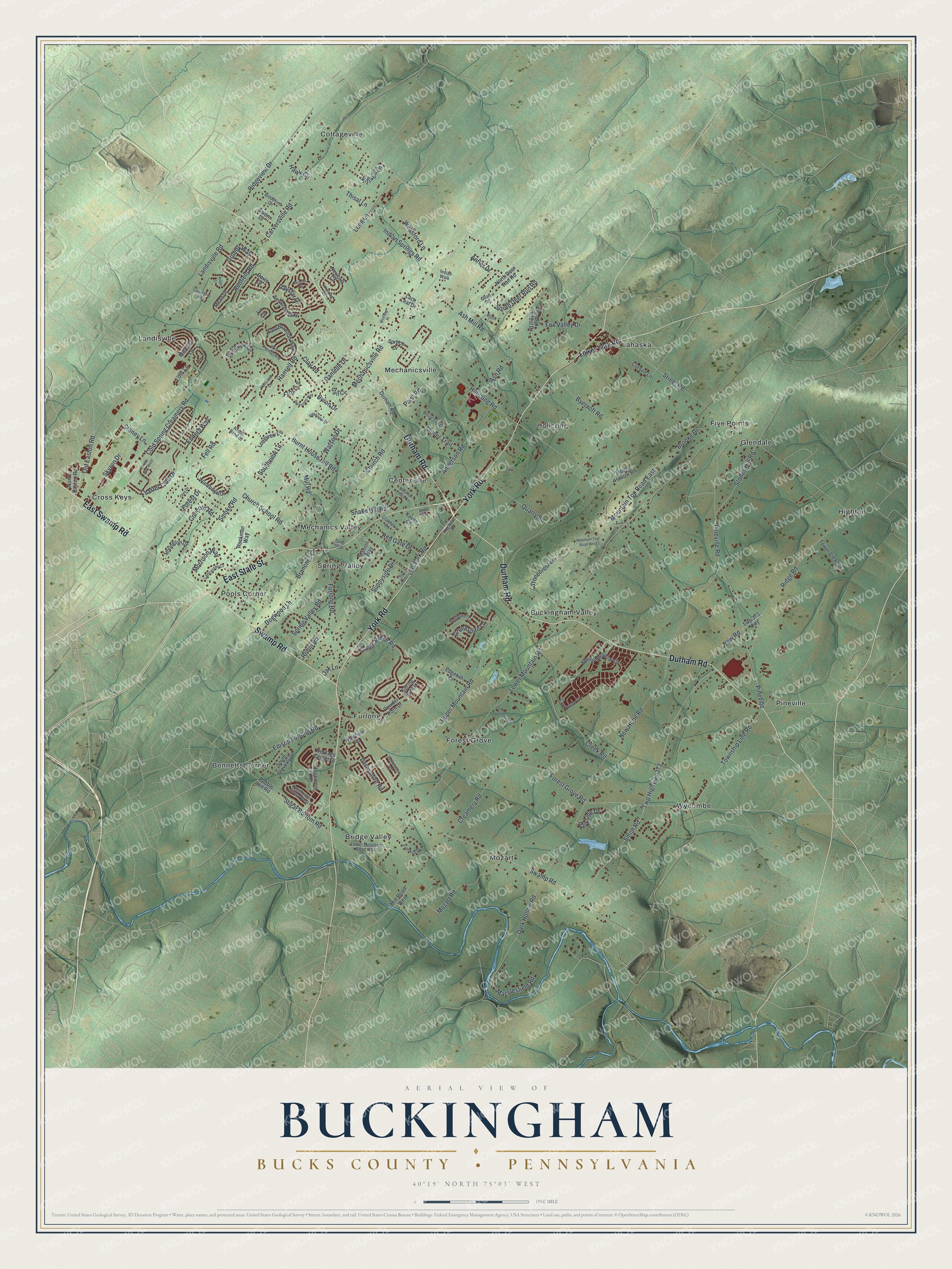
Created by KNOWOL in 2026, this Buckingham map suits a family room, a home office or a den. The hills are shaded in soft green from USGS elevation data, and the buildings stand out in red. The title panel reads "Aerial View of Buckingham, Bucks County, Pennsylvania" with the coordinates 40°19' North, 75°03' West and a one-mile scale bar.
It's a thoughtful gift for someone who grew up in Buckingham, went to school here or moved away from Bucks County. Open the watermarked preview, find the Centerville crossroads and trace the road to your house. Shop the Buckingham, Bucks County, Pennsylvania map.