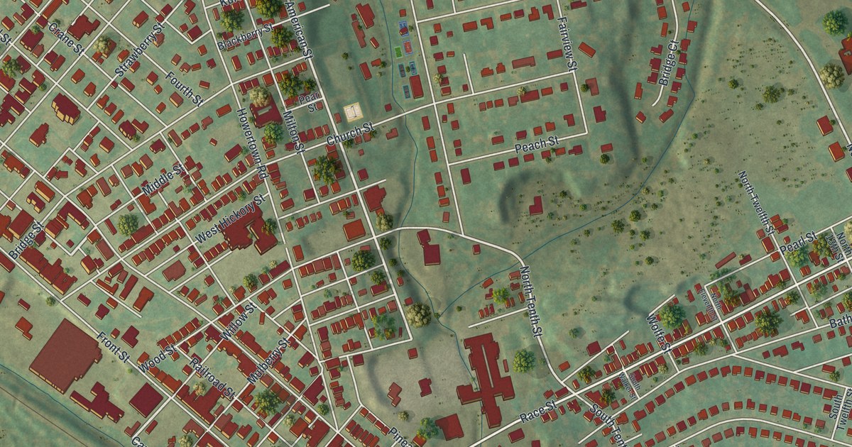
If you grew up in Catasauqua, went to school here, or still have family near Front Street or in Hawktown, this map gives you plenty to find. It's a modern aerial view of the borough of Catasauqua in Lehigh County, Pennsylvania, made from modern data with a vintage artistic feel. The Lehigh River curves down the left side of the sheet, though it isn't labeled. The old streets climb the slope beside it, packed with red buildings. Out east, Hawktown sits at center right, with long curving rows of homes below it. Explore the print options for Catasauqua.
Front Street, Race Street and the Crane Iron Works
Start where Race Street meets Front Street, near the middle of the sheet. Follow Front Street north, up toward the top left. Wood Street, Church Street, Bridge Street and Pine Street all cross it along the way. Turn right on Pine Street and head uphill. It crosses Railroad Street and Howertown Road on its way to the top center. Walnut Street runs even farther, out to Covington Place and Cambridge Place near the ball fields drawn at the top right. Now go back to Race Street and head east. Past Pineapple Street and Wolfe Street, you'll come to Hawktown, printed at center right. Bath Avenue and Bethlehem Road carry on from there. Below Hawktown, Circle Drive and Faith Drive curve through long rows of homes. Tioga Street runs down to Pennsylvania Avenue and York Street near the bottom right. Many of the roads are labeled, and each red shape is a building, so zoom in on the preview and look for yours.
That first corner, at Race and Front, is the oldest part of town. A state historical marker there says it was called Biery's Port, and its first building was a grist mill from about 1752. Then came iron. The Crane Iron Works fired its first furnace on July 4, 1840. It burned anthracite, a hard coal. The marker calls it the first long-term, commercially successful anthracite iron furnace. David Thomas, a native of Wales, built it for the Lehigh Crane Iron Co. It soon made 50 to 60 tons of pig iron a week. By 1868 the works had six furnaces. Iron making there stopped in 1930.
The Williams family came from Wales too. The 1914 History of Lehigh County says David Williams came from Wales in 1840 and took a contract for moulding with the Crane Iron Co. One of his sons, John, later became the company's cashier. Another marker, on Pine Street across from the Presbyterian church, says David Thomas lived there. It calls him the "Father of the American anthracite iron industry." The furnace marker stands on Front Street between Church Street and Wood Street. Neither marker is printed on the map, but those streets are. Find where they cross Front Street, and you've found the block where the furnace marker stands.
For someone who knows Front Street and Hawktown
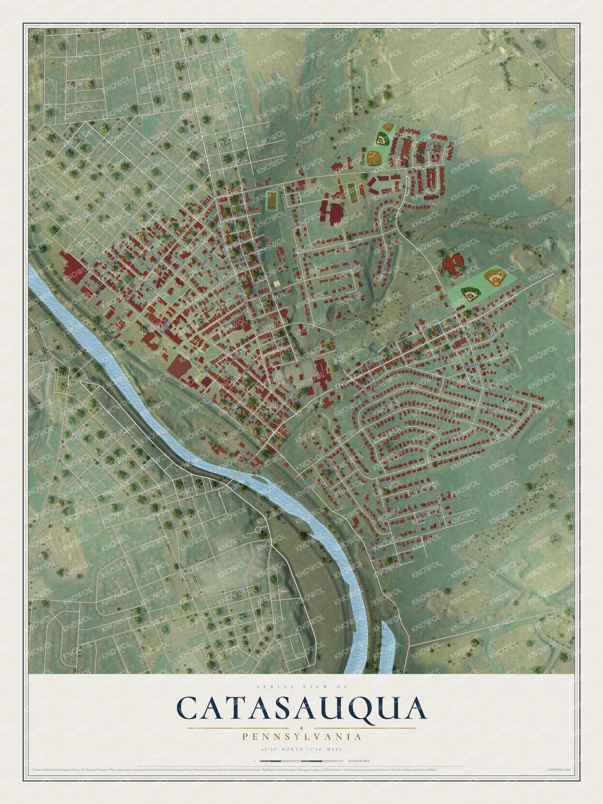
Created by KNOWOL in 2026 from geographic records of roads, buildings and terrain, this Catasauqua map fits a living room, a den or an office. The shaded hills come from USGS elevation data. Zoom in and you can pick out the buildings along Front Street, then follow Race Street out to Hawktown. The title panel reads "Aerial View of Catasauqua, Pennsylvania" with the coordinates 40°39' North, 75°28' West and a quarter-mile scale bar.
It makes a thoughtful gift for someone who grew up here, went to school here, or moved away from Race Street years ago. Open the watermarked preview and trace a street you know, then choose your print on the product page. Shop the Catasauqua, Pennsylvania map.