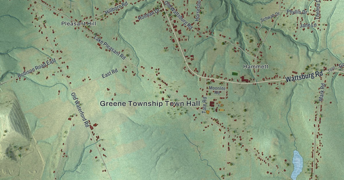
If you grew up in Greene Township, or you still have family on a farm along Wattsburg Road or Lake Pleasant Road, this map gives you a lot to find. It's a modern aerial view of Greene Township in Erie County, Pennsylvania, made from modern data and given a vintage feel. Soft green hills are shaded across the whole sheet, and about 5,000 buildings are marked in dark red. The view runs from Belleview Heights and Kuhl at the top down to Sampson and West Greene at the bottom. Explore the print options for Greene, Erie County.
From Greene Township Town Hall to Bogus Corners and West Greene
Start at Greene Township Town Hall, a little left of the middle of the sheet. Tate Road runs past it and up to Wattsburg Road. Turn right and head east. You'll pass Hammett and Mark Road, then Dewey Road and Dutch Road. Keep going to Bogus Corners, where Jones Road and Barton Road meet Wattsburg Road. State Game Lands Number 218 is printed below it. Now go back to the town hall and find Lake Pleasant Road. It runs down to the southeast. Follow it to Weeds Corners, where West Greene Road comes up from the south. Take West Greene Road down to West Greene near the bottom of the sheet. Many roads are labeled, and each red shape is a building, so zoom in on the preview and look for yours.
Why the northeast corner was called Wales
In the spring of 1802, Thomas Hinton made a home in the northeast part of the township. He brought five sons and two daughters. The family had come over from Wales the year before. So people called their corner Wales, and the name stayed. Other Welsh families followed. The 1884 History of Erie County names the Joneses, Knoyles, Morgans and Wilkinses. By then, Wales had a Presbyterian church, a Methodist church, a schoolhouse and a few farmhouses.
Now look at the top right corner of the map. Wales Road, Knoyle Road and Jones Road are all printed there, close together. The old book doesn't say the roads were named for those families. But the names are still on the map. Knoyle Road runs east from Kuhl, which is printed at the top center. The same book says Irish families started settling here about 1836, mostly along the Kuhl road. Filley Road is up in that corner too. The book also says Six Mile Creek started on Mrs. Sarah Filley's farm, a short way south of Wales. The creek isn't labeled on this map.
How Wattsburg Road and Lake Pleasant Road began
Greene Township was called Beaver Dam until 1840. That year it took the name of General Greene of the Revolutionary War. Lake Pleasant Road was opened from Erie in the winter of 1821 to 1822. It reached French Creek five winters later, and much of the way ran through thick forest. Wattsburg Road was a plank toll road, finished in 1853. It stopped charging tolls in the spring of 1865. The 1884 book says both roads crossed the whole township from northwest to southeast. Trace them from the top left corner of the map and you'll see they still do.
For anyone who knows Wattsburg Road or West Greene
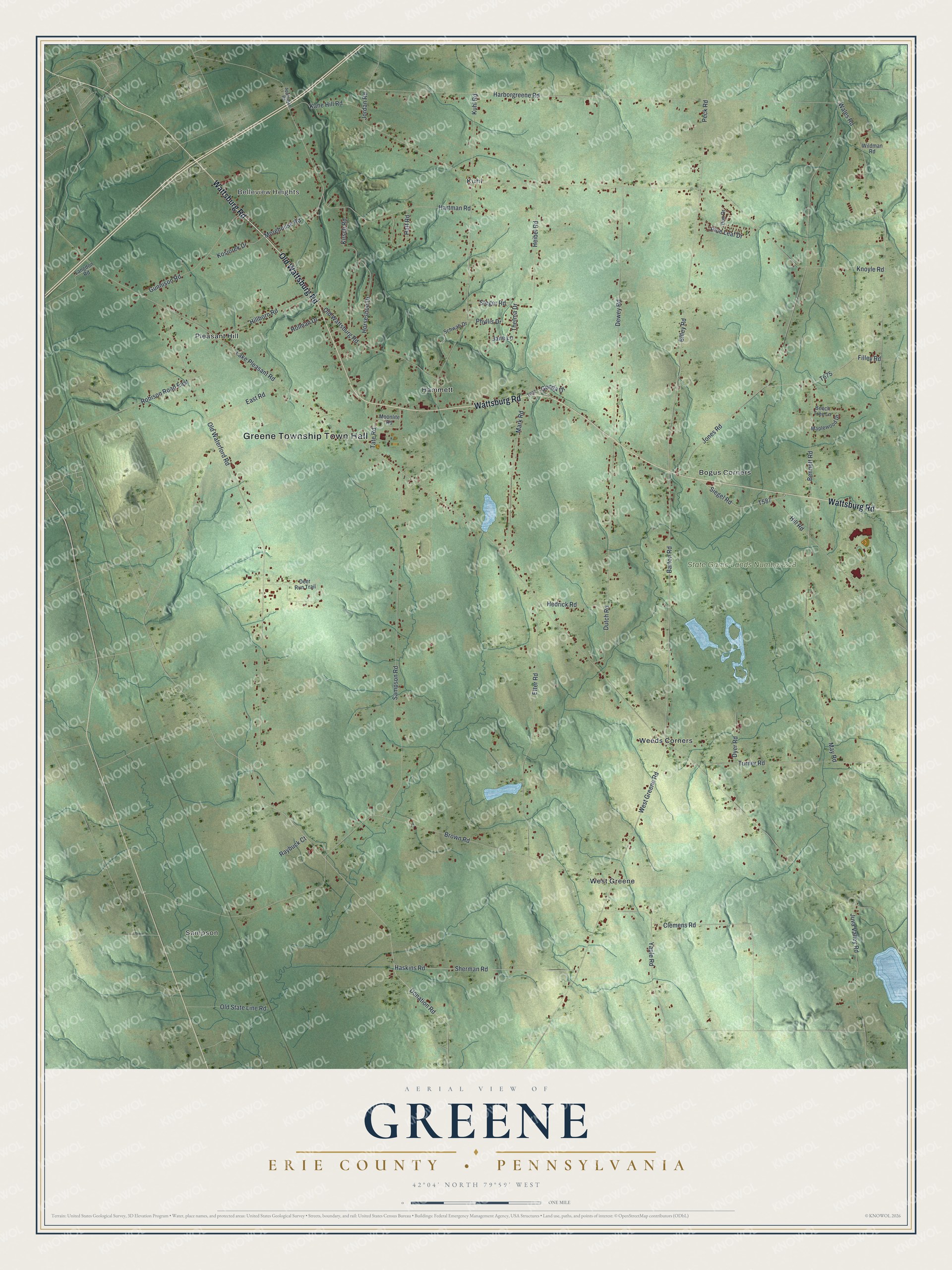
Created by KNOWOL in 2026, this Greene Township map fits a farmhouse kitchen, a den or an office. The hills are shaded in soft green from USGS elevation data, and a few small ponds show in pale blue, though they aren't labeled. The title panel reads "Aerial View of Greene, Erie County, Pennsylvania" with 42°04' North, 79°59' West and a one-mile scale bar.
It's a thoughtful gift for someone who grew up between Kuhl and West Greene, moved away from Erie County, or still has family out on these roads. Open the preview, zoom in and find the farm or the corner you know. Shop the Greene, Erie County, Pennsylvania map.