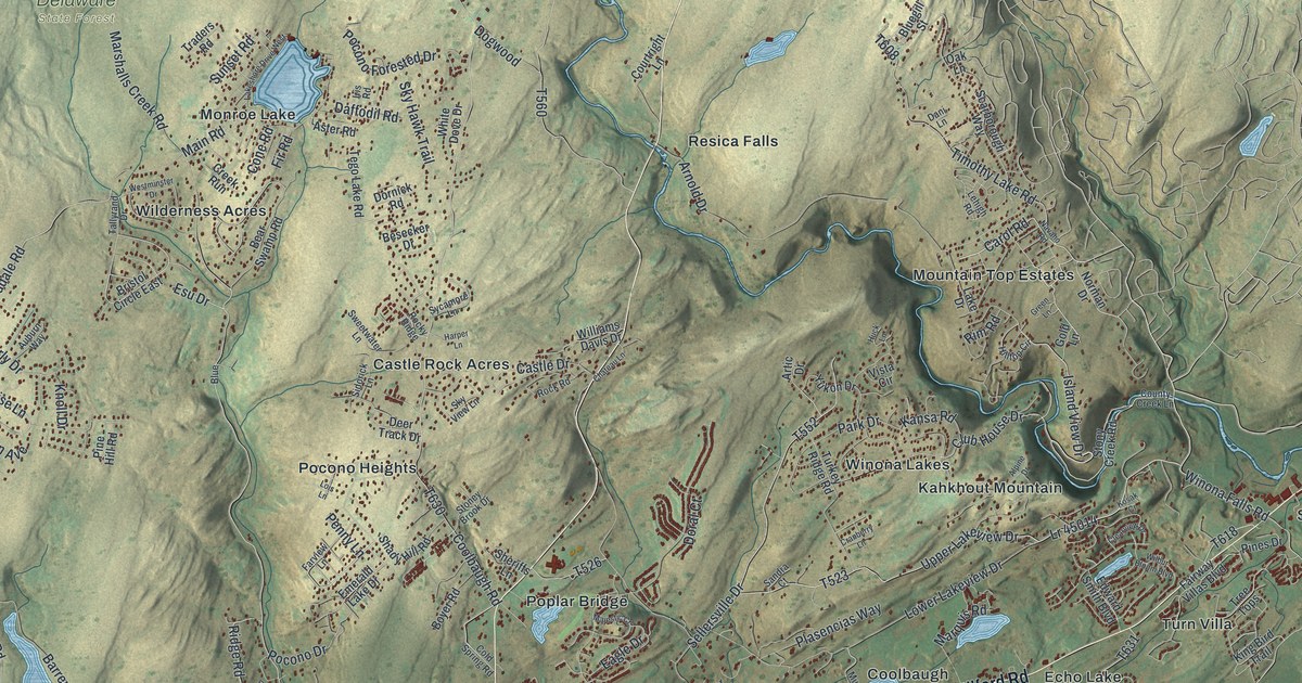
If you grew up along Milford Road or have family near Echo Lake, Resica Falls or Winona Lakes, this map gives you a lot to find. It's a modern aerial view of Middle Smithfield Township in Monroe County, Pennsylvania, made from modern data with a vintage look. Shaded green hills fill the sheet, and small lakes show in pale blue. More than 14,000 buildings are marked in red, with many clustered near Milford Road in the lower middle of the map. A wide blue river curves down the right side.
Milford Road, Echo Lake and Resica Falls
Start at the Middle Smithfield Township label near the bottom center of the map. Milford Road runs right past it. Just above the road sit the Coolbaugh and Echo Lake labels. Follow Milford Road northeast and you'll pass Turn Villa. Keep going to Shoemakers, where River Road branches off. The Delaware Water Gap National Recreation Area label sits down by the river. Now go back and head southwest on Milford Road. You'll pass Frutchey and then Oak Grove.
Near Oak Grove, Resica Falls Road heads north. It passes Poplar Bridge, and Castle Rock Acres sits just off it on Castle Drive. Keep following Resica Falls Road north and you'll reach Resica Falls. Farther west, Marshalls Creek Road crosses the sheet from left to right near Wilderness Acres. Main Road leads off it to Monroe Lake. Delaware State Forest is labeled in the upper left. Many roads are labeled, and each red shape is a building, so zoom in on the preview and look for yours.
The Marshalls Creek mastodon
A Pennsylvania Historical and Museum Commission marker records a discovery near Marshalls Creek. In 1968, John W. Leap and workers at a nearby peat bog found the bones of a mastodon that died about 12,000 years ago. The specimen is now in the State Museum of Pennsylvania and ranks among the most complete mastodon skeletons found on the East Coast.
The marker places the find on Milford Road near Oak Grove. Find those two names on the preview, then look at the hills and buildings around them.
Echo Lake and Milford Road on your wall
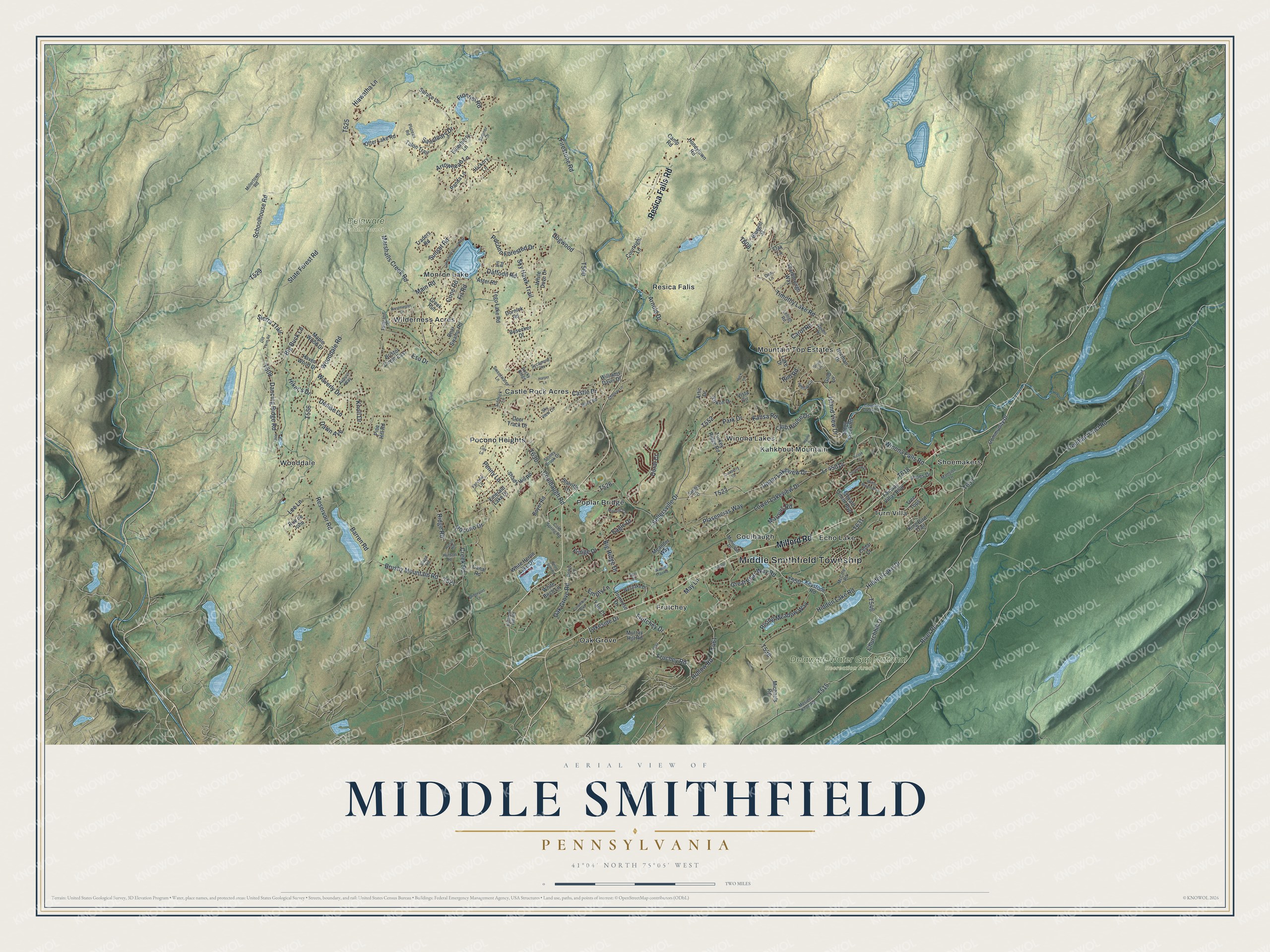
Created by KNOWOL in 2026, this map of Middle Smithfield shows the township's hills in soft shaded relief, with lakes in pale blue and buildings in deep red. The hill shading comes from USGS elevation data. The title panel reads "Aerial View of Middle Smithfield, Pennsylvania," with the coordinates 41°04' North, 75°05' West and a two-mile scale bar.
It suits a living room, a den or the wall of a lake house. It's a gift for someone who grew up near Echo Lake or moved away from Monroe County. Open the preview, zoom in on Milford Road and find the streets you know. See sizes and frames for the Middle Smithfield map.