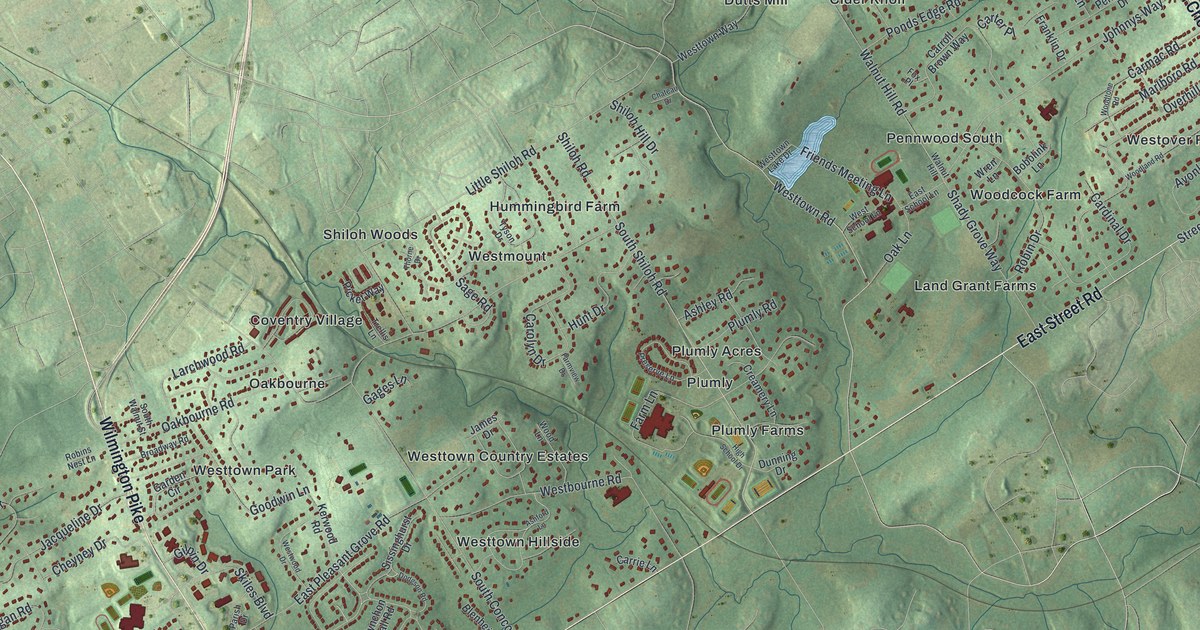
This beautifully detailed map of Westtown, Pennsylvania was created in 2026 using aerial imagery combined with modern topographical, census, street and landmark data. It’s a one-of-a-kind view of Westtown that combines accurate data with a vintage aesthetic. The map shows every building in its true location, many of the roads carry their names, and the shaded topographic relief shows the shape of the land.
Explore an aerial view of Westtown, Pennsylvania
On the map you’ll find Cider Knoll, Coventry Village, Darlington Corners, Dutts Mill, Green Lane Village, Hilloch Manor, Hummingbird Farm, Land Grant Farms, Oakbourne, Pennwood South, Pleasant Grove, Plumly, and more. If you look closely you can even find your house accurately drawn in its correct location. Zoom in on the preview to look for yours.
Did you know this piece of Westtown, Pennsylvania history?
Philadelphia Quakers opened Westtown School on May 6, 1799. They chose land a full day’s carriage ride from the city, away from its influences. Boys and girls attended from the very start. It is the oldest coeducational boarding school in the country still operating.
Take a closer look at the Westtown map
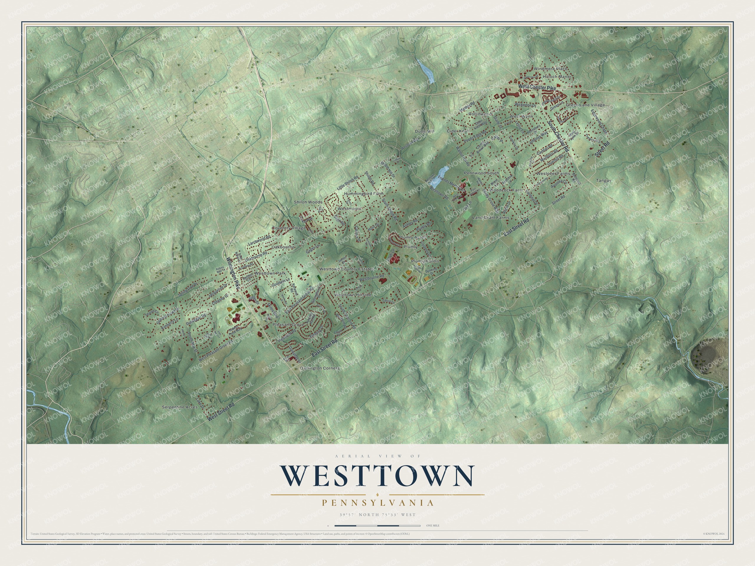
Street and place names on the Westtown, Pennsylvania map
These names are printed on the map of Westtown, Pennsylvania.
Places: Cider Knoll, Coventry Village, Darlington Corners, Dutts Mill, Green Lane Village, Hilloch Manor, Hummingbird Farm, Land Grant Farms, Oakbourne, Pennwood South, Pleasant Grove, Plumly, Plumly Acres, Plumly Farms, Rollinwood, Serpentine Acres, Shiloh Woods, Tanguy, West Wynn, Westmount, Westover Farms, Westtown Country Estates, Westtown Hillside, Westtown Park, Windmere Place and Woodcock Farm.
Streets and roads: South Chester Road, Street Road, East Street Road, Wilmington Pike, West Street Road, West Chester Pike, Westtown Road, Walnut Hill Road, Oakbourne Road, Shiloh Road, South Shiloh Road, South New Street.
More street names, A to Z
Ashford Lane, Ashley Road, Avonlea Circle, Blenheim Road, Bobolink Lane, Broadway Road, Butternut Road, Cardinal Drive, Carlyle Road, Carmac Road, Carolyn Drive, Carrie Lane, Carroll Brown Way, Carter Place, Chateau Drive, Chesterfield Drive, Cheyney Drive, Cider Knoll Way, Creamery Lane, Damallay Drive, Diane Drive, Dodgson Road, Dunning Drive, Dunuegan Road, East Niels Lane, East Pleasant Grove Road, East School Lane, Edgewood Chase, Farm Lane, Farmview Drive, Fielding Drive, Fox Place, Franklin Drive, Friends Meeting Lane, Gages Lane, Garden Circle, General Howe Drive, Gilpin Drive, Goodwin Lane, Grant Road, Green Lane, Hidden Pond Way, High School Drive, Hinchley Run, Hunt Drive, Jacqueline Drive, James Drive, Jennifer Lane, Johnnys Way, Kerwood Road, Kimberly Lane, Knoll Way, Lake Drive, Larchwood Road, Leslie Lane, Little Shiloh Road, Manley Road, Marlboro Road, Oak Lane, Overhill Road, Parish Drive, Pennsbury Drive, Picket Way, Piedmont Road, Plumly Road, Ponds Edge Road, Powderhorn Drive, Preserve Lane, Pynchon Hall Road, Robin Drive, Robins Nest Lane, Sage Road, Shady Grove Way, Sharon Circle, Shiloh Hill Drive, Sissinghurst Drive, Skiles Boulevard, South Concord Road, South Walnut Street, Spring Line Drive, Thorne Drive, Trellis Lane, Tyson Drive, Walnut Hill, Westbourne Road, West Lynn Drive, West Niels Lane, West Pleasant Grove Road, West School Lane, Westtown Lake Drive, Westtown Way, Westwood Drive, Wickerton Drive, Windermere Road, Woodland Road, Wood Lane, Woodtone Road, Wren Lane.
See the Westtown, Pennsylvania map on a wall
The Westtown map as an 18 x 24 inch print in a black frame.

This beautifully detailed map of Westtown makes an attractive addition to your office, library, or den, and it can even be used to teach children the geography and history of the area. It also makes a great gift for someone who left Westtown and still calls it home. When you’re done exploring, click here to get your copy of the Westtown map.