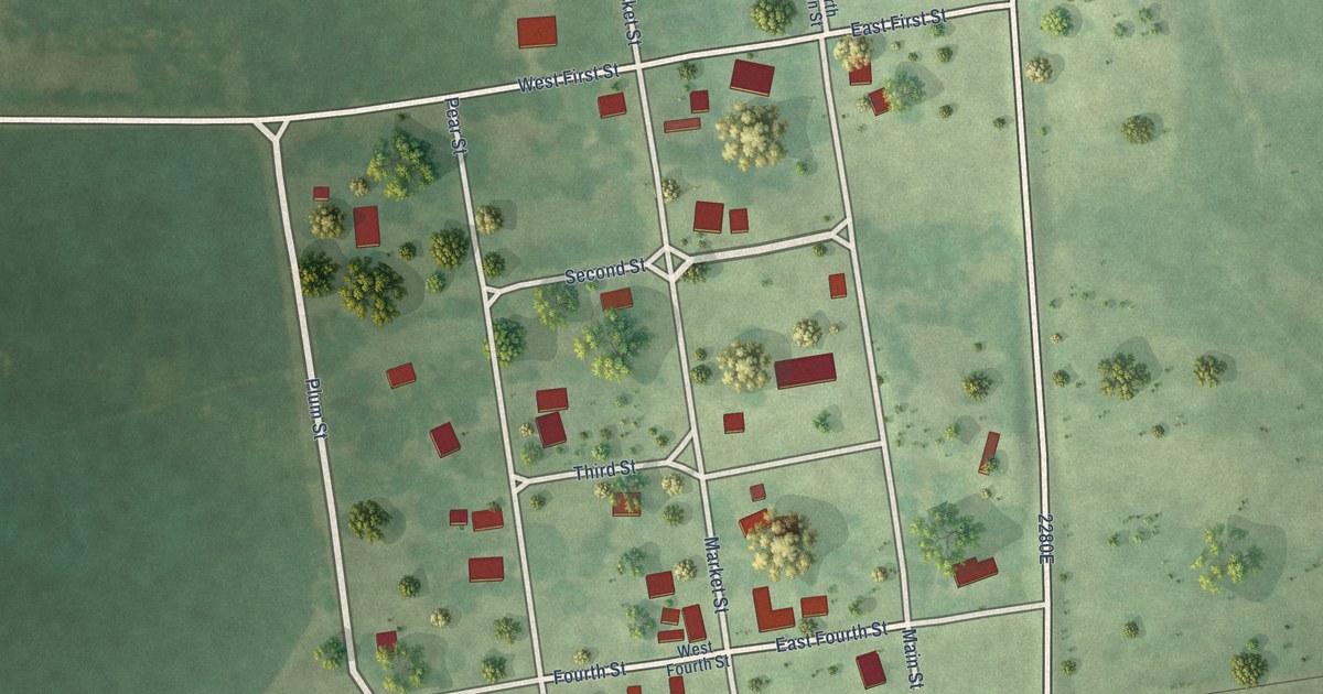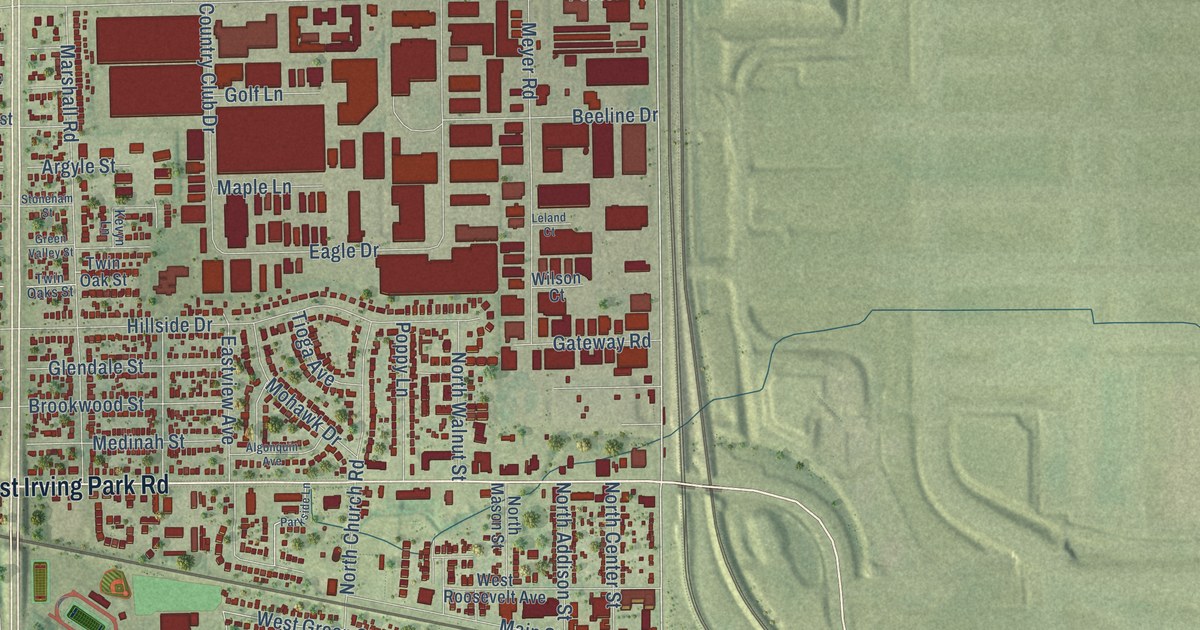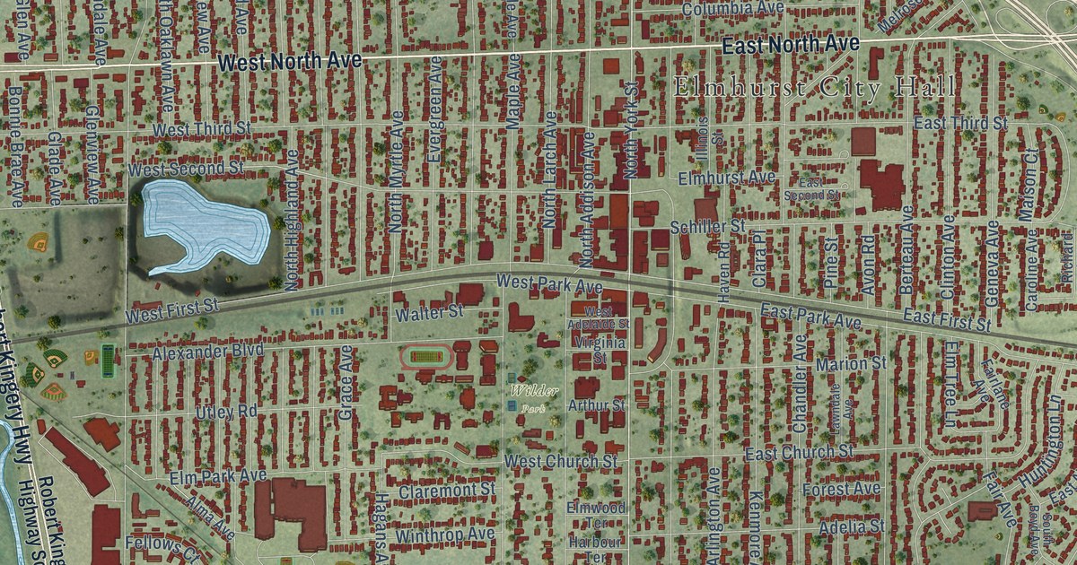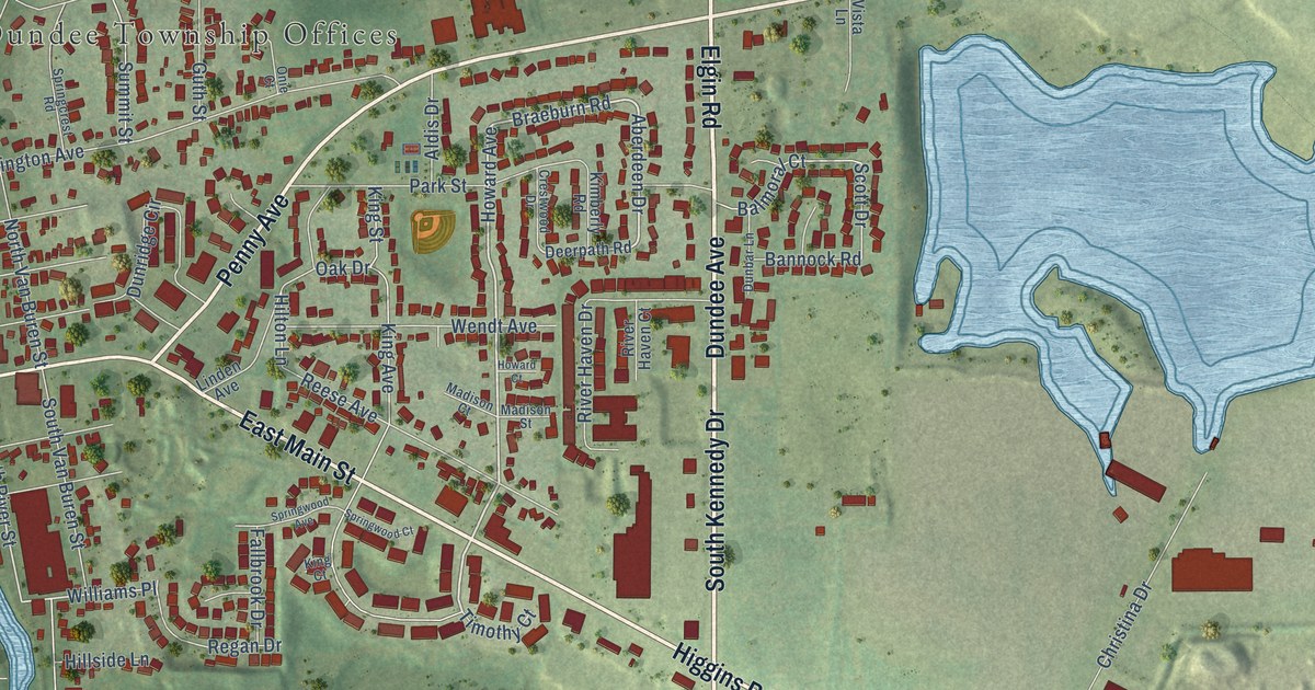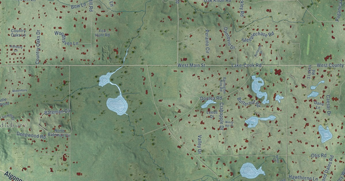
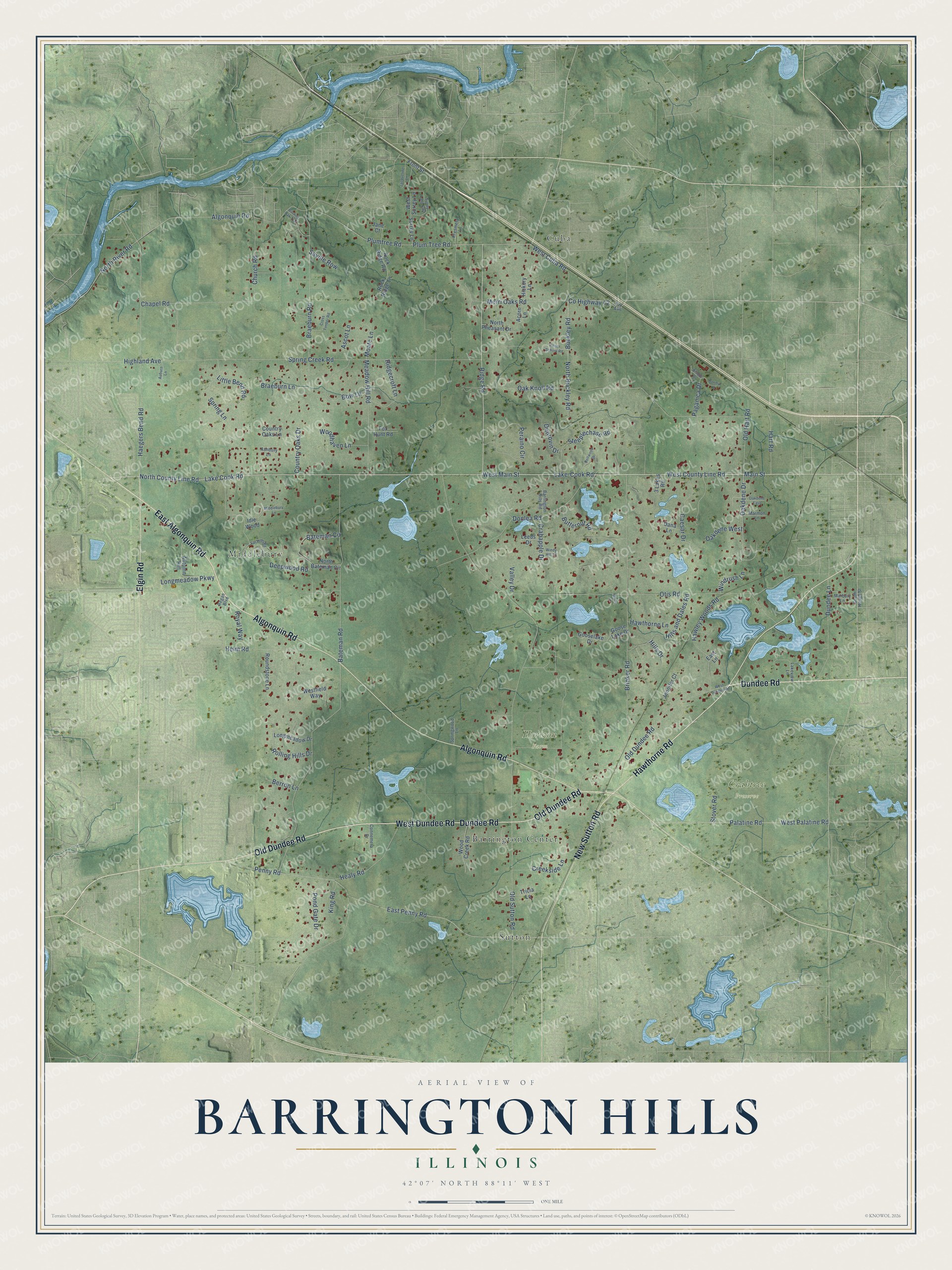
This beautifully detailed map of Barrington Hills, Illinois was created in 2026 using aerial imagery combined with modern topographical, census, street and landmark data. It's a modern aerial view of Barrington Hills in Cook County, Illinois, that combines modern data with a vintage aesthetic. The roads feature printed names, and if you look closely you can find your exact house accurately shown in its correct location.
Explore an aerial view of Barrington Hills, Illinois
On this map you'll find Crabtree Preserve, Horizon Farm, Barrington Center, Cuba, Middlebury, Sutton, East Algonquin Road, Dundee Road, West Dundee Road, Old Dundee Road, Hawthorne Road, Algonquin Road, and more. Each red shape is a building, so zoom in on the preview and look for yours.
Barrington Hills has a story worth telling. The National Park Service puts it this way: "Barrington Hills is fortunate to have many homes designed by noted architects such as Lloyd Wright, Dennis Blair, and Don Erickson; most of whom worked with Wright earlier in their careers."
Barrington Hills is a village in Cook County. The Census Bureau counted 4,114 people here in 2020.
Take a closer look at the Barrington Hills map
Names on this map
These names are printed on this map.
Places: Crabtree Preserve, Horizon Farm, Barrington Center, Cuba, Middlebury and Sutton.
Streets and roads: East Algonquin Road, Dundee Road, West Dundee Road, Old Dundee Road, Hawthorne Road, Algonquin Road, Elgin Road, New Sutton Road, West County Line Road, West Main Street, Lake-Cook Road, Ridge Road.
More street names, A to Z
3 Lakes Road, Acorn Lane, Ascot Lane, Ashbury Lane, Auburn Lane, Autumn Hill, Barrington Hills Road, Bateman Circle, Bateman Road, Bellwood Drive, Berron Lane, Bisque Drive, Bow Lane, Braeburn Lane, Braeburn Road, Brinker Road, Buckley Road, Burning Oak Trail, Butternut Road, Caesar Drive, Chapel Road, Church Road, Connemera Drive, Country Oaks Drive, Country Oaks Lane, County Highway 42, Crabapple Drive, Creekside Lane, Cross Timber Road, Cty A46, Dana Lane, Deepwood Road, Donlea Road, Dormy Lane, Dundee Lane, Dunrovin Drive, East Lane, East Penny Road, Far Hills Road, Fox Hunt Road, Front Street, Goose Lake Drive, Gooselake Drive, Haegers Bend Road, Hart Road, Hawley Woods Road, Hawthorne Lane, Healy Road, Helm Road, Heron Lane, Hickory Lane, Highland Avenue, Hills and Dales Road, Hills Drive, Idle Wood, Jacqueline Lane, Jane Court, Jennifer Court, King Road, Kresmery Lane, Lake Cook Road, Lakeview Lane, Leeds Drive, Little Bend Road, Longmeadow Drive, Longmeadow Parkway, Main Street, Marbury Lane, Marmon Lane, Meadow Hill Road, Merri Oaks Road, Middlebury Lane, Moate Lane, North Bateman Circle, North Buckley Road, North County Line Road, North Pheasant Drive, North River Road, Oakdene Drive, Oakdene East, Oakdene West, Oak Knoll Road, Old Hart Road, Old Sutton Road, Otis Road, Paganica Drive, Palatine Road, Penny Road, Peraino Circle, Plum Tree Road, Plumtree Road, Pond Gate Drive, Porter School Road, Regan Boulevard, Ridgecroft Lane, Rock Ridge Lane, Rock Ridge Road, Rolling Hills Drive, Roundstone Lane, Royal Way, Saville Row, South Hough Street, Spring Creek Road, Spring Lane, Springwood Lane, Steeplechase Road, Stover Road, Surrey Lane, Surrey Lane East, Tricia Lane, Valley Drive, West Cuba Road, Westfield Way, West Palatine Road, West Surrey Lane, Windrush Lane, Windy Hill Drive, Wood Creek Road, Woodhaven Lane.
Created by KNOWOL in 2026. The buildings are small red shapes, the roads carry their printed names, and shaded relief shows the shape of the land. The title panel reads "AERIAL VIEW OF BARRINGTON HILLS ILLINOIS" with 42°07' NORTH 88°11' WEST.
It looks right in a kitchen, an office or a den, and it's a gift for anyone who grew up in Barrington Hills or moved away. Open the preview and find your street. See sizes and frames for the Barrington Hills map.