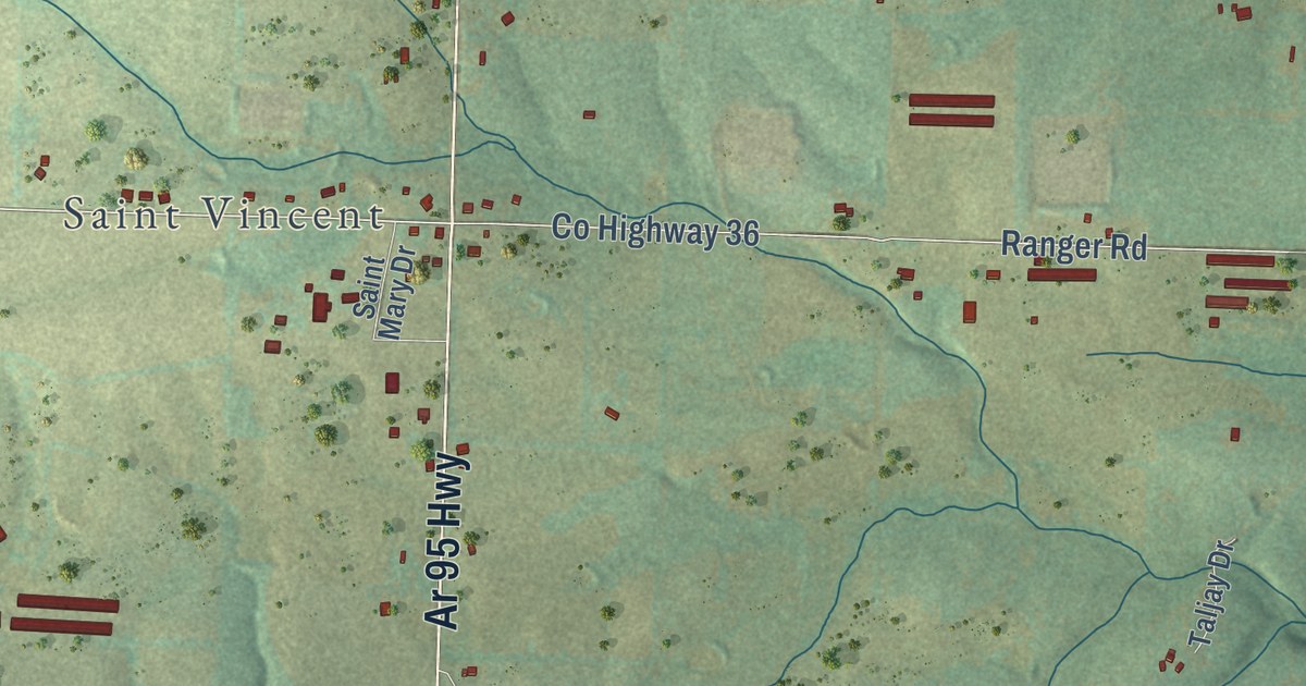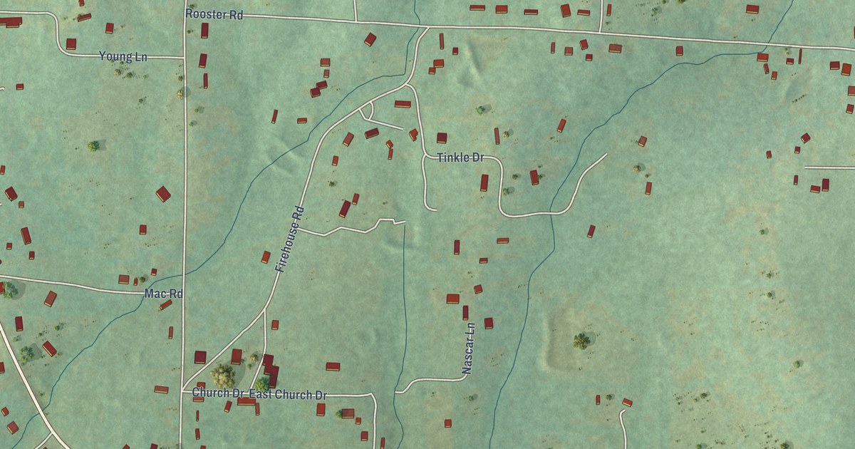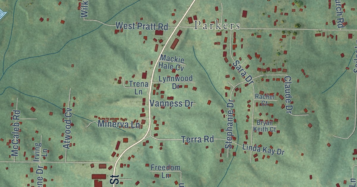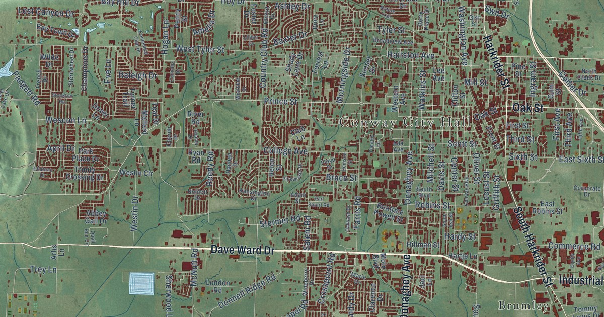
This beautifully detailed map of Conway, Arkansas was created in 2026 using aerial imagery combined with modern topographical, census, street and landmark data. It’s a one-of-a-kind view of Conway that combines accurate data with a vintage aesthetic. The map shows every building in its true location, many of the roads carry their names, and the shaded topographic relief shows the shape of the land.
Explore an aerial view of Conway, Arkansas
On the map you’ll find Conway City Hall, Belk Corner, Brumley, Gleason, Red Hill, Rolling Hills, and Round Mountain, along with Dave Ward Drive, East Oak Street, Oak Street, Old Morrilton Highway, Harkrider Street, and more. If you look closely you can even find your house accurately drawn in its correct location. Zoom in on the preview to look for yours.
Did you know this piece of Conway, Arkansas history?
From the CALS Encyclopedia of Arkansas: "Two later newspapers, the Conway Democrat, founded by Colonel George Washington Bruce in 1878, and the Log Cabin by Able F. Livingston in 1879, merged in 1901 and became the current Log Cabin Democrat."
Conway is a city in Faulkner County.
Take a closer look at the Conway map
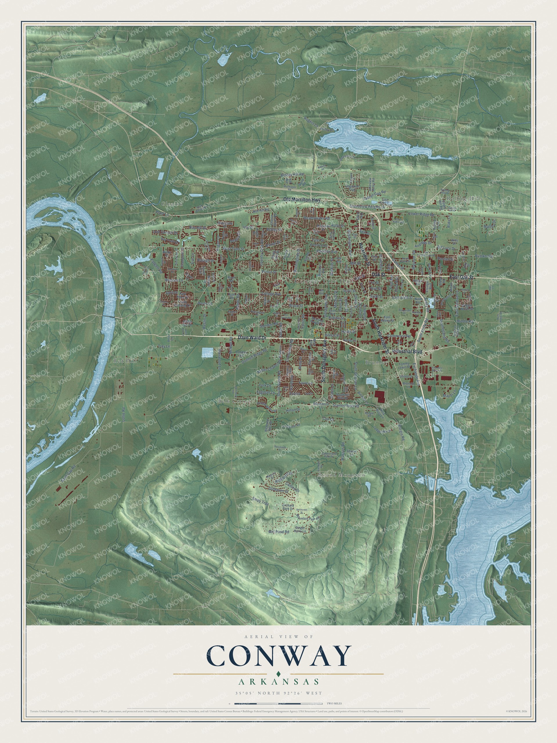
Street and place names on the Conway, Arkansas map
These names are printed on the map of Conway, Arkansas.
Places: Conway City Hall, Belk Corner, Brumley, Gleason, Red Hill, Rolling Hills and Round Mountain.
Streets and roads: Dave Ward Drive, East Oak Street, Oak Street, Old Morrilton Highway, Harkrider Street, Industrial Boulevard, South Donaghey Avenue, South Harkrider Street, Prince Street, Amity Road, Middle Road, Exchange Avenue.
More street names, A to Z
Abbey Gail Drive, Acorn Kid Loop, Ada Avenue, Adam Street, Amelia Drive, Andrews Drive, Andy Drive, April Drive, Arden Lane, Artis Lane, Ashley Drive, Azalea Loop, Baxter Drive, Bay Hill Drive, Bay Town Drive, Beatrice Powell Street, Bernard Drive, Berry Place Drive, Bill Bell Lane, Bill Lucy Drive, Blackberry Lane, Blake Lane, Blaney Hill Road, Blustery Way, Broadview Avenue, Bronnie Lane, Brookside Drive, Bruce Street, Cadron Gap Road, Carl Stuart Road, Cedar Hill Road, Centennial Club Drive, Center Street, Champions Drive, Charlie Dayer Road, Chateau Drive, Cherub Drive, Chicot Drive, Clarence Drive, Clifton Street, Clover Lane, Club Lane, College Avenue, Collier Drive, Collins Drive, Commerce Road, Conway Boulevard, Corporate Drive, Country Club Road, Cox Cv, Crosspoint Road, Cumberland Park Drive, Cumulus Drive, Dahlia, Davis Street, Denison Street, Doe Trail, Dogwood Trail, Donaghey Avenue, Donnell Ridge Road, Dover Lane, Drury Lane, Earnhart Road, East German Lane, East Robins Street, East Siebenmorgan Road, East Sixth Street, East West Martin Drive, Ed Speaker Road, Eggman Lane, Elsinger Boulevard, Empy Trail, Equity Avenue, Eve Lane, Evening Drive, Farris Road, Favre Lane, Fifth Avenue, First Avenue, First Street, Floyd Drive, Forrest Lane, Foster Drive, French Drive, Front Street, Gardenia, Ginger Kerry Lane, Gist Street, Glohaven Drive, Grand Falls, Grandview Heights Drive, Griffith Street, Gum Street, Hairston Avenue, Hallous Street, Halter Road, Hannah Drive, Hardy Street, Hartje Lane, Hart Lane, Helen Street, Hickory Hill Road, Hillman Street, Hilton Drive, Hogan Lane, Hutto Street, Ingram Street, Irby Drive, Jaci Lane, Jaguar Drive, Jeanna Drive, Joyner Drive, Kensington Drive, Kinley Drive, Lake Front Drive, Lakeview Acres Road, Ledgelawn Drive, Lee Avenue, Lillian Cv, Locust Street, Lollie Road, London Road, Lost Canyon Drive, Lower Ridge Road, Majestic Circle, Mallard Lane, Marie Drive, Martha Drive, Mayor Lane, McNutt Road, Meadowlake Road, Milam Drive, Mill Pond Road, Mill Street, Millwood Drive, Mitchell Street, Mockingbird Lane, Moix Boulevard, Morningside Drive, Morse Drive, Mountain Park Road, Museum Road, Muskogee Road, Nabco Drive, Nature Trail, Newcastle Drive, Nina Russ Lane, Ninth Avenue, Nob Hill Road, Noblett Drive, North Creek Drive, Nutter Chapel Road, Oaklawn Drive, Old Military Road, Oliver Street, Orchard Park Drive, Padgett Road, Pamela Lane, Park Place Drive, Pat's Lane, Peabody Drive, Pebble Beach Drive, Penny Street, Persimmon Drive, Pickwicket Drive, Pike Ridge, Pine Street, Plant Lane, Pyramid Drive, Quail Run Circle, Rachel Drive, Raleigh Drive, Ray Street, Redhaven Drive, Reedy Road, Richland Hills Drive, River Road, Roberts Road, Robins Street, Rogers Lane, Rolling Hills Drive, Ronald Road, Rumker Road, Runway Drive, Ryan Road, Salem Road, Sanders Street, Sand Gap Road, Scott Street, Shady Lane Drive, Sharon Lane, Sherwood Lane, Simon Road, Sixth Street, Sklar Circle, Skunk Hollow Road, Solid Waste Road, South Amity Road, South Ash Street, South Boulevard, South East German Lane, Southerland Road, Southern Hills Drive, South German Lane, South Salem Road, Southshore Lane, Spencer Lake Drive, Sprincrest Street, Stanley Russ Road, Stermer Road, Sternwheel Drive, Stockton Road, Stone Road, Story Drive, Sturgis Road, Sunset Drive, Swn Drive, Teal Drive, Third Avenue, Third Street, Timothy Lane, Tommy Lewis Drive, Trey Lane, Trinity Crossing Drive, Turner Trail, Tyler Street, United Drive, Vail Avenue, Vineyard Drive, Washington Avenue, Wasson Road, Watkins Street, Wescon Lane, Western Avenue, Westfield Drive, Westin Circle, Westin Drive, West Tyler Street, Wiggle Worm Road, Wilde Drive, Wills Drive, Wineberry Drive, Woodside Drive, York Lane, Zoysia.
See the Conway, Arkansas map on a wall
The Conway map as an 18 x 24 inch print in a black frame.

This beautifully detailed map of Conway makes an attractive addition to your office, library, or den, and it can even be used to teach children the geography and history of the area. It also makes a great gift for someone who left Conway and still calls it home. When you’re done exploring, click here to get your copy of the Conway map.