Arkansas Town Maps A to Z
All 658 town maps, from Acorn to Zinc. Each one opens its own page with the whole map.
A
B
- Bald Knob
- Banks
- Barling
- Barton
- Bassett
- Batavia
- Batesville
- Bauxite
- Bay
- Bearden
- Beaver
- Beaver Lake
- Bee Branch
- Beebe
- Beedeville
- Beirne
- Bella Vista
- Bellefonte
- Belleville
- Ben Lomond
- Benton
- Bentonville
- Bergman
- Berryville
- Bethesda
- Big Flat
- Bigelow
- Biggers
- Birdsong
- Biscoe
- Bismarck
- Black Oak
- Black Rock
- Black Springs
- Blevins
- Blue Eye
- Blue Mountain
- Bluff City
- Blytheville
- Board Camp
- Bodcaw
- Boles
- Bonanza
- Bono
- Booneville
- Bowman
- Bradford
- Bradley
- Branch
- Briarcliff
- Brinkley
- Brookland
- Bruno
- Bryant
- Buckner
- Buffalo City
- Bull Shoals
- Bull Shoals Lake
- Burdette
C
- Cabot
- Caddo Gap
- Caddo Valley
- Caldwell
- Cale
- Calico Rock
- Calion
- Camden
- Cammack Village
- Campbell Station
- Canehill
- Caraway
- Carlisle
- Carthage
- Casa
- Cash
- Cato
- Caulksville
- Cave City
- Cave Springs
- Cedarville
- Center Point
- Center Ridge
- Center Valley
- Centerton
- Centerville
- Central City
- Charleston
- Cherokee City
- Cherokee Village
- Cherry Valley
- Chester
- Chidester
- Cincinnati
- Clarendon
- Clarkedale
- Clarksville
- Clinton
- Coal Hill
- College Station
- Collins
- Colt
- Concord
- Conway
- Corinth
- Corning
- Cotter
- Cotton Plant
- Cove
- Coy
- Crawfordsville
- Crossett
- Crystal Hill
- Crystal Springs
- Cushman
D
E
F
G
H
- Hackett
- Hagarville
- Halley
- Hamburg
- Hampton
- Hardy
- Harmony Grove
- Harrell
- Harrisburg
- Harrison
- Hartford
- Hartman
- Haskell
- Hatfield
- Hattieville
- Havana
- Haynes
- Hazen
- Heber Springs
- Hector
- Helena-West Helena
- Henderson
- Hensley
- Hermitage
- Hickory Ridge
- Higden
- Higginson
- Highfill
- Highland
- Hindsville
- Holiday Island
- Holland
- Holly Grove
- Hope
- Horatio
- Horseshoe Bend
- Horseshoe Lake
- Hot Springs
- Hot Springs National Park
- Hot Springs Village
- Houston
- Hoxie
- Hughes
- Humnoke
- Humphrey
- Hunter
- Huntington
- Huntsville
- Huttig
I
J
K
L
- Lacey
- Lafe
- LaGrange
- Lake City
- Lake Conway
- Lake Dardanelle
- Lake Greeson
- Lake Hamilton
- Lake Maumelle
- Lake Ouachita
- Lake View
- Lake Village
- Lakeview
- Lamar
- Landmark
- Lavaca
- Lawson
- Leachville
- Lead Hill
- Leola
- Lepanto
- Leslie
- Letona
- Lewisville
- Lexa
- Lincoln
- Little Flock
- Little Rock
- Lockesburg
- London
- Lonoke
- Lonsdale
- Lost Bridge Village
- Louann
- Lowell
- Luxora
- Lynn
M
- Madison
- Magazine
- Magness
- Magnet Cove
- Magnolia
- Malvern
- Mammoth Spring
- Manila
- Mansfield
- Marianna
- Marie
- Marion
- Marked Tree
- Marmaduke
- Marshall
- Marvell
- Maumelle
- Mayflower
- Maynard
- Maysville
- McAlmont
- McCaskill
- McCrory
- McDougal
- McGehee
- McNab
- McNeil
- McRae
- Melbourne
- Mellwood
- Mena
- Menifee
- Midland
- Midway
- Mineral Springs
- Minturn
- Mitchellville
- Monette
- Monroe
- Monticello
- Montrose
- Moorefield
- Morning Star
- Moro
- Morrilton
- Morrison Bluff
- Morrow
- Mount Holly
- Mount Ida
- Mount Judea
- Mount Olive
- Mount Pleasant
- Mount Vernon
- Mountain Home
- Mountain Pine
- Mountain Springs
- Mountain View
- Mountainburg
- Mulberry
- Murfreesboro
N
O
P
- Palestine
- Pangburn
- Paragould
- Paris
- Parkdale
- Parkers Chapel
- Parkin
- Patmos
- Patterson
- Payneway
- Pea Ridge
- Peach Orchard
- Pearcy
- Pencil Bluff
- Perla
- Perry
- Perrytown
- Perryville
- Piggott
- Pindall
- Pine Bluff
- Pineville
- Piney
- Pinnacle
- Plainview
- Pleasant Grove
- Pleasant Plains
- Pleasant View
- Plumerville
- Pocahontas
- Pollard
- Ponca
- Poplar Grove
- Portia
- Portland
- Pottsville
- Powhatan
- Poyen
- Prairie Creek
- Prairie Grove
- Prattsville
- Prescott
- Preston
- Princeton
- Pyatt
Q
R
S
- Salado
- Salem
- Salesville
- Saratoga
- Sardis
- Scott
- Scranton
- Searcy
- Sedgwick
- Shannon Hills
- Sheridan
- Sherrill
- Sherwood
- Shirley
- Sidney
- Siloam Springs
- Sloan
- Smackover
- Smithville
- Sonora
- South Lead Hill
- Southside
- Sparkman
- Spring Hill
- Springdale
- Springfield
- Springhill
- Springtown
- St. Charles
- St. Francis
- St. Joe
- St. Paul
- Stamps
- Star City
- Staves
- Stephens
- Strawberry
- Strong
- Stuttgart
- Subiaco
- Success
- Sulphur Rock
- Sulphur Springs
- Summers
- Summit
- Sunset
- Sweet Home
- Swifton
T
U
V
W
- Wabbaseka
- Walcott
- Waldenburg
- Waldo
- Waldron
- Walker
- Walnut Ridge
- Ward
- Warm Springs
- Warren
- Washington
- Watson
- Wayton
- Weiner
- Weldon
- Wesley
- West Crossett
- West Fork
- West Memphis
- West Point
- Western Grove
- Wheatley
- Whelen Springs
- White Hall
- Wickes
- Widener
- Wiederkehr Village
- Wilburn
- Williford
- Willisville
- Wilmar
- Wilmot
- Wilson
- Wilton
- Winchester
- Winslow
- Winthrop
- Witts Springs
- Wonderview
- Woodlawn
- Woodson
- Wooster
- Wrightsville
- Wynne
Y
Z
Don’t see your town? Ask us to draw it.
About Arkansas
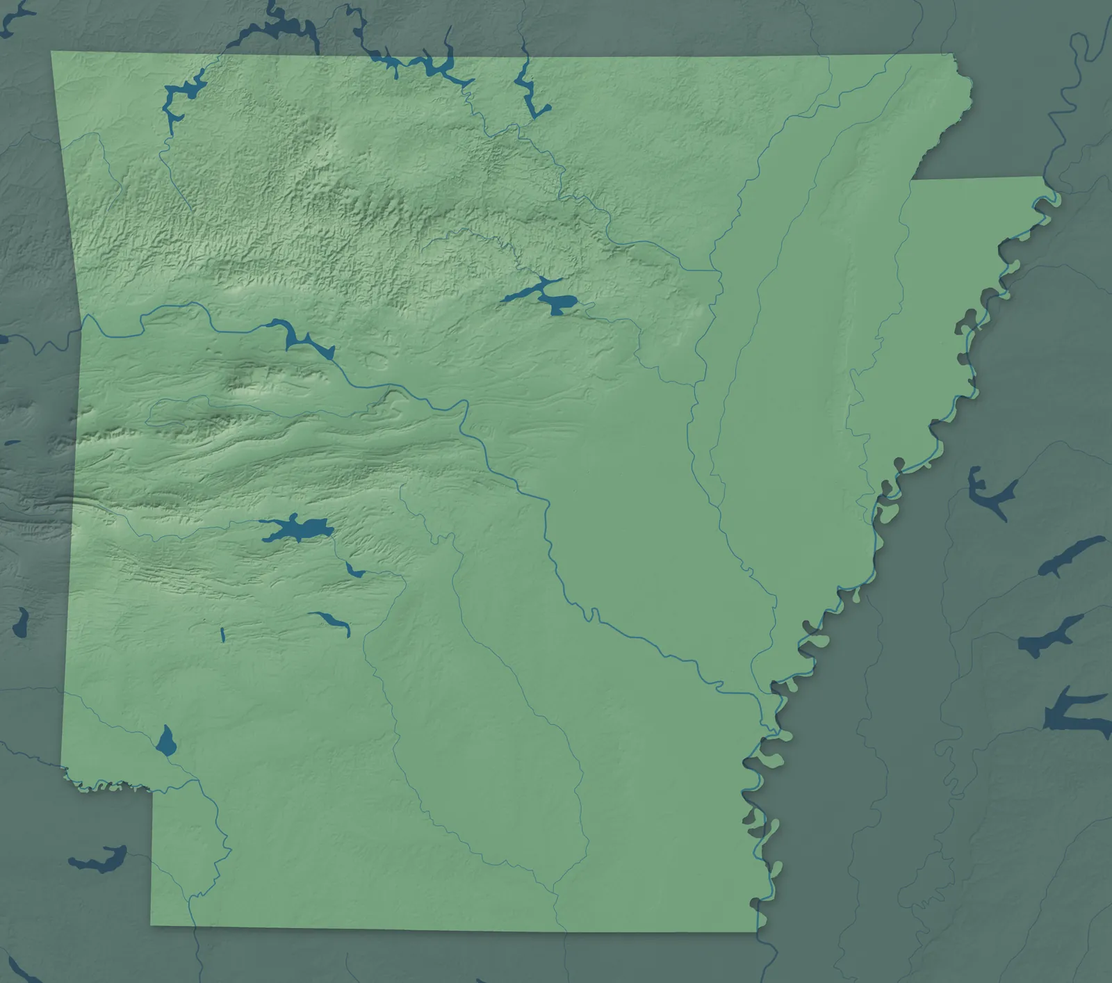
The Arkansas River cuts across the middle of the state, with the Ozark Mountains to the north and the Ouachita Mountains to the south. East of the hills, the flat farmland of the Delta runs to the Mississippi River, and pine forests cover much of the south. Arkansas became the 25th state in 1836, and in 1881 its legislature settled how to say the name: Ar-kan-saw.
Little Rock and the cities of Northwest Arkansas are the biggest population centers, but most towns here began small, as river landings, railroad stops, county seats, sawmill towns and farm towns. Arkansas grows more rice than any other state, close to half of the country's crop.
- Statehood
- June 15, 1836
- Capital
- Little Rock
- Population
- 3,114,7912025 Census estimate
- Highest point
- Mount Magazine, 2,753 feet
- Lowest point
- Ouachita River at the Louisiana border, 55 feet
- Size
- 53,179 square miles, the 29th largest state
Northwest Arkansas
Fayetteville, Springdale, Rogers and Bentonville have grown into one long string of cities on the western edge of the Ozarks, and people here just call it NWA. The University of Arkansas was founded in Fayetteville in 1871. Sam Walton opened his five-and-dime on the Bentonville square in 1950, and the old store is now the Walmart Museum. Out past the cities are smaller towns like Siloam Springs, Pea Ridge and Huntsville.


The Ozarks
East of Northwest Arkansas, the Ozarks are steep, wooded hills cut by clear rivers and big lakes, with Harrison, Mountain Home, Batesville and Heber Springs among the main towns. The Buffalo River became the country's first national river in 1972. Eureka Springs was founded in 1879 by people who believed its spring water could heal, and its Victorian streets still wind up the hillsides. In Mountain View, musicians gather on the courthouse square to play folk music.


Fort Smith and the River Valley
Between the Ozarks and the Ouachitas, the Arkansas River runs through a broad valley past Fort Smith, Van Buren, Clarksville, Russellville and Morrilton. Fort Smith began as an Army post in 1817, on a bluff where the Poteau River meets the Arkansas. Swiss and German immigrants settled around Altus, and family wineries they started, like Wiederkehr in 1880, still make wine there. Near Morrilton, Petit Jean became Arkansas's first state park in 1923.


Little Rock and Central Arkansas
Little Rock sits where the hills, the Delta and the southern plains meet, with North Little Rock, Conway, Benton, Cabot and Searcy around it. The city is named for a small rock ledge on the south bank of the Arkansas River, which French travelers called the little rock. Its Old State House, begun in 1833, is the oldest standing state capitol west of the Mississippi. Across the river, North Little Rock's Old Mill appears in the opening credits of Gone with the Wind.


Hot Springs and the Ouachitas
The ridges of the Ouachita Mountains run east to west, which is unusual in North America, and Hot Springs, Malvern, Arkadelphia, Mount Ida and Mena sit in and around them. Congress set aside the hot springs in 1832, forty years before Yellowstone, and the bathhouses of Bathhouse Row still line Central Avenue. Near Murfreesboro, visitors to Crater of Diamonds State Park dig for real diamonds and keep what they find.


The Arkansas Delta
The Delta is flat, rich farmland along the Mississippi, St. Francis and White rivers, with Jonesboro, Paragould, West Memphis, Blytheville, Stuttgart and Helena-West Helena among its towns. Jonesboro sits on Crowley's Ridge, a narrow band of hills that rises above the fields. Johnny Cash grew up in Dyess, a farm colony started in 1934, and his boyhood home there is open to visitors. In Helena, the blues radio show King Biscuit Time first went on the air in 1941.


South Arkansas and the Timberlands
Pine forests cover the rolling hills of the south, around Texarkana, Hope, Magnolia, El Dorado, Camden, Monticello and Pine Bluff. El Dorado grew several times over after oil gushed from a well just west of town in January 1921. In Texarkana, the post office and federal courthouse sits right on the state line, half in Arkansas and half in Texas. Crossett began as the company town of the Crossett Lumber Company, founded in 1899.


- 12 × 18 inPrint $39.99Framed $89.99
- 18 × 24 inPrint $49.99Framed $129.99
- 24 × 36 inPrint $89.99Framed $199.99

Sizes and Prices
Every map comes in three sizes on archival matte paper. Framed prints come in black or white wood.
How each map is made
It starts with the real place
Streets, buildings, terrain and water form the map, drawn the way Arkansas looks today.
Then the details
Local research and an old atlas style give each town its character.
Then it's yours
Look around the map, then pick a print to keep or give.