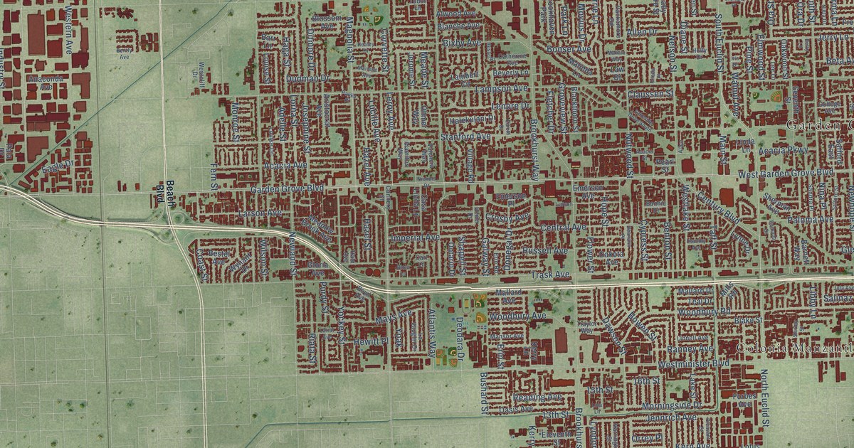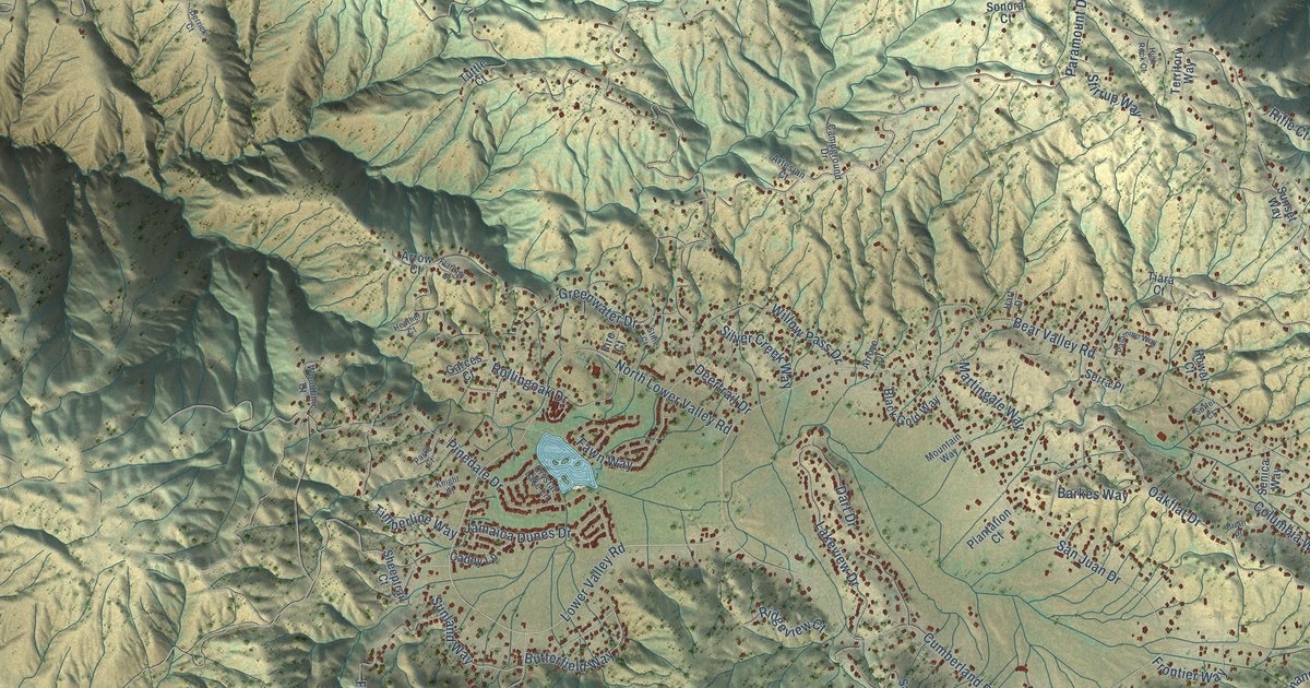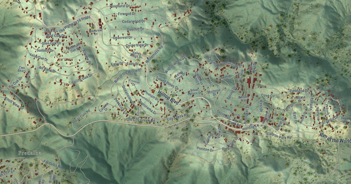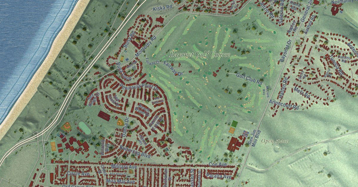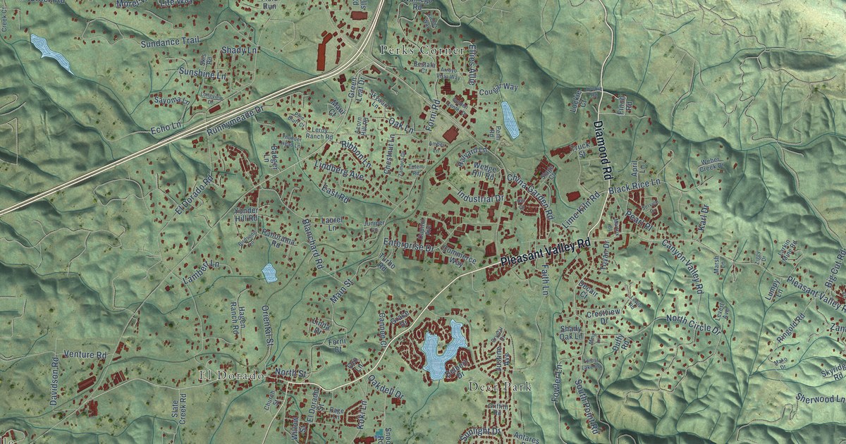
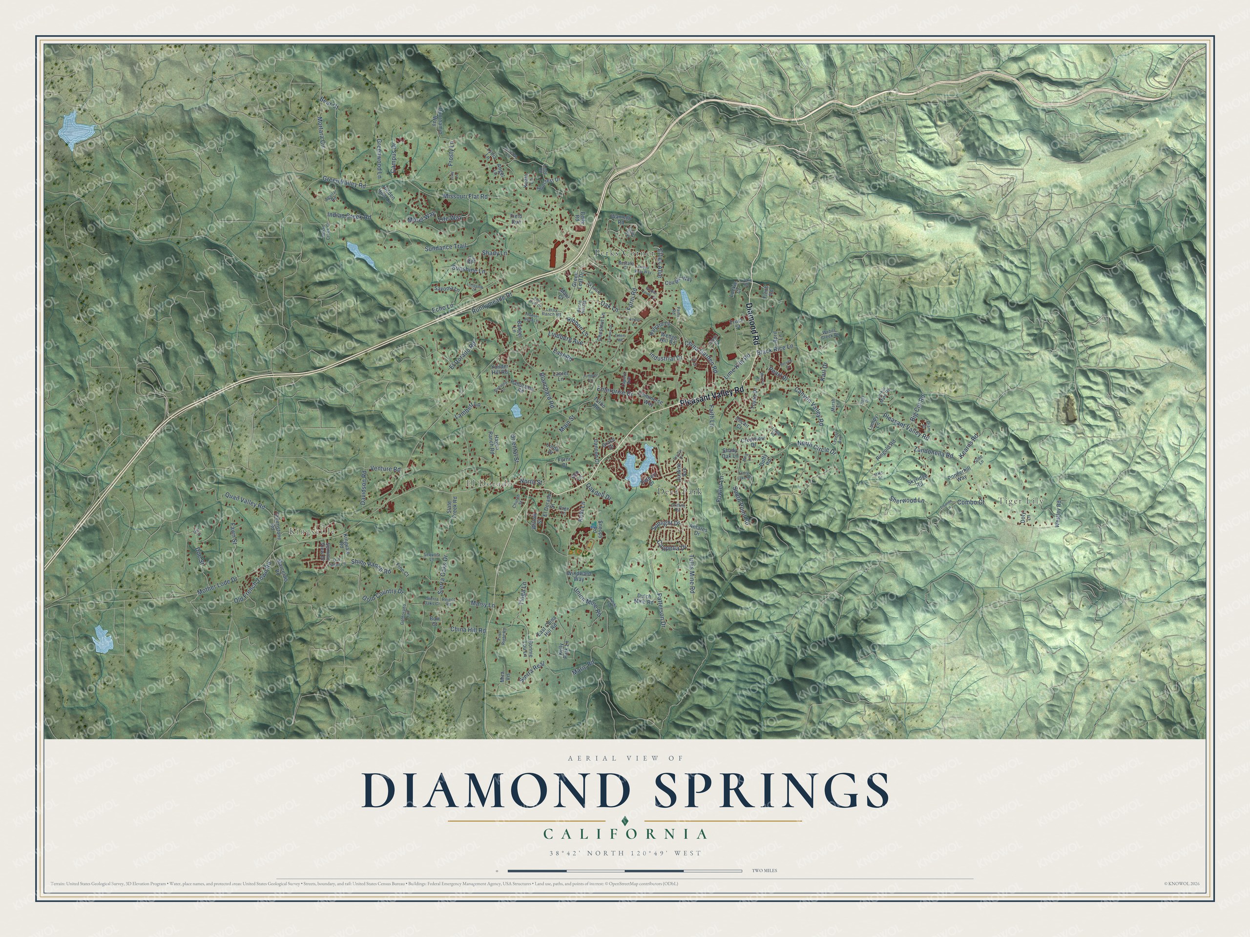
This beautifully detailed map of Diamond Springs, California was created in 2026 using aerial imagery combined with modern topographical, census, street and landmark data. It's a modern aerial view of Diamond Springs in El Dorado County, California, that combines modern data with a vintage aesthetic. The roads feature printed names, and if you look closely you can find your exact house accurately shown in its correct location.
Explore an aerial view of Diamond Springs, California
On this map you'll find Kingsville, Tiger Lily, El Dorado, Deer Park, Perks Corner, Pleasant Valley Road, Diamond Road, Mother Lode Drive, Missouri Flat Road, Fowler Lane, El Dorado Road, Main Street, and more. Each red shape is a building, so zoom in on the preview and look for yours.
Every town has a first chapter, and Diamond Springs is no exception. The record at ohp.parks.ca.gov puts it this way: "This town, settled in 1848, derived its name from its crystal clear springs."
Diamond Springs is a community in El Dorado County. The Census Bureau counted 11,345 people here in 2020.
Take a closer look at the Diamond Springs map
Names on this map
These names are printed on this map.
Places: Kingsville, Tiger Lily, El Dorado, Deer Park and Perks Corner.
Streets and roads: Pleasant Valley Road, Diamond Road, Mother Lode Drive, Missouri Flat Road, Fowler Lane, El Dorado Road, Main Street, Patterson Drive, Green Valley Road, Union Mine Road, Gold Country Drive, Sundance Trail.
More street names, A to Z
Acorn Hill Road, Aguilar Road, Amber Lane, Angel Lane, Antares Drive, April Lane, Arroyo Vista Way, Badger Lane, Bear Court, Bells Road, Bestafa Court, Big Cut Road, Birdsong Lane, Black Rice Lane, Blanchard Road, Bonnie Lou Lane, Bow Court, Campus Drive, Cannon Court, Canyon Valley Road, Capitol Avenue, Cappella Drive, Chestnut Lane, China Garden Road, China Hill Road, Church Street, Combo Court, Commerce Way, Cougar Way, Crestview Drive, Crystal Drive, Davidson Road, Decair Court, Delbert Drive, Diam Drive, Doe Court, Doe Street, Doty Lane, Duffy Road, Dunroamin Way, Dutch Mine Road, East China Hill Road, East Road, Echo Lane, El Dorado Street, Ellies Allie, Enterprise Drive, Faith Lane, Fawn Street, Field Run, Finch Road, Fine Court, First Right Road, Forest Lake Road, Forni Court, Forni Road, Frosty Lane, Glee Lane, Golden Center Drive, Goldorado Trail, Grace Drive, Green Leaf Drive, Greenstone Road, Greenwood Lane, Griffith Road, Hagen Ranch Road, Halyard Lane, Hidden Hills Lane, Hill Drive, Indian Creek Court, Indian Creek Road, Industrial Drive, Jericho Lane, Juniper Lane, Justine Avenue, Karl Drive, Kearns Road, Kelly Park Lane, Kieber Way, Kingvale Road, Koala Lane, Koki Lane, Lambert Lane, Larkin Mine Road, Laurel Lane, Leroy Ranch Road, Levert Avenue, Lewis Road, Life Way, Lime Kiln Road, Linda Drive, Lindberg Avenue, Lisanne Lane, Lockie Court, Lockie Road, Lode Road, Longview Drive, Lumpy Lane, Lydia Lane, Maisy Lane, Mako Drive, Marcelais Road, Maric Road, Marsh Lane, Martrix Court, Maui Court, Ming Lane, Mira Vis, Morel Way, Mortara Circle, North Circle Drive, North Street, Oakdell Drive, Oak Lane, Old French Town Road, Old Timer Lane, Oriental Street, Oro Lane, Page Lane, Panorama Road, Pearl Place, Penn Road, Pine Bluff Court, Ponderhill Way, Quail Valley Road, Reject Road, Ribbon Lane, Ringold Road, Runnymeade Drive, Sayoma Lane, Sequoia Lane, Service Drive, Shady Lane, Shady Oak Lane, Sherwood Lane, Shinn Ranch Road, Sierra Oaks Court, Sierra Oaks Drive, Sierra Real, Skis Road, Skyridge Road, Skyward Lane, Slate Creek Road, Snoopy Road, South Point Road, Stage Court, Summit View Drive, Suncrest Drive, Sunlight Drive, Sunshine Lane, Thunder Head Lane, Tioga Lane, Totem Road, Toyan Drive, Treeko Trail, Truck Street, Tullis Mine Road, Turbo Road, Venture Road, Vista Lane, Wamego Road, Weber Creek Drive, Wedge Hill Road, Westley Road, Willow Street, Windward Way, Yonder Hill Road, Zamora Drive, Zandonella Road, Ziggy Drive.
Created by KNOWOL in 2026. The buildings are small red shapes, the roads carry their printed names, and shaded relief shows the shape of the land. The title panel reads "AERIAL VIEW OF DIAMOND SPRINGS CALIFORNIA" with 38°42' NORTH 120°49' WEST.
Hang it in the hallway, the office or the cabin, or give it to someone who left Diamond Springs and still calls it home. Open the preview and look for a street you know. See sizes and frames for the Diamond Springs map.