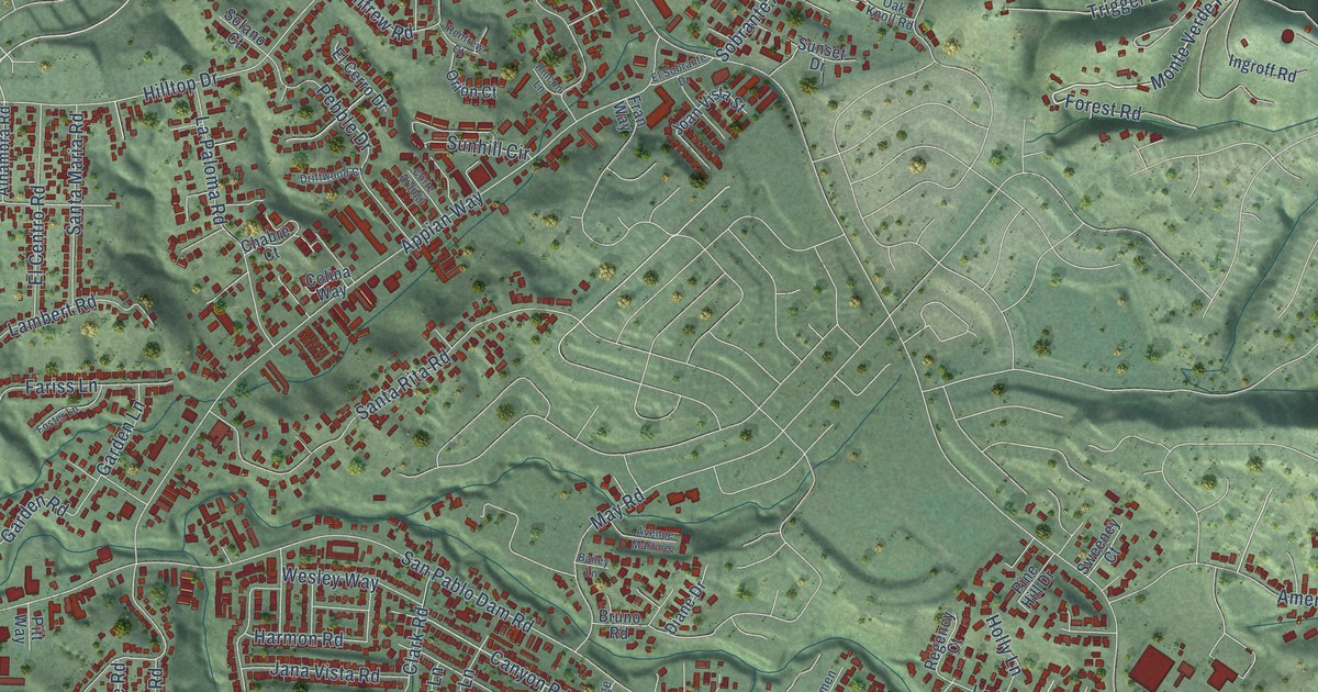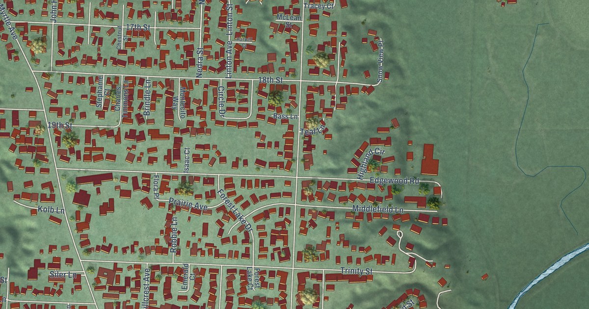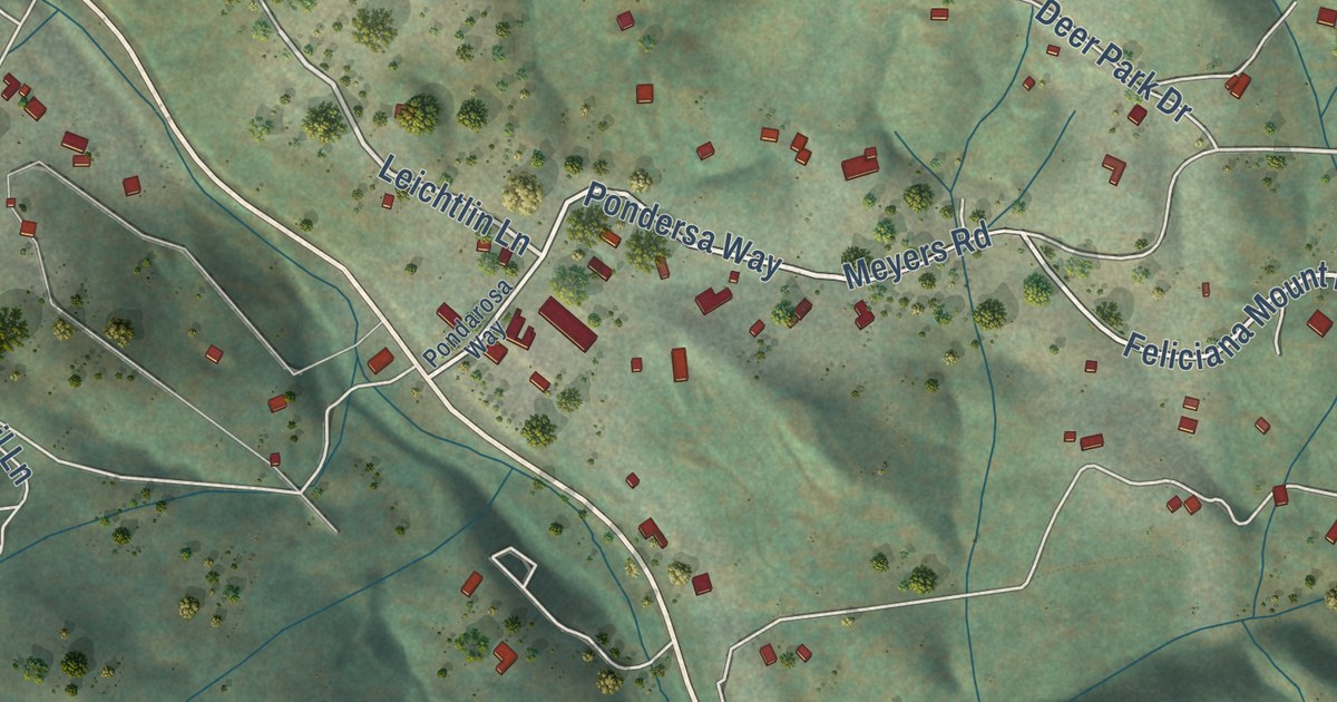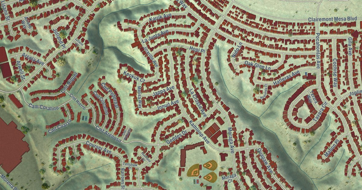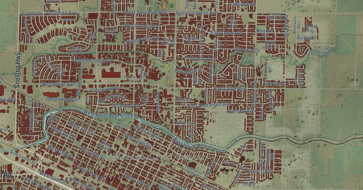
This beautifully detailed map of Merced, California was created in 2026 using aerial imagery combined with modern topographical, census, street and landmark data. It’s a one-of-a-kind view of Merced that combines accurate data with a vintage aesthetic. The map shows every building in its true location, many of the roads carry their names, and the shaded topographic relief shows the shape of the land.
Explore an aerial view of Merced, California
On the map you’ll find Merced Civic Center and Kadota, along with East State Highway 140, McSwain Road, Yosemite Parkway, Snelling Highway, West Childs Avenue, North Gardner Avenue, East Cardella Road, Cardella Road, South West Avenue, North West Avenue, and more. If you look closely you can even find your house accurately drawn in its correct location. Zoom in on the preview to look for yours.
Did you know this piece of Merced, California history?
From the Yosemite Online Library: "Merced came into existence on February 8, 1872, when a subsidiary corporation of the Central Pacific Railroad auctioned off building lots."
Take a closer look at the Merced map
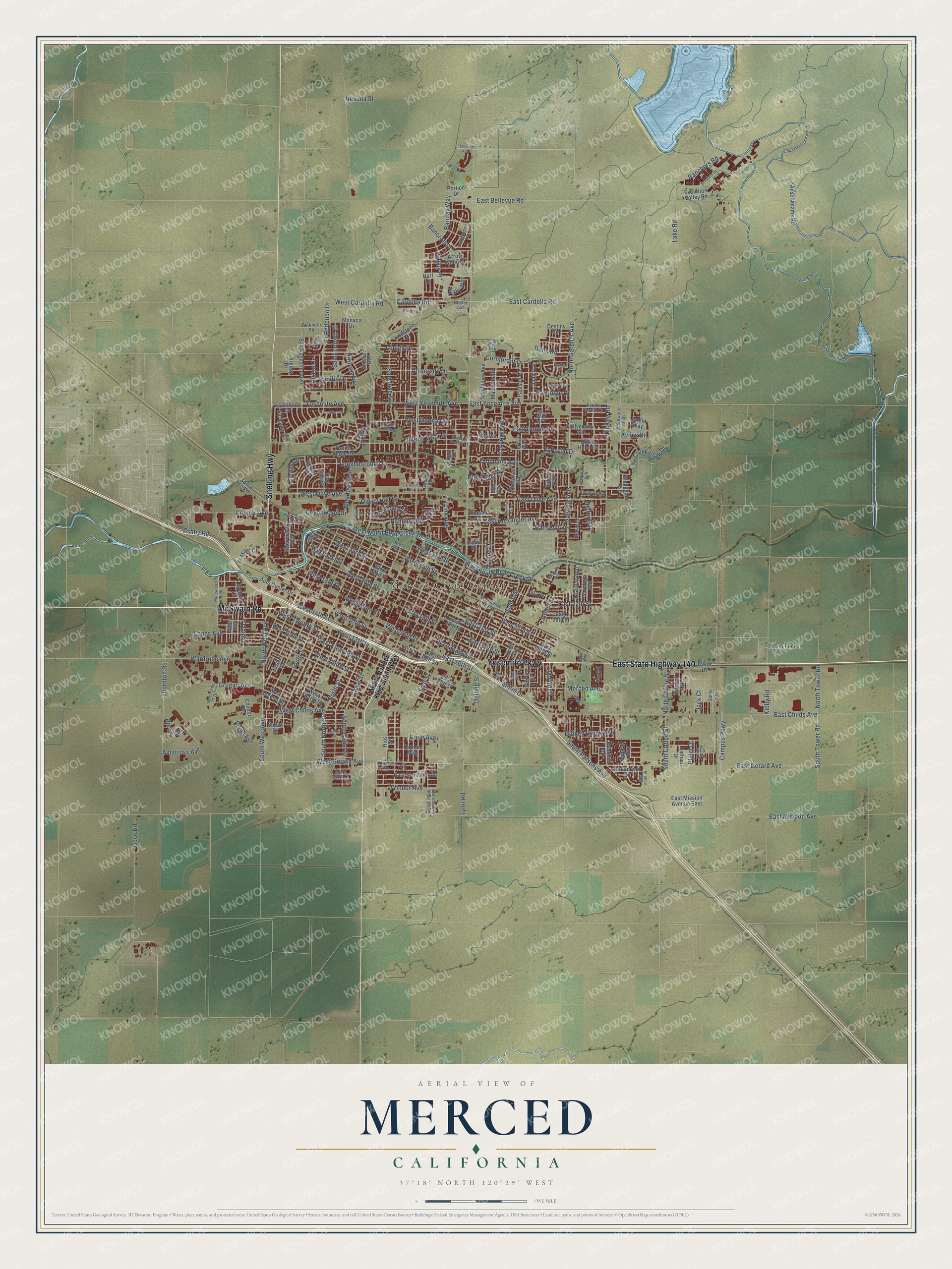
Street and place names on the Merced, California map
These names are printed on the map of Merced, California.
Places: Merced Civic Center and Kadota.
Streets and roads: East State Highway 140, McSwain Road, Yosemite Parkway, Snelling Highway, West Childs Avenue, North Gardner Avenue, East Cardella Road, Cardella Road, South West Avenue, North West Avenue, West Gerard Avenue, East Gerard Avenue.
More street names, A to Z
Albatross Avenue, Alfarata Boulevard, Alpine Drive, Alviso Drive, Amy Street, Andover Way, Ansel Adams Road, Argosy Drive, Arrow Wood Drive, Ashby Road, Austin Avenue, Auto Center Drive, Aviles Drive, Baker Drive, Ballantyne Drive, Bancroft Drive, Barclay Way, Bedford Drive, Bismark Drive, Bixby Way, Blix Avenue, Branco Avenue, Brimmer Road, Brookdale Drive, Buena Vista Drive, Campus Parkway, Canal Street, Carmen Way, Carol Avenue, Cassis Drive, Catalina Drive, Centro, Cherokee Avenue, Cheyenne Drive, Citadel Avenue, Collins Drive, Colony Lane, Columbia Avenue, Condor Drive, Cone Avenue, Cooper Avenue, Cordova Avenue, Cormorant Drive, Creekview Drive, Daffodil Drive, Delong Street, Destiny Drive, Devonwood Drive, Dinkey Creek Avenue, Dublin Avenue, Dunn Road, East 13th Street, East 15th Street, East 16th Street, East 19th Street, East 20th Street, East 21st Street, East 22nd Street, East 23rd Street, East 26th Street, East 27th Street, East Alexander Avenue, East Bellevue Road, East Childs Avenue, East Donna Drive, East Main Street, East Mission Avenue, East Mission Avenue East, East Olive Avenue, East San Pedro Street, East Santa Fe Avenue, East South Bear Creek Drive, East Street, East Yosemite Avenue, El Portal Drive, El Redondo Drive, El Verano Way, Emerald Drive, Emory Way, Erie Avenue, Esplanade Drive, Evolution Valley Road, Fairfield Drive, Farmland Avenue, Favier Drive, Gail Court, Glen Avenue, Gove Road, Green Street, Grogan Avenue, Hansen Avenue, Hart Drive, Heron Way, Horizon Avenue, Hunters Drive, Hutchinson Lane, Ironstone Drive, Jack Court, Jackson Avenue, Jardin Way, Jenner Drive, Joerg Avenue, John Street, June Court, Kelly Avenue, Kibby Road, Kimberly Avenue, La Jolla Way, Lake Road, La Mirada Drive, Lehigh Drive, Lesher Drive, Linda Lane, Line Drive, Lopes Avenue, Loughborough Drive, Macready Drive, Madroan Avenue, Mansionette Drive, Marie Lane, Martin Luther King Junior Way, Massasso Street, McKee Road, Meadows Avenue, Merced Avenue, Mercy Avenue, Miles Court, Monaco Drive, Motel Drive, Nevada Street, North Coffee Street, North Street, North Tower Road, Northwood Drive, Oleander Avenue, Olivewood Drive, Pacific Drive, Park Avenue, Parsons Avenue, Partridge Drive, Paseo Verde Avenue, Paseo Verde Drive, Paulson Road, Pebble Beach Drive, Pettinotti Road, Phelps Drive, Pine Street, Pluim Drive, Portico Drive, Quail Avenue, Rambler Road, Ranchers Road, Riggs Avenue, Rios Street, Robin Hood Lane, Rose Avenue, Sable Street, Saint Tropez Court, San Augustine Avenue, Sandpiper Avenue, San Jose Avenue, Santa Clara Court, Santa Fe Road, Sarasota Avenue, Saratoga Avenue, Scholars Lane, Shafer Avenue, Shirley Street, Sibley Place, Silverado Avenue, Solstice Avenue, South Canal Street, South Coffee Street, South Mather Road South, South North Street, South Parsons Avenue, South Street, South Tower Road, Stonybrook Avenue, Stuart Drive, Sunset Drive, Sydney Lane, Tahoe Drive, Thornton Road, Tyler Road, Union Avenue, University Drive, Vernal Avenue, Villa Drive, Wardrobe Avenue, West 13th Street, West 14th Street, West 15th Street, West 16th Street, West 18th Street, West 19th Street, West 20th Street, West 21st Street, West 22nd Street, West 23rd Street, West 25th Street, West 26th Street, West 27th Street, West Cardella Road, West Donna Drive, West Eleventh Street, West El Portal Drive, West Fourth Street, West Main Street, West Ninth Street, West North Bear Creek Drive, West Olive Avenue, West Second Street, West Street, West Tenth Street, West Twelfth Street, West Yosemite Avenue, Whitewater Way, Winder Avenue, Wooddale Avenue, Yosemite Avenue.
See the Merced, California map on a wall
The Merced map as an 18 x 24 inch print in a black frame.

This beautifully detailed map of Merced makes an attractive addition to your office, library, or den, and it can even be used to teach children the geography and history of the area. It also makes a great gift for anyone who grew up in Merced or moved away. When you’re done exploring, click here to get your copy of the Merced map.