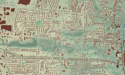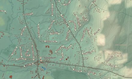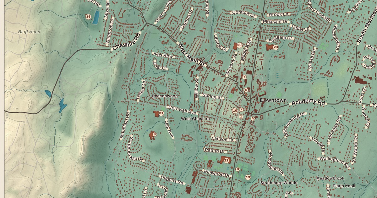
If you grew up in Cheshire, or you’ve ever biked the Farmington Canal trail through town, you’ll find your town on this map just as it stands in 2026. Look for your road. West Johnson Avenue, Reinhard Road, Waterbury Road, Huckins Road, Blacks Road, Highland Avenue, West Main Street, Main Street, South Main Street, Academy Road, Wallingford Road, North Brooksvale Road, South Brooksvale Road and Bethany Mountain Road are all printed by name, along with many more.
Cheshire is in New Haven County, Connecticut.
KNOWOL made this map in 2026 from public survey data, and gave it the look of an old atlas. The shaded hills, from Mountaincrest across to Brooksvale and Mixville, come from United States Geological Survey elevation data, and the streets and the town line come from the Census Bureau. Cheshire, West Cheshire, Mixville, Brooksvale, Ives Corner, Richards Corner and Mountaincrest are all printed by name. A guide of 34 numbered landmarks runs along the bottom, with the National Register sites marked, and we checked those against National Park Service records.
New Cheshire Parish
Cheshire was first settled in 1694 as part of Wallingford. Early on it was known as North Farms, and the parish here was called New Cheshire Parish. After many tries at breaking away from Wallingford, it was incorporated as its own town in May 1780, and the title panel on the map prints the year: Incorporated 1780. The name was carried over from Cheshire in England. The town once reached farther west, too, and Prospect was part of Cheshire until 1829.
For most of its history Cheshire was a farming town, with saw and grist mills for local needs. In the middle of the 1800s it had a short run of copper and barite mining. After World War II it grew into a suburb, but it kept much of its farm country, and its lively farm business has earned it the name Bedding Plant Capital of Connecticut. Click here to learn more about the history of Cheshire.
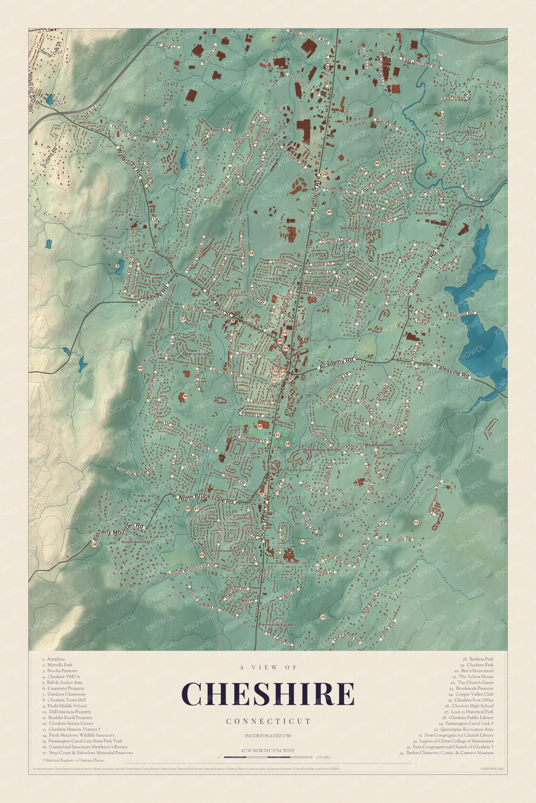
Click to explore a larger preview. The digital watermark does not appear on printed maps.
Names on this map
These names are printed on this map.
Places: Mountaincrest, Fernwood Estates, Ball & Socket Arts, Bartlem Park, Boulder Knoll Property, Briar Court & Salvadore Memorial Preserves, Brooke Preserve, Brooksvale Preserve, Carmichael Sanctuary-Nettleton's Ravine, Casertano Property, Cheshire High School, Cheshire Historic District, Cheshire Park, Cheshire Public Library, Cheshire Reservoir, Cheshire Senior Center, Cheshire Town Hall, Copper Valley Club, DeDominicis Property, Dodd Middle School, East Wallingford, Farmington Canal Line State Park Trail, Farmington Canal Lock, Fox Hollow, Fresh Meadows Wildlife Sanctuary, Honeypot Glen, Ives Corner, Lock 12 Historical Park, Mixville Park, Outdoor Classroom, Pine Brook, Platts Knoll, Quinnipiac Recreation Area, Richards Corner, Strathmore Woods, The Church Green, The Yellow House, West Cheshire and Wolf Hill.
Streets and roads: Oak Dr, Village Rd, Vista Ter, Creamery Rd, E Johnson Ave, Knobhill Rd, Highland Ave, Allen Ave, Brook Ln, Reservoir Rd, Walter Dr, Boulder Ave.
More street names, A to Z
Fenn Rd, Hollow Rd, Main St.
The Town Center and the Church Green
The cluster of numbers along Main Street is the old center of town, which grew up around the site of the first meetinghouse. The guide marks it as the Cheshire Historic District (13), listed on the National Register of Historic Places in 1986. It covers about 35 acres along Main Street and Wallingford Road, with many houses built before 1850, three churches and the town hall of 1867, a late example of the Greek Revival style.
The First Congregational Church of Cheshire (33) stands on the site of that first meetinghouse. It was built in 1827 to a design by David Hoadley, with four fluted columns across the front and a steeple above a clock tower. It’s one of six Connecticut churches built to nearly the same design, along with churches in Old Lyme, Milford, Litchfield, Southington and Guilford. A surviving piece of the old town green lies between the church and Route 10. The church cares for it now, and the guide calls it The Church Green (22). The First Congregational Church Library (31) is numbered here too. Cheshire Town Hall (8) is across Route 10 from the church, and the Cheshire Public Library (28) and the Cheshire Senior Center (12) are close by.
Cheshire Academy is in the center of town as well. Samuel Seabury, the first Episcopal bishop of Connecticut, founded it in 1794 as the Episcopal Academy of Connecticut. Its Bowden Hall, put up in 1796, is the oldest schoolhouse in the state still in use.
The Button Shop
Ball & Socket Arts (5), west of the center, is in the old button factory. The Cheshire Manufacturing Company was founded on April 11, 1850 to make “buttons of every description.” It made its name with fancy glass buttons called Cheshire Jewels, which collectors prize today. In 1901 it merged with the Ball & Socket Fastener Company of New Hampshire. A ball and socket is what we’d now call a snap. The company became one of the world’s largest makers of metal buttons, and its buttons were worn on uniforms from the Civil War to World War II.
For many years it was the biggest employer in town, and many women found their first jobs there. People in Cheshire used to say that “sooner or later, everyone works at the Button Shop.” The factory closed in 1994 after 144 years, and in 2014 Ball & Socket Arts bought the property, with its 1889 main factory building and its 1914 front office.
The Farmington Canal and Lock 12
The Farmington Canal was dug through Cheshire in the 1820s, on its way from New Haven to Northampton, Massachusetts. It had 28 locks in Connecticut. The canal lost money, and in 1848 a railroad began running along its path, right beside the spot where the button company would be founded two years later. Today the old line is the Farmington Canal Line State Park Trail (15), a trail without motor traffic that runs from New Haven north to Suffield.
Lock 12 is out on North Brooksvale Road, near Brooksvale. It started as a wood lined lock and was rebuilt in stone, and it survives mostly whole, along with its lock house. The guide gives it two numbers. The Farmington Canal Lock (29) is its National Register name, from 1973, and Lock 12 Historical Park (27) is the name it took when it was restored in 1980, with a bridge and rebuilt gates. The Brooksvale Preserve (23) is nearby.
Parks, Schools and the Rest of the Guide
Cheshire Park (19) is a 75 acre park in the north of town, and the Barker Character, Comic, & Cartoon Museum (34) is up that way too, full of lunch boxes, Pez dispensers and other keepsakes of cartoon and comic book characters. Bartlem Park (18) has a playscape and a skate park. Mixville Park (2), at Mixville in the west, has sledding in winter and swimming and fishing at Mixville Pond in summer. The Quinnipiac Recreation Area (30) is in the northeast, and Artsplace (1) is in the northwest.
Cheshire High School (26) and The Yellow House (21) are a little southwest of the center, near Bartlem Park, and Dodd Middle School (9) is north of it. The Legion of Christ College of Humanities (32), where the Legion of Christ trains young men for the priesthood, and the Cheshire YMCA (4) are in the southwest. The Cheshire Post Office (25) and the Copper Valley Club (24) are in the guide as well. The rest of the guide is open land: the Brooke Preserve (3), the Casertano Property (6), the Outdoor Classroom (7), the DeDominicis Property (10), the Boulder Knoll Property (11), the Fresh Meadows Wildlife Sanctuary (14), the Carmichael Sanctuary at Nettleton’s Ravine (16), the Briar Court and Salvadore Memorial Preserves (17) and Ben’s Homestead (20).
This map of Cheshire makes a handsome addition to a living room, office, library or den, and it can even help teach children the geography and history of the town. It’s a thoughtful gift for anyone who calls Cheshire home, grew up here, or moved away. Created by KNOWOL in 2026, it’s printed on museum quality archival paper in three sizes. Zoom in on the preview above to explore the details, then click here to get your copy of the Cheshire map.

Sources