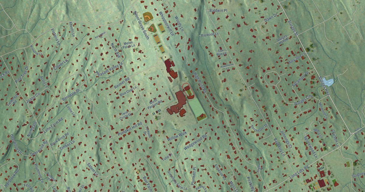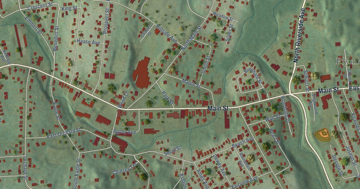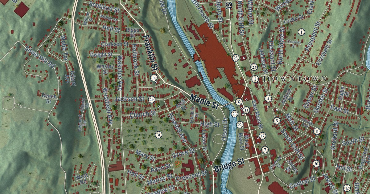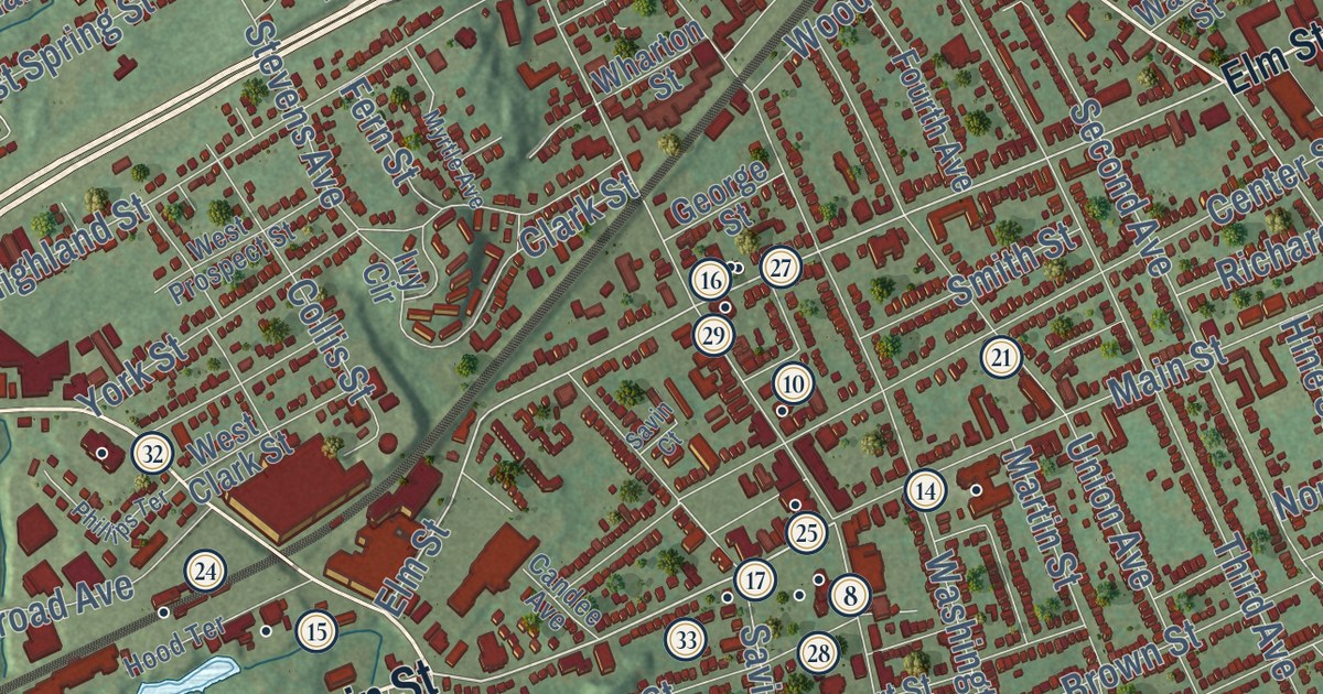
This beautifully detailed map of West Haven, Connecticut was created in 2026 using aerial imagery combined with modern topographical, census, street and landmark data. It’s a one-of-a-kind view of West Haven that combines accurate data with a vintage aesthetic. The map shows every building in its true location, many of the roads carry their names, and the shaded topographic relief shows the shape of the land.
See it on a wall
The West Haven map as an 18 x 24 inch print in a black frame.

Explore an aerial view of West Haven, Connecticut
On the map you’ll find Downtown, West Shore, Allingtown, Allington Hill, Bradley Point, Jones Hill, Edgewood Park Pond, Horseshoe Lagoon, Morse Park, Painter Park, Saint Lawrence Cemetery, Savin Rock, and more. If you look closely you can even find your house accurately drawn in its correct location. Zoom in on the preview to look for yours. Click here to learn more about the history of West Haven.
Take a closer look at the West Haven map
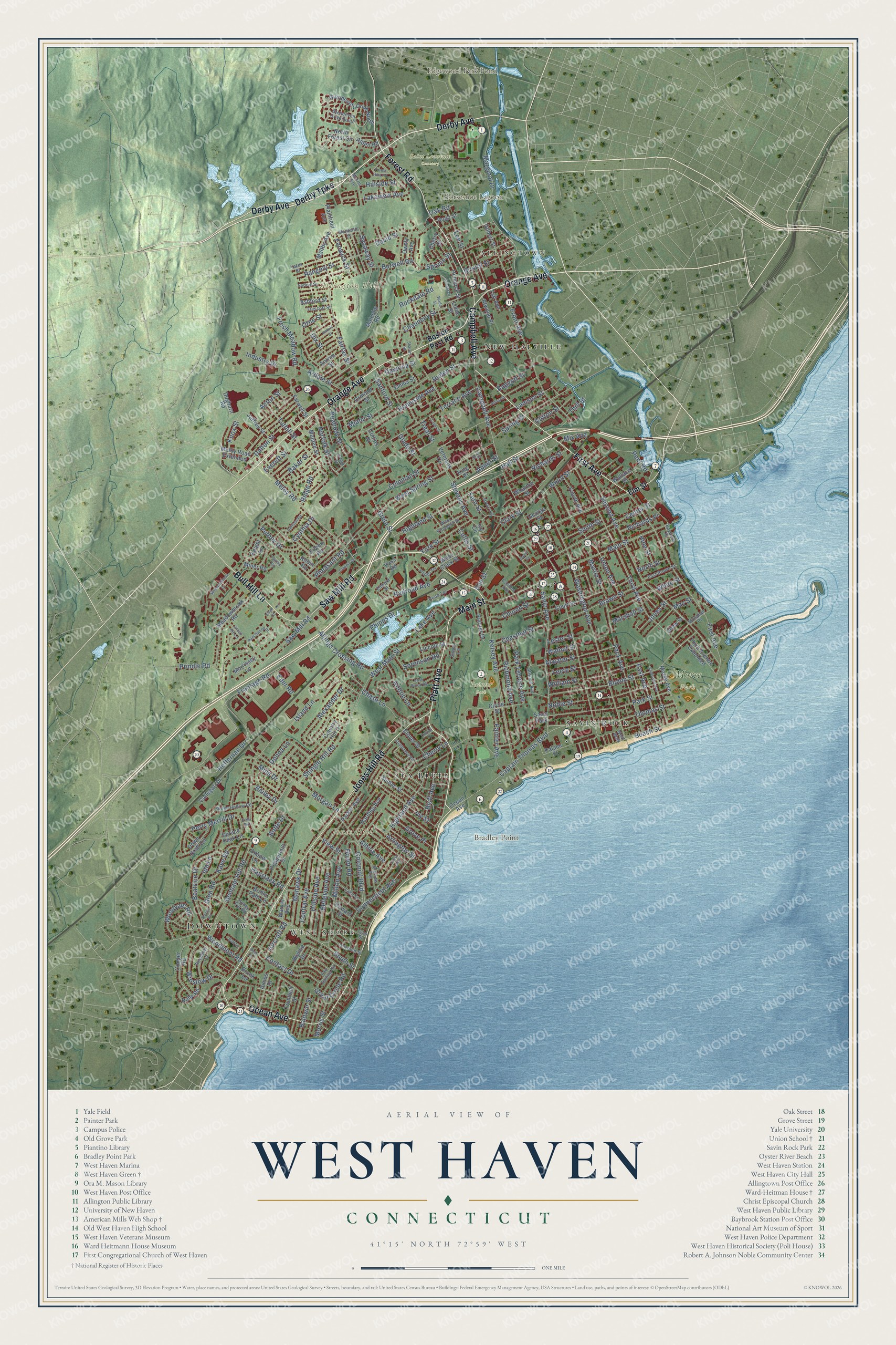
Click to explore a larger preview. The digital watermark does not appear on printed maps.
Names on this map
These names are printed on this map.
Places: Downtown, West Shore, Allingtown, Allington Hill, Bradley Point, Jones Hill, Edgewood Park Pond, Horseshoe Lagoon, Morse Park, Painter Park, Saint Lawrence Cemetery, Savin Rock, New Halville, Sea Bluff and Savin Park.
Streets and roads: Derby Avenue, Main Street, Platt Avenue, Saw Mill Road, Orange Avenue, First Avenue, Ocean Avenue, Jones Hill Road, Forest Road, Derby Turnpike, Bull Hill Lane, Campbell Avenue.
More street names, A to Z
Abner Street, Acton Street, Aimes Drive, Aircraft Road, Albion Avenue, Alden Road, Alexander Drive, Allings Crossing Road, Alling Street, Anderson Avenue, Antrim Street, Ardale Street, Arlington Street, Ashford Street, Atwater Street, Atwood Avenue, Atwood Place, Baggott Street, Bailey Drive, Baker Street, Baldwin Street, Batt Lane, Bayview Place, Beach Street, Beatrice Drive, Belle Circle, Bellevue Avenue, Benham Hill Road, Blohm Street, Bluff Avenue, Boston Post Road, Botte Drive, Bridle Path Lane, Bristol Street, Brook Lane, Brown Street, Burwell Road, Callegari Drive, Candee Avenue, Captain Thomas Boulevard, Carlson Road, Carroll Street, Center Street, Central Avenue, Chase Lane, Chauncey Street, Cherry Lane, Cherry Street, Chestnut Street, Chew Street, Church Street, Circle Street, Clark Street, Claudia Drive, Clifton Street, Clover Street, Coleman Street, Collins Drive, Collis Street, Colonial Boulevard, Connecticut Avenue, Contact Drive, Cooper Road, Country Hill Drive, Court Street, Cove Brook Road, Crest Avenue, Crest Street, Cynthia Drive, Dalton Street, Daniel Road, David Street, Daytona Street, Dix Street, Dogburn Road, Donna Lane, Down Draft Circle, East Avenue, East Brown Street, Eder Road, Edward Street, Eileen Road, Ellyn Court, Elm Street, Ely Street, Emma Street, Everett Street, Fairfax Street, Fairlea Road, Fair Sailing Road, Farwell Street, Fenwick Street, Fern Street, Forest Hills Road, Fourth Avenue, Fresh Meadow Road, Frontage Road, Front Avenue, George Street, Gilbert Street, Glade Street, Glendevon Drive North, Glendevon Drive South, Glen Road, Great Circle Road, Green Hill Lane, Greta Street, Grove Place, Hall Street, Harding Avenue, Harold Street, Haystack Road, Heffernan Drive, Hemlock Street, Highland Avenue, Highland Street, Hillside Avenue, Hillside Street, Hilltop Lane, Hine Street, Homeside Avenue, Honey Pot Road, Honor Road, Hood Terrace, Howard Street, Hugo Street, Ida Lane, Industry Drive, Island Lane, Ivy Circle, Ivy Street, Jaffrey Street, Jones Street, Kaye Road, Kelsey Avenue, King Place, Knight Lane, Knox Street, Lake Avenue, Lake Street, Lakeview Avenue, Lamson Street, Lee Street, Leete Street, Lester Street, Lincoln Street, Linde Street, Linwood Street, Malcolm Road, Malden Street, Maltby Avenue, Marginal Drive, Marshall Street, Martin Street, May Street, Meadowbrook Court, Meadowbrook Road, Meloy Road, Meloy Road Extended, Miami Street, Mills Drive, Milton Avenue, Miner Road, Mix Avenue, Mohawk Drive, Monahan Place, Monteith Street, Morgan Lane, Morris Avenue, Morrissey Lane, Morris Street, Morse Avenue, Myrtle Avenue, Noble Street, Norfolk Street, North Forest Circle, North Street, Norwell Street, Oak Road, Orford Street, Ormond Street, Orne Street, Ownly Avenue, Oxbow Lane, Painter Avenue, Painter Drive, Palace Street, Parker Avenue, Park Street, Park Terrace Avenue, Peabody Street, Peck Avenue, Pent Road, Peppermill Drive, Perry Merrill Drive, Pheasant Road, Phillips Terrace, Phipps Drive, Plainfield Avenue, Prindle Road, Putney Drive, Railroad Avenue, Ranchwood Drive, Rangely Street, Richards Place, Richards Street, Richmond Avenue, Ridge Hollow Road, Ridge Road, Robin Road, Rochdale Terrace, Rockdale Road, Ruby Road, Ruden Street, Sanford Street, Savin Avenue, Savin Court, Seaview Avenue, Second Avenue, Sharon Street, Shingle Hill Road, Simos Lane, Skyline Drive, Smith Street, Sorenson Road, South Street, Spring Street, Spruce Peak Lane, Spruce Street, Stevens Avenue, Strathmore Road, Sumac Street, Sunset Drive, Sycaway Street, Taft Avenue, Terrace Avenue, Thill Street, Third Avenue, Third Avenue Extended, Thomas Street, Toll Road, Treat Street, Trescott Street, Trumbull Street, Tuthill Street, Tyler Street, Union Avenue, Veterans Circle, View Street, Voss Road, Wade Street, Wallace Street, Walnut Street, Warner Avenue, Washington Avenue, West Clark Street, West Main Street, West Prospect Street, West Spring Street, West Walk, Wharton Street, White Street, William Street, Winslow Drive, Woodmont Road, Wood Street, Woodvale Road, Yates Street, York Street.
This beautifully detailed map of West Haven makes an attractive addition to your office, library, or den, and it can even be used to teach children the geography and history of the area. It also makes a great gift for anyone with West Haven roots. When you’re done exploring, click here to get your copy of the West Haven map.