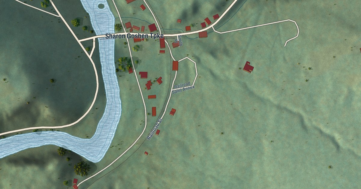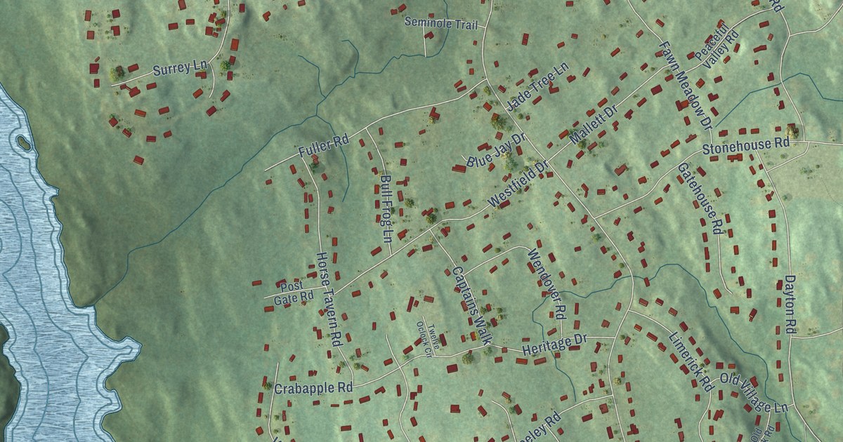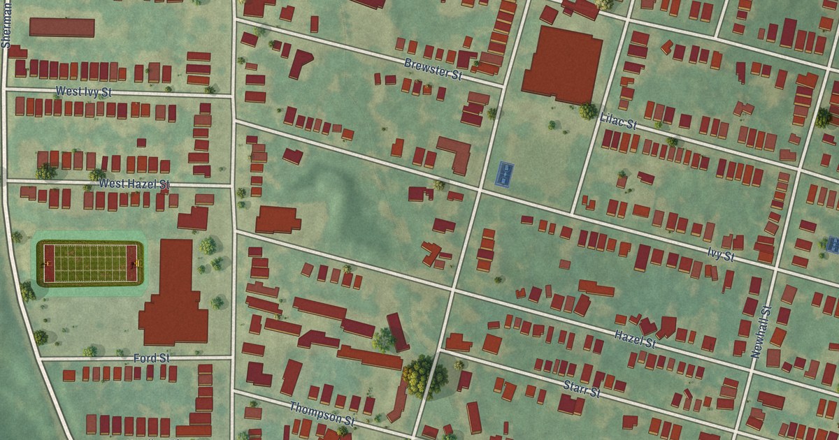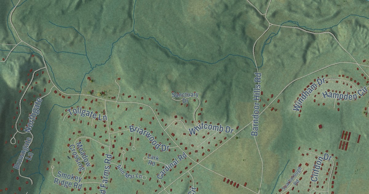
This beautifully detailed map of Simsbury, Connecticut was created in 2026 using aerial imagery combined with modern topographical, census, street and landmark data. It’s a one-of-a-kind view of Simsbury that combines accurate data with a vintage aesthetic. The map shows every building in its true location, many of the roads carry their names, and the shaded topographic relief shows the shape of the land.
See it on a wall
The Simsbury map as an 18 x 24 inch print in a black frame.

Explore an aerial view of Simsbury, Connecticut
On the map you’ll find Downtown, Tariffville, Crowleys Corner, Hoskins, Bushy Hill, Grant Hill, Holcomb Island, Horseshoe Cove, Cold Spring Reservoir, Ensign Bickford Pond, Curtiss Park, Massacoe State Forest, and more. If you look closely you can even find your house accurately drawn in its correct location. Zoom in on the preview to look for yours. Click here to learn more about the history of Simsbury.
Take a closer look at the Simsbury map
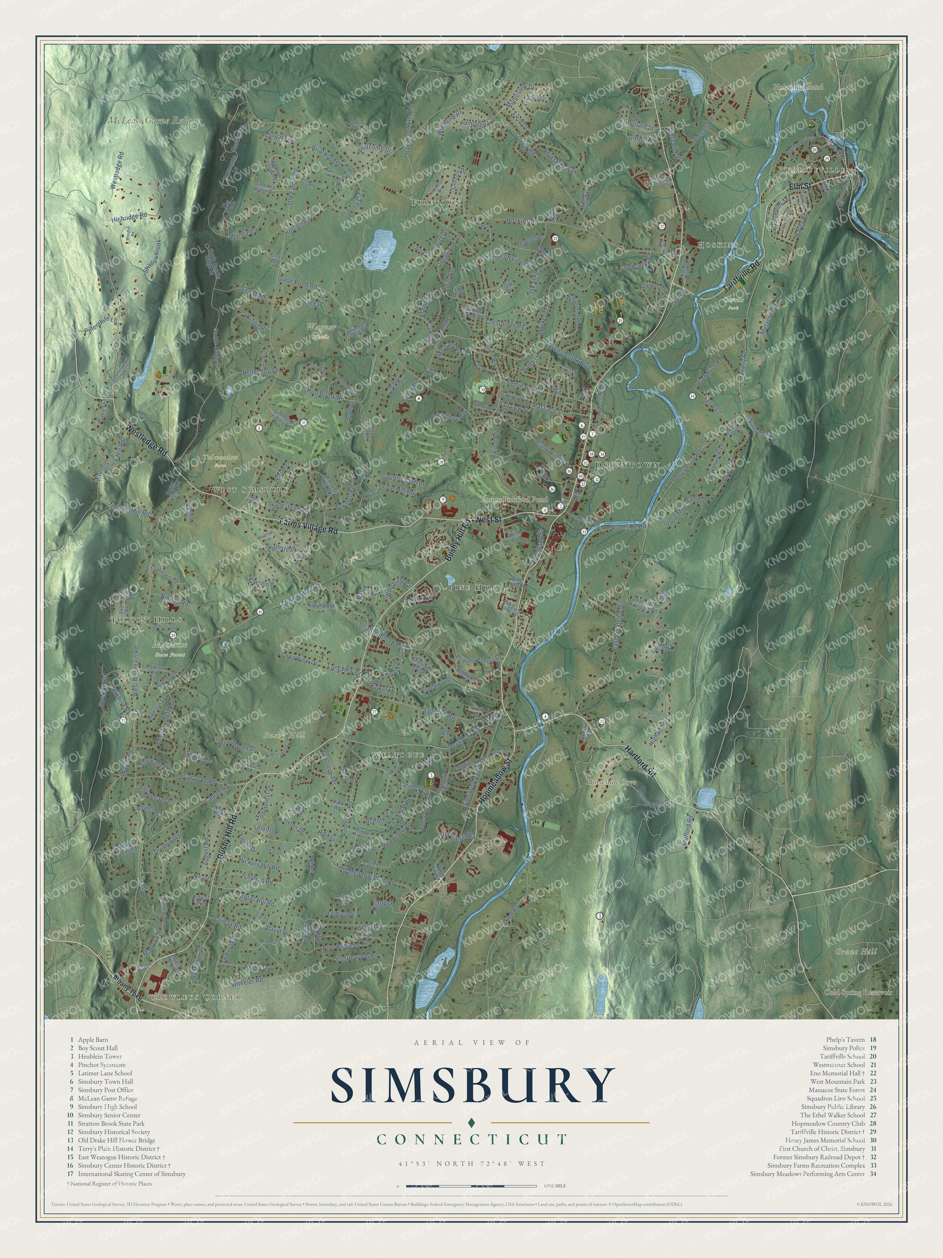
Click to explore a larger preview. The digital watermark does not appear on printed maps.
Names on this map
These names are printed on this map.
Places: Downtown, Tariffville, Crowleys Corner, Hoskins, Bushy Hill, Grant Hill, Holcomb Island, Horseshoe Cove, Cold Spring Reservoir, Ensign Bickford Pond, Curtiss Park, Massacoe State Forest, McLean Game Refuge, Tulmeadow Farm, Wagner Woods, Firetown, Pine Hill, Weatogue, West Simsbury and Tootin' Hills.
Streets and roads: Hopmeadow Street, Bushy Hill Road, Farms Village Road, Hartford Road, Tariffville Road, Westledge Road, West Street, Elm Street, Powder Forest Drive, Deer Park Road, August Road, Firetown Road.
More street names, A to Z
Adams Road, Albany Turnpike, Alcima Drive, Alder Road, Amy Lane, Andrew Drive, Anja Drive, Ann Mar Lane, Apple Lane, Ardsley Way, Arrowhead Drive, Ashton Circle, Aspenwood, Avery Way, Bailey Drive, Banbury Drive, Banks Road, Barndoor Hills Road, Barry Lane, Berkshire Way, Birch Road, Blue Ridge Drive, Bob White Way, Branch Brook Drive, Briarwood Drive, Bridlepath Road, Brook Drive, Browngate Lane, Bushy Hill Lane, Butternut Lane, Camille Lane, Canaan Way, Canal Street, Canton Road, Cardinal Road, Carver Circle, Caryn Lane, Case Circle, Castlewood Road, Cedar Glen Road, Cedar Hill Road, Chestnut Hill Road, Church Street, Clifdon Drive, Climax Road, Clover Lane, Cobtail Way, Colby Court, Colonial Drive, Country Club Drive, County Road, Crane Place, Crestview Road, Crestwood Road, Croft Lane, David Drive, Deepwood Road, Dominique Lane, Dorset Crossing, Drake Hill Road, Drumlin Road, Eastview Drive, East Weatogue Street, Echo Lane, Elaine Drive, Elcy Way, Elliott Drive, Ely Lane, Ely Place, Eno Place, Erica Lane, Evans Drive, Fairview Street, Farmstead Lane, Fawnbrook Lane, Fernwood Drive, Ferry Lane, Field Drive, Fox Den Road, Goodrich Road, Gordon Street, Grant Estate Drive, Great Pond Road, Gretel Lane, Grimes Brook Place, Hallview Drive, Hampden Circle, Harding Drive, Hartland Road, Harvest Hill Road, Hayes Road, Hedgehog Lane, Hickory Hill Road, Highcroft Place, High Hill Circle, Highridge Road, Highwood, Hildurcrest Drive, Hilltop Drive, Holcomb Street, Homestead Road, Hop Brook Road, Hop Hollow, Hoskins Road, Hunting Ridge Drive, Ichabod Road, Iron Horse Boulevard, Joshua Drive, Knollwood Circle, Lark Road, Latimer Lane, Laurel Drive, Laurel Lane, Lawton Drive, Lenora Drive, Library Lane, Lincoln Lane, Linda Lane, Lionel Drive, Long View Drive, Longview Drive, Lostbrook Road, Lucy Way, Madison Lane, Main Street, Mall Way, Massaco Street, Maureen Drive, Meadow Crossing, Merrywood, Metacom Drive, Michael Road, Minister Brook Drive, Mountain Road, Mountain View Drive, Munnisunk Drive, Musket Trail, Neal Drive, Newbury Court, Nilas Way, Nimrod Road, Nod Brook Drive, Nod Road, North Drive, Northfield Road, Northgate, North Saddle Ridge Drive, Notch Road, Oak Glen Court, Oakhurst Road, Oakwood Street, Old Barge Road, Old Canal Way, Old Farms Road, Old Meadow Plain Road, Old Oak Drive, Old Stone Crossing, Overlook Terrace, Owens Brook Boulevard, Oxford Court, Ox Yoke Drive, Park Road, Pheasant Lane, Pilfershire Lane, Pine Glen Road, Pine Hill Drive, Pinnacle Mountain Road, Plank Hill Road, Pondside Lane, Powder Horn Drive, Quad Hill Road, Quarry Road, Quorn Hunt Road, Red Stone Drive, Ridge Road, Riverside Road, Roberts Road, Robin Road, Rocklyn Drive, Rosewood Drive, Roswell Drive, Ruthies Lane, Ryan Circle, Sachems Trail, Saddle Ridge Drive, Sanctuary Drive, Sand Hill Road, Saw Mill Road, Saxton Brook Drive, Scarborough Road, School House Lane, Seminary Road, Shadowbrook, Shady Lane, Sharlin Drive, Shaw Drive, Shingle Mill Road, Simsbury Farms Road, Simsbury Landing, Simsbury Manor Drive, Simscroft Place, Smokey Ridge Road, Springbrook Lane, Spruce Lane, Squadron Line Road, Stafford Road, Stillwood Chase, Stockade Road, Stonepost, Stratton Brook Road, Stratton Lane, Sugar Hollow Lane, Sugar Loaf Cut, Summerwood Road, Summit Ridge Drive, Sunset Hill Road, Surry Circle, Talcott Ests, Talcott Mountain Road, Terrys Plain Road, The Glade, Tim Clark Circle, Tollgate Lane, Tootin Hill Road, Town Forest Road, Trainor Drive, Tuller, Tunxis Way, Valley View Drive, Victoria Lane, Vining Drive, Walker Drive, Washburn Drive, Watson Drive, Werk Way, Wescott Road, West Mary Drive, West Mountain Road, West Point Terrace, Westridge Drive, Westwood Drive, Wheeler Road, Whitcomb Drive, White Oak Lane, White Water Turn, Whitman Pond Road, Wiggins Farm Drive, Wildwood Road, Willard Street, Windham Drive, Winterset Lane, Wintonbury Road, Wolcott Road, Woodchuck Hill Road, Woodhaven Drive, Woodland Street, Woodlot Road, Woodside Circle, Wyngate.
This beautifully detailed map of Simsbury makes an attractive addition to your office, library, or den, and it can even be used to teach children the geography and history of the area. It also makes a great gift for anyone with Simsbury roots. When you’re done exploring, click here to get your copy of the Simsbury map.