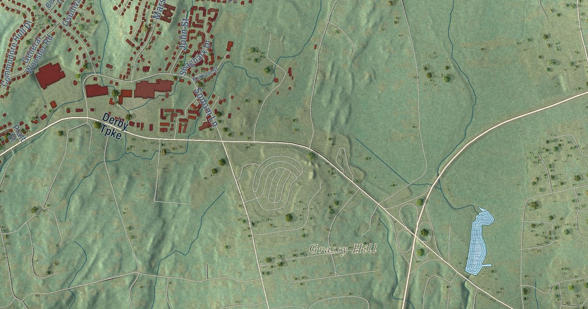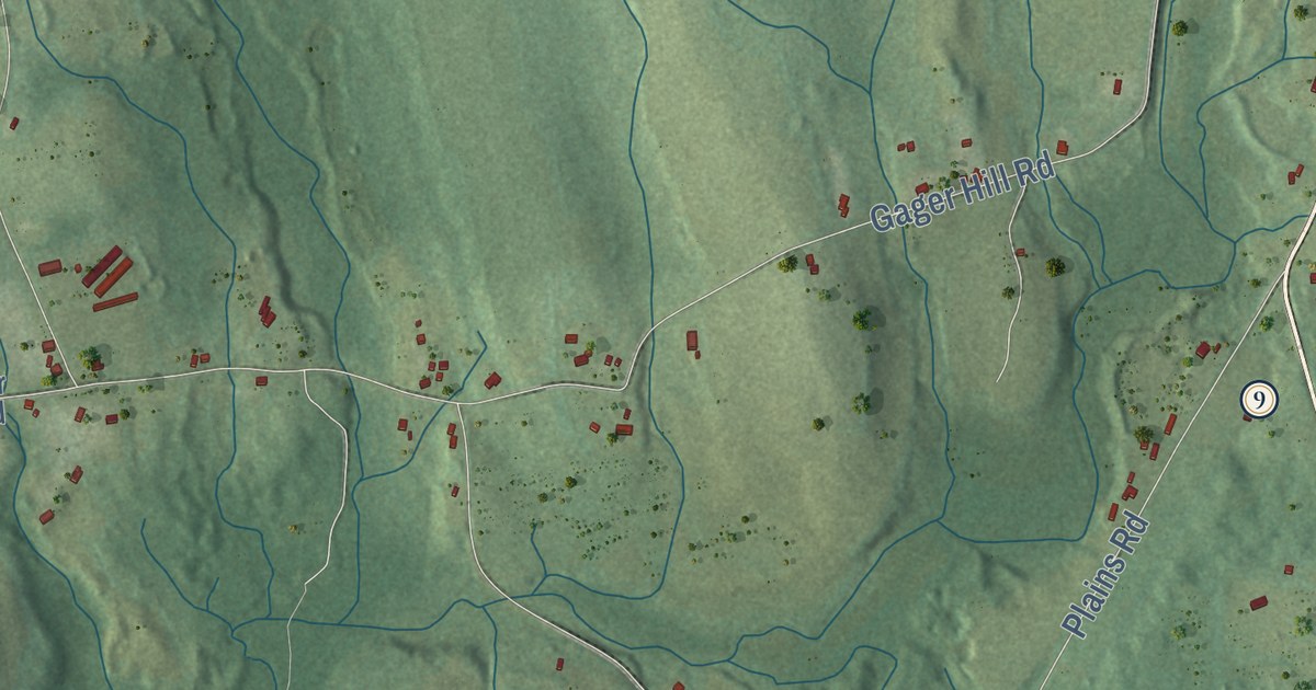
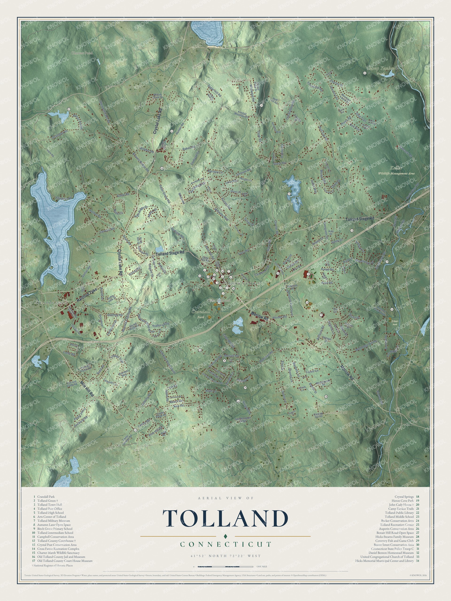
This beautifully detailed map of Tolland, Connecticut was created in 2026 using aerial imagery combined with modern topographical, census, street and landmark data. It’s a one-of-a-kind view of Tolland that combines accurate data with a vintage aesthetic. The map shows every building in its true location, many of the roads carry their names, and the shaded topographic relief shows the shape of the land.
See it on a wall
The Tolland map as an 18 x 24 inch print in a black frame.

Explore an aerial view of Tolland, Connecticut
On the map you’ll find Downtown, Quarryville, Buff Cap Hill, Cassidy Hill, Kendall Hill, Charters Pond, Cider Millpond, Camp Yankee Trails, Crandall Park, Kollar Wildlife Management Area, and River Park, along with Merrow Road, and more. If you look closely you can even find your house accurately drawn in its correct location. Zoom in on the preview to look for yours. Click here to learn more about the history of Tolland.
Take a closer look at the Tolland map
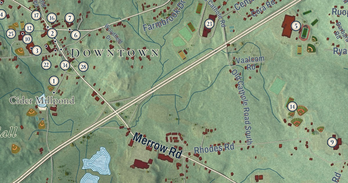
Click to explore a larger preview. The digital watermark does not appear on printed maps.
Names on this map
These names are printed on this map.
Places: Downtown, Quarryville, Buff Cap Hill, Cassidy Hill, Kendall Hill, Charters Pond, Cider Millpond, Camp Yankee Trails, Crandall Park, Kollar Wildlife Management Area and River Park.
Streets and roads: Merrow Road, Crystal Lake Road, Mile Hill Road, Tolland Stage Road, Hartford Turnpike, Mountain Spring Road, Reed Road, Cook Road, Candlewood Drive, Dimock Road, Old Stafford Road, Glenn Drive.
More street names, A to Z
Alden Circle, Amanda Way, Amy Drive, Anderson Road, Angela Drive, Ann Drive, Anthony Road, Anthony Road South, Apple Road, Arnold Drive, Austin Drive, Autumn Lane, Avebury Lane, Babcock Road, Bakos Road, Bald Hill Road, Barbara Road, Barstow Lane, Baxter Street, Beech Road, Belvedere Drive, Birch Hill Drive, Birchwood Drive, Bonair Hill Road, Branden Way, Brookmoor Road, Browns Bridge Road, Bucks Crossing, Buff Cap Road, Burbank Road, Carriage Drive, Cassidy Hill Road, Cedar Swamp Road, Center Road, Cervens Road, Chardonnay Lane, Charles Street, Charter Road, Cider Mill Road, Columbine Road, Cora Road, Corrine Drive, Cortland Drive, Crossen Drive, Crystal Ridge Drive, Deerwood Road, Derek Drive, Dockeral Road, Doe Run, Doyle Road, Dunn Hill Road, Eaton Road, Elgin Drive, Ellington Road, Elm Road, Elna Drive, Evergreen Drive, Farmbrook Drive, Fernwood Road, Fieldstone Drive, Fish and Game Road, Florence Drive, Forest Lane, Fox Ridge Lane, Garnet Ridge Drive, Garry Road, Gehring Road, Gehring Road Extended, Gerber Drive, Goose Lane, Gottier Road, Grahaber Road, Grandview Street, Grant Hill Road, Hare Road, Heritage Lane, Hidden Valley, High Ridge Drive, Hilltop Road, Hunter Road, Hurlbut Road, Industrial Park Road East, Johnson Road, Josiah Lane, Julia Road, Justin Way, Kate Lane, Kendall Mountain Road, Kim Circle, Kozley Road, Lakeview Heights, Lamont Lane, Laurel Ridge Road, Lawlor Road, Lee Lane, Leela Way, Lisa Lane, Loehr Road, Lorraine Drive, Marbella Lane, Meadowood Road, Merlot Way, Metcalf Road, Midland Drive, Morgan Lane, Mountain Laurel Drive, Nedwied Road, Neff Hill Road, New Road, Noah Lane, North River Road, Old Cathole Road, Old Cathole Road South, Old Kent Road North, Old Kent Road South, Old Post Road, Pamela Court, Partridge Lane, Paula Joy Lane, Pepperwood Drive, Pero Road, Peter Green Road, Pilgrim Drive, Pine Hill Road, Plains Road, Rhodes Road, Robbie Road, Robin Circle, Ruops Road, Ryan Road, Sage Meadow Drive, Sand Hill Road, Sandy Drive, Settlers Way, Shanda Lane, Shanti Place, Shenipsit Lake Road, Shepard Road, Sherry Circle, Shores Drive, Slater Road, South River Road, Stag Trail, Stephanie Lane, Stuart Drive, Sugar Bush Lane, Sugar Hill Road, Summerwood Ridge, Summit Drive, Susan Drive, Timber Trail, Tolland Farms Road, Tolland Green, Torry Road, Vaalcom Road, Valley View Drive, Virginia Lane, Walbridge Hill Road, Webber Road, Weigel Valley Road, Weigold Road, White Road, Whitetail Way, Wildwood Road, Williams Way, Willie Circle, Willow Creek Drive, Woodfield Drive, Woodhenge Drive, Zinfandel Circle, Zoey Place.
This beautifully detailed map of Tolland makes an attractive addition to your office, library, or den, and it can even be used to teach children the geography and history of the area. It also makes a great gift for anyone who grew up in Tolland or moved away. When you’re done exploring, click here to get your copy of the Tolland map.