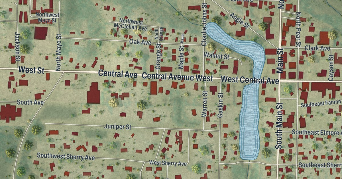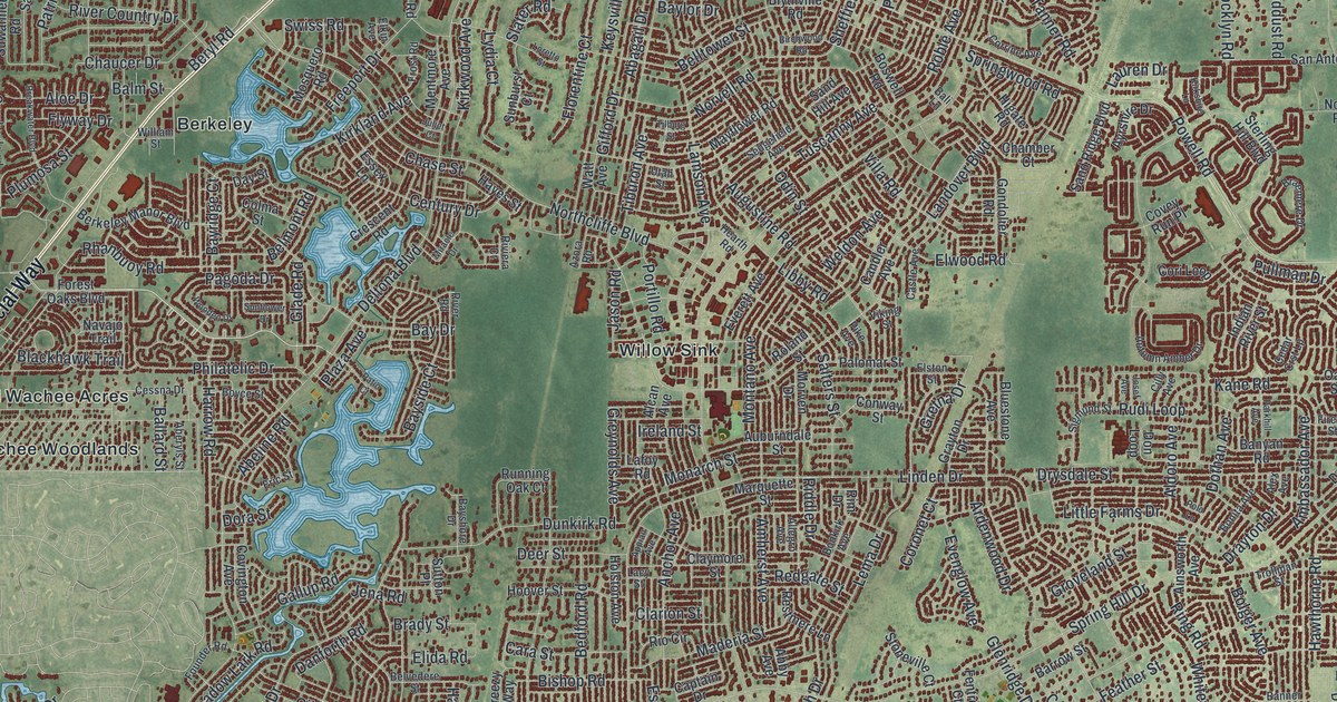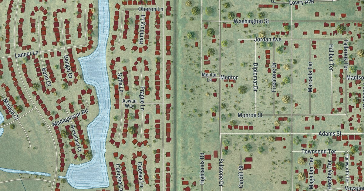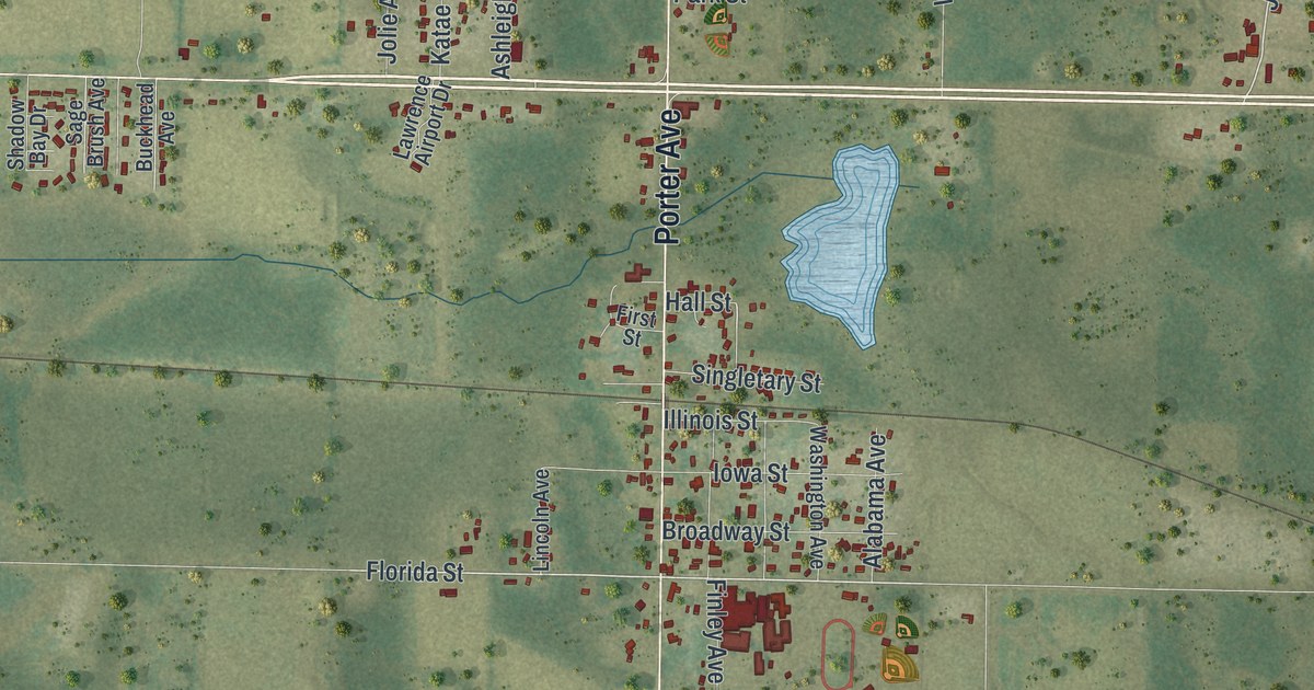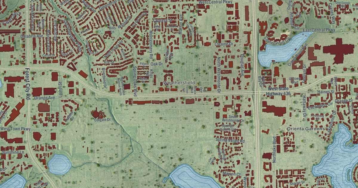
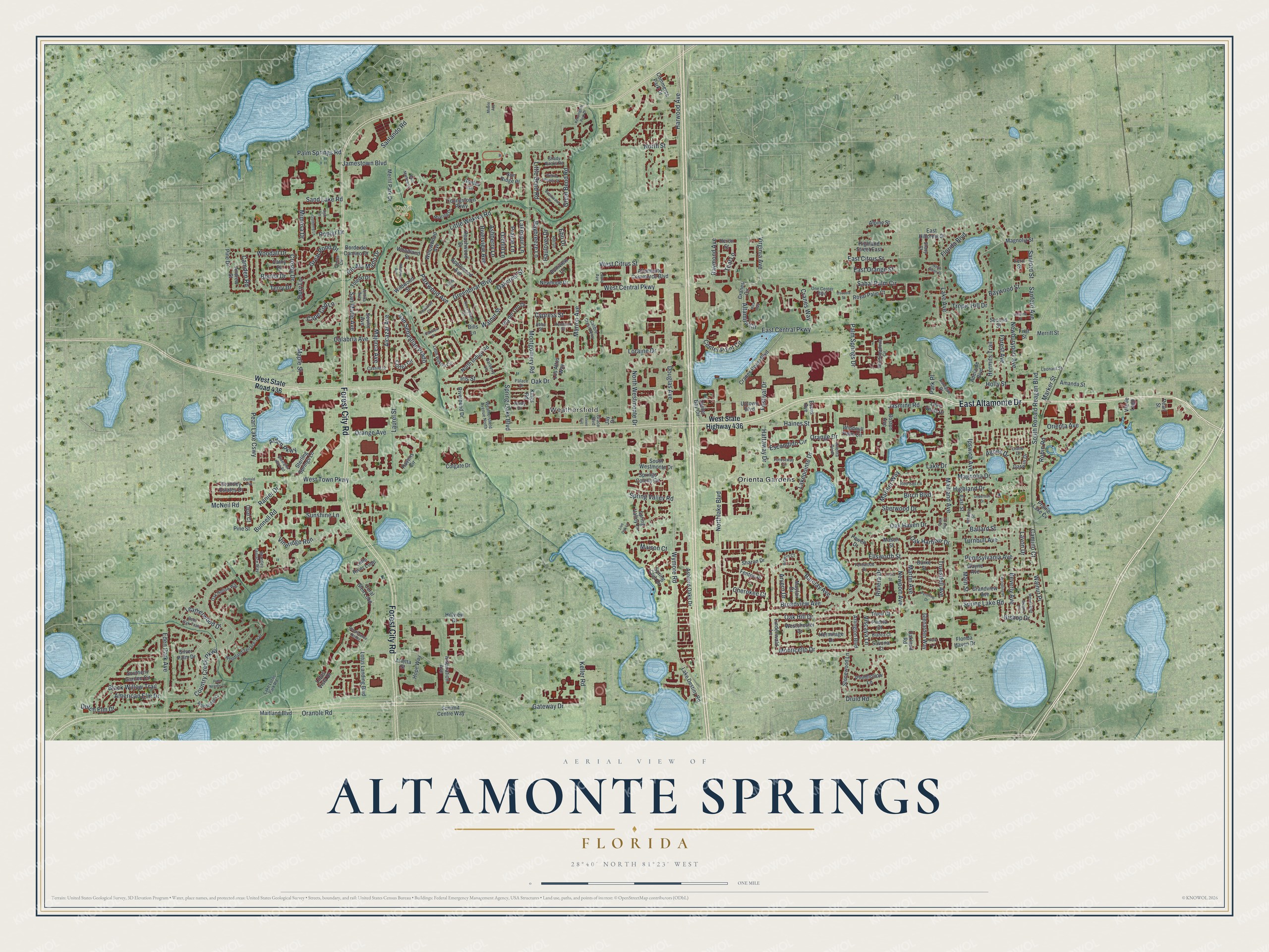
This beautifully detailed map of Altamonte Springs, Florida was created in 2026 using aerial imagery combined with modern topographical, census, street and landmark data. It’s a one-of-a-kind view of Altamonte Springs that combines accurate data with a vintage aesthetic. The map shows every building in its true location, many of the roads carry their names, and the shaded topographic relief shows the shape of the land.
Explore an aerial view of Altamonte Springs, Florida
On the map you’ll find Weathersfield, Lake Lotus, Eastmonte Park, Merrill Park, Pearl Lake, Spring Lake, Trout Lake, and Orienta Gardens, along with East Altamonte Drive, Forest City Road, Spring Lake Road, Ballard Street, and more. If you look closely you can even find your house accurately drawn in its correct location. Zoom in on the preview to look for yours.
Did You Know?
Dr. Washington Kilmer of Cincinnati settled here around 1870 and named the area Altamonte. In 1882 a firm called the Altamonte Land, Hotel and Navigation Company added Springs to the name. Thomas C. Simpson and four other Massachusetts businessmen had founded that company. Residents voted 38 to 7 to incorporate on November 11, 1920.
Take a closer look at the Altamonte Springs map
Names on this map
These names are printed on this map.
Places: Weathersfield, Eastmonte Park, Merrill Park and Orienta Gardens.
Streets and roads: East Altamonte Drive, Forest City Road, Spring Lake Road, Ballard Street, Orange Drive, Haines Street, Oak Haven Drive, Hattaway Drive, San Sebastian Prado, Maitland Avenue, Wymore Road, Laurel Street.
More street names, A to Z
Abba Street, Adelaide Boulevard, Adelaide Drive, Agnes Drive, Alcazar Avenue, Alden Parkway, Alpine Street, Altamira Circle, Altamonte Commerce Boulevard, Amanda Street, American Elm Drive, Andrew Street, Antilla Avenue, Applewood Avenue, Arletta Street, Arlington Boulevard, Arvern Court, Arvern Drive, Ashberry Lane, Ashford Oaks Drive, Ash Lane, Astria Street, Barberry Lane, Barclay Avenue, Baybreeze Lane, Baywood Street, Bent Oak Trail, Beverly Avenue, Bianca Court, Bills Lane, Birch Boulevard, Bishop Drive, Black Willow Trail, Bonita Drive, Boniview Lane, Borde del Camino Drive, Boston Avenue, Brantley Estates Drive, Brantley Terrace Way, Breakwater Drive, Broadview Avenue, Bunnell Road, Burke Street, Calabria Avenue, Calibre Crest Parkway, Camden Road, Camino Court, Cape Cod Lane, Castile Drive, Cathy Drive, Center Point Circle, Centre Circle, Cherokee Court, Colby Court, Colgate Drive, Commerce Park Drive, Coral Glen Loop, Cortez Circle, Country Creek Parkway, Cranes Circle, Cranes Roost Boulevard, Cranes Way, Crosby Drive, Cypress Street, Darwin Drive, Derby Drive, Diane Drive, Donald Avenue, Dory Lane, Douglas Avenue, Druid Road, Dutch Elm Drive, East Central Parkway, East Citrus Street, East Hillcrest Street, East Orange Street, East Street, Eastwood Court, Ebb Drive, Eden Park Avenue, Eileen Avenue, Ellsworth Street, Escondido Circle, Essex Avenue, Fenton Place, Fern Street, Fernwood Drive, Festival Drive, First Street, Florida Boulevard, Florida Haven Drive, Forest Avenue, Forestway Circle, Gateway Drive, Glades Circle, Glenarden Way, Grace Boulevard, Grandview Avenue, Great Bend Road, Great Pond Drive, Greenbriar Boulevard, Gregory Lane, Gullberry Lane, Harwood Avenue, Haulover Drive, Hemlock Street, Hermitage Drive, Hermits Trail, Heron Street, Hickorywood Avenue, Highland Drive, Highland Street East, Hillview Drive, Holly Street, Hope Way, Inspiration Avenue, Ipswich Avenue, Ipswich Street, Iris Street, Jamestown Boulevard, Jasmine Road, Jay Drive, Josiane Court, Keller Road, Kensington Park Drive, Kings Road, Lake Avenue, Lake Destiny Road, Lake Drive, Lake Lotus Park Road, Lakepointe Drive, Lakespur Lane, Lake Villas Drive, Laura Avenue, Lavon Drive, Leatherwood Drive, Leonard Street, Lindenwald Lane, Little Bend Road, Little River Loop, Little Wekiva Circle, Little Wekiva Road, Live Oak Lane, Loraine Drive, Los Altos Way, Lotus Landing Boulevard, Lotus Vista Drive, Magnolia Drive, Magnolia Street, Main Street, Maison Court, Maitland Boulevard, Majorca Avenue, Maple Street, Mariner Way, Marion Avenue, Marker Street, Martin Avenue, Mason Street, Mayfair Drive, McNeil Road, Meiner Boulevard, Merril Park Drive, Merritt Street, Mimosa Drive, Mira Way, Mobile Avenue, Montgomery Road, Monticello Drive, Newburyport Avenue, Newhope Drive, Newport Avenue, North Glenn Drive, North Indigo Road, Northlake Boulevard, North Street, North Westmonte Drive, Oakcrest Street, Oak Drive, Oak Harbour Drive, Oak Hill Drive, Oak Hollow Way, Oakland Road, Oakview Street, One Center Boulevard, Opal Court, Orange Avenue, Oranole Road, Orchid Lane, Orienta Avenue, Orienta Point, Osceola Street, Oyster Bay Circle, Palace Drive, Palm Springs Drive, Palm Springs Road, Park Lane, Park Place, Parkwood Avenue, Peachwood Drive, Pearl Lake Causeway, Pearl Street, Pennsylvania Avenue, Pershing Drive, Pine Drive, Pine Needle Court, Pine Street, Plumhollow Lane, Poplar Drive, Post Oak Circle, Powell Drive, Prairie Lake Cv, Prairie Lane, Puerta Court, Ranier Drive, Ravens Circle, Raymond Avenue, Red Sail Lane, Renaissance Pointe, Rill Drive, Rio Ala Mano Drive, Riverbend Drive, Riverview Avenue, Riviera Drive, Roaring Drive, Robin Road, Royal Palm Court, Sabal Palm Circle, Saint Mathew Circle, Sand Lake Road, Sanford Avenue, Sanford Street, Sanlando Road, San Marie Avenue, Savona Court, Second Street, Seville Avenue, Shady Banks Road, Shady Court, Sharon Drive, Sherwood Drive, Silverglen Afton Road, Silver Palm Drive, Southern Garden Circle, South Ronald Reagan Boulevard, South Westmonte Drive, Spring Club Drive, Spring Oaks Boulevard, Springs Colony Circle, Spring Valley Lane, Spring Valley Road, Sterling Springs Lane, Stonewood Lane, Summit Centre Way, Sun Ridge Place, Sunshine Lane, Teal Lane, Terry Drive, Tivoli Court, Toledo Drive, Tropic Hill Drive, Truesdell Avenue, Turnbull Avenue, Underoak Drive, Uptown Boulevard, Via de Lago, Via del Oro Drive, Vineridge Run, Virginia Avenue, Viscaya Lane, Walnut Place, Walnut Street, Wayne Avenue, Weathersfield Avenue North, Wekiva Rapids Drive, West Central Parkway, Westchester Drive, West Citrus Street, West State Highway 436, West State Road 436, West Town Parkway, Wheeling Avenue, Wildwood Street, Willowwood Avenue, Windmeadows Circle, Windmill Palm Circle, Woodall Drive, Woodland Street, Woodland Terrace Trail, Woodling Place, Woodridge Court, Youngstown Parkway.
See it on a wall
The Altamonte Springs map as a framed print. Swipe for more.


This beautifully detailed map of Altamonte Springs makes an attractive addition to your office, library, or den, and it can even be used to teach children the geography and history of the area. It also makes a great gift for someone who left Altamonte Springs and still calls it home. When you’re done exploring, click here to get your copy of the Altamonte Springs map.