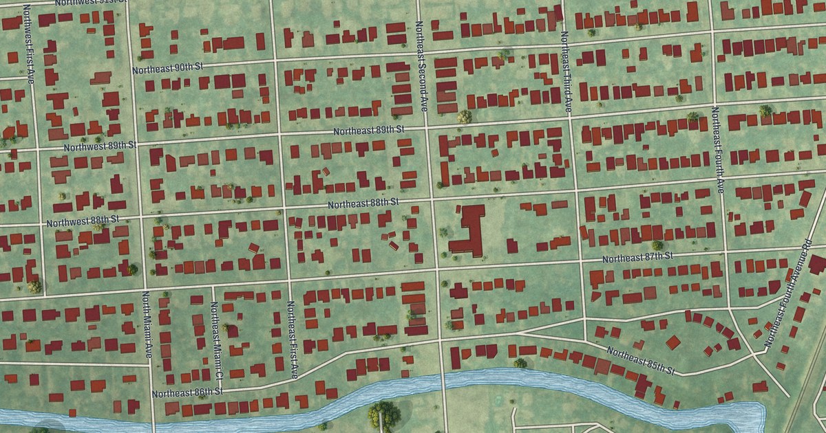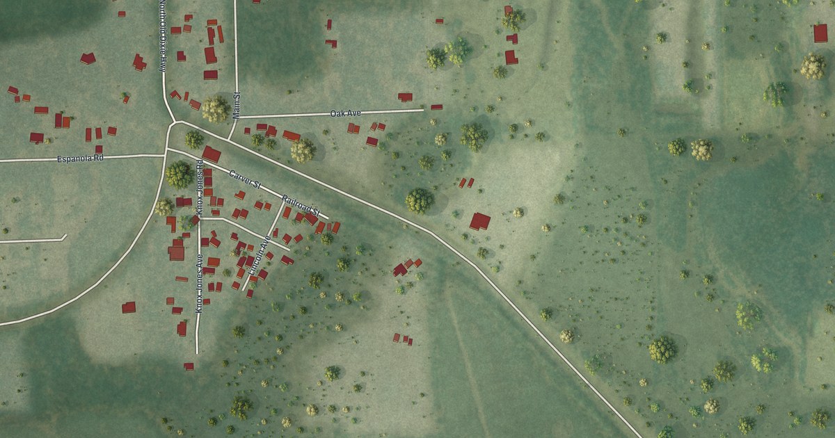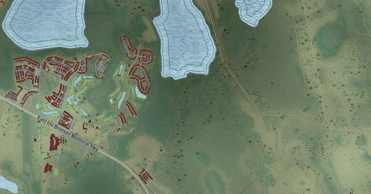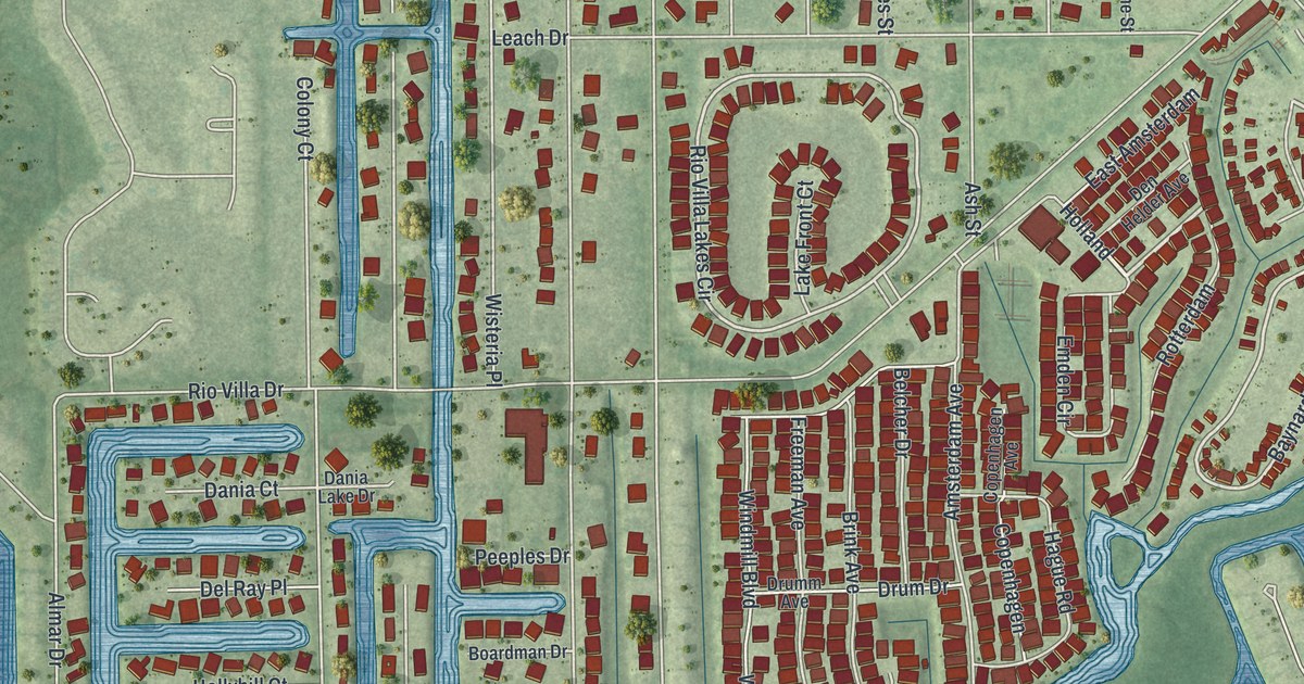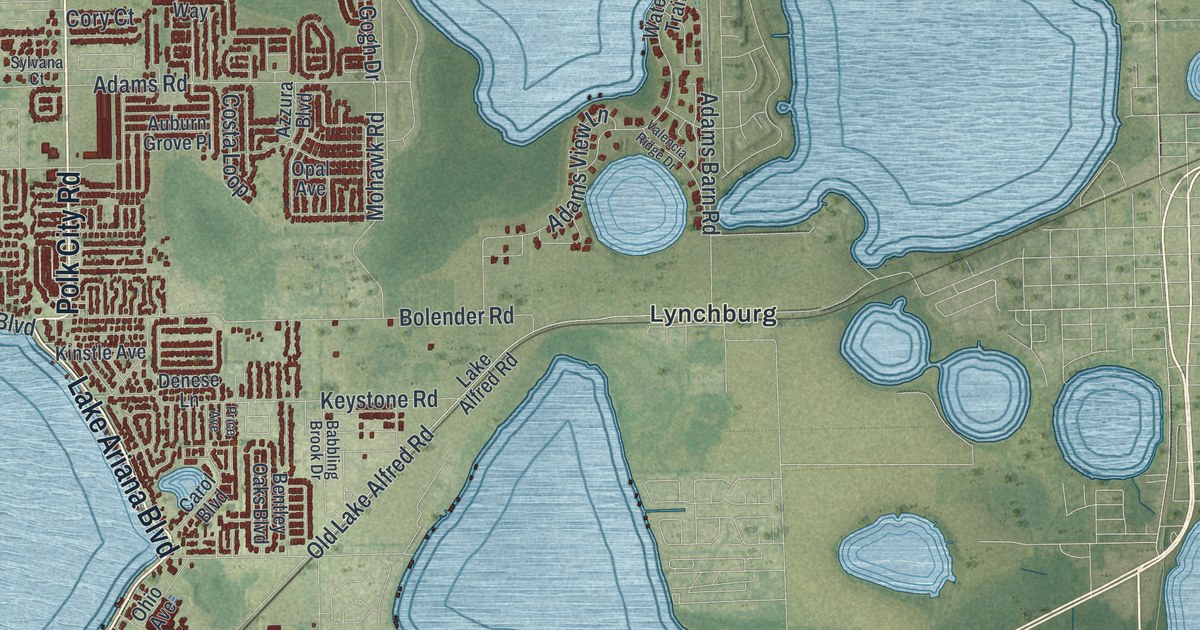
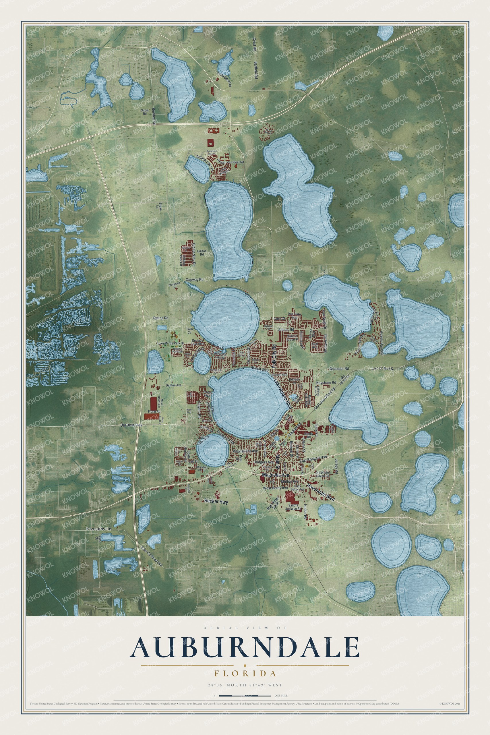
This beautifully detailed map of Auburndale, Florida was created in 2026 using aerial imagery combined with modern topographical, census, street and landmark data. It’s a one-of-a-kind view of Auburndale that combines accurate data with a vintage aesthetic. The map shows every building in its true location, many of the roads carry their names, and the shaded topographic relief shows the shape of the land.
Explore an aerial view of Auburndale, Florida
On the map you’ll find Kossuthville and Lynchburg, along with Magnolia Avenue, Lake Ariana Boulevard, Polk City Road, Main Street, Havendale Boulevard, Recker Highway, Berkley Road, Bridgers Avenue, Old Dixie Highway, Spring Road, and more. If you look closely you can even find your house accurately drawn in its correct location. Zoom in on the preview to look for yours.
Did You Know?
Frank Fuller founded the town in 1880 to escape cold winters in the Northeast. It was first called Sanatoria, after a hotel there. When the railroad came in the 1880s, settlers from Auburndale, Massachusetts suggested the name it has today.
Take a closer look at the Auburndale map
Names on this map
These names are printed on this map.
Places: Kossuthville and Lynchburg.
Streets and roads: Magnolia Avenue, Lake Ariana Boulevard, Polk City Road, Main Street, Havendale Boulevard, Recker Highway, Berkley Road, Bridgers Avenue, Old Dixie Highway, Spring Road, East Bridgers Avenue, Ariana Boulevard.
More street names, A to Z
Abundant Life Drive, Adams Barn Road, Adams Road, Adams Street, Adams View Lane, Allred Drive, Amber Boulevard, Ariana Avenue, Auburn Grove Place, Azzura Boulevard, Babbling Brook Drive, Barfield Road, Bay Street, Bennett Street, Bentley Oaks Boulevard, Berkley Pointe Drive, Bishop Street, Bluff Drive, Bolender Road, Bonnie Drive, Bryan Lane, Camp Gilead Drive, Carol Boulevard, Center Street, Charles Avenue, Church Street, Clayton Road, Clinton Street, Cory Court, Costa Loop, Crest Road, Crestview Drive, Dairy Road, Deen Boulevard, Denese Lane, Denton Avenue, East County Road 542, East Derby Avenue, Edison Road, Elaine Drive, Enclave Lake Boulevard, Erikson Park Circle, Floral Road, Gandy Road, Gapway Road, Grandview Glen Drive, Hobbs Road, Jersey Road, Juliana Lake Drive, Keystone Road, Kinstle Avenue, Kirkland Lake Drive, Lake Alfred Road, Lake Lena Boulevard, Lake Myrtle Park Drive, Lake Vista Drive, Lantana Circle, Leo Drive, Leta Street, Main Street South, Medora Street, Melton Avenue, Mohawk Road, Moss Road East, Moss Road Extension, Neptune Road, Oak Street, Ohio Avenue, Old Berkley Road, Old Lake Alfred Road, Old Winter Haven Road, Opal Avenue, Osceola Street, Palm Avenue, Paradise Lane, Pearl Street, Pilaklakaha Avenue, Pine Street, Price Avenue, Ramsgate Road, Sandra Jackson Road, Shalisa Boulevard, Shelby Street, Skyview Drive, Snow Road, Somerset Street, South Berkley Road, Stadium Road, Strickland Lane, Sylvana Court, Taylor Street, Third Street, Twin Cv, Valencia Ridge Drive, Van Fleet Court, Van Gogh Drive, Van Oaks Way, Walton Way, Waterfern Trail Drive, West Bridgers Avenue, West Derby Avenue, Willet Circle, William Van Fleet Road, Winona Circle, Wood Duck Drive.
See it on a wall
The Auburndale map as a framed print. Swipe for more.


This beautifully detailed map of Auburndale makes an attractive addition to your office, library, or den, and it can even be used to teach children the geography and history of the area. It also makes a great gift for someone who left Auburndale and still calls it home. When you’re done exploring, click here to get your copy of the Auburndale map.