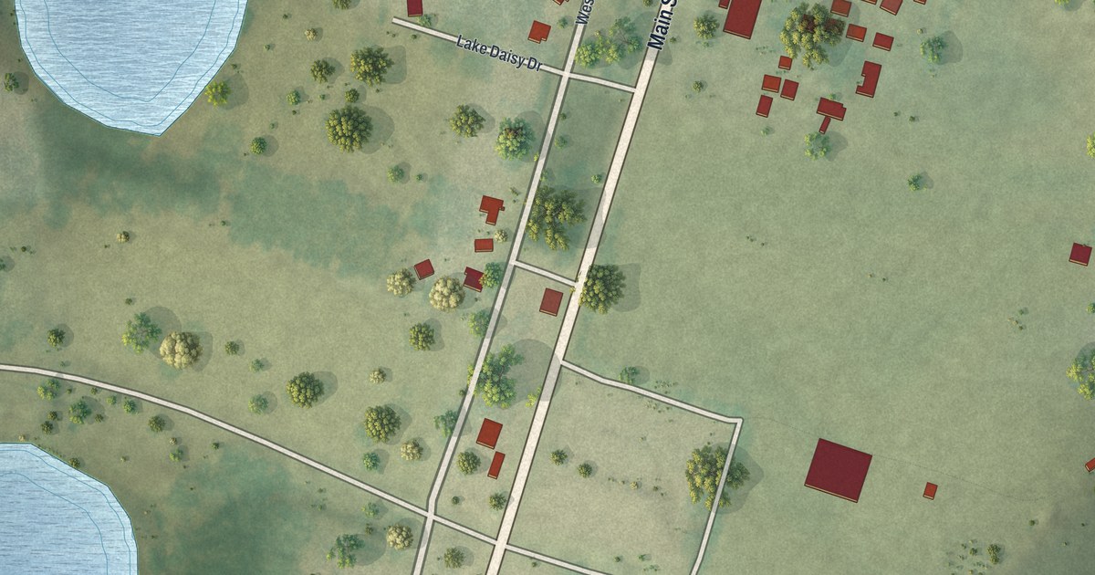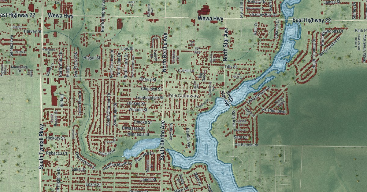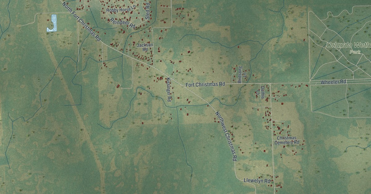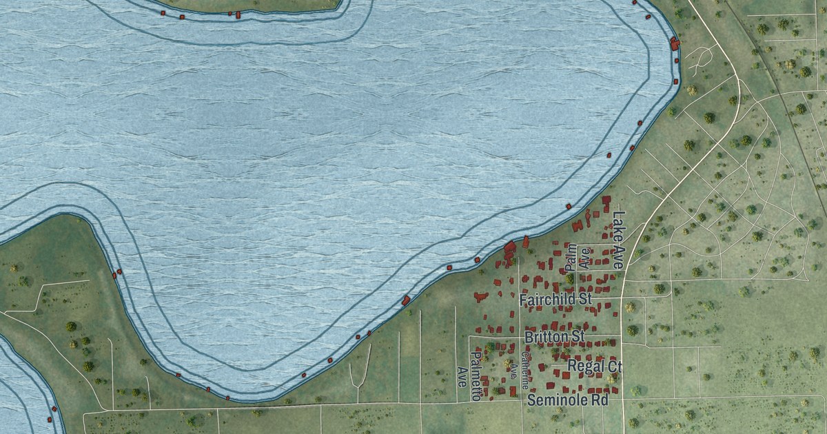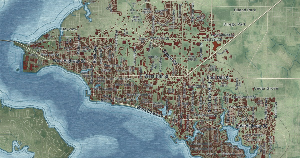
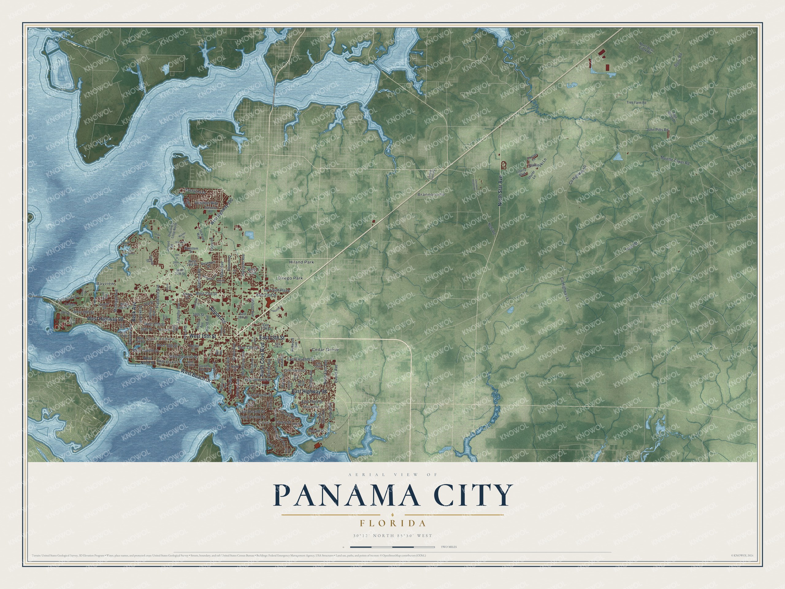
This beautifully detailed map of Panama City, Florida was created in 2026 using aerial imagery combined with modern topographical, census, street and landmark data. It’s a one-of-a-kind view of Panama City that combines accurate data with a vintage aesthetic. The map shows every building in its true location, many of the roads carry their names, and the shaded topographic relief shows the shape of the land.
Explore an aerial view of Panama City, Florida
On the map you’ll find Saint Andrew, Baker, Bayview, Brannonville, Cedar Grove, Cove, Dirego Park, Glenwood, Hiland Park, and Millville, along with West 15th Street, Airport Road, and more. If you look closely you can even find your house accurately drawn in its correct location. Zoom in on the preview to look for yours.
Did You Know?
The town of Harrison got a new name in 1906. George Mortimer West hoped to sell land while the Panama Canal was being built. A straight line from Chicago to the capital of Panama crossed the town, so he renamed it Panama City. The city incorporated in 1909.
Take a closer look at the Panama City map
Names on this map
These names are printed on this map.
Places: Saint Andrew, Baker, Bayview, Brannonville, Cedar Grove, Cove, Dirego Park, Glenwood, Hiland Park and Millville.
Streets and roads: West 15th Street, Airport Road, West Beach Drive, Beck Avenue, East 15th Street, West Highway 98, North Star Avenue, North Cove Boulevard, East Highway 98, Harrison Avenue, Bayview Avenue, West Twelfth Street.
More street names, A to Z
16th Street, 18th Street, 19th Street, 21st Street, 28th Court, 30th Street, Allen Avenue, Ashland Road, Atkinson Road, Baker Court, Balboa Avenue, Bay Avenue, Bell Avenue, Bluestem Street, Bonita Avenue, Brandeis Avenue, Bunkers Cove Road, Cactus Avenue, Calhoun Avenue, Capri Drive, Chandlee Avenue, Cherokee Heights Road, Cherry Street, College Avenue, College Street, Collegiate Drive, Conner Lane, County Highway 43, County Highway 50, Cypress Avenue, Deer Avenue, Dewitt Street, Discovery Loop, Discovery Loop North, Drake Avenue, East 13th Court, East 13th Street, East 17th Street, East 19th Street, East 23rd Street, East 24th Plaza, East Eleventh Street, East Fourth Street, East Second Court, East Second Street, East Seventh Street, East Sixth Street, East Tenth Street, East Third Street, Elm Avenue, Emory Drive, Everitt Avenue, Fairmont Drive, Fairy Avenue, Fifth Court, Florida Avenue, Flower Avenue, Fortune Avenue, Frankford Avenue, Gabriel Street, Garden Club Drive, Grace Avenue, Grant Avenue, Gulf Avenue, Hannah Avenue, Harbour Place, Harris Avenue, Hollis Avenue, Industrial Drive, Jackson Way, Jenks Avenue, John Pitts Road, Joy Circle, Kirklin Avenue, Kraft Avenue, Kristanna Drive, Liberty Boulevard, Lincoln Drive, Lindsey Crossing, Lisenby Avenue, Luverne Avenue, Majette Tower Road, Massalina Drive, Mc Kenzie Avenue, Michigan Avenue, Mulberry Avenue, Nehi Road, Nelson Street, Ninth Street, North Bear Creek Road, North Bonita Avenue, North East Avenue, North Gray Avenue, Northside Drive, Oak Avenue, Oliva Lane, Peters Drive, Redwood Avenue, Rosemont Drive, Sage Brush Drive, Shurer Lane, Slabinski Lane, South Bonita Avenue, Stanford Road, State Avenue, Stone Road, Token Road, Tram Road, Tree Farm Road, Tupelo Drive, Twelfth Court, Tyndall Drive, Venetian Way, Warbler Street, West 13th Street, West 14th Street, West 16th Street, West 17th Street, West 19th Street, West 20th Court, West 23rd Street, West 27th Street, West 28th Place, West 30th Court, West Eleventh Street, West Highway 390, West Ninth Street, West Tenth Street, Wilson Avenue, Wood Avenue, Wood Trail.
See it on a wall
The Panama City map as a framed print. Swipe for more.


This beautifully detailed map of Panama City makes an attractive addition to your office, library, or den, and it can even be used to teach children the geography and history of the area. It also makes a great gift for anyone with Panama City roots. When you’re done exploring, click here to get your copy of the Panama City map.