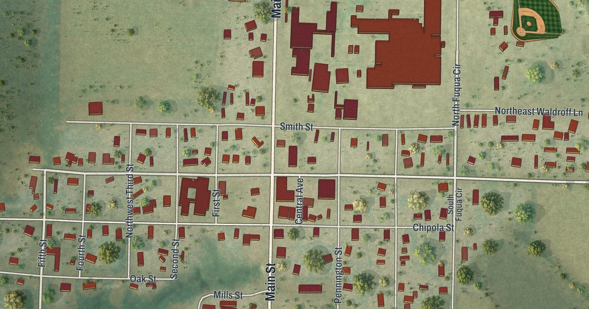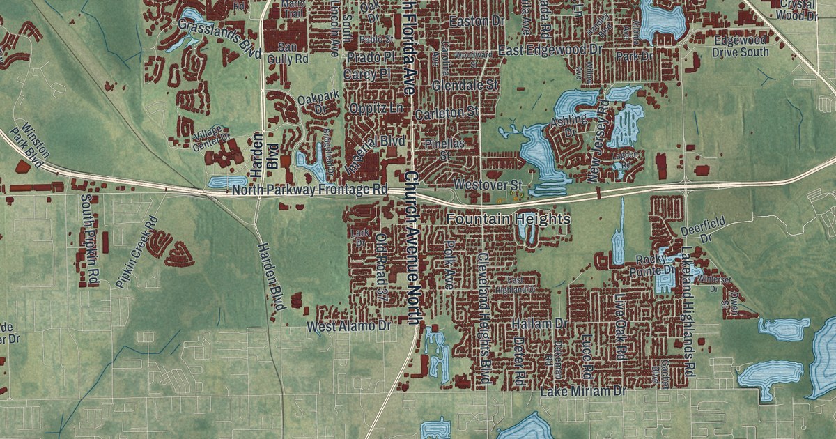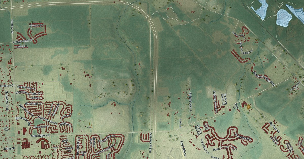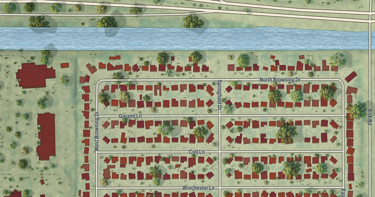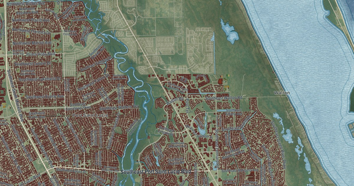
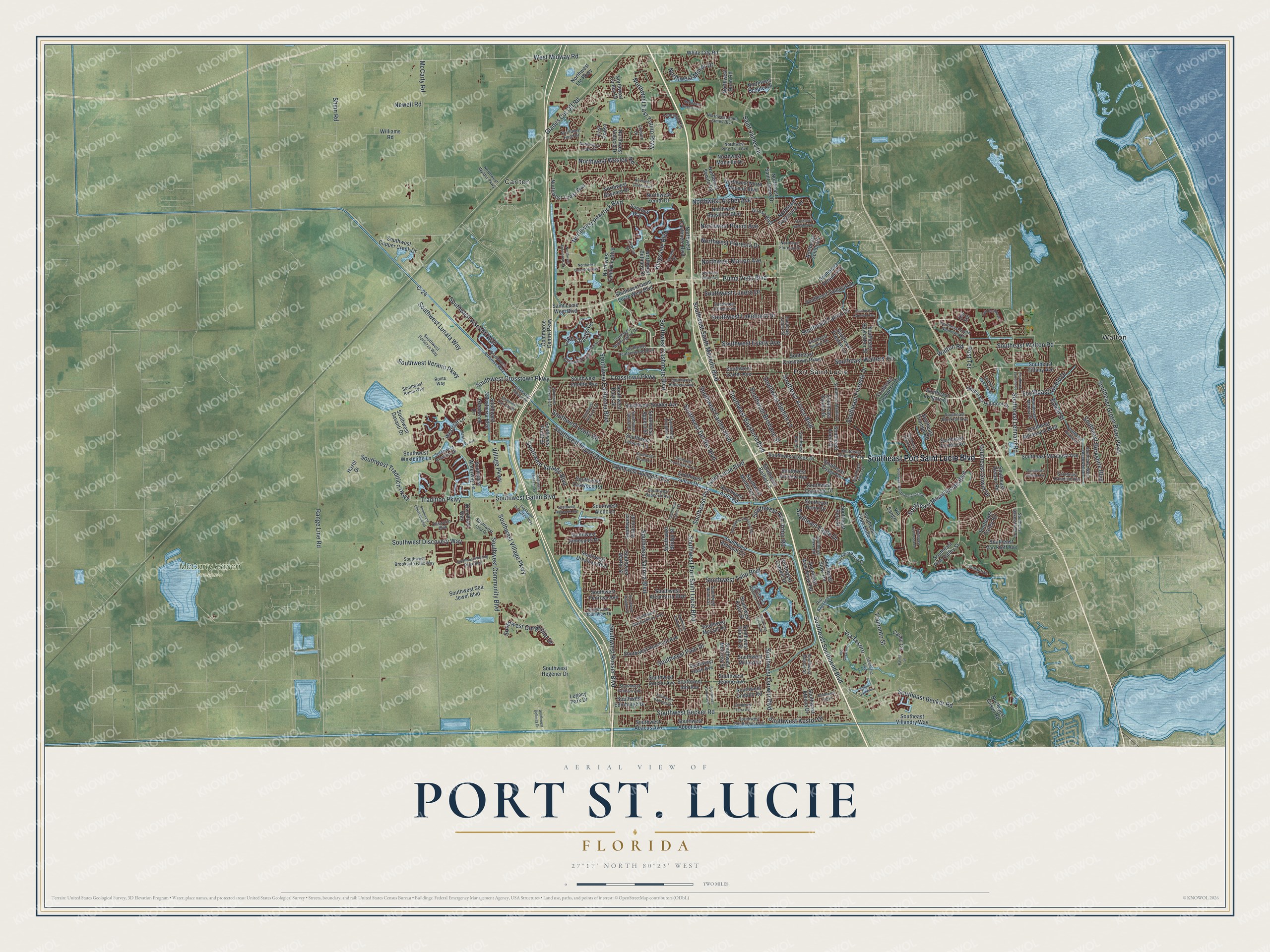
This beautifully detailed map of Port St. Lucie, Florida was created in 2026 using aerial imagery combined with modern topographical, census, street and landmark data. It’s a one-of-a-kind view of Port St. Lucie that combines accurate data with a vintage aesthetic. The map shows every building in its true location, many of the roads carry their names, and the shaded topographic relief shows the shape of the land.
Explore an aerial view of Port St. Lucie, Florida
On the map you’ll find McCarty Ranch Preserve, Carlton, and Walton, along with Southeast Port Saint Lucie Boulevard, Southeast Airoso Boulevard, Prima Vista Boulevard, Post Terrace, Southeast Morningside Boulevard, Lake Charles Circle, Southeast Lennard Road, Crosstown Parkway, and more. If you look closely you can even find your house accurately drawn in its correct location. Zoom in on the preview to look for yours.
Did You Know?
In 1958 the General Development Corporation bought 40,000 acres beside the St. Lucie River’s North Fork. It opened its first bridge over the river in 1959, so cars could reach the land. By February 1961 about 250 homes stood there. The city was incorporated on April 27 of that year.
Take a closer look at the Port St. Lucie map
Names on this map
These names are printed on this map.
Places: McCarty Ranch Preserve, Carlton, Port Saint Lucie and Walton.
Streets and roads: Southeast Port Saint Lucie Boulevard, Southeast Airoso Boulevard, Prima Vista Boulevard, Post Terrace, Southeast Morningside Boulevard, Lake Charles Circle, Southeast Lennard Road, Crosstown Parkway, Southwest Crosstown Parkway, Southwest Bayshore Boulevard, Southeast Fallon Drive, Shinn Road.
More street names, A to Z
Airoso Boulevard, Ballantrae Court, Bay Saint Lucie Drive, Bowie Street, C-24, Calmo Circle, Cleburn Drive, Commerce Centre Parkway, Del Sol, East Caribbean, East Coosa, Ellsworth Boulevard, Glades Cut Off Road, Glenbrook Drive, Hazel Drive, Kings Isle Boulevard, Lawton Road, Legacy Park Drive, Leonardo Circle, McCarty Road, Newberry Avenue, Newell Road, Northeast Floresta Drive, Northeast Sagamore Terrace, Northeast Saint James Drive, Northeast Solida Circle, Northeast Surfside Avenue, Northwest Archer Avenue, Northwest Baynard Drive, Northwest Bayshore Boulevard, Northwest Bethany Drive, Northwest Billiar Avenue, Northwest California Boulevard, Northwest Cashmere Boulevard, Northwest Conley Drive, Northwest Culebra Avenue, Northwest Dunn Road, Northwest East Torino Parkway, Northwest Enterprise Drive, Northwest Floresta Drive, Northwest Gilson Road, Northwest Hann Drive, Northwest Leah Drive, Northwest Ltc Parkway, Northwest Manville Drive, Northwest Marion Avenue, Northwest Milner Drive, Northwest North Macedo Boulevard, Northwest Peacock Boulevard, Northwest Pine Trail Avenue, Northwest Placid Avenue, Northwest Saint James Boulevard, Northwest Scepter Drive, Northwest Selvitz Road, Northwest Stratford Lane, Northwest Topaz Way, Northwest University Boulevard, Northwest Volucia Drive, Northwest Wesley Road, Northwest Wylder Parkway, Northwest Zenith Drive, Palma Street, Range Line Road, Rio Angelica, Rio Casarano, Roma Way, Saint James Drive, Saint Lucie West Boulevard, Santa Gardenia, Southbend Boulevard, Southeast Allen Street, Southeast Aneci Street, Southeast Bakersfield Street, Southeast Bayharbor Street, Southeast Becker Road, Southeast Berkshire Boulevard, Southeast Blockton Avenue, Southeast Bowie Street, Southeast Caladium Avenue, Southeast Calmoso Drive, Southeast Carnival Avenue, Southeast Cascella Court, Southeast Chapman Avenue, Southeast Crosstown Parkway, Southeast Crowberry Drive, Southeast Delano Road, Southeast Eagle Drive, Southeast Essex Drive, Southeast Farley Road, Southeast Fiore Bello, Southeast Floresta Drive, Southeast Gillette Avenue, Southeast Gowin Drive, Southeast Grand Drive, Southeast Green River Parkway, Southeast Guava Terrace, Southeast Hillmoor Drive, Southeast Ladner Street, Southeast Lorraine Street, Southeast Lyngate Drive, Southeast Manth Lane, Southeast Mantua Street, Southeast Mariposa Avenue, Southeast Melaleuca Boulevard, Southeast Nome Drive, Southeast Overbrook Drive, Southeast Peru Street, Southeast Pine Valley Street, Southeast Portillo Road, Southeast Preston Lane, Southeast Sandia Drive, Southeast Shelter Drive, Southeast Southbend Boulevard, Southeast South Niemeyer Circle, Southeast Stow Terrace, Southeast Tiffany Avenue, Southeast Triumph Road, Southeast Van Kleff Avenue, Southeast Verada Avenue, Southeast Villandry Way, Southeast Wake Road, Southeast Walters Terrace, Southeast Walton Road, Southeast West Blackwell Drive, Southeast Westmoreland Boulevard, Southeast West Snow Road, Southwest Abacus Avenue, Southwest Abbot Avenue, Southwest Abingdon Avenue, Southwest Aguero Street, Southwest Airview Avenue, Southwest Alcantarra Boulevard, Southwest Aledo Lane, Southwest Ambrose Way, Southwest Ann Arbor Road, Southwest Aster Road, Southwest Athena Drive, Southwest Aventino Drive, Southwest Babcock Avenue, Southwest Barber Lane, Southwest Beard Street, Southwest Becker Road, Southwest Bellevue Avenue, Southwest Belmont Circle, Southwest Belterra Drive, Southwest Bridge Street, Southwest Brisbane Street, Southwest Brookside Falls Way, Southwest California Boulevard, Southwest Cameo Boulevard, Southwest Carter Avenue, Southwest Cashmere Boulevard, Southwest Catskill Drive, Southwest Cherryhill Road, Southwest Colleen Avenue, Southwest Community Boulevard, Southwest Copper Creek Drive, Southwest Darwin Boulevard, Southwest Davanti Drive, Southwest Davis Street, Southwest Del Rio Boulevard, Southwest Dinner Street, Southwest Discovery Way, Southwest Dreyfuss Boulevard, Southwest Edinburgh Drive, Southwest Ellsworth Boulevard, Southwest Essex Drive, Southwest Eyerly Avenue, Southwest Fair Isle Road, Southwest Fortezza Way, Southwest Gadsan Avenue, Southwest Galiano Road, Southwest Gatlin Boulevard, Southwest Gemini Lane, Southwest Gingerline Drive, Southwest Glastonberry Avenue, Southwest Haas Avenue, Southwest Haines Street, Southwest Hainlin Street, Southwest Halissee Street, Southwest Hayworth Avenue, Southwest Heatherwood Boulevard, Southwest Hegener Drive, Southwest Hickock Terrace, Southwest Hunnicut Avenue, Southwest Idol Avenue, Southwest Import Drive, Southwest Innovation Way, Southwest Jamesport Drive, Southwest Janette Avenue, Southwest Jeanne Avenue, Southwest Jericho Avenue, Southwest Kail Street, Southwest Kakopo Street, Southwest Kalevala Drive, Southwest Kasin Street, Southwest Kestor Drive, Southwest Lake Charles Circle, Southwest Lakehurst Drive, Southwest Leafy Road, Southwest Leisure Lane, Southwest Log Drive, Southwest Lucero Drive, Southwest Lunata Way, Southwest Lyra Drive, Southwest Mackenzie Street, Southwest Margela Street, Southwest Martin Street, Southwest McCall Road, Southwest McCrory Street, Southwest Millard Drive, Southwest Mockingbird Drive, Southwest Monterrey Lane, Southwest Muncie Street, Southwest Oakridge Drive, Southwest Oakwood Road, Southwest Open View Drive, Southwest Paar Drive, Southwest Panther Trce, Southwest Penrose Avenue, Southwest Port Saint Lucie Boulevard, Southwest Provincetown Lane, Southwest Pruitt Street, Southwest Rivera Street, Southwest Roma Way, Southwest Rosser Boulevard, Southwest Saint Lucie West Boulevard, Southwest Salvatierra Boulevard, Southwest Savage Boulevard, Southwest Savona Boulevard, Southwest Sea Jewel Boulevard, Southwest South Macedo Boulevard, Southwest South Quick Circle, Southwest Sudder Avenue, Southwest Sultan Drive, Southwest Sunglow Street, Southwest Tarra Avenue, Southwest Tradition Parkway, Southwest Tulip Boulevard, Southwest Undallo Road, Southwest Verano Parkway, Southwest Vicuna Lane, Southwest Village Parkway, Southwest Visconti Way, Southwest Vittorio Street, Southwest Waterway Lane, Southwest Westcliffe Lane, Southwest Winding Ridge Boulevard, Southwest Yamada Drive, Sunview Way, Tradition Parkway, Tramonto Street, Tuscany Drive, Via Sangro, Via Tesoro, Village Parkway, Walton Road, Westcliff Lane, West Midway Road, White City Road, Williams Road, Wyndham Way.
See it on a wall
The Port St. Lucie map as a framed print. Swipe for more.


This beautifully detailed map of Port St. Lucie makes an attractive addition to your office, library, or den, and it can even be used to teach children the geography and history of the area. It also makes a great gift for anyone with Port St. Lucie roots. When you’re done exploring, click here to get your copy of the Port St. Lucie map.